
National Register of Historic Places listings in Cook County, Illinois facts for kids
The National Register of Historic Places is an official list of places in the United States that are important to history. These places could be buildings, sites, objects, or even entire neighborhoods. When a place is added to this list, it means it's recognized for its special history, architecture, or culture. This helps protect these places for future generations to learn from and enjoy.
This article shares some of the amazing historic places found in Cook County, Illinois. These are places located outside of the big city of Chicago and the nearby city of Evanston. Cook County has many cool historic spots, from old houses to unique buildings and even natural areas. Let's explore some of them!
Contents
- Historic Places in Cook County
- Arlington Heights
- Barrington
- Berwyn
- Blue Island
- Brookfield
- Burr Ridge
- Chicago Heights
- Cicero
- Des Plaines
- Forest Park
- Forest View
- Glencoe
- Glenview
- Hoffman Estates
- Kenilworth
- La Grange
- Lansing
- Lemont
- Lincolnwood
- Lyons
- Maywood
- Midlothian
- Morton Grove
- Oak Lawn
- Oak Park
- Olympia Fields
- Orland Park
- Palatine
- Park Ridge
- River Forest
- River Grove
- Riverdale
- Riverside
- Schaumburg
- Skokie
- Tinley Park
- Western Springs
- Wilmette
- Winnetka
- Images for kids
- Key to Symbols
Historic Places in Cook County
Arlington Heights
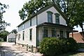
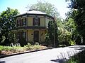
- Nathaniel Moore Banta House in Arlington Heights. This historic house was listed in 1998.
- Muller House in Arlington Heights. This house was added to the list in 1979.
- Wheeler-Magnus Round Barn in Arlington Heights. This unique round barn was recognized in 1992. It's a cool example of old farm buildings.
Barrington
- Barrington Historic District in Barrington. This is a whole area of Barrington that was listed in 1986 because of its many historic buildings.
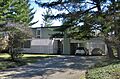
- Octagon House in Barrington. This house, listed in 1979, has a very unusual eight-sided shape!
- John Robertson, Jr., House in Barrington. This house was added to the list in 2014.
Berwyn
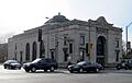
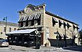
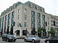
- American State Bank in Berwyn. This bank building was listed in 2000.
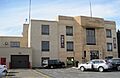
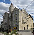
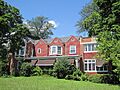
- Berwyn Health Center in Berwyn. This building, important for community health, was listed in 2002.
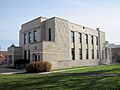
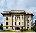
- Berwyn Municipal Building in Berwyn. This city building was added to the list in 2001.
- Central Berwyn Bungalow Historic District in Berwyn. This district, listed in 2015, is a neighborhood full of charming bungalow-style homes.
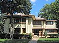
- Arthur J. Dunham House in Berwyn. This house was listed in 1982.
- Mr. Robert Silhan House in Berwyn. This house was added to the list in 2007.
Blue Island
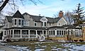
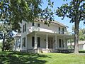
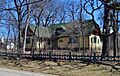
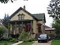
- Joshua P. Young House in Blue Island. Built around 1852, this house belonged to an important developer of Chicago's southern suburbs. It was listed in 1982.
Brookfield
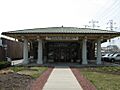
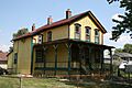
- Grossdale Station in Brookfield. This old train station was listed in 1982.
Burr Ridge
- Robert Vial House in Burr Ridge. This historic house was added to the list in 2007.
Chicago Heights
- Bloom Township High School in Chicago Heights. This high school building was listed in 1982.
- Flat Iron Building in Chicago Heights. This building, listed in 2003, was torn down in 2009.
Cicero
- J. Sterling Morton High School East Auditorium in Cicero. This school auditorium was listed in 1983.
Des Plaines
- Des Plaines Methodist Camp Ground in Des Plaines. This camp ground, listed in 2005, is a historic district.
Forest Park
- Haymarket Martyrs' Monument in Forest Park. This monument, listed in 1997, is a National Historic Landmark. It remembers important labor history.
Forest View
- Chicago Portage National Historic Site in Forest View. This site, listed in 1966, marks an important portage route used by Native Americans and early explorers.
- Chicago Sanitary and Ship Canal Historic District in Forest View. This canal is a huge waterway that connects the Great Lakes to the Mississippi River system. It's a historic district that runs through several counties and was listed in 2011.
Glencoe
- Edmund D. Brigham House in Glencoe. This house was listed in 2016.
- Mr. James Kent Calhoun House in Glencoe. This house was listed in 2010.
- William A. Glasner House in Glencoe. This house was added to the list in 2005.
- John Rogerson Montgomery House in Glencoe. This house was listed in 2004.
- Jesse L. Strauss Estate in Glencoe. This estate was listed in 2014.
- Sylvan Road Bridge in Glencoe. This bridge was listed in 1978 but has since been torn down.
Glenview
- Hangar 1, Naval Air Station-Glenview in Glenview. This hangar from the old naval air station was listed in 1998.
- Kennicott's Grove in Glenview. This historic grove, listed in 1973, is a National Historic Landmark.
Hoffman Estates
- Sunderlage Farm Smokehouse in Hoffman Estates. This old smokehouse from a farm was listed in 1990.
Kenilworth
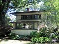
- Hiram Baldwin House in Kenilworth. This house was listed in 1983.
- Dr. Robert Hohf House in Kenilworth. This house was listed in 2008.
- Kenilworth Club in Kenilworth. This club building was added to the list in 1979.
- George W. Maher House in Kenilworth. This house was listed in 1979.
- Mr. J. William de Coursey O'Grady House in Kenilworth. This house was listed in 2008.
- Charles N. Ramsey and Herry E. Weese House in Kenilworth. This house was listed in 2009.
- Root-Badger House in Kenilworth. This house was listed in 1992.
- Wild Flower and Bird Sanctuary in Mahoney Park in Kenilworth. This beautiful natural area was listed in 1985.
La Grange
- La Grange Village Historic District in La Grange. This historic district was listed in 1979.
- Lyons Township Hall in La Grange. Also known as the LaGrange Village Hall, this building was listed in 1978.
- George E. Purple House in La Grange. This house was listed in 2005.
Lansing
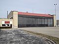
- Ford Airport Hangar in Lansing. This old airplane hangar was listed in 1985.
Lemont
- Lemont Central Grade School in Lemont. This school building was listed in 1975.
- Lemont Downtown Historic District in Lemont. This area of downtown Lemont was listed as a historic district in 2016.
- Lemont Methodist Episcopal Church in Lemont. This church was listed in 1986.
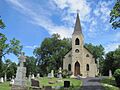
- St. James Catholic Church and Cemetery in Lemont. This church and its cemetery were listed in 1984.
Lincolnwood
- Hyatt House Hotel in Lincolnwood. Also known as the Purple Hotel, this building was listed in 2013 but was torn down later that year.
Lyons
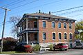
- Hofmann Tower in Lyons. This unique tower was listed in 1978.
Maywood
- Mrs. Henry F. Akin House in Maywood. This house was listed in 1992.
- Jacob Bohlander House in Maywood. This house was listed in 1989.
- Richard Cluever House in Maywood. This house was added to the list in 1977.
- William Frangenheim House in Maywood. This house was listed in 1992.
- William and Caroline Gibbs House in Maywood. This house was listed in 1992.
- Caroline Grow House in Maywood. This house was listed in 1992.
- Mads C. Larson House in Maywood. This house was listed in 1992.
- Timothy J. Lynch House in Maywood. This house was listed in 1992.
- Masonic Temple Building in Maywood. This temple building was listed in 1992.
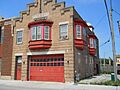
- Maywood Fire Department Building in Maywood. This fire department building was listed in 1992.
- Caroline Millward House in Maywood. This house was listed in 1992.
- Harry H. Nichols House in Maywood. This house was listed in 1992.
- Robinson House in Maywood. This house was listed in 1992.
- Albert Soffel House in Maywood. This house was listed in 1992.
- Joseph P. O. Sullivan House in Maywood. This house was listed in 1992.
- Jennie S. Thompkins House in Maywood. This house was listed in 1992.
Midlothian
- George R. Thorne House in Midlothian. This house was listed in 1997.
Morton Grove
- Herbert A. Dilg House in Morton Grove. This house was listed in 2009.
Oak Lawn
- Oak Lawn (Cook) School in Oak Lawn. This school was listed in 1990 but was torn down in 2003.
Oak Park
- Mrs. Thomas H. Gale House in Oak Park. This house was listed in 1970.
- Walter Gale House in Oak Park. This house was listed in 1973.
- Gunderson Historic District in Oak Park. This district, listed in 2002, includes some of the first homes built with steel beams in the U.S.
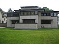
- Arthur Heurtley House in Oak Park. This house, listed in 2000, is a National Historic Landmark.
- Masonic Temple Building in Oak Park. This temple building was listed in 1982.
- Oak Park Conservatory in Oak Park. This beautiful conservatory was listed in 2005.
- Oak Park Village Hall in Oak Park. This village hall was listed in 2014.
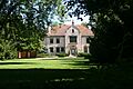
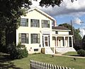
- Pleasant Home in Oak Park. Also known as the John Farson House, this home was listed in 1972 and is a National Historic Landmark.
- Ridgeland-Oak Park Historic District in Oak Park. This large historic district was listed in 1983.
- River Forest Historic District in River Forest. This historic district was listed in 1977.
- Scoville Place in Oak Park. This area was listed as a historic district in 2002.
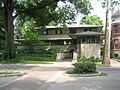
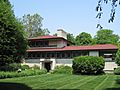
- Frank Thomas House in Oak Park. This house was listed in 1972.
- Unity Temple in Oak Park. This famous temple, listed in 1970, is a National Historic Landmark.
- William H. Winslow House and Stable in River Forest. This house and stable were listed in 1970.
- Frank Lloyd Wright House and Studio in Oak Park. This home and studio, listed in 1972, is a National Historic Landmark.
- Frank Lloyd Wright-Prairie School of Architecture Historic District in Oak Park. This historic district, listed in 1973, features many buildings designed in the unique Prairie School style.
Olympia Fields
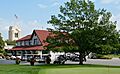
- Olympia Fields Country Club in Olympia Fields. This country club was listed as a historic district in 2001.
Orland Park
- John Humphrey House in Orland Park. This house was listed in 2005.
- Twin Tower Sanctuary in Orland Park. This sanctuary was listed in 1988.
Palatine
- George Clayson House in Palatine. This house was listed in 1979.
- Charles H. Patten House in Palatine. This house was listed in 2006.
Park Ridge
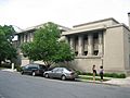
- Illinois Industrial School for Girls in Park Ridge. Now known as the Youth Campus, this historic district was listed in 1998.
- Pickwick Theater Building in Park Ridge. This theater building was listed in 1975.
River Forest
- William E. Drummond House in River Forest. This house was listed in 1970.
- William H. Hatch House in River Forest. This house was listed in 2007.
River Grove
- Dorhmann-Buckman House in River Grove. This house was listed in 1995.
Riverdale
- Pacesetter Gardens Historic District in Riverdale. This historic district, listed in 2005, features unique housing units.
Riverside
- Arcade Building in Riverside. This building was listed in 2016.
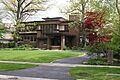
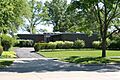
- Avery Coonley House in Riverside. This house, listed in 1970, is a National Historic Landmark.
- Riverside Landscape Architecture District in Riverside. This area, listed in 1969, is a National Historic Landmark district known for its special landscape design.
- F.F. Tomek House in Riverside. This house, listed in 1999, is a National Historic Landmark.
Schaumburg
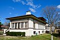
- Paul Schweikher House and Studio in Schaumburg. This house and studio were listed in 1987.
Skokie
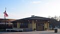
- Dempster Street Station in Skokie. This train station was listed in 1996.
- Harrer Building in Skokie. This building was listed in 1983.
Tinley Park
- Karl Vogt Building in Tinley Park. This building was listed in 1988.
Western Springs
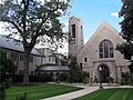
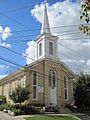
- First Congregational Church of Western Springs in Western Springs. This church was listed in 2006.
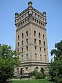
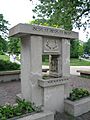
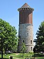
- Western Springs Water Tower in Western Springs. This water tower was listed in 1981.
Wilmette
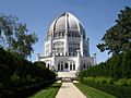
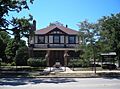
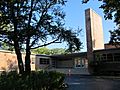
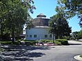
- Baha'i Temple in Wilmette. This beautiful temple, listed in 1978, is a unique place of worship.
- Bailey–Michelet House in Wilmette. This house was listed in 1982.
- Frank J. Baker House in Wilmette. This house was listed in 1974.
- Alfred Bersbach House in Wilmette. This house was listed in 2003.
- Chicago and Northwestern Depot in Wilmette. This old train depot was listed in 1975.
- Robert and Suzanne Drucker House in Wilmette. This house was listed in 2013.
- Gross Point Village Hall in Wilmette. This old village hall, now a historical museum, was listed in 1991.
- Linden Avenue Terminal in Wilmette. This train terminal was listed in 1984.
- Oak Circle Historic District in Wilmette. This historic district was listed in 2001.
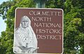
- Ouilmette North Historic District in Wilmette. This large historic district, listed in 2005, is named after Antoine Ouilmette, an early settler.
Winnetka
- Anita Willets Burnham Log House in Winnetka. This unique log house was listed in 2005.
- Community House in Winnetka. This community building was listed in 2007.
- Crow Island School in Winnetka. This school, listed in 1989, is a National Historic Landmark known for its modern design.
- Dr. Paul W. and Eunice Greeley House in Winnetka. This house was listed in 2011.
- Henry Demarest Lloyd House in Winnetka. Also known as The Wayside, this house was listed in 1966 and is a National Historic Landmark.
- Lola Maverick Lloyd House in Winnetka. This house was listed in 2006.
- William McJunkin House in Winnetka. This house was listed in 2006.
- Orth House in Winnetka. This house was listed in 1976.
Images for kids
-
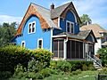
Mrs. Henry F. Akin House
-
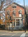
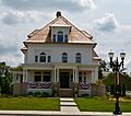
American State Bank
-
Arcade Building
-
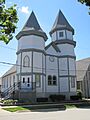
Baha'i Temple
-
Bailey–Michelet House
-
Frank J. Baker House
-
Hiram Baldwin House
-
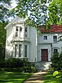
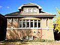
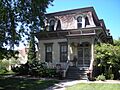
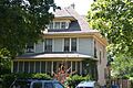
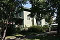
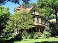
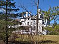
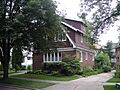
Nathaniel Moore Banta House
-
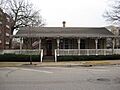
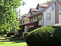
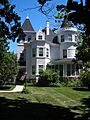
Barrington Historic District
-
Alfred Bersbach House
-
Berwyn Health Center
-
Berwyn Municipal Building
-
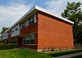
Bloom Township High School
-
Jacob Bohlander House
-
Anita Willets Burnham Log House
-
Mr. James Kent Calhoun House
-
Central Berwyn Bungalow Historic District
-
Chicago and Northwestern Depot
-
Chicago Portage National Historic Site
-
Chicago Sanitary and Ship Canal Historic District
-
George Clayson House
-
Richard Cluever House
-
Community House
-
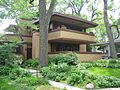
Avery Coonley House
-
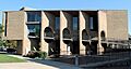
Crow Island School
-
Dempster Street Station
-
Des Plaines Methodist Camp Ground
-
Herbert A. Dilg House
-
Dorhmann-Buckman House
-
Robert and Suzanne Drucker House
-
William E. Drummond House
-
Arthur J. Dunham House
-
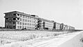
Edward Hines, Jr., Veterans Administration Hospital Historic District
-
First Congregational Church of Western Springs
-
Flat Iron Building
-
Ford Airport Hangar
-
William Frangenheim House
-
Mrs. Thomas H. Gale House
-
Walter Gale House
-
William and Caroline Gibbs House
-
William A. Glasner House
-
Dr. Paul W. and Eunice Greeley House
-
Gross Point Village Hall
-
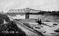
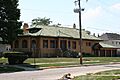
Grossdale Station
-
Caroline Grow House
-
Gunderson Historic District
-
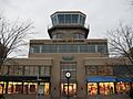
Hangar 1, Naval Air Station-Glenview
-
Harrer Building
-
William H. Hatch House
-
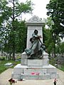
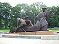
Haymarket Martyrs' Monument
-
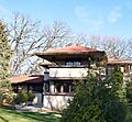
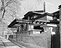
Arthur Heurtley House
-
Dr. Robert Hohf House
-
Hofmann Tower
-
John Humphrey House
-
Hyatt House Hotel
-
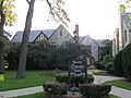
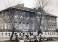
Illinois Industrial School for Girls
-
Kenilworth Club
-
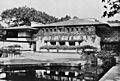
Kennicott's Grove
-
La Grange Village Historic District
-
Mads C. Larson House
-
Lemont Central Grade School
-
Lemont Downtown Historic District
-
Lemont Methodist Episcopal Church
-
Linden Avenue Terminal
-
Henry Demarest Lloyd House
-
Timothy J. Lynch House
-
Lyons Township Hall
-
George W. Maher House
-
Marshall Field and Company Store
-
Masonic Temple Building
-
Masonic Temple Building
-
Lola Maverick Lloyd House
-
Maywood Fire Department Building
-
William McJunkin House
-
Caroline Millward House
-
John Rogerson Montgomery House
-
J. Sterling Morton High School East Auditorium
-
Muller House
-
Harry H. Nichols House
-
Mr. J. William de Coursey O'Grady House
-
Oak Circle Historic District
-
Oak Lawn (Cook) School
-
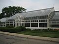
Oak Park Conservatory
-
Oak Park Village Hall
-
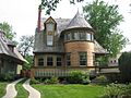
Octagon House
-
Olympia Fields Country Club
-
Orth House
-
Ouilmette North Historic District
-
Pacesetter Gardens Historic District
-
Charles H. Patten House
-
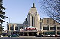
Pickwick Theater Building
-
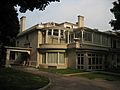
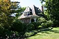
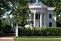
Pleasant Home
-
George E. Purple House
-
Charles N. Ramsey and Herry E. Weese House
-
Ridgeland-Oak Park Historic District
-
River Forest Historic District
-
Riverside Landscape Architecture District
-
John Robertson, Jr., House
-
Robinson House
-
Root-Badger House
-
St. James Catholic Church and Cemetery
-
Scoville Place
-
Mr. Robert Silhan House
-
Albert Soffel House
-
Jesse L. Strauss Estate
-
Joseph P. O. Sullivan House
-
Sunderlage Farm Smokehouse
-
Sylvan Road Bridge
-
Frank Thomas House
-
Jennie S. Thompkins House
-
George R. Thorne House
-
F.F. Tomek House
-
Twin Tower Sanctuary
-
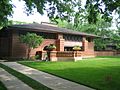
Unity Temple
-
Robert Vial House
-
Karl Vogt Building
-
Western Springs Water Tower
-
Wheeler-Magnus Round Barn
-
Wild Flower and Bird Sanctuary in Mahoney Park
-
William H. Winslow House and Stable
-
Frank Lloyd Wright House and Studio
-
Frank Lloyd Wright-Prairie School of Architecture Historic District
-
Joshua P. Young House


_01.JPG)


_01.JPG)


.jpg)


.jpg)


.jpg)


_01.JPG)


_02.JPG)


_02.JPG)


_02.JPG)
.jpg)


.jpg)


_01.JPG)


Key to Symbols
- A plain entry means it's a regular historic place listed on the National Register.
- A small infinity symbol (∞) means it's a historic district, which is a group of buildings or an area that is historically important.
- A star (*) means it's a National Historic Landmark, which is a place recognized as being important to the entire country's history.
- A small infinity symbol (∞) with a star means it's a National Historic Landmark and also a Historic district.
