
New Boston, New Hampshire facts for kids
Quick facts for kids
New Boston, New Hampshire
|
||
|---|---|---|
|
Town
|
||

Town Hall
|
||
|
||
| Nickname(s):
Gravity Center of the World
|
||

Location in Hillsborough County, New Hampshire
|
||
| Country | United States | |
| State | New Hampshire | |
| County | Hillsborough | |
| Incorporated | 1763 | |
| Area | ||
| • Total | 43.2 sq mi (111.9 km2) | |
| • Land | 42.8 sq mi (110.9 km2) | |
| • Water | 0.4 sq mi (1.0 km2) 0.92% | |
| Elevation | 420 ft (130 m) | |
| Population
(2020)
|
||
| • Total | 6,108 | |
| • Density | 143/sq mi (55.1/km2) | |
| Time zone | UTC-5 (Eastern) | |
| • Summer (DST) | UTC-4 (Eastern) | |
| ZIP code |
03070
|
|
| Area code(s) | 603 | |
| FIPS code | 33-50740 | |
| GNIS feature ID | 0873674 | |

New Boston is a small town in Hillsborough County, New Hampshire, in the United States. In 2020, about 6,108 people lived here. This was more than the 5,321 people counted in 2010.
New Boston is famous for its yearly Hillsborough County Agricultural Fair. It also has the Molly Stark Cannon, a historic cannon from 1743. This cannon is even shown on the town's official seal. General John Stark gave it to the New Boston Artillery Company after the Battle of Bennington.
The main part of town is called the New Boston census-designated place. In 2020, 326 people lived in this central village area.
Contents
History of New Boston
New Boston was first given land in 1736 by Governor Jonathan Belcher. He was the governor for both Massachusetts and New Hampshire. At that time, there was a disagreement about the land west of the Merrimack River.
Governor Belcher gave the land to families from Boston. They planned to call it "Lanestown" or "Piscataquog Township." But by 1751, they started calling it "New Boston" because it reminded them of their hometown.
Not all the families claimed their land. So, ten years later, the land was given again to settlers from Londonderry, New Hampshire. In 1763, Governor Benning Wentworth officially made "New Boston" the town's name.
Growth and Changes Over Time
In 1820, New Boston was a busy place. It had 25 sawmills for cutting wood and six grain mills for grinding grain. There were also clothing mills, carding mills, and places for making leather called tanneries. The town had 14 schoolhouses and a tavern too.
A big fire happened in 1887. It started when a spark from a cooper's shop (someone who makes barrels) set a barn on fire. This "Great Village Fire" destroyed almost 40 buildings in the lower part of the village.
In 1893, the railroad came to New Boston. This made it easier to send farm products to cities. Passenger trains stopped running in 1931, and the tracks were removed in 1935. Today, the old railroad path is a walking and biking trail called the New Boston Rail Trail.
New Boston Space Force Station
New Boston is home to the New Boston Space Force Station. This large area covers about 2,800 acres. It started as an Army Air Corps bombing range in 1942.
By 1960, it became a U.S. Air Force base. Its job was to track military satellites. In July 2021, the facility got its current name and became part of the United States Space Force.
Gravity Research Foundation
New Boston was also home to the Gravity Research Foundation. This group was here from the late 1940s to the mid-1960s. Its founder, Roger Babson, chose New Boston. He believed it would be safe from nuclear fallout if big cities like New York or Boston were attacked.
Dodge's Store
Dodge's Store is in the center of town. It opened in 1872 and was run by five generations of the Dodge family. Clarence H. Dodge started the business. The family owned it until 1994, when Malcom J. Dodge sold it. The store closed in 2011 because of money problems. However, it has since reopened with new owners.
Geography of New Boston
New Boston covers about 111.9 square kilometers (43.2 square miles). Most of this area, about 110.9 square kilometers (42.8 square miles), is land. The rest, about 1.0 square kilometer (0.4 square miles), is water. Water makes up about 0.92% of the town.
The town gets its water from the South Branch and Middle Branch of the Piscataquog River. The southeastern part of town is drained by Joe English Brook, which flows into Baboosic Brook. All the water in New Boston eventually flows into the Merrimack River.
The highest point in New Boston is Joe English Hill. It is about 1,285 feet (392 meters) above sea level. You can find it in the southern part of the town.
Roads and Nearby Towns
New Boston has three main state roads: Route 13, Route 77, and Route 136. These three roads meet in the center of New Boston village. Klondike Corner is a small living area in the southeastern part of town.
Neighboring Towns
New Boston shares its borders with several other towns:
- Weare (to the north)
- Goffstown (to the east)
- Bedford (to the southeast)
- Amherst (to the southeast)
- Mont Vernon (to the south)
- Lyndeborough (to the southwest)
- Francestown (to the west)
Population of New Boston
| Historical population | |||
|---|---|---|---|
| Census | Pop. | %± | |
| 1790 | 1,202 | — | |
| 1800 | 1,491 | 24.0% | |
| 1810 | 1,619 | 8.6% | |
| 1820 | 1,686 | 4.1% | |
| 1830 | 1,680 | −0.4% | |
| 1840 | 1,570 | −6.5% | |
| 1850 | 1,477 | −5.9% | |
| 1860 | 1,369 | −7.3% | |
| 1870 | 1,241 | −9.3% | |
| 1880 | 1,144 | −7.8% | |
| 1890 | 1,067 | −6.7% | |
| 1900 | 1,002 | −6.1% | |
| 1910 | 982 | −2.0% | |
| 1920 | 768 | −21.8% | |
| 1930 | 693 | −9.8% | |
| 1940 | 773 | 11.5% | |
| 1950 | 865 | 11.9% | |
| 1960 | 925 | 6.9% | |
| 1970 | 1,390 | 50.3% | |
| 1980 | 1,928 | 38.7% | |
| 1990 | 3,214 | 66.7% | |
| 2000 | 4,138 | 28.7% | |
| 2010 | 5,321 | 28.6% | |
| 2020 | 6,108 | 14.8% | |
| U.S. Decennial Census | |||
In 2000, there were 4,138 people living in New Boston. These people lived in 1,434 households, and 1,162 of these were families. The population density was about 96.6 people per square mile (37.3 people per square kilometer).
About 44.4% of households had children under 18 living with them. Most households (70.3%) were married couples living together. The average household had 2.88 people, and the average family had 3.15 people.
The town's population was spread out by age. About 30.4% were under 18. The median age was 36 years old. For every 100 females, there were about 100.2 males.
The median income for a household in New Boston was $66,020. For families, the median income was $69,458. About 4.3% of the total population lived below the poverty line. This included 5.7% of those under 18.
Education in New Boston
New Boston is part of School Administrative Unit 19, which also includes Goffstown. Students in New Boston go to New Boston Central School for elementary grades, up to sixth grade.
After elementary school, students attend Mountain View Middle School in Goffstown for seventh and eighth grades. Then, they go to Goffstown High School for high school.
Culture and Events
New Boston's fairgrounds host several fun events each year.
Hillsborough County Fair
The Hillsborough County Fair usually happens in September. This fair helps keep the town's farming history alive. Families can enjoy rides, see different exhibits, and watch the popular tractor pull competition.
Fourth of July Celebration
The Fourth of July celebration in New Boston is a big event. It starts with a parade that goes through the center of town and ends at the fairgrounds. The parade features floats made by locals, marching bands, and emergency vehicles. A special part of the celebration is the yearly firing of the Molly Stark cannon.
Notable People from New Boston
- Roger Babson (1875-1967): A college professor and economist who led the Gravity Research Foundation in New Boston.
- William A. Crombie (1844–1914): He was a mayor of Burlington, Vermont.
- Horton Foote (1916–2009): A famous playwright and screenwriter.
- Dean Potter (1972–2015): A well-known rock climber.
- Joseph Reed Whipple (1842-1912): A hotel owner from Boston who also owned the Valley View Farm in New Boston.
Images for kids
-
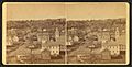
New Boston around 1875
-
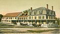
The Tavern around 1905
-
The Creamery around 1912
-
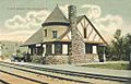
The old Depot around 1905
-
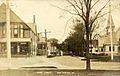
River Road around 1912
-
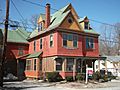
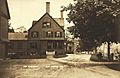
Some Victorian architecture


See also
 In Spanish: New Boston (Nuevo Hampshire) para niños
