Newington, Edinburgh facts for kids
Quick facts for kids Newington |
|
|---|---|
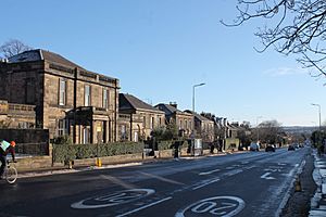 Minto Street, looking south |
|
| Population | 11,130 |
| Council area |
|
| Lieutenancy area | |
| Country | Scotland |
| Sovereign state | United Kingdom |
| Post town | EDINBURGH |
| Postcode district | EH8 |
| Postcode district | EH9 |
| Dialling code | 0131 |
| Ambulance | Scottish |
| EU Parliament | Scotland |
| UK Parliament |
|
| Scottish Parliament |
|
Newington is a lively neighbourhood in southern Edinburgh, Scotland. It started growing in the early 1800s. Today, it's a well-off area where most people live in homes.
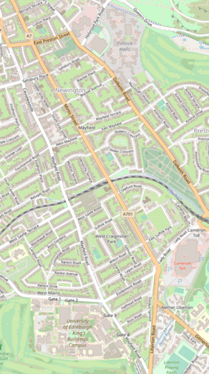
Newington is about 1 to 2.5 miles (1.5 to 4 km) south of Edinburgh city centre. It's surrounded by other areas like St Leonard's and Prestonfield to the east. To the south are Cameron Toll and Nether Liberton. On the west, you'll find Blackford, the Grange, and Sciennes. To the north is the Southside, Edinburgh. Newington became part of Edinburgh between 1832 and 1896.
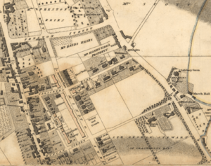
This area was once part of an old forest called Drumselch. The land was first rented out by the Edinburgh town council starting in 1586. For a long time, it was mostly countryside. Then, in 1805, a surgeon named Benjamin Bell bought the land. He began to develop it into a suburb. Around this time, a new road was being built from Edinburgh's New Town to Liberton through Newington. This helped the city grow southwards.
From the 1850s, buses connected Newington to the city centre. Trams arrived in 1871. Newington station opened for passengers in 1884. By then, most of the area was already built up. In the late 1800s, important places like the Longmore Hospital, the Royal Blind Asylum, and St Margaret's School were set up here. Newington station closed for passengers in 1962.
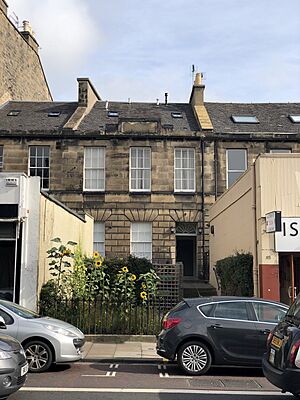
The northern part of Newington has many old Victorian apartment buildings and Georgian-style houses. South of Salisbury Road, you'll find more spread-out homes from the late Georgian and early Victorian times. Some of these were even built as gated communities. Southern Newington features Victorian villas (large houses) and terraces (rows of houses). There are also some old factory buildings that have been changed into homes.
Newington has about 11,000 people living there today. It continues to be a wealthy area, mainly for homes. It's also one of Edinburgh's most diverse places. Newington is home to Edinburgh's only synagogue. It also has the main office for Historic Environment Scotland and a building for the National Library of Scotland.
Contents
What's in a Name?
The name Newington probably comes from "Newton," which means "new farm" in Scots. The name might have been created by Alexander or Mariota Slowman, or their daughter Margaret. These families bought most of the land in Newington between 1602 and 1628. Later, Alexander Ellis bought these lands in 1649 and started calling himself "Alexander Ellis of Newington."
Another idea is that the name comes from "New town meadow." This would refer to Edinburgh's role in the land deals of the 1500s. The "ing" part of the name would mean a meadow.
In the late 1700s and early 1800s, property records sometimes called the Newington area "Belleville." We don't know for sure where this name came from. It might be linked to another name for a large house called Clockmiln. This name is not used anymore, except for one mansion on Blacket Avenue.
Newington's Past
Early Days and Growth
Before the 1500s, Newington was part of a large forest. The only clearings were the nearby Grange of St Giles and two main roads. These roads led south to Liberton and Dalkeith. A path called "Mounthooly Loan" connected these two roads. This path might have been named after a lost chapel or an old burial site.
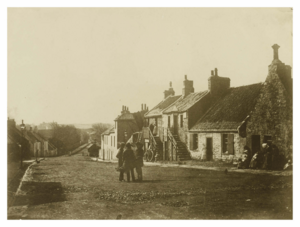
In 1586, the town council rented out six plots of land. This land was uncultivated and bordered by what are now East and West Preston Street, Dalkeith Road, East and West Mayfield, and Causewayside. At the same time, the Dalkeith and Liberton roads were made wider. The Liberton road was also paved, which is why it became known as "Causewayside." The area stayed mostly open countryside until the late 1700s. For a while, Mounthooly Loan was called "Gibbet Loan" because of gallows (a structure for hanging criminals) that stood there.
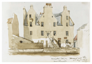
Before the 1700s, there were some smaller buildings in Newington. The Mayfield farmlands, once called Newlands, were centered around Mayfield House. There were also small houses at Echo Bank and near the Powburn. Along Causewayside, there was a house known as Broadstairs House and Wormwoodhall. This house was taken down in 1880. Summerhall was first rented out in 1705, and a brewery was there by 1739.
1700s and Early 1800s Development
By the mid-1700s, new areas like George Square and Nicolson Street brought wealthy people from Edinburgh's Old Town to the Southside. However, growth further south slowed down when the North Bridge opened in 1772. This bridge helped the city grow north towards the New Town.
Southward growth started again in 1788 with the building of the South Bridge. This bridge connected Nicolson Street to the Old Town. In 1794, a law was passed to build a major road south through Newington. This road would follow the line of Nicolson Street. Minto Street was planned as part of this by 1795. By 1812, it was connected to the Liberton and Gilmerton roads. By the early 1800s, many people from the New Town built houses in Newington. They used them as country homes or as quieter places to live.
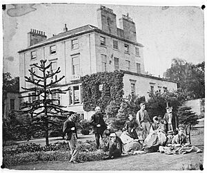
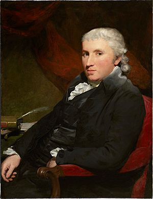
In 1805, the surgeon Benjamin Bell bought all of the Newington estate. He built Newington House that same year on eight acres of land. The house was reached from Blacket Avenue, named after Bell's family lands. After Bell died in 1806, Sir George Stewart bought the house and land in 1808. Stewart built gates and gatehouses at both ends of Blacket Avenue and Mayfield Terrace. These gates were closed every evening at dusk. A map from 1817 shows that most of the streets we see today were already planned and named by then. By the late 1830s, the northern part of Blacket Place had detached and semi-detached homes. Villas were built in Upper Gray Street, near rows of houses in Middleby Street and Duncan Street.
The growth of Newington and the Southside led to the building of the Hope Park Chapel in 1823. This chapel helped serve the growing population. In 1859, it became a full parish church called Newington Parish Church. The church also started a school on Dalkeith Road. Around the time the chapel was built, the old burial ground was too full. So, a new burial ground was opened at East Preston Street in 1820.
Victorian Era Changes
Building in Newington slowed down between 1830 and 1850. But it quickly picked up speed again after that. During this time, homes were built in the southern part of Blacket Place and villas in Mayfield Terrace. By 1865, a report found that Newington was the most crowded of Edinburgh's southern suburbs. As the suburb grew, a new cemetery, Newington Cemetery, opened in 1846 for burials. It was designed by David Cousin starting in 1848.
Causewayside, in particular, became very crowded and busy from 1850 onwards. Barriers were put up in Duncan Street and Salisbury Place. These were meant to stop people from the crowded area from easily reaching the wealthier homes on Minto Street.
Better transport links helped Newington grow quickly during this time. Buses arrived in the 1850s, and trams in 1871. Newington Railway Station opened in 1884.
Many new churches were built in Newington during the 1800s. Different Christian groups, like the Free Church, United Presbyterian Church, and Church of Scotland, all set up congregations. Other churches, including Baptist, Congregationalist, Episcopal, and Roman Catholic, also opened.
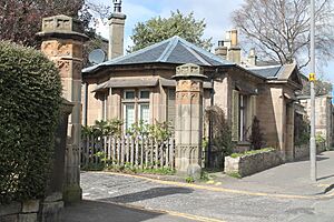
After Sir George Stewart died in 1822, Newington House had several owners. In 1852, Duncan McLaren, a Liberal politician, moved in. McLaren also bought land nearby called Mayfield and Rosebank. From 1862, land around Waverley Park was rented out for building, following a plan by David Cousin. In 1864, Cousin changed his plan to create curving streets around a shared green space at Waverley Park. This idea might have come from a similar plan in London. Cousin also suggested that, like the Blacket area, this new development would have gates and gatehouses. Some of these gatehouses still stand today.
After McLaren bought the Mayfield estate in 1863, he asked Cousin to create another building plan. However, only two rows of houses on the east side of Mayfield Gardens were built according to this plan. Still, the area was almost completely developed by the time McLaren died in 1886. The names of the streets he developed show his personality and politics. For example, Cobden Road, Peel Terrace, and Bright's Crescent are named after other reformist politicians. Queen's Terrace shows his loyalty to Queen Victoria. Waverley Park is named for his love of books. Mentone and Ventnor terraces are named after his favourite holiday spots.
Inspired by McLaren's success, Sir Robert Gordon-Gilmour began renting out land to the south in 1876. This area became East and West Craigmillar Park. However, building was slower here. The remaining empty land was turned into a nine-hole golf course in 1895. After some of the golf course was used for housing in 1904, the club moved. The rest of the area became sports fields. In the same year, Craigmillar Park Bowling Club opened. These new sports facilities joined the Waverley Lawn Tennis and Squash Club, which started in 1885.
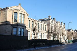
The 1800s also saw several health and education institutions set up in Newington. The West Craigmillar Asylum for Blind Females was finished in 1877. It took over from an older blind asylum. In 1875, Longmore Hospital opened on Salisbury Place as the Edinburgh Hospital for Incurables. Other schools in Newington during this time included Munro's Academy and Robertson's Academy. St Margaret's School was founded in Craigmillar Park in 1890. Also in 1890, Madame Muriset's Craigmillar Park College opened as a boarding school for girls. It closed in 1932. By 1896, a new public school was needed. Preston Street School opened in 1897 and is still a primary school today.
Modern Newington: 20th and 21st Centuries
From 1907, the mapmaker John George Bartholomew lived in Newington House. He moved his family's map-making company to Duncan Street. In 1915, Bartholomew sold Newington House. Another printing company, Pillans & Wilson, moved its production to Bernard Terrace in 1919.
In 1913, undeveloped land at East Craigmillar Park was bought for student housing. These residences opened in 1915. During the Second World War, they were used as a camp for German naval officers who were prisoners of war. They became student residences again in 1945.
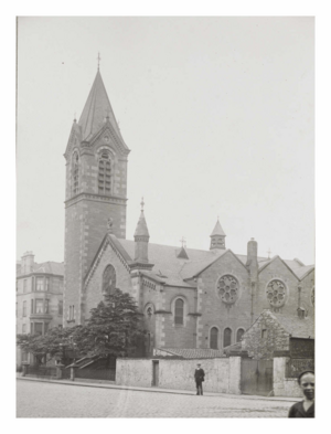
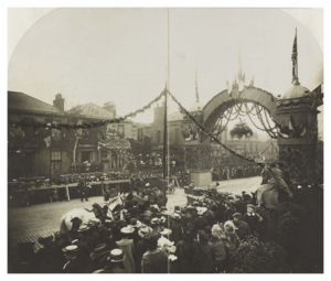
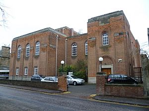
Many churches in Newington joined together in the early 1900s. Edinburgh's only purpose-built synagogue opened on Salisbury Road in 1932. It was opened by the Chief Rabbi in front of a large crowd.
In 1940, two churches joined to form Newington South and Hope Park Church. The Hope Park buildings were taken down in 1949. Other churches also merged in the following decades.

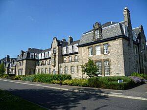
The late 1900s and early 2000s brought more changes. Tram services through Newington stopped between 1950 and 1956. Newington station closed for passengers in 1962. Newington House was taken down in 1966, and the land was sold to the University of Edinburgh. The Longmore Hospital closed in 1991. It was then redeveloped into Longmore House, which is now the main office for Historic Environment Scotland.
Across from Longmore House, the National Library of Scotland's Causewayside building was built between 1984 and 1994. It stands on the site of a former biscuit factory. Bartholomew's map company closed in 1987. Its old building was turned into housing.
In education, St Margaret's School closed in 2010. Its buildings have been turned into a care home. The school's buildings at the former Craigmillar Park Free Church are now used by Iqra Academy. This is a mosque and an Islamic education centre. The school's playing fields were developed for housing from 2015. The Royal (Dick) School of Veterinary Studies moved out of its buildings in 2011. These buildings are now used as a creative arts centre called Summerhall. The Royal Blind School moved out of its old building in 2014. In 2019, the city council approved plans to turn its buildings into flats.
Newington's Location and Look
Newington is on a gentle slope that faces south. The main road, the A701, runs through it from north to south. This road changes names as it goes through the area. The old road from Edinburgh to Liberton (Causewayside) forms Newington's western border. The old road to Dalkeith (Dalkeith Road) forms its eastern border.
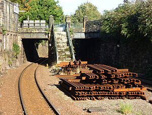
The A701 and Dalkeith Roads are major routes into Edinburgh city centre. The city centre is about 1 to 2.5 miles (1.5 to 4 km) north of Newington. The Southside is north of Newington. Cameron Toll and Nether Liberton are to the south and west. The old Edinburgh Suburban and Southside Junction Railway runs east to west through southern Newington. It closed for passengers in 1962 but is still used for freight trains.
Newington is mostly a residential area, meaning people live there. South Clerk Street and Newington Road are the main shopping streets. There are also shops on Causewayside and Salisbury Place. Many guest houses are found on Minto Street. Important buildings include the Summerhall arts centre and Historic Environment Scotland's Longmore House.
From the higher ground in northern Newington, you can see Arthur's Seat to the east. You can also see Liberton and the countryside of Midlothian to the south. Newington has many trees and small green areas. The only public park is a small area near the Braid Burn at the very south. The green space of East Preston Street Burial Ground is in northern Newington. Newington Cemetery is a noticeable feature at the south-eastern edge of the area.
How Newington Looks

The northern part of Newington has large, solid blocks of buildings. Buildings on South Clerk Street and Causewayside are right on the pavement. Other blocks are set back a bit, with small front gardens. Buildings in this northern area are usually two to five storeys tall.
South of Salisbury Place, buildings are less crowded. This is because of the strict building plans from the Georgian and Victorian times. In this southern part, quiet residential streets cross the main north-south roads. Between Salisbury Road, Minto Street, Dalkeith Road, and West Mayfield, a plan from 1825 created regular plots for detached houses and larger rows of houses. Many of the gardens in this area have mature trees.
On the western side of Minto Street, the area around South Gray Street and Duncan Street has a mix of homes and other buildings. This includes the telephone exchange and Duncan Street Baptist Church. This area also has old industrial buildings that have been turned into homes. The Waverley Park area has large gardens with mature plants and few through roads, making it feel private and green. The southern part of Newington also has low-rise homes set back from the street with front gardens and mature trees.
Local landmarks in northern Newington include the tall spire of St Peter's Episcopal Church on Lutton Place. Also, the National Library of Scotland's Causewayside building is on the corner of Causewayside and Salisbury Place. In southern Newington, the large spire of Mayfield Salisbury Parish Church is a landmark. Other landmarks include the former Craigmillar Park Free Church and Craigmillar Park Church.
 |
Sciennes | The Southside | St Leonard's |  |
| The Grange | Prestonfield | |||
| Blackford | Nether Liberton | Cameron Toll |
How Newington is Governed
Local Government
Newington is part of the Southside/Newington ward. This ward has four members on the City of Edinburgh Council. The current councillors are Cameron Rose (Conservative), Alison Dickie (SNP), Steve Burgess (Green), and Ian Perry (Labour).
Most of Newington is covered by the Grange/Prestonfield Community Council. This council helps local people have a say in their area. The northern part of Newington is covered by the Southside Community Council. Both community councils are active.
Before the 1800s, Newington was part of the county of Midlothian. It was divided between two church areas. Newington was added to Edinburgh in stages between 1832 and 1896.
Parliamentary Representation
In the Scottish Parliament, most of Newington is in the Edinburgh Southern area. This area has been represented by Daniel Johnson (Labour) since 2016. The northern part of Newington is in the Edinburgh Central area. This area has been represented by Angus Robertson (SNP) since 2021. Both areas are part of the wider Lothian region.
In the UK Parliament, most of Newington is in the Edinburgh South area. Ian Murray (Labour) has represented this area since 2010. The rest of Newington is in the Edinburgh East area. This area has been represented by Tommy Sheppard (SNP) since 2015.
Protected Areas
The northern part of Newington is within the South Side Conservation Area. This area was set up in 1975 to protect its special character.
Just south of this, the area of Newington north of East and West Mayfield is in the Blacket Conservation Area. This area was set up in 1972.
The southern part of Newington is in the Craigmillar Park Conservation Area, set up in 1997.
The remaining area west of Dalkeith Road is in the Waverley Park Conservation Area, set up in 1977. These conservation areas help protect the historic buildings and green spaces of Newington.
Newington's People
Newington had about 11,130 people living there in 2019. It's a fairly wealthy area. Most parts of Newington are among the least deprived areas in Scotland. In 2018, the average house price in Newington was much higher than the average for Edinburgh and Scotland as a whole.
Newington is one of Edinburgh's most diverse areas. In the Southside/Newington ward, the 2011 census showed that a higher percentage of people were of Asian descent compared to the rest of Edinburgh.
Newington's Buildings
Religious Buildings
Here are some notable religious buildings in Newington:
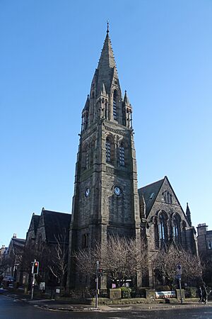
- Mayfield Salisbury Parish Church, Mayfield Road: This church was designed by Hippolyte Blanc in a French Gothic style. It was built between 1876 and 1879. Its tall spire, which is 48 meters (157 feet) high, was added in 1894. The church has beautiful stained glass windows from the late 1800s and early 1900s. The spire is a well-known landmark.
- St Peter's Episcopal Church, Lutton Place: Built between 1857 and 1867, this church has a tall steeple that reaches 56 meters (184 feet). It's a very noticeable landmark in northern Newington. The inside has columns made of granite and stained glass windows.
- Craigmillar Park Church, Craigmillar Park: This church opened in 1878. It has a Gothic design. The inside was changed in 1956 and includes stained glass. A steeple was planned but never built.
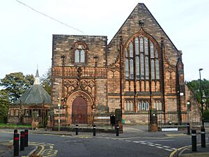
- Iqra Academy, East Suffolk Road: This building was originally a church, built in 1898. It has a unique design with an octagonal (eight-sided) former church hall. The inside of the main area was divided into two floors in 1976.
- St Columba's Roman Catholic Church, Upper Gray Street: This church was finished in 1888. It has a French Renaissance design with a triangular top section.
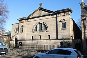
- Edinburgh Hebrew Congregation, Salisbury Road: This synagogue opened in 1932. It's built of red brick in a simpler Byzantine style. The inside has stained glass from 1957.
- King's Hall, South Clerk Street: This building opened as a church in 1843. It was changed in 1847 and again in 1907, when a Gothic front was added.
- The former Hope Park & Buccleuch Congregational Church, Hope Park Terrace: Completed in 1876, this building has a Lombard design with a short tower.
- Duncan Street Baptist Church, Duncan Street: Finished around 1843, this church has a strong, classical front. The inside was changed in 1888.
Public and Commercial Buildings
Here are some important public and commercial buildings in Newington:

- Summerhall, Causewayside: This building opened in 1916 as a veterinary school. It has a large front with eleven sections. Today, it's an arts and events venue.
- Longmore House, Salisbury Place: This building opened in 1879 as a hospital. It has a classical design with a central part that has a triangular top.
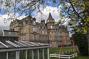
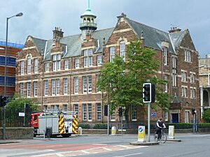
- The former Royal Blind Asylum: Built in 1874, this building has a French Renaissance design with a sloped roof and a central clock tower. It's being turned into housing.
- National Library of Scotland Annexe, Causewayside: Built between 1984 and 1994, this building is made of sandstone and has jagged glass spires. It's a noticeable landmark.
- Southside Garage: This garage, built in 1933-1934, is an early example of modern architecture in Edinburgh. It's made of white concrete and has a glass upper floor. It's now used as an off-licence.
- The former Geographical Institute, Duncan Street: This two-storey office building was opened in 1910. It has a classical design. The front entrance was originally from another building, Falcon Hall, and was moved here. It's now converted into flats.
- Preston Street Primary School, East Preston Street: This red sandstone building opened in 1897. It has white decorations and a noticeable wood and copper vent on the roof. Its design is inspired by older architectural styles.
Homes and Houses
Most buildings in Newington were built from the early 1800s onwards. However, there are some older 1700s houses on Causewayside and Ratcliffe Terrace.
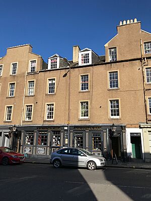
In northern Newington, two and three-storey houses were built along South Clerk Street and Newington Road from 1805. Often, single-storey shops were added to the front gardens of these homes. West Newington House on Newington Road, built around 1805, has large columns on its front. Early Victorian apartment buildings, like those on Lutton Place, look similar to the older Georgian style. Later Victorian apartment buildings, like those from 1887-1888 on Dalkeith Road, have features like spired towers and sloped roofs.
South of Preston Street and west of Minto Street, Georgian and Victorian houses stand on larger plots with mature trees. The first of these was Newington House, a grand classical mansion. Other notable homes include 23–25 Blacket Place and Arthur Lodge. Three sets of Gothic-style gates and gatehouses were built around 1825 to limit access to the Blacket development. These gates showed the exclusive nature of the original area.
South of this area, Victorian villas and rows of houses are a bit closer together. An example is David Cousin's row of houses from 1862. Other notable rows of houses include those at 2–28 Moston Terrace.
One large residential building is the five-storey former Longmore Hospital Nurse Home on Salisbury Road. It was built between 1938 and 1947 and stands out among the surrounding buildings. Another is the former women's student residences on East Suffolk Road. These buildings, started in 1914, are designed in the Arts & Crafts style.
Newer developments include an apartment building from the 1930s on the corner of Bernard Terrace and Dalkeith Road. Modern buildings have also been added in places like Causewayside and East Newington Place. Many detached and semi-detached homes have had ground floor extensions added since the late 1900s.
Things to Do and See
Getting Around Newington
Buses
Lothian Buses serves the main road (the A701) through Newington with several bus routes. These include the 3, 7, 8, 29, 31, 37, 47, and 49.
The route along East Preston Street and Dalkeith Road is served by the 2, 30, and 33 buses. The 14 bus also follows Dalkeith Road. The 5 bus goes via Salisbury Place and Newington Road.
The 42 bus serves Causewayside and Lady Road. Lady Road is also served by the 24 and 38 buses.
Borders Buses also operates long-distance buses, like the X62 to Galashiels and the X95 to Carlisle, which pass through Newington.
Trains
The old Edinburgh Suburban and Southside Junction Railway runs through southern Newington. It's now used by freight trains. Newington railway station was open for passengers from 1884 to 1962. There have been talks about reopening the line for passengers, but no plans have been approved yet.
Proposed Tram Extension
There are plans to extend the Edinburgh Trams network through Newington. The City of Edinburgh Council's 2021 City Mobility Plan includes ideas for a tram line along the A701 through Newington.
Places of Worship
Newington has several places of worship. There are two Church of Scotland congregations: Mayfield Salisbury Parish Church and Craigmillar Park Church. Mayfield Salisbury Parish Church also hosts a Chinese evangelical congregation.
St Peter's is an Episcopal church on Lutton Place. St Columba's is a Roman Catholic church on Upper Gray Street. Nearby is Duncan Street Baptist Church. The former Newington Free Church building is now used by Edinburgh Community Church, a non-denominational church, and is called King's Hall.
Newington also has non-Christian places of worship. The Edinburgh Hebrew Congregation synagogue on Salisbury Road opened in 1932. It is Edinburgh's only synagogue. Iqra Academy on East Suffolk Road serves as a mosque and an Islamic education and community centre.
Cemeteries
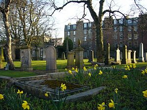
Newington Cemetery is located near the southern end of Dalkeith Road. It opened in 1846. Further north, at the corner of Dalkeith Road and East Preston Street, is East Preston Street Burial Ground, founded in 1820. Both are now closed for new burials and are looked after by the City of Edinburgh Council.
Schools and Learning
The only school in Newington is Preston Street Primary School. It opened in 1897 and is on the corner of East Preston Street and Dalkeith Road. Most of Newington is in the catchment areas for Preston Street Primary School and Sciennes Primary School. These primary schools feed into James Gillespie's High School.
For Roman Catholic state schools, Newington is in the catchment area for St Peter's Roman Catholic Primary School. This school then feeds into St Thomas of Aquin's High School.
The University of Edinburgh has several sites near Newington. Some university accommodation blocks are located within Newington itself.
Culture and Fun
The former buildings of the Royal (Dick) Veterinary College on Causewayside have been used since 2011 as Summerhall. This is an arts and events venue where you can see shows and exhibitions.
Newington Library is nearby on Fountainhall Road. It's a public library run by the City of Edinburgh Council. The National Library of Scotland's maps reading room is in its Causewayside building.
For sports, there's Craigmillar Park Bowling Club on Gilmour Road. The Waverley Lawn Tennis, Squash and Sports Club on Suffolk Road offers tennis, squash, and gym facilities.
Famous People from Newington
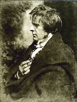
Many interesting people have lived in Newington. The first well-known resident was the surgeon Benjamin Bell, who built Newington House. Later, the politician Duncan McLaren and the mapmaker John George Bartholomew lived there. Other early residents included William Blackwood, who started a publishing company, and Robert Knox, an anatomist.
In the early Victorian period, Newington was home to important church leaders like William Cunningham and Thomas Guthrie. The artist and photographer David Octavius Hill, famous for his early photographs, died in his Newington home in 1870.
In the 1900s, residents included the entertainer Will Fyffe, the athlete and missionary Eric Liddell, the geneticist C. H. Waddington, the choreographer Lindsay Kemp, Corries folk singer Ronnie Browne, and author Ian Rankin.
 | Bessie Coleman |
 | Spann Watson |
 | Jill E. Brown |
 | Sherman W. White |


