St Boswells facts for kids
Quick facts for kids St Boswells
|
|
|---|---|
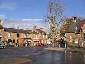
 Village centre |
|
| Area | 0.65 km2 (0.25 sq mi) |
| Population | 1,440 (2020) |
| • Density | 2,215/km2 (5,740/sq mi) |
| OS grid reference | NT592309 |
| • Edinburgh | 34 mi (55 km) NW |
| Civil parish |
|
| Council area | |
| Lieutenancy area |
|
| Country | Scotland |
| Sovereign state | United Kingdom |
| Post town | MELROSE |
| Postcode district | TD6 |
| Dialling code | 01835 |
| Police | Lothian and Borders |
| Fire | Lothian and Borders |
| Ambulance | Scottish |
| EU Parliament | Scotland |
| UK Parliament |
|
| Scottish Parliament | |
St Boswells is a lovely village in the Scottish Borders. It sits on the south side of the River Tweed. You can find it about 1 kilometer (0.6 miles) southeast of Newtown St Boswells. The village is also right on the A68 road. It is part of the historic area called Roxburghshire.
St Boswells has many useful places for its residents. These include a hotel, a post office, and a popular butcher shop. There is also a garage, a fish and chip shop, and a bookshop with a café. You can find several convenience stores too. For sports lovers, the village has a golf course near the River Tweed. There are also clubs for cricket, football, rugby, and tennis.
The village is famous for being on the St Cuthbert's Way walking route. This long path connects Melrose Abbey to the Holy Island of Lindisfarne. Lindisfarne is off the coast of Northumberland in northeast England. The village's name remembers Saint Boisil. He was an important religious leader from Melrose.
St Boswells also hosts an annual gypsy fair. This fair used to be a big event for trading horses. It attracted Gypsies from Scotland, northern England, and Ireland. Today, it is a smaller, two-day gathering on the village green. The fair happens every year on July 18th. Many local people still enjoy having their fortunes told there.
Contents
A Look at St Boswells' Past
Ancient Times and Early Settlements
The Romans arrived in this area almost 2,000 years ago. They left behind Dere Street, an old Roman road. They also built a fort nearby called Trimontium. After the Romans left, the area became part of the Anglian kingdom of Northumbria.
In the 600s, Oswald ruled Northumbria. He became a Christian and, with St Aidan's help, started a monastery at Lindisfarne. Under Oswald, a monastery was also built at Old Melrose. One of the monks from this new religious center was Boisil. He is the one who gave his name to the village and parish of St Boswells. Some people think the first homes were in a low area by the river. But because of flooding, people later moved to higher ground. This new spot was called Lessudden, which means "the place of Aidan." This is where St Boswells is today.
St Boswells also gave its name to a settlement in Canada. This Canadian village was in southwest Saskatchewan. It was started in the early 1900s. It grew until the mid-1930s but later disappeared after World War Two.
The Village of Lessuden
The village, once known as Lessuden, had one long main street. This is now called Main Street. There was also a narrow back road along Braeheads, high above the river. Several paths connected Braeheads to the main street. The village still looks much like it did back then.
In 1544, an English army under the Earl of Hertford attacked the Border Abbeys. They also destroyed homes in Lessuden, including Lessuden House. This house was later rebuilt. Near this house was the first village church, St Mary's. It was built in the 1100s during the reign of David I. Over time, people moved to a new church built at Benrig. This church was repaired many times but was finally taken down in 1952.
The people from Benrig then moved to the church in the village. This church also has an interesting history. In 1843, many ministers left the Church of Scotland. They formed the Free Church. A new church was built in St Boswells in 1844. Later, in 1900 and 1929, different church groups joined together again. The building has been known by several names, including St Boswells Free Church and St Modans. Today, it is called St Boswells Parish Church. The building is still standing and was updated in 1959.
How People Made a Living
For many years, farming was the main way people earned money in St Boswells. The village land was split into two parts: infield and outfield. The infield was used for growing crops like wheat, barley, and peas. Turnips were also grown later and became very successful. The land was often hard to work with clay soil. This meant a lot of effort was needed to clear land, drain water, and add lime to the soil.
New farm tools changed how farming was done. Large machines meant less need for traditional farm work. Interestingly, in the late 1800s, people in the village did not want to remove pigsties from their homes. Records show that eight farms in the village had to be registered as dairies.
Besides farming, many other businesses helped the village be self-sufficient. There were joiners (who work with wood), plumbers, builders, drapers (who sell cloth), bakers, butchers, fishmongers, publicans (who run pubs), carters (who transport goods), undertakers, and bankers. They all made a living within the village. Today, with easier travel and changes in the economy, many of these local businesses have closed.
Life in the Village
Modernizing St Boswells
The 1800s brought many changes to St Boswells. A water fountain on Main Street was built by Lord Polwarth. This was part of the first public water system. Water came from Clintmains through lead pipes. Paraffin street lamps were put in in 1870. These were replaced by gas lamps in 1912. Electric street lighting arrived in 1929. You can still see two old cast iron oil lamps from 1902. They were put up to celebrate King Edward VII's Coronation. They were fixed up and repainted in 2016 and now have LED bulbs.
The old school was taken down, and a new one was built in 1836. It is now at Hamilton Place. One of the builders was John Smith, who also made the William Wallace Statue near Dryburgh. Mertoun Bridge was built to replace an old river crossing. As more people moved to the village, sandstone houses were built at West Croft and Jenny Moore's Road. The Public Hall opened in 1896. It was used for public events, storing village items, and holding equipment for the fire brigade. The hall is still used a lot by community groups today.
The Impact of the Kennels and Transport
Building the Kennels in 1836 was a big boost for the village. These were for the Duke of Buccleuch's hunting dogs. The hunting season brought many visitors. This led to the building of the Buccleuch Arms Hotel. The local blacksmith shop moved closer to the Kennels. At one time, the Kennels housed up to fifty horses.
Many roads in the area started as paths for walking or riding to the old church at Benrig. Others were access roads to farms. The main roads to Melrose, Jedburgh, and Kelso used a turnpike system. This meant horse-drawn coaches had to pay a road tax at tollhouses. You can still see one of these tollhouses at Mertoun Bridge.
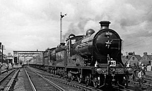
The arrival of the railway in 1849 changed country life a lot. Building, running, and maintaining the railway created new jobs. The Waverley Line ran west of St Boswells. The closest station was St. Boswells railway station at Newtown. The Henderson brothers ran a horse-drawn cab service to and from the station. This service was very popular for passengers and delivering goods. Later, they bought a Model T Ford, one of the first cars in the area. The railway line closed in 1969. However, people are now talking about possibly reopening it.
The Village Green and Fair
The village green is still quite large. Old maps show it was once even bigger. It used to be common land for animals to graze. Its size and uses have changed over time. It has been used for sports, games, picnics, parties, and even military camps.
The most famous use of the Green is the historic St Boswells Fair. It is held every year on July 18th. The fair used to be held in a low area by the river. But in 1743, heavy rains caused the river to flood the fair. So, it was moved to the Green, and it has been there ever since. It started as a sheep fair and wool market. Later, it became a place to sell cattle and horses. It was common for a thousand horses to be traded during the fair. Gypsies came in their colorful wagons from Scotland, England, and Ireland. It was a time for fun, with kiosks, booths, and campfires. The fair still happens on the same date each year, but it is much smaller now.
Trees were planted on the Green to remember important events. These include Queen Victoria's Diamond Jubilee in 1898 and the Boer War. There are also trees for the coronation of George V and Queen Mary in 1911. These trees make the Green a nice place to walk and relax. You can still see cast iron plaques on some trees. They remember historical events from the late 1800s and early 1900s. Four plane trees were planted in 1900 to remember four victories in the Boer War. Only one plaque remains today.
During the war years, the army used the village and surrounding area a lot. There was a munitions factory nearby. Stores and fuel dumps were everywhere. Soldiers stayed in the Kennels. The Home Guard, air raid wardens, and volunteer ambulance drivers helped them. Local groups provided canteens and first aid. Everyone in the village, young and old, helped with the war effort.
The River Tweed
You cannot talk about St Boswells without mentioning the River Tweed. It flows and twists north of the village. The river is famous for its salmon and brown trout. Many local houses were built using stones from the riverbed. Walking along the riverside is always pleasant and sometimes beautiful. Walkers on St Cuthbert's Way pass through the village. They see the same view of the Eildon Hills that people like Modan, Aidan, Cuthbert, and Boisil saw long ago. Boisil, after a life of helping others, gave his name to the village of St Boswells.
Sports in St Boswells
St Boswells is one of the most active villages in the Borders for organized sports.
It's unusual for Scotland, but part of the Green is used for cricket. The current Cricket Club started in 1895. The Duke of Buccleuch gave the land for the current pitch, which has been used since the 1920s. Around the same time, the Curling Club was also formed. They built a pond near the Green, where the tennis courts are now. They used water from the Laret Burn. Winters must have been colder back then, as ice formed, and games were played. Trees were planted to stop the sun from melting the ice. The pond closed in 1964, and the club moved to an indoor rink in Kelso.
The cricket team has been very successful. They played in the national league in 2006. They also won the Border League four times between 2004 and 2008. The football and rugby teams have not had as much luck. Both clubs finished last in their leagues in the 2005–06 season.
Here is a list of the sports clubs in St Boswells:
- Golf Club
- Tennis Club
- Model Boat Club
- Amateur Football Club
- Junior Football Club
- Cricket Club
- Badminton Clubs (Monday, Tuesday, and Thursday)
- Curling Club
- Rugby Football Club
St Boswells in Books
St. Boswells Fair is mentioned in a funny story by James Hogg. It's called Willie Wastle and his Dog Trap and was first published in 1832. St. Boswells Green also appears in Elliot Cowan Smith's book, Mang Howes an Knowes: A Day's Dander Throwe Border Waeter-Gates. This book was published in 1925.
See also
 In Spanish: St Boswells para niños
 | Laphonza Butler |
 | Daisy Bates |
 | Elizabeth Piper Ensley |


