Tangier, Virginia facts for kids
Quick facts for kids
Tangier Island, Virginia
|
||
|---|---|---|
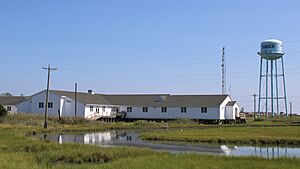
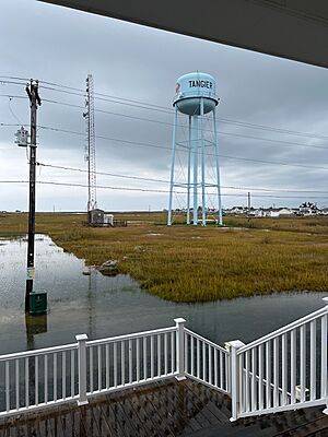
Tangier Combined School and the Tangier water tower, two landmarks on the island
|
||
|
||
| Country | United States | |
| State | Virginia | |
| County | Accomack | |
| Area | ||
| • Total | 0.54 sq mi (1.40 km2) | |
| • Land | 0.54 sq mi (1.40 km2) | |
| • Water | 0.00 sq mi (0.00 km2) | |
| Elevation | 3 ft (0.9 m) | |
| Population
(2020)
|
||
| • Total | 436 | |
| • Density | 805.9/sq mi (311.42/km2) | |
| Time zone | UTC-5 (Eastern (EST)) | |
| • Summer (DST) | UTC-4 (EDT) | |
| ZIP code |
23440
|
|
| Area code(s) | 757, 948 | |
| FIPS code | 51-77520 | |
| GNIS feature ID | 1500206 | |
Tangier is a small town in Accomack County, Virginia. It is located on Tangier Island in the Chesapeake Bay. In 2020, 436 people lived there.
Since 1850, the island's land has shrunk by 67%. Experts think much of the island could be lost in the next 50 years. This is due to sea level rise. The town might need to be left empty.
The first people to live on the island permanently arrived in the 1770s. They were farmers. Later, in the late 1800s, islanders started catching crabs and oysters. This job is called being a waterman. It became very important and earned good money. Sometimes, there were arguments between watermen from Virginia and Maryland.
Many people on Tangier speak a special way. It is a unique dialect of Southern American English. Some people thought it came from old British English. But experts like David Shores say it's a mix of different American dialects. This special way of speaking has lasted because the island is quite isolated. Tangier Island is listed on the National Register of Historic Places.
Contents
Island History
Tangier Island was likely used by Native Americans. They used it for hunting and fishing. Old tools and a large oyster shell pile have been found. But no one lived there when John Smith visited in 1608. Smith called the area the "Russel Isles."
In 1670, Ambrose White got the island as a land grant. He was a tavern owner from Accomac, Virginia. The next year, it went to Charles Scarburgh and John West. They were big landowners who used the island to feed their animals.
Today, many people on the island have the last name Crockett. John Crockett was the first permanent Anglo-American settler. Other common names include Pruitt, Thomas, Marshall, and Shores. By 1900, over 1,000 people lived there.
War of 1812 on Tangier
The British used the island in 1813 and 1814. This was during the War of 1812. Rear Admiral George Cockburn set up a base there. They built Fort Albion. Up to 1,200 British troops were on the island at one time.
Many enslaved people escaped to the British on Tangier. They were given their freedom. Some even joined the Corps of Colonial Marines. British sailors captured by Americans told stories. They spoke of hard times on the island. They also talked about building Fort Albion.
Tangier was a base for a big attack on the American capital. This led to the British victory at Bladensburg. It also led to the Burning of Washington in August 1814. After this, the British attacked Baltimore. They failed to take Fort McHenry. This battle inspired Francis Scott Key to write "The Star-Spangled Banner." This song became the American national anthem.
Island Churches and Cemeteries
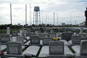
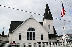
The first church on the island was Lee's Bethel. It burned down in the 1800s. A bench marks its spot in a graveyard. The oldest church still standing is Swain Memorial Methodist Church. It was built in 1835.
The New Testament Congregation is the only other church. It started in 1946. It is a non-denominational Christian church. Sometimes, people are buried in house yards. There are also cemeteries at each church.
Recent Challenges
Three hurricanes caused major flooding on the island. These were Isabel (2003), Ernesto (2006), and Sandy (2012). Some houses were left empty or torn down. Others were lifted higher on new foundations. New buildings are still being built on the island.
In the 1960s, the United States Army took over parts of Tangier Island. They used a process called eminent domain. Some residents had to move to Exmore on the mainland. The military needed the land for missile testing.
Island Geography
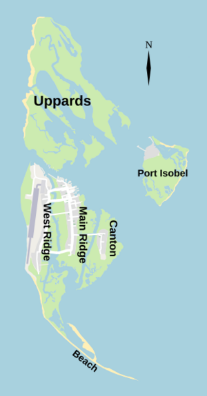
Tangier Island is in the Chesapeake Bay. It is part of Accomack County, Virginia. The island has three sandy ridges. Marshes and small streams divide them. These ridges are West Ridge, Main Ridge, and Canton Ridge. They run from east to west, parallel to each other.
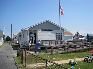
Most of the island's main places are on the Main Ridge. This includes the post office, restaurants, and Tangier Combined School. The West Ridge has four bridges to the Main Ridge. It also has a seawall built in 1990 to stop erosion. The Tangier Island Airport is also here. Canton Ridge has only one bridge. It used to be the biggest ridge. Now it is the smallest, with only a few families.
Nearby Islands
Some smaller, mostly empty islands are around Tangier. Uppards is the largest. It is north of the main island. It used to have a community called Canaan. About 40 families lived there. They left in 1928 because the water channel grew wider. Today, it has a few buildings for hunting.
Port Isobel is to the east. It has an education center. The Chesapeake Bay Foundation owns it. Other islands used to be lived on but are now underwater. These include Shanks and Piney Islands.
Shrinking Land
The island is in danger of disappearing. This is due to land turning into wetlands. Also, sea level rise caused by climate change is a problem. Since 1850, the island's land has shrunk by 67%. Experts believe two of the three ridges could become wetlands by the 2030s. The last ridge might be gone by 2051.
Many residents think erosion causes more flooding. A 2015 study by the Army Corps of Engineers agreed. They said Tangier might only be livable for 25–50 more years. The land has been sinking since the mid-1800s.
The study found several reasons for the sinking land. These include sea-level rise from melting ice sheets. Also, water is pumped out of the ground on mainland Virginia. The effects of an ancient meteor impact also play a role.
The town has asked politicians for help for many years. They want jetties or sea walls to protect the island. The town and its museum are raising money for a sea wall fund. In 2017, CNN showed a story about Tangier. Mayor James W. Eskridge was featured. President Donald Trump called the mayor. He said the town would survive. But he did not offer specific help or money.
Marshes and Waterfowl
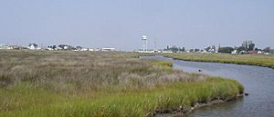
Tangier and nearby islands have important salt marshes. These are homes for many water birds. There are few predators for birds that nest on the ground. Many birds live in Tangier marshes. These include pelicans, blue herons, egrets, and different types of ducks and geese. The islands are a key place for American Black Ducks in Virginia.
Including the marshes, Tangier Island is less than 740 acres. But only 83 acres are high enough for people to live on. The highest point is barely 4 feet above sea level. About 9 acres of Tangier shoreline are lost to the Chesapeake each year. Islanders feel their way of life is threatened. This is due to fewer catches, fishing rules, constant erosion, and more frequent flooding.
Getting Around Tangier
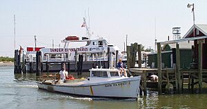
The only ways to get to and from the island are by boat or airplane. There is an airport. It is open from morning until night. Two boats travel regularly from Crisfield, Maryland, to Tangier. They carry people and mail.
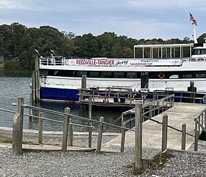
The mail boat, the Courtney Thomas, leaves Tangier at 8:00 am. It leaves Crisfield at 12:30 pm. The Steven Thomas is a cruise boat for 300 people. It leaves Crisfield at 12:30 pm and Tangier at 4:00 pm in summer. The Chesapeake Breeze travels daily from Reedville, Virginia. It leaves Reedville at 10:00 am and Tangier at 2:00 pm. Another ferry, the Joyce Marie II, runs daily from Onancock, Virginia in warmer months.
People on the island do not use many cars. Some residents use golf carts with trailers. They give "historical tours" to visitors. The roads on Tangier are wide enough for two golf carts. Tourists and islanders use golf carts, boats, mopeds, and bikes. Some people also have trucks and cars.
Island Language
Many people on Tangier Island speak a special dialect of Southern American English. Some scholars thought it came from 17th and 18th-century British English. But linguist David Shores says it's a unique dialect. It keeps some British features because the island is isolated. But it has also changed over time.
Many popular stories say the dialect came from early settlers from Cornwall and Devon in the United Kingdom. But David Shores disagrees with this idea. BBC Travel even made a short film about the language.
Before bridges were built, boats were the only way to travel between ridges. This helped the islands stay separate from the mainland. The local accent is sometimes compared to the "Hoi Toiders" of the Outer Banks. They have some similarities, but they are different dialects. Smith Island, Maryland, which is close to Tangier, has a dialect more like Tangier's.
Island Economy
Main Industries
Today, people on Tangier mainly make a living by crabbing. Tangier is often called the "soft-shell crab capital of the world." It is known as one of the last waterman communities. Most fishermen catch and sell crabs and oysters.
North of the island are many docks not connected to land. Fishermen use them to hold crabs while they molt. Oyster fishing used to be a big industry. It has returned recently to help the crabbing business. In 2014, a new oyster-farming company started. It is called Tangier Island Oyster Company.
The other main industry on the island is tourism. In the summer, several cruise ships visit daily. Passengers can explore and buy things from islanders. Two bed-and-breakfast inns offer places for guests to stay overnight. There are also several restaurants and gift shops for tourists.
Things to Do
Residents can easily stay in touch with the mainland. They have regular phone service, cable television, and internet. The island has several restaurants and an ice cream shop. There are four gift shops and a hardware store.
There is a natural beach without a boardwalk or shops. The island also has a historical museum. It offers a "historical tour" of the island. Tangier is famous for its seafood dishes. The soft-shell crab sandwiches are especially popular.
Island Life and Culture
The Nichols Health Center is on Tangier. The Riverside Health System runs it. This system also works on the Eastern Shore of Virginia.
Historically, two cases of Tangier disease were found here. This is a rare genetic disorder. It causes high blood cholesterol. The disease was named after the island. Very few people with this condition live on the island now.
Residents got cable television and internet in 2010. This was thanks to a microwave tower. Phone lines are also on the island. One physician assistant and several nurses live there. David Nichols treated residents for 30 years. He flew in once a week. In 2007, ABC World News Tonight featured him. Nichols passed away in 2010. A new clinic was named after him.
Emergency patients go by helicopter to hospitals in Maryland. The island has a power plant for emergencies. Power comes from the Eastern Shore of Virginia through an underwater cable.
Methodism has always been very important on Tangier. This started with preacher Joshua Thomas in the early 1800s. Because of their ties to the Northern Methodist Church, Tangier residents did not support slavery. They did not join Virginia in leaving the Union during the Civil War.
Education
Accomack County Public Schools runs the Tangier Combined School. It is the only public school in Virginia that teaches all grades, K-12. In 2018, it had 60 students.
Island Population
| Historical population | |||
|---|---|---|---|
| Census | Pop. | %± | |
| 1910 | 698 | — | |
| 1920 | 962 | 37.8% | |
| 1930 | 1,120 | 16.4% | |
| 1940 | 1,020 | −8.9% | |
| 1950 | 915 | −10.3% | |
| 1960 | 876 | −4.3% | |
| 1970 | 814 | −7.1% | |
| 1980 | 771 | −5.3% | |
| 1990 | 659 | −14.5% | |
| 2000 | 604 | −8.3% | |
| 2010 | 727 | 20.4% | |
| 2020 | 436 | −40.0% | |
| U.S. Decennial Census | |||
2020 Census Details
In 2020, 436 people lived in Tangier. There were 205 households and 213 families. The island had about 806 people per square mile. There were 271 housing units.
Most residents (97.9%) were White. There were two Asian residents and seven residents of two or more races. The average age was 54.6 years.
About 17.5% of households had children under 18. Nearly 48% were married couples. About 40% were non-families. Many households (38.5%) had one person living alone. About 27% had someone aged 65 or older living alone. The average household size was 2.09 people.
See also
 In Spanish: Tangier (Virginia) para niños
 | Jewel Prestage |
 | Ella Baker |
 | Fannie Lou Hamer |


