Tenza Valley facts for kids
Quick facts for kids Tenza Valley |
|
|---|---|
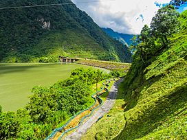
Chivor Reservoir and Dam in the Tenza Valley
|
|
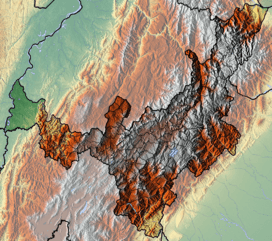
Topographical map of Boyacá
Tenza Valley is located in the south the elongated Chivor Reservoir is inside the valley |
|
| Floor elevation | 395–2,095 m (1,296–6,873 ft) |
| Geology | |
| Type | Valley |
| Geography | |
| Location | Eastern Ranges |
| Country | Colombia |
| State | Cundinamarca, Boyacá |
| Population centers | Tenza, Garagoa and Sutatenza |
| River | Lengupá |
The Tenza Valley (in Spanish: Valle de Tenza) is a beautiful valley found in the Eastern Mountains of the Colombian Andes. This valley stretches across the southeastern part of the Boyacá department and the northeastern part of Cundinamarca. It is located east of the Altiplano Cundiboyacense, a high plateau. Long ago, before the Spanish conquest of the Muisca, the higher parts of the Altiplano were home to the Muisca people. The lower areas to the east were inhabited by the Tegua.
Contents
What Does "Tenza" Mean?
The Tenza Valley gets its name from the town of Tenza. In the old Chibcha language, "Tenza" can mean "Behind the mouth" or "Going down at night."
Exploring the Tenza Valley's Geography
The Tenza Valley is nestled in the Eastern Mountains of the Colombian Andes. Its elevation changes quite a bit, from about 2,100 meters (6,900 feet) in the northwest to 400 meters (1,300 feet) in the southeast.
The Lengupá River flows through the valley. This river is part of the larger Orinoco River system, which eventually drains into the Atlantic Ocean. The Lengupá River connects the higher Altiplano Cundiboyacense with the Llanos Orientales, which are vast eastern plains. The valley has many water sources, and its average temperature is a pleasant 20 degrees Celsius (68 degrees Fahrenheit).
A Look into Tenza Valley's Past
Before the Spanish arrived, the Tenza Valley was home to the Muisca people. The valley was governed by a local leader called a cacique. This cacique was loyal to a more powerful ruler known as the zaque, who lived in Hunza (which is now Tunja).
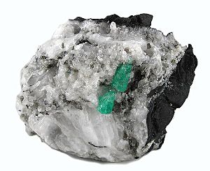
The Muisca people were skilled farmers. They grew many crops on the valley's fertile land. The Tenza Valley was also very important for the Muisca economy because it had valuable emerald mines in places like Chivor and Somondoco.
Archaeologist Juanita Sáenz Samper has found interesting things in the Tenza Valley. She discovered three ancient farming terraces and five cemeteries from pre-Columbian times. These sites also contained special grey ceramics, which are unique to the Tenza Valley and are called Valle de Tenza Gris.
Modern Times in the Valley
Today, the Chivor Reservoir is a major feature in the Tenza Valley. This reservoir is very important because it produces 8% of Colombia's hydroelectric energy, which is electricity made from water power. Even though the valley has a nice climate, it is not a very popular tourist spot compared to other parts of Boyacá.
What Grows and Is Mined in Tenza Valley?
The warm climate of the Tenza Valley is perfect for growing many different kinds of crops. Farmers here grow:
- Maize (corn)
- Yuca
- Potatoes and papa criolla (a type of yellow potato)
- Sugarcane
- Tomatoes
- Bananas
- Coffee
- Fique (a plant used for fibers)
- Arracacha (a root vegetable)
- Peas and beans
- Cucumbers and pumpkins
- Many fruits like mangoes, chirimoya, oranges, avocadoes, pineapples, mandarines, papayas, maracuyá, guayaba, and lulo.
The valley is also rich in minerals. The emerald mines of Chivor and Somondoco are very famous. There are also coal mines and some gold extraction. On a smaller scale, salt is mined in Sutatenza, and gypsum (a mineral used in plaster and fertilizer) is found in Macanal.
Towns and Cities in the Tenza Valley
Many towns and cities are located within the Tenza Valley, each with its own history and features. Here's a list of them:
| Municipality | Department | Ancient Ruler(s) | Altitude urban centre (m) |
Surface area (km2) |
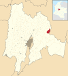
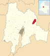
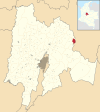
Interesting Facts | Map |
|---|---|---|---|---|---|---|
| Tenza | Boyacá | cacique | 1600 | 51 | The valley is named after this town. | |
| Almeida | Boyacá | zaque | 1925 | 57.98 | Home to a hydroelectric plant for the Chivor Reservoir. | |
| La Capilla | Boyacá | zaque | 1750 | 57.26 | ||
| Chinavita | Boyacá | zaque | 1763 | 148 | ||
| Chivor | Boyacá | cacique | 1800 | 108.36 | Known for its important emerald mines. | |
| Garagoa | Boyacá | zaque | 1650 | 191.75 | The main town for the Catholic Church's Diocese in the area. | |
| Guateque | Boyacá | cacique | 1815 | 36.04 | ||
| Guayatá | Boyacá | cacique | 1767 | 112 | Famous for its delicious bread rolls called mogollas. | |
| Macanal | Boyacá | zaque | 1680 | 199.5 | Has Gypsum mining. | |
| Pachavita | Boyacá | zaque | 1985 | 68 | ||
| Somondoco | Boyacá | zaque | 1670 | 58.7 | Another town with important emerald mines. | |
| Sutatenza | Boyacá | zaque | 1890 | 41.26 | Has small-scale salt mining. | |
| Manta | Cundinamarca | cacique | 1924 | 105 | Possibly the birthplace of Jorge Eliécer Gaitán, a famous Colombian politician. | |
| Machetá | Cundinamarca | zaque | 2094 | 229.35 | ||
| Tibiritá | Cundinamarca | zaque | 1980 | 57.2 | ||
| Santa María | Boyacá | Tegua | 850 | 326.44 | ||
| San Luis de Gaceno | Boyacá | Tegua | 395 | 458.5 |
See also
 In Spanish: Valle de Tenza para niños
 | Stephanie Wilson |
 | Charles Bolden |
 | Ronald McNair |
 | Frederick D. Gregory |


