Wirral Peninsula facts for kids
|
|
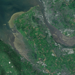
Satellite image of the peninsula
|
|
| Geography | |
|---|---|
| Location | Northwest England |
| Coordinates | 53°22′N 3°05′W / 53.367°N 3.083°W |
| OS grid reference | SJ285850 |
| Adjacent bodies of water | Irish Sea (Liverpool Bay) • Dee Estuary • Mersey Estuary |
| Administration | |
| Country | England |
| Region | North West England |
| Ceremonial county | Merseyside • Cheshire |
| Boroughs | Wirral • Cheshire West and Chester (part) |
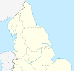
The Wirral Peninsula, often called the Wirral, is a piece of land in North West England surrounded by water on three sides. It's about 15 miles (24 km) long and 7 miles (11 km) wide. The Dee Estuary is to its west, the Mersey Estuary to its east, and Liverpool Bay to the north.
Historically, the Wirral was part of Cheshire. However, since 1972, most of it is now in the Metropolitan Borough of Wirral in Merseyside. A small part in the southwest is even in the Welsh county of Flintshire.
Contents
What's in a Name?
The name Wirral means "myrtle corner." It comes from Old English words: wir for myrtle tree and heal for angle or corner. People believe the area was once covered in a plant called bog myrtle. This plant is no longer found there, but it was common in similar habitats. The name was given to the area around the 8th century.
A Look Back: Wirral's History
Early People and Settlements
People first lived on the Wirral around 12,000 BC, during the Mesolithic period. Tools and hearths found at Greasby show that hunter-gatherers lived here. Other old evidence has been found at Irby, Hoylake, and New Brighton.
Later, in the Neolithic period, stone axes and pottery were found in Oxton, Neston, and Meols. Meols was an important port from at least 500 BC. Traders from far away came to get minerals from North Wales and Cheshire. There's also an Iron Age fort at Burton, which is how the town got its name.
Romans and Britons in Wirral
Around AD 70, the Romans built Chester. They left signs of their presence on the Wirral, like parts of a road near Mollington. This road might have led to the port at Meols, which Romans might have used to attack the North Wales coast.
Even after the Romans left in 410 AD, Meols continued to be a trading port. Evidence of early Celtic Christianity from the 5th or 6th centuries can be seen in the round shape of churchyards in places like Bromborough. The names Liscard and Landican also suggest an ancient British origin. The name Wallasey means "Welsh (or foreigners') island," showing British people lived there.
English and Norse Settlers
Around 616 AD, the Anglo-Saxons attacked Chester. The area west and south of the Mersey became part of Mercia. Anglo-Saxon settlers moved into the Wirral, naming many villages like Willaston and Eastham.
Later, in the late 800s, Vikings started raiding and settling. They lived along the Dee side of the peninsula and the coast. They gave names to villages like Kirby, Greasby, and Meols. They even had their own local government system with a meeting place at Thingwall.
The Vikings' influence is still seen in place names today. For example, many names end with "-by," which means "village" in Scandinavian languages. Tranmere comes from a Norse name meaning "cranebird sandbank."
Bromborough on the Wirral is one possible site of the Battle of Brunanburh in 937 AD. This battle was important because it united England against Norse and Scottish forces. Some historians call it the birthplace of England.
Normans and the Middle Ages
After the Normans invaded in 1066, much of the Wirral was damaged. In 1086, the Wirral was more populated than most of England. Many areas were controlled by Norman lords.
Between 1120 and 1123, the Wirral became a hunting forest. This meant hunting deer and boar was only allowed for certain people. If you hunted without permission, you faced harsh punishments. However, after complaints, the Wirral stopped being a hunting forest in 1376.
Around the late 1100s, Birkenhead Priory was built. Its monks started the first official Mersey ferry service to Liverpool around 1330. At this time, much of the Wirral was owned by Chester Abbey. Meols continued to be an important port, and many old items have been found there.
Changes in the 16th, 17th, and 18th Centuries
By 1545, the Wirral had about 4,000 people. It was divided into 15 parishes, which were like small rural villages.
The nearby port of Chester influenced the Dee side of the Wirral. As the Dee River became shallower, new ports developed at places like Neston and Parkgate. However, Liverpool grew much faster, especially after its first wet dock opened in 1715.
The growth of Liverpool led to more lighthouses being built along the north Wirral coast. Ferries across the River Mersey also became very busy. By the late 1700s, there were five ferry houses on the Wirral side of the Mersey. Roads also improved, and the Ellesmere Canal was started in 1793, leading to the growth of Ellesmere Port.
The 19th Century: Growth and Industry
In 1817, the first steam ferry service started across the Mersey. This helped industries grow along the Wirral's Mersey coast. The area became known for shipbuilding when William Laird opened his shipyard in Birkenhead in the 1820s.
The Laird family helped Birkenhead grow quickly. They planned it as a new town like Edinburgh. In 1847, Birkenhead's first docks and municipal park opened. This park was the first of its kind in Britain and inspired New York's Central Park. Birkenhead's population grew from under a thousand in 1801 to over 157,000 by 1901.
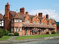
Liverpool merchants also bought land on the Wirral. They developed resorts like New Brighton and new estates for wealthy families. In 1852, Price's Patent Candle Company built a factory and village at Bromborough. Later, in 1888, William Lever created the large Sunlight soap factory and Port Sunlight garden village for his workers.
In 1886, the Mersey Railway tunnel opened, connecting the Wirral and Liverpool. This led to many new suburbs growing in places like Wallasey and West Kirby.
The 20th Century: Modern Wirral
The dock areas of Wallasey and Birkenhead continued to grow in the early 1900s. They specialized in trade with Africa and the Far East. Many related industries, like flour milling and oil refining, also developed. In 1922, a new oil dock was built at Stanlow near Ellesmere Port.
In 1929, the 3rd World Scout Jamboree was held at Arrowe Park. Over 30,000 Scouts from 35 countries attended.
In 1934, a vehicle tunnel, the Queensway Tunnel, opened under the Mersey. A third tunnel, the Kingsway Tunnel, opened in 1971. These tunnels helped people commute by car between Liverpool and the Wirral. This led to new housing estates around villages like Moreton and Greasby.
During World War II (1940-1941), parts of the Wirral, especially around the docks, were heavily bombed. Many homes were destroyed, and hundreds of people were killed. The Wirral also had RAF sites and anti-aircraft defenses to protect the docks.
After the war, some older industries declined. However, new industrial areas developed, including the large Vauxhall Motors car factory.
The 21st Century: New Plans
In 2006, plans were announced for a huge development called Wirral Waters around the docklands. This project includes homes, offices, and leisure facilities. Work began in 2011 and could continue for 30 years.
Wirral's Landscape
What the Land is Made Of
The Wirral is mostly made of sedimentary rocks from the Triassic age. These include sandstone, mudstones, and siltstones. You can see these rocks at places like Bidston Hill and Hilbre Island.
Most of the bedrock is covered by thick layers of till, which is left over from the last ice age. Wind-blown sands cover the northern coast. The Dee and Mersey estuaries were shaped by ice moving during past ice ages.
Physical Features
The Wirral is a peninsula surrounded by the Dee and Mersey estuaries and the Irish Sea. The Shropshire Union Canal also runs across its base, technically making it an island.
Two parallel sandstone ridges run down the peninsula. The western ridge includes Grange and Caldy Hills, and Thurstaston Hill. The highest point on the Wirral is Poll Hill in Heswall, at 350 feet (107 meters). The eastern ridge includes Bidston Hill and Storeton Hill.
Weather and Climate
The Wirral has a temperate maritime climate. This means it has mild summers, cool winters, and rain spread throughout the year.
People and Places
The main towns on the Wirral are Birkenhead and Wallasey in the east. The west and south parts are more rural. Most of the Wirral's population lives in Birkenhead and Wallasey. Ellesmere Port is also often seen as a "border town" of the Wirral.
Towns and Villages
Many towns and villages are on the Wirral. Some are in the Metropolitan Borough of Wirral, and others are in Cheshire West and Chester. These include:
|
|
|
|
|
The M53 Divide
The M53 motorway is sometimes seen as a line that divides the Wirral. Areas to the west of the motorway are often considered more affluent, while areas to the east are still developing.
Cool Places to Visit
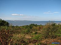
Even with its towns and industries, the Wirral has beautiful villages, sandy beaches, and lots of land owned by the National Trust. You can enjoy views across the estuaries and out to the Irish Sea.
Some great outdoor places include Bidston Hill, Caldy Hill, Eastham Country Park, Hilbre Island, and the Wirral Way. The Ness Botanical Gardens are part of the University of Liverpool and have won many awards. You can also watch birds at the RSPB Burton Mere Wetlands nature reserve.
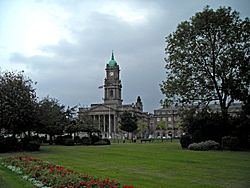
Places with interesting buildings include Hamilton Square, Rock Park, and Port Sunlight. The view of Liverpool's Pier Head from the Mersey Ferry is very famous. Many Wirral villages, like Burton, have well-preserved red sandstone buildings. The old port of Parkgate is also popular.
For art lovers, there's the Lady Lever Art Gallery at Port Sunlight and the Williamson Art Gallery in Birkenhead. Historical sites include Birkenhead Priory, Leasowe Lighthouse, and the ancient carvings on Bidston Hill.
How People Talk: Accents and Dialects
The way people speak on the Wirral can vary. On the east side, accents tend to sound more like those from Merseyside. On the west side, they might sound a bit different. Neston once had its own unique way of speaking, influenced by coal miners.
Wirral in Books
- Sir Gawain spent Christmas on the Wirral in the old story Sir Gawain and the Green Knight. The poem describes it as a wild place.
- Writer Olaf Stapledon lived in West Kirby and Caldy. Many places in his books are based on Wirral landscapes.
- Local historian John Lamb believes that Jules Verne and Robert Louis Stevenson used parts of the Wirral in their famous books.
- Poet Jim Bennett lives on the Wirral, and his poems often mention local landmarks.
- In Helen Forrester's book Twopence to Cross the Mersey (1974), the Wirral is seen as a rich, faraway place from the perspective of a poor girl in Liverpool.
- The Wirral is the setting for Kevin Samson's novel Awaydays, which was later made into a film.
- Writer Ramsey Campbell lives on the Wirral, and his horror novels often use local landscapes like Thurstaston Common.
Famous People from Wirral
Wirral on Screen
The Wirral has been a filming location for many movies and TV shows.
- Chariots of Fire was filmed at places like the Oval Sports Centre in Bebington and Woodside Ferry Terminal.
- The 1950 comedy The Magnet was filmed in Wallasey and New Brighton.
- The 51st State had scenes filmed around the docks in Birkenhead.
- Awaydays, based on a Wirral novel, was filmed extensively here.
- The movie Blood (2012) was filmed on the Wirral.
- The Queensway Tunnel in Birkenhead appeared in Harry Potter and the Deathly Hallows – Part 1 and Fast & Furious 6. An unused part of the tunnel was used for a New York scene in Jack Ryan: Shadow Recruit.
- Scenes for Florence Foster Jenkins (2016), starring Hugh Grant and Meryl Streep, were filmed in New Brighton.
For TV shows:
- The sitcom Watching was partly set and filmed in Wirral, especially Meols.
- Mike Bassett: Manager featured a fictional football club called Wirral County, based on Tranmere Rovers.
- Hollyoaks is believed to film sometimes on the Wirral.
- Candy Cabs filmed scenes in West Kirby and Hoylake.
- Wallasey School was featured in Grease: The School Musical on Sky One.
- Peaky Blinders filmed scenes in Port Sunlight.
- Peter Kay's Car Share filmed in Meols and West Kirby.
- Sky One's The Five shot scenes around the Wirral.
- The ITV drama Safe House filmed several scenes here.
- In 2017, a movie about author Tolkien was filmed in Port Sunlight and Thornton Hough.
- Port Sunlight village also appeared on The Great Interior Design Challenge and The Antiques Roadshow.
- In 2018, the film Official Secrets filmed beach scenes at Thurstaston.
Media in Wirral
Local news and TV shows come from BBC North West and ITV Granada. You can also get TV signals from North Wales.
Local radio stations include BBC Radio Merseyside, Heart North West, and Radio Wirral.
The main local newspapers are the Wirral Globe and the Liverpool Echo.
Getting Around: Transport
The M53 motorway runs through the Wirral. At the northern end, the Wirral is connected to Liverpool by three tunnels under the Mersey: two for cars (Kingsway and Queensway) and one for the Mersey Railway.
Buses serve the Wirral, run by companies like Arriva North West and Stagecoach Wirral. Most services start from bus stations in Birkenhead, Heswall, and Woodside.
The Wirral Line of the Merseyrail train network connects towns like West Kirby, New Brighton, Chester, and Ellesmere Port to Liverpool's city centre stations. Another train line, the Borderlands Line, connects Bidston to Wrexham in North Wales.
Regular Mersey Ferry crossings go to Liverpool from Woodside and Seacombe. These are used by commuters and for fun boat trips.
The closest airports for passengers are Liverpool John Lennon Airport and Manchester Airport.
Sports and Activities
Football Fun
- Tranmere Rovers Football Club is the Wirral's only professional football club. They play at Prenton Park in Birkenhead.
- Cammell Laird 1907 F.C. is a non-league football club that plays in Rock Ferry.
- Other football teams, like the old New Brighton Tower F.C., have also played in New Brighton.
Golf Courses
- The Open Championship, a very famous golf tournament, has been played many times at the Royal Liverpool Golf Club in Hoylake. The Women's British Open was also played there in 2012.
Rugby Teams
- Caldy RFC plays rugby union at Paton Field in Thurstaston. They are in England's second-highest league.
- Wirral Warriors play rugby league in Clatterbridge.
- Other rugby clubs include Birkenhead Park FC, Wirral Rugby Club, Anselmians RUFC, Hoylake RUFC, Port Sunlight RFC, Oldershaw RUFC, New Brighton RUFC, and Wallasey RUFC.
Water Sports
- Hoylake is a top spot for land sailing (sand yachting) in Europe. It has hosted European Championships.
- West Kirby has a marine lake perfect for windsurfing, sailing, and sea kayaking. It hosts a big sailing competition called the Wilson Trophy.
- New Brighton is popular for jet-skiing, paddle boarding, and kitesurfing.
Cricket Clubs
- Birkenhead Park Cricket Club
- Birkenhead St Mary's Cricket Club
- Irby Cricket Club
- Neston Cricket Club
- Upton Cricket Club
- Wirral Cricket Club
Other Sports
- Neston South Wirral Hockey Club is the biggest hockey club on the Wirral.
- Oxton Hockey Club was founded in 1888 and is now a National League side.
See also
 In Spanish: Península de Wirral para niños


