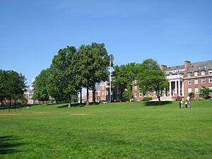
Wallingford, Connecticut facts for kids
Quick facts for kids
Wallingford
|
|||
|---|---|---|---|
| Town of Wallingford | |||
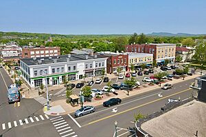
Downtown Wallingford
|
|||
|
|||
| Motto(s):
"A Great New England Town"
|
|||
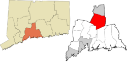
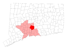 New Haven County and Connecticut New Haven County and Connecticut |
|||
| Country | United States | ||
| U.S. state | Connecticut | ||
| County | New Haven | ||
| Region | South Central CT | ||
| MSA | Greater New Haven | ||
| CSA | New York | ||
| Established | 1670 | ||
| Government | |||
| • Type | Mayor-council | ||
| Area | |||
| • Total | 39.9 sq mi (103.3 km2) | ||
| • Land | 39.0 sq mi (101.1 km2) | ||
| • Water | 0.9 sq mi (2.2 km2) | ||
| Elevation | 151 ft (46 m) | ||
| Population
(2020)
|
|||
| • Total | 44,396 | ||
| • Density | 1,112.7/sq mi (429.78/km2) | ||
| Time zone | UTC−5 (Eastern) | ||
| • Summer (DST) | UTC−4 (Eastern) | ||
| ZIP Codes |
06492, 06493
|
||
| Area code(s) | 203/475 | ||
| FIPS code | 09-78740 | ||
| GNIS feature ID | 0213522 | ||
Wallingford is a town in New Haven County, Connecticut, United States. It is located between the cities of New Haven and Hartford. It is also between Boston and New York City.
Wallingford is part of the South Central Connecticut Planning Region. It is also part of the larger New York Metropolitan Area. In 2020, about 44,396 people lived here. The town was named after Wallingford, a town in England.
Contents
History of Wallingford
Wallingford, Connecticut, has a rich history from early America. It was founded on October 10, 1667, by the Connecticut General Assembly. A group of 38 settlers, called "planters and freemen," started the town. Important people like John Moss, Samuel Street, and Robert Wallace were among them.
The first settlers chose a good spot near the Quinnipiac River. This area is now known as Main Street. By May 12, 1670, 126 people lived in temporary homes. By 1675, 40 permanent houses were built. This showed the town was growing and becoming stable.
Early Settlers and Yale University
One of Wallingford’s first settlers was Thomas Yale. He was an important person in the New Haven Colony. He was also an ancestor of Elihu Yale, who helped start Yale University. Thomas Yale signed the agreement to establish Wallingford in 1667.
Witchcraft Trials and Independence
In 1697, Wallingford was the site of New England's last witchcraft trial. A woman named Winifred Benham was accused of being a witch. She was tried three times in Wallingford but was found innocent each time. This event marked the end of witch trials in the area. It showed that fears about witchcraft were fading.
The town also played a big part in America’s fight for freedom. Lyman Hall was born in Wallingford in 1724. He became a doctor and a leader. He represented Georgia in the Continental Congress. Hall was one of the people who signed the Declaration of Independence. This shows Wallingford's strong connection to the founding of the United States.
Growth and Industry
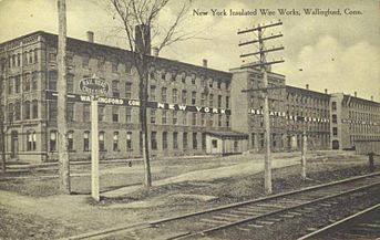
In the 1800s, Wallingford changed from a farming town to an industrial one. The railroad arrived in the 1840s. This helped the town grow even faster. The railroad connected Wallingford to bigger markets. It made it easier to transport goods, like the town's famous silver products. This also led to new industries starting up.
Wallingford became well-known for making silver. Companies like Hall, Elton & Co., Simpson, Hall, Miller & Co., and R. Wallace & Sons became famous across the country. Samuel Simpson was a key person in this industry. He was a local business owner and helped the community. He played a big part in Wallingford becoming a center for silver manufacturing. His company, Simpson, Hall, Miller & Co., became a top producer of silverware. Samuel Simpson's work helped make Wallingford a major place for silver production. His company later joined the International Silver Company. This made the region a global leader in silver manufacturing.
Moses Y. Beach, the founder of Associated Press, was also born in Wallingford. He was an inventor, newspaperman, entrepreneur, and philanthropist. Moses is known for creating the "penny press," which made newspapers cheap for everyone.
A Devastating Tornado
However, Wallingford also faced a terrible event. On August 9, 1878, a powerful tornado hit the town. It caused a lot of damage and killed at least 29 people, possibly as many as 34. This tornado is still the deadliest in Connecticut's history. The disaster had a lasting effect on the community.
Modern Wallingford
In the 1900s, Wallingford became more of a residential town. It still kept its different types of businesses. After World War II, many more people moved to Wallingford. This was part of a big growth in suburbs across America. New neighborhoods were built, attracting families. They wanted a mix of city conveniences and small-town charm.
Even with more homes, Wallingford continued to attract businesses. It kept a strong economy. The town became a center for many industries. These included medical, healthcare, high-tech manufacturing, and research. Several industrial parks were built, like Barnes Industrial Park and MedWay Industrial Park. These parks brought many businesses to Wallingford. This helped the town's economy grow even more. An "Interchange Zone" was created where Interstate 91 and Route 68 meet. This helped office parks, research centers, and hotels grow. It made Wallingford an important economic center in the region.
One major company in Wallingford was Bristol-Myers Squibb. This pharmaceutical company had a research facility in MedWay Industrial Park. It was the town's largest taxpayer and a big part of its economy. However, in 2017, Bristol-Myers Squibb moved its operations. The facility was torn down in 2018.
-
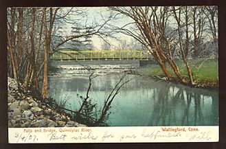
Bridge and falls at Quinnipiac River in Wallingford, 1907.
Education
Wallingford has its own public school district. It includes several elementary schools. There are two middle schools: Dag Hammarskjold and James H. Moran. The town also has two high schools: Mark T. Sheehan and Lyman Hall.
The school district offers many different programs. These include Advanced Placement (AP) courses, STEM (Science, Technology, Engineering, and Math) education, and arts programs. Lyman Hall High School has a special agricultural science program. The district also helps students with special needs and those learning English. It offers many sports, like football, soccer, basketball, and track and field.
Private Schools
Wallingford is also home to three private schools:
- Choate Rosemary Hall: This is a private school where both boys and girls learn together. It prepares students for college and offers boarding (students live at the school).
- Heritage Baptist Academy
- Holy Trinity School
Geography
Wallingford covers about 39.9 square miles (103.3 km2). Most of this area, 39.0 square miles (101.1 km2), is land. The rest, 0.9 square miles (2.2 km2), is water.
The town is located along the Quinnipiac River in northern New Haven County. It is about 90 miles northeast of New York City. Wallingford is about 5 miles south of Meriden. It is also about 13 miles north of New Haven.
Neighboring Towns
Wallingford shares borders with several other towns:
- Cheshire
- Durham
- Hamden
- Meriden
- Middlefield
- North Branford
- North Haven
Major Roads
Wallingford is located in the area between Hartford, New Haven, and Springfield, Massachusetts. Several important roads pass through the town:
- U.S. Route 5
- Interstate 91
- State Highways Route 15 (Wilbur Cross Parkway)
- Route 68
- Route 71
- Route 150
Main Communities
Wallingford has several main communities within its borders:
- East Wallingford
- Quinnipiac (partly in North Haven)
- Tracy
- Wallingford Center
- Yalesville
Demographics
| Historical population | |||
|---|---|---|---|
| Census | Pop. | %± | |
| 1820 | 2,237 | — | |
| 1850 | 2,595 | — | |
| 1860 | 3,206 | 23.5% | |
| 1870 | 3,676 | 14.7% | |
| 1880 | 4,686 | 27.5% | |
| 1890 | 6,584 | 40.5% | |
| 1900 | 9,001 | 36.7% | |
| 1910 | 11,155 | 23.9% | |
| 1920 | 12,010 | 7.7% | |
| 1930 | 14,278 | 18.9% | |
| 1940 | 14,788 | 3.6% | |
| 1950 | 16,976 | 14.8% | |
| 1960 | 29,920 | 76.2% | |
| 1970 | 35,714 | 19.4% | |
| 1980 | 37,274 | 4.4% | |
| 1990 | 40,822 | 9.5% | |
| 2000 | 43,026 | 5.4% | |
| 2010 | 45,135 | 4.9% | |
| 2020 | 44,396 | −1.6% | |
| U.S. Decennial Census | |||
In 2022, Wallingford had about 44,446 residents. Most residents (80.2%) are white. About 11.6% are Hispanic, and 4.4% are Asian. The median age in Wallingford is 44.3 years old. This means there is a mix of families and young working adults. About 63% of households are families. Of these, 24% have children living at home.
In 2023, the median household income in Wallingford was $101,572. The median family income was $123,493. The average household income was $120,987, and the average family income was $145,477. Wallingford's income is much higher than the national average. This puts it among the top 25% of households in the U.S.
Economy
Top Employers
Here are the top employers in Wallingford, based on the town's 2022 financial report:
| # | Employer | # of Employees |
|---|---|---|
| 1 | Town of Wallingford | 1,478 |
| 2 | Anthem BC/BS | 1,225 |
| 3 | Gaylord Hospital | 529 |
| 4 | Community Health Network of CT | 438 |
| 5 | Masonic Healthcare Center | 417 |
| 6 | Choate Rosemary Hall | 299 |
| 7 | Ulbrich Stainless Steels & Special Metals, Inc. | 215 |
| 8 | BYK | 197 |
| 9 | Thurston Foods Inc | 169 |
| 10 | Fosdick Fulfillment Corp | 157 |
Transportation
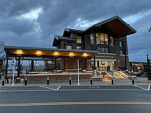
Mass Transit
Wallingford is on the New Haven–Springfield Line. This means there are daily passenger trains going north and south. You can travel directly to New York City. You can also get to Boston by changing trains in New Haven. The Wallingford station is served by CT Rail's Hartford Line trains. It is also served by Amtrak's Hartford Line, Northeast Regional, and Valley Flyer trains.
Airports
The closest commercial airports to Wallingford are:
- Tweed New Haven Airport (HVN) in East Haven
- Westchester County Airport in Westchester County
- Bradley International Airport (BDL) in Windsor Locks
Municipal Electric Utility
The Wallingford Electric Division (WED) is a special company owned by the town. It provides electricity to all homes and businesses in Wallingford. WED was started in 1899. It is one of the few electric companies in Connecticut owned by a town. It is known for offering reliable service at good prices.
WED is in charge of making, distributing, and maintaining the town's electricity system. It focuses on being efficient and dependable. The Public Utilities Commission of Wallingford oversees WED. They manage its operations, money, and future plans. WED's goal is to provide affordable and reliable electricity. It also aims to meet the changing needs of the community.
Sports
In 1943 and 1944, the Boston Braves baseball team held their spring training in Wallingford. They trained at Choate's Winter Exercise Building. The town is also home to the Connecticut Bearcats. This is a team in the New England Football League.
Notable People
- Alice Blaski, baseball player
- Erich Auerbach, German language expert
- Moses Yale Beach, American inventor, business owner, and publisher. He started the Associated Press.
- William Yale Beach, early banker in Wallingford, son of Moses Yale Beach
- Stephen R. Bradley, United States Senator
- Michael Buckley, YouTuber
- Mary Atwater Choate, co-founded Choate Rosemary Hall school
- William Gardner Choate, American judge, co-founded Choate Rosemary Hall school
- Bates Cooke, US Congressman
- D.J. Cotrona, actor
- Pasquale DeBaise (1926–2022), businessman and Connecticut state politician
- Beverly Donofrio, author
- Morton Downey, singer, businessman
- Morton Downey, Jr. (1932–2001), talk show host
- Lauren Geremia, interior designer
- Robert Gober, influential contemporary artist
- Lyman Hall, an American Founding Father, doctor, and signer of the Declaration of Independence
- Dorothy Kosinski, art scholar
- Raoul Lufbery, World War I flying ace
- John A. McGuire, member of the United States House of Representatives
- Art Nugent, cartoonist, creator of Uncle Art's Funland
- Jay Allen Sanford, author and cartoonist
- Samuel Simpson, silversmith business owner
- Hilton Valentine (1943–2021), musician from The Animals, moved to Wallingford in 1977
- Theophilus Yale, captain, judge, and early settler of Wallingford
- Elihu Yale, captain, pioneer bayonet maker in Connecticut
- Charles Dwight Yale, Connecticut State Senator, businessman, co-owner of Simpson, Hall, Miller & Co.
- Thomas Yale, one of the co-founders of Wallingford
Points of Interest
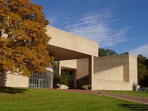
- Choate Rosemary Hall
- Oakdale Theatre
- Paul Mellon Arts Center
- Yalesville Underpass
National Register of Historic Places
Ten buildings and areas in Wallingford are listed on the National Register of Historic Places. This means they are important historical sites:
- Center Street Cemetery, added August 1, 1997
- Franklin Johnson House, added November 23, 1998
- John Barker House, added August 3, 1974
- Joseph Blakeslee House, added April 13, 1998
- Nehemiah Royce House, added August 24, 1998
- Samuel Parsons House, added April 12, 1982
- Samuel Simpson House, added June 18, 1986
- Theophilus Jones House, added January 30, 1992
- Wallingford Center Historic District, added December 2, 1993
- Wallingford railroad station, added November 19, 1993
See also
 In Spanish: Wallingford (Connecticut) para niños
 | Janet Taylor Pickett |
 | Synthia Saint James |
 | Howardena Pindell |
 | Faith Ringgold |


