Warwickshire ring facts for kids
The Warwickshire Ring is a cool route of canals that goes in a big circle around the West Midlands part of England. It's made up of five different canals: the Coventry Canal, the Oxford Canal, the Grand Union Canal, the Stratford-upon-Avon Canal, and the Birmingham and Fazeley Canal. Lots of people love to travel this route because it's a circle, and you get to see both busy city areas and peaceful countryside.
The whole ring is about 106 miles long and has 115 locks. There are two ways to go through the southern part of Birmingham. From Kingswood Junction, you can follow the Grand Union Canal to Salford Junction. Or, you can take the Stratford Canal (north) and the Worcester and Birmingham Canal to Gas Street Basin in central Birmingham. The second way is a bit longer and has more locks. But many people think it's prettier and more fun.
Contents
Exploring the Warwickshire Ring
The Warwickshire Ring offers a bit of everything for canal explorers. You'll find both wide and narrow locks. You'll see beautiful open countryside and also areas that used to be industrial. Some old factories are gone, some have been improved, and some are still there. You can visit popular tourist spots like Warwick Castle. There are also world-class attractions like Drayton Manor Theme Park.
The ring uses parts of four main canals:
Grand Union Canal Adventures
Starting at Braunston Turn, you head west on the Grand Union Main Line. This part is about five miles long and goes through nice farmland to Napton Junction. The village of Lower Shuckburgh is close by. This section used to be part of the Oxford Canal.
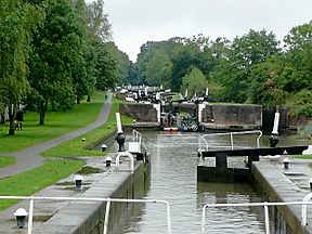
At Napton Junction, the Oxford Canal goes straight. But the ring turns north. You'll pass Napton Reservoirs on your left. Then, you go down through the first three locks at Calcutt. These locks were made wider in the 1930s. You can still see the old, narrow locks next to them.
Journey to Warwick
Turning west, the canal goes towards Stockton locks. These eight locks take the canal downhill to Long Itchington. Again, you can still see the old narrow locks. After two more single locks, you reach the Bascote four. The top two of these form a staircase, where one lock leads right into the next. Six more locks take the canal down to the Leam and Avon valleys.
In Royal Leamington Spa, you can visit the lovely Jephson Gardens. These gardens honor Dr. Jephson, who helped make the town famous for its spa. In Warwick, a big attraction is the 14th-century Warwick Castle. Its grounds were designed by a famous landscape architect named Capability Brown.
Climbing Hatton Locks
The climb out of the Avon Valley starts at the two Cape Locks. The Cape of Good Hope pub here even sells a local beer called "Two Locks." This is because the brewery is two locks down from the pub! The route then turns right onto the Warwick and Birmingham Canal. This was another canal that joined to form the Grand Union Canal. To the left is Saltisford Basin, run by a Canal Trust. It used to be the end of the Warwick and Birmingham Canal.
After climbing some of the 21 Hatton Locks, you get an amazing view. You can see the huge locks climbing the hill in a long line. Even though they are big, these locks fill and empty quickly. From the top of Hatton, you get a ten-mile break from locks. You'll go through the 443-yard Shrewley Tunnel. This tunnel has a path for walking and is wide enough for two boats to pass. It comes out near Shrewley village.
Choices at Kingswood Junction
At Kingswood Junction, you have a choice of routes. If you want to go to Gas Street and Birmingham city center, the narrow Stratford-on-Avon Canal has more locks and takes longer. But if you're just going around the ring, the main line is shorter and faster.
The five locks at Knowle raise the canal to its highest point. These replaced six narrow locks in 1930. You can still see the remains of the old locks. These are the last wide locks before Birmingham. After going under the M42 motorway, an aqueduct carries the canal over the River Blythe. Then, it turns west near Solihull. The journey through Solihull is in a deep, green cutting. This hides the city views from boaters. Later, trees give way to old wharves and houses.
Birmingham's Canal History
The six Camp Hill locks are narrow. They drop the canal down to Bordesley Junction. Here, the Warwickshire Ring turns right. Straight ahead is the route to Digbeth Basin. In the 1930s, this was a major center for canal transport. You can see old warehouses, an ice house, and a tea warehouse.
From Bordesley Junction, Saltley Cut used to be very dirty. Gas works, a power station, and factories all used to dump waste into the canal. Now, it has been cleaned up. There are new houses along the waterfront.
The five Garrison Locks lower the canal into the valley of the River Rea. The canal crosses this river on an aqueduct. It also crosses the River Tame just before Salford Junction. This is where the Grand Union Canal meets the Birmingham and Fazeley Canal and the Tame Valley Canal. The junction and aqueduct are overshadowed by the huge road bridges of Spaghetti Junction.
Birmingham and Fazeley Canal Journey
At Salford Junction, boaters on the Warwickshire Ring turn right onto the Birmingham and Fazeley Canal. This canal runs between factories and the M6 motorway. You'll pass a large electricity center. Then, you reach Erdington Hall, where a factory is built over the canal. It almost feels like a tunnel. Nearby was Fort Dunlop, where the Dunlop Rubber company made tires. At its busiest, 10,000 people worked there.

The canal eventually comes out into the quieter area of Minworth. Here, three locks lower the canal's level. To the south is Minworth Sewage Treatment Works. It's one of Britain's biggest, cleaning 220 million gallons of water every day. The canal then goes through a tree-lined cutting. It passes through the short, 57-yard Curdworth tunnel. This tunnel goes under the M6 Toll motorway. The first of the eleven Curdworth locks is right after the bridge. The canal continues through open countryside and old gravel pits. The M42 motorway is always close by to the east.
Some of the gravel pits have been turned into Kingsbury Water Park. This park covers 600 acres and has 30 lakes and pools. You can enjoy walking, nature trails, sailing, and horse riding here. There's also a children's farm. At Fazeley, the canal runs next to Drayton Manor Theme Park. It crosses Bourne Brook, another river, before reaching Fazeley Junction and the Coventry Canal.
Coventry Canal Highlights
The section of the Coventry Canal that turns left was actually built by the Birmingham and Fazeley Canal. This happened because the Coventry Canal ran out of money. However, the Warwickshire Ring turns right. This part was built before the money problems. Near the junction is Fazeley Mill, which has made tape since 1886. There's also a mill built in 1791, which is a great example of its kind.
A large aqueduct carries the canal over the River Tame. After this, you'll see the houses and factories of Tamworth. The Reliant Car Company used to make Reliant Robin cars here. Tamworth also has a castle with many different building styles. It has a Norman mound, an Elizabethan timbered hall, and Jacobean apartments.
Two locks raise the canal's level in Tamworth. Then, there's a long flat section. Beyond Tamworth's houses, the canal passes the remains of Alvecote Priory. It then turns south-east. After going under the M42 motorway, it joins the valley of the River Anker. It follows this river on a ledge on the west side of the valley. It goes through the center of Polesworth. Then, it's surrounded by farmland. Finally, it starts to climb out of the valley to Atherstone. This climb is through eleven narrow locks. Atherstone was famous for making hats, even for armies.
Between Atherstone and Nuneaton, the canal water looks rusty. This is from minerals in the soil. You can also see the remains of large granite quarries. Many are now nature reserves. A big feature is Mount Judd, a hill made from waste from Judkins Quarry.
South of Nuneaton is Marston Junction, where the Ashby Canal joins. Beyond that, the canal goes along the eastern edge of Bedworth in a long cutting. Soon after, the canal reaches Hawkesbury Junction. Here, the Coventry Canal continues into Coventry. The Oxford Canal turns off to the south-east.
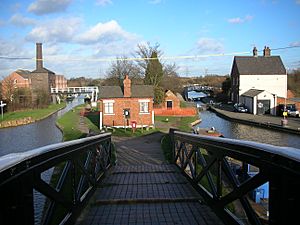
At Hawkesbury Junction, there's an old engine house, a curved bridge, and the Greyhound pub. The route into Coventry, though not part of the ring, has been greatly improved. The towpath is clean, lit, and has sculptures. It's a nice place to walk or boat. The journey is like a trip through car history. Cars like Daimlers, Rileys, Hillmans, and Humbers were made here.
You enter Coventry Basin through a tiny bridge hole. This was designed so it could be closed off each night. The basin has been beautifully restored. New shops blend well with old buildings. A large statue of James Brindley stands in the center.
Oxford Canal's Winding Path
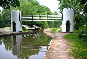
From Hawkesbury Junction, the Oxford Canal twists and turns, generally heading south-east. Its engineer, James Brindley, built it to follow the land's curves. In the 1820s, it was straightened to compete better with railways. The distance to Braunston was cut from 36 miles to 22 miles. Where the canal still winds, the towpath crosses on elegant cast iron bridges. These bridges say "Horseley Ironworks 1828."
Most of the route is rural. However, the M69 motorway and the M6 motorway both cross the canal. Brinklow once had a branch of the canal, which is now unused. An aqueduct near the start has been filled in to become an embankment. At Newbold-on-Avon, there's a 250-yard tunnel. After this, the scenery becomes more urban. The canal passes north-east of Rugby on an embankment, separated by a railway line.
There's a lively community of boaters and businesses at Hillmorton Locks. These locks were doubled in the 1830s to help with traffic. The 820-foot-high Hillmorton Wireless Aerials, built in 1924, are a huge landmark. Beyond Hillmorton, the canal goes under the railway. Then, it passes under the M45 motorway on its way to Braunston. The unique spire of Braunston Church is another landmark on the final part of the journey back to the start of the Warwickshire Ring.
 | May Edward Chinn |
 | Rebecca Cole |
 | Alexa Canady |
 | Dorothy Lavinia Brown |


