Woolston, Southampton facts for kids
Quick facts for kids Woolston |
|
|---|---|
| Suburb | |
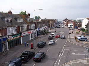 Shops on Bridge Road |
|
| Population | 13,852 (2011 Census. Ward) |
| Unitary authority | |
| Ceremonial county | |
| Region | |
| Country | England |
| Sovereign state | United Kingdom |
| Post town | SOUTHAMPTON |
| Postcode district | SO19 |
| Dialling code | 023 |
| Police | Hampshire |
| Fire | Hampshire |
| Ambulance | South Central |
| EU Parliament | South East England |
| UK Parliament | |
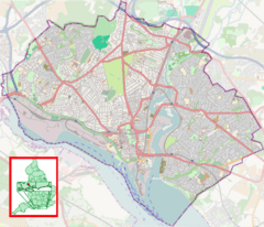
Woolston is a lively area in Southampton, England. It sits on the eastern side of the River Itchen. Woolston is surrounded by other areas like Sholing, Peartree Green, Itchen, and Weston.
This place has a long and interesting past, especially with ships and planes. Woolston grew a lot during the Victorian era (the time of Queen Victoria). New factories, roads, and railways helped it become bigger. In 1920, Woolston officially became part of Southampton.
Contents
Woolston's Past: A Journey Through Time
Woolston's name might come from Olafs tun. This was a strong, walled village built by a Viking leader named Olaf I of Norway about 1,000 years ago.
In a very old book from 1086, called the Domesday Book, the area was called Olvestune. People believe that "Olvestune" became "Woolston" because of the wool trade. Wool was brought here to be carried across the River Itchen, Hampshire.
During the Victorian times, Woolston grew quickly. New industries, roads, and railways arrived. Woolston officially joined Southampton in 1920. For a short time, from 1848 to 1850, a sport called First-class cricket was played here. It happened at a place called Day's Itchen Ground.
In the 1970s, the Itchen Bridge was built. This bridge connects Woolston to Southampton city centre. Building it meant some old houses had to be taken down. But it also meant a bus station was no longer needed, so new houses were built there instead.
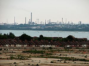
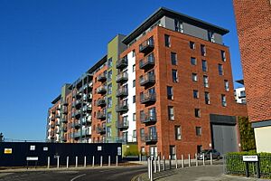
In the 2000s, the big Vosper Thorneycroft shipyard in Woolston closed. A new housing and business area called Centenary Quay was built on its site.
How Woolston is Governed
Woolston is part of Southampton. Southampton is a unitary authority, which means it has its own council, the Southampton City Council, that makes decisions for the area.
Woolston is in a special area called a "ward." This ward also includes Weston. People in the ward vote for three councillors to represent them on the city council. Some parts of Woolston, like the train station, are actually in a nearby ward called Peartree.
Woolston is also part of a larger area called the Southampton Itchen parliamentary area. This area chooses one person to represent them in the House of Commons in London.
Woolston's Location
Woolston is bordered by Sholing, Peartree Green, Itchen, and Weston. The River Itchen forms its western edge. A small stream that flows through Mayfield Park marks the boundary with Weston.
The closest big road is the M27. Woolston is near junctions 7 and 8 of this motorway.
What Woolston Offers
Woolston has a main shopping area. It is around the Victoria Road and Portsmouth Road crossroads. There is also shopping near where the old Woolston Floating Bridge used to be.
For many years, a shipbuilding company called Vosper Thornycroft was a major employer here. It had been building ships since 1870. But on March 31, 2004, the company moved its operations to Portsmouth.
A large Co-op supermarket opened in April 2004. It replaced an older, smaller shop. In May 2015, this Co-op closed. A new Lidl supermarket opened in the same building in February 2017.
New Developments by the River
The old shipyard site on Victoria Road was bought in 2003. Vosper Thorneycroft left the site in 2004.
Plans were made to develop the site into two main parts:
- A place for homes and shops, called Centenary Quay.
- A large area for marine businesses. This part would create many jobs. It would also have a hotel.
The marine business area will have several places for ships to dock:
| Feature | What it's for |
|---|---|
| North Quay | A special dock for fixing and updating ships up to 75 meters long. |
| Centenary Quay | The main commercial dock for ships up to 76 meters long. |
| Central Basin | A work area with a large lift for boats and places to tie them up. |
| South Quay | A new pier for special ships up to 65 meters long. |
These new developments might make the shopping area better. But they could also mean more traffic on the Itchen Bridge. The people building the homes are thinking about bringing back a ferry service to Southampton.
Work on the first part of Centenary Quay started in July 2010. This part included building family homes and creating a nice front along Victoria Road.
New houses have also been built on land at Weston Shore. This land used to have Royal Navy stores. Cleaning up this old industrial site was a big job. It was tricky because of old bombs and dangerous materials like Mustard Gas and asbestos buried there. This redeveloped area is now part of Woolston.
So, Woolston is becoming more of a place where people live. But it will still have some marine industry, with places for ships up to 76 meters long to dock.
Famous Spots in Woolston
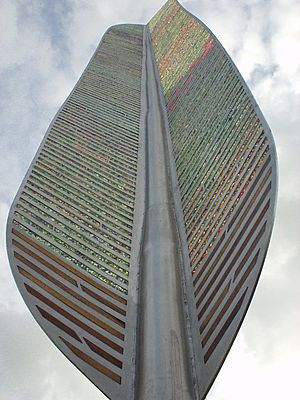
The Woolston Millennium Garden was made by local people for everyone to enjoy. It was finished in 2002. The main feature is a 10-meter tall metal feather. It is made from recycled glass and shows Woolston's history with flying and sailing. The garden has three parts: earth, sky, and sea. Many people who worked on the famous Titanic ship came from Woolston. There are bricks in the garden's path with their names on them.
Centenary Quay also has the tallest building in Southampton. It is located on the edge of Woolston.
Learning in Woolston
St. Mark's Infants school moved to a new building in 1974. It is now called Woolston Infant School. Ludlow Infant School and Ludlow Junior School are on the same site. Ludlow Junior School is the biggest primary school in Southampton, with 600 students.
Woolston no longer has schools for students over eleven years old. Woolston School closed in July 2008. A new school, Oasis Academy Mayfield, was built instead.
Southampton City College has a Marine Skills Centre nearby. It offers courses for students aged 16 and older who want to learn about marine jobs.
Places of Worship
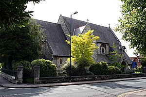
Woolston has three Christian churches. St. Mark's Church was built in 1863. It is a listed building and serves the Church of England. St. Patrick's Church was built in 1884 for the Roman Catholic community. There is also a Catholic primary school on its site. A Kingdom Hall for Jehovah's Witnesses is also in Woolston.
An old Presbyterian church, St. Mary's, was built in 1876 but was taken down in 1972.
Fun and Community
The Archery Grounds is a large grassy area with a playground for children. It is located between Swift Road and Archery Road. A path from here leads to Mayfield Park. This park has both wooded and open areas. It is on the border of Woolston and Weston.
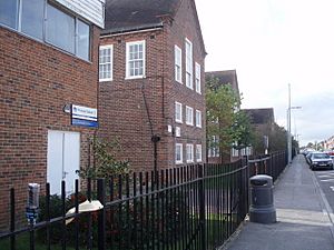
The building that used to be St. Mark's Infants School is now the Woolston Community Centre.
Local Services
The fire station on Portsmouth Road was no longer needed after the Itchen Bridge opened. Fire crews from Southampton could easily get to Woolston. That old building is now a doctors' surgery.
Across the road, there are two more doctors' surgeries: Woolston Lodge Surgery and Canute Surgery. There is also a Lloyds pharmacy nearby.
Getting Around Woolston
Woolston railway station is on the West Coastway Line. It is at the end of the Itchen Bridge. South Western Railway operates trains from here. The train line from Southampton to Woolston opened in 1866. It was later extended to Royal Victoria Military Hospital and then to Fareham.
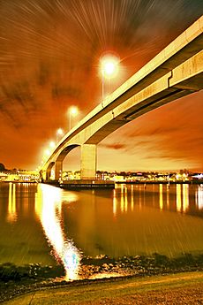
The Itchen Bridge is a toll bridge that crosses the River Itchen. It connects Woolston to the Chapel area of Southampton. The bridge opened on June 1, 1977. It cost £5.7 million to build. The bridge is high above the river, allowing large ships to pass underneath. Cars have to pay a toll to cross, but buses, people walking, cyclists, and motorcyclists can cross for free. Before the bridge, a special cable ferry called the Woolston Floating Bridge carried people across the river. Even before that, small Itchen ferry boats did the job.
There is a big bus stop on the Woolston link road. This road is only for buses and lets them get onto the Itchen Bridge without paying a toll. Many bus routes serve the area.
 | Bayard Rustin |
 | Jeannette Carter |
 | Jeremiah A. Brown |


