
Cherokee County, Alabama facts for kids
Quick facts for kids
Cherokee County
|
|||
|---|---|---|---|

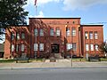
Cherokee County Courthouse in Centre
|
|||
|
|||

Location within the U.S. state of Alabama
|
|||
 Alabama's location within the U.S. |
|||
| Country | |||
| State | |||
| Founded | January 9, 1836 | ||
| Named for | Cherokee Nation | ||
| Seat | Centre | ||
| Largest city | Centre | ||
| Area | |||
| • Total | 600 sq mi (2,000 km2) | ||
| • Land | 554 sq mi (1,430 km2) | ||
| • Water | 46 sq mi (120 km2) 7.7% | ||
| Population
(2020)
|
|||
| • Total | 24,971 | ||
| • Estimate
(2023)
|
25,666 |
||
| • Density | 42/sq mi (16.1/km2) | ||
| Time zone | UTC−6 (Central) | ||
| • Summer (DST) | UTC−5 (CDT) | ||
| Congressional districts | 3rd, 4th | ||
|
|||


Cherokee County, Alabama is a county located in the northeastern part of the U.S. state of Alabama. In 2020, about 24,971 people lived here. The main town and county seat is Centre. The county is named after the Cherokee tribe, a group of Native Americans.
Contents
History
For many years, the land that is now Cherokee County belonged to the Muscogee (Creek) Nation. Later, the Cherokee people began to move into the area.
On January 9, 1836, the state of Alabama officially created Cherokee County. A couple of years later, the United States government forced many Cherokees to leave their homes. This difficult journey is known as the Trail of Tears.
Cherokee County was in the news on Palm Sunday, March 27, 1994. A very strong tornado, called an F4 tornado, hit the area. It destroyed Goshen United Methodist Church shortly after a warning was issued.
Geography
Cherokee County covers about 600 square miles. Most of this area, about 554 square miles, is land. The rest, about 46 square miles, is water. It is one of the smallest counties in Alabama by land size.
Major Roads
 U.S. Highway 278
 U.S. Highway 411
 State Route 9
 State Route 35
 State Route 68
 State Route 273
 State Route 283
Neighboring Counties
- DeKalb County - to the north
- Chattooga County, Georgia - to the northeast
- Floyd County, Georgia - to the east
- Polk County, Georgia - to the southeast
- Cleburne County - to the south
- Calhoun County - to the south
- Etowah County - to the west
Protected Natural Areas
- Little River Canyon National Preserve (part of it)
- Talladega National Forest (part of it)
Water Bodies
- The Coosa River flows through the county. A large part of it is now Weiss Lake.
Population Information
| Historical population | |||
|---|---|---|---|
| Census | Pop. | %± | |
| 1840 | 8,773 | — | |
| 1850 | 13,884 | 58.3% | |
| 1860 | 18,360 | 32.2% | |
| 1870 | 11,132 | −39.4% | |
| 1880 | 19,108 | 71.6% | |
| 1890 | 20,459 | 7.1% | |
| 1900 | 21,096 | 3.1% | |
| 1910 | 20,226 | −4.1% | |
| 1920 | 20,862 | 3.1% | |
| 1930 | 20,219 | −3.1% | |
| 1940 | 19,928 | −1.4% | |
| 1950 | 17,634 | −11.5% | |
| 1960 | 16,303 | −7.5% | |
| 1970 | 15,606 | −4.3% | |
| 1980 | 18,760 | 20.2% | |
| 1990 | 19,543 | 4.2% | |
| 2000 | 23,988 | 22.7% | |
| 2010 | 25,989 | 8.3% | |
| 2020 | 24,971 | −3.9% | |
| 2023 (est.) | 25,666 | −1.2% | |
| U.S. Decennial Census 1790–1960 1900–1990 1990–2000 2010–2020 |
|||
In 2020, the county had 24,971 people. Most residents were White (about 90%). About 4% were Black or African American, and about 3% were of mixed races. Around 1.6% of the population was Hispanic or Latino.
The average age in the county in 2010 was about 43.9 years old. About 21.4% of the people were under 18 years old.
Education
Cherokee County has one main public school district. Around 3,800 students attend public schools from kindergarten through 12th grade.
There is also a college campus in the county. Gadsden State Community College has a campus located in Centre.
School Districts
- Cherokee County School District
Communities
Cities
- Centre (This is the main county town)
- Piedmont (Part of this city is also in Calhoun County)
Towns
- Cedar Bluff
- Collinsville (Part of this town is also in DeKalb County)
- Gaylesville
- Leesburg
- Sand Rock (Part of this town is also in DeKalb County)
Census-Designated Places
These are areas that are like towns but are not officially incorporated.
Unincorporated Communities
These are smaller communities that are not officially part of a city or town.
Ghost Towns
These are towns that used to exist but are now abandoned.
Images for kids
-
Cherokee County Courthouse in Centre
See also
 In Spanish: Condado de Cherokee (Alabama) para niños
