
Douala facts for kids
Quick facts for kids
Douala
|
|
|---|---|

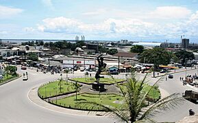
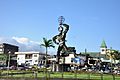
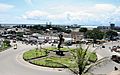
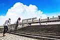
Panoramic view
|
|

Douala
Location in Cameroon
|
|
| Country | Cameroon |
| Region | Littoral |
| Department | Wouri |
| Area | |
| • Total | 923 km2 (356 sq mi) |
| Elevation | 13 m (43 ft) |
| Population
(2015 Projection)
|
|
| • Total | 5,066,000 |
| Time zone | UTC+1 (WAT) |
| • Summer (DST) | UTC+1 (WAT) |
| Climate | Am |
Douala is the biggest city in Cameroon. It is also the country's main economic center. Douala is the capital of Cameroon's Littoral Region. It used to have Central Africa's largest port, but a new port in Kribi is now taking over.
The city is home to the country’s main international airport, Douala International Airport (DLA). Douala is very important for trade in Cameroon and the wider CEMAC region. This region includes countries like Gabon, Congo, Chad, and the Central African Republic. Douala handles most of Cameroon's major exports. These include oil, cocoa, coffee, timber, metals, and fruits. In 2023, about 5,066,000 people lived in Douala and its surrounding areas. The city is located on the mouth of the Wouri River. It has a tropical climate.
Contents
History of Douala
,_Kamerun,_Dezember_1884.jpg)
The first Europeans to visit this area were the Portuguese around 1472. Back then, the mouth of the Wouri River was called the "Shrimp River" (Rio dos Camarões). By 1650, a town had grown there. It was formed by people who came from Congo and spoke the Duala language. In the 1700s, this area became a major center for the transatlantic slave trade.
In 1826, Douala was made up of four villages. These were Deido, Akwa, Njo, and Hickory-town (which is now Bonaberi).
Between 1884 and 1895, Germany ruled the city as a protectorate. German colonial rule focused on trade and exploring new lands. In 1885, the first British Baptist Church mission was set up. That same year, the city known as Kamerun was renamed Douala. It became the capital of the territory until 1902, when the capital moved to Buéa.
In 1907, a special government department for colonies was created. At this time, Douala had about 23,000 citizens.
After World War I in 1919, Germany lost its colonies. France was given the job of managing Douala. A special agreement was signed with the local leaders.
From 1940 to 1946, Douala was again the capital of Cameroon. By 1955, the city had more than 100,000 people.
In 1960, Cameroon became an independent country. Its capital moved to Yaoundé. Douala grew into the main economic city. By 1972, Douala had about 500,000 people.
In the 1980s, people in Cameroon wanted more freedom and a multi-party democracy. From May to December 1991, Douala was central to a protest called the "ghost town operation" (ville morte). During this time, businesses shut down to pressure the government. They wanted the government to allow more political parties and freedom of speech.


How Douala Got Its Name
When the Portuguese arrived in the 1400s, they called the area Rio dos Camarões (Shrimp River). Before Germany took over in 1884, the town was also known as Cameroons Town. After that, it became Kamerunstadt ("Cameroon City"). This was because it was the capital of German Kamerun.
In 1907, the city was renamed Douala. This name came from the local people, the Dua ala Ijaws (Njos). In 1919, Douala became part of French Cameroon. Many Ijaw (Njo) people moved to the Niger Delta in Nigeria during the Portuguese era.
Geography of Douala

Douala is the largest city in Cameroon. It is located on the Atlantic Ocean coast. This is about 130 miles (210 km) west of Yaoundé. The city sits on the banks of the Wouri River. The two sides of the city are connected by the Bonaberi Bridge.
Douala's Climate
Douala has a tropical monsoon climate. This means it has warm and humid weather all year. The average temperature is about 81°F (27°C). The air is usually very humid, around 83%.
Douala gets a lot of rain throughout the year. On average, about 142 inches (3600 mm) of rain falls each year. December is the driest month, with only about 1.1 inches (28 mm) of rain. August is the wettest month, with almost 27.5 inches (700 mm) of rain.
| Climate data for Douala (1971-2000, extremes 1885–present) | |||||||||||||
|---|---|---|---|---|---|---|---|---|---|---|---|---|---|
| Month | Jan | Feb | Mar | Apr | May | Jun | Jul | Aug | Sep | Oct | Nov | Dec | Year |
| Record high °C (°F) | 35.8 (96.4) |
39.8 (103.6) |
37.8 (100.0) |
37.1 (98.8) |
36.9 (98.4) |
39.0 (102.2) |
32.5 (90.5) |
32.0 (89.6) |
33.1 (91.6) |
35.0 (95.0) |
38.0 (100.4) |
35.8 (96.4) |
39.8 (103.6) |
| Mean daily maximum °C (°F) | 32.2 (90.0) |
32.8 (91.0) |
32.5 (90.5) |
32.1 (89.8) |
31.4 (88.5) |
29.9 (85.8) |
28.1 (82.6) |
27.7 (81.9) |
29.0 (84.2) |
29.8 (85.6) |
30.9 (87.6) |
31.7 (89.1) |
30.7 (87.3) |
| Daily mean °C (°F) | 27.8 (82.0) |
28.5 (83.3) |
28.2 (82.8) |
27.8 (82.0) |
27.3 (81.1) |
26.5 (79.7) |
25.4 (77.7) |
25.3 (77.5) |
25.9 (78.6) |
26.2 (79.2) |
27.1 (80.8) |
27.5 (81.5) |
27.0 (80.6) |
| Mean daily minimum °C (°F) | 23.4 (74.1) |
24.1 (75.4) |
23.9 (75.0) |
23.5 (74.3) |
23.2 (73.8) |
23.0 (73.4) |
22.7 (72.9) |
22.8 (73.0) |
22.8 (73.0) |
22.5 (72.5) |
23.2 (73.8) |
23.3 (73.9) |
23.2 (73.8) |
| Record low °C (°F) | 18.0 (64.4) |
19.0 (66.2) |
18.0 (64.4) |
18.3 (64.9) |
16.0 (60.8) |
18.2 (64.8) |
18.2 (64.8) |
19.0 (66.2) |
18.5 (65.3) |
16.8 (62.2) |
18.5 (65.3) |
18.0 (64.4) |
16.0 (60.8) |
| Average precipitation mm (inches) | 34.2 (1.35) |
54.5 (2.15) |
155.2 (6.11) |
241.2 (9.50) |
276.2 (10.87) |
354.1 (13.94) |
681.4 (26.83) |
687.5 (27.07) |
561.2 (22.09) |
406.6 (16.01) |
123.1 (4.85) |
27.5 (1.08) |
3,602.7 (141.84) |
| Average precipitation days (≥ 0.1 mm) | 5 | 9 | 15 | 18 | 21 | 23 | 27 | 30 | 26 | 24 | 12 | 5 | 215 |
| Average relative humidity (%) | 80 | 79 | 80 | 81 | 82 | 85 | 87 | 88 | 86 | 84 | 83 | 82 | 83 |
| Mean monthly sunshine hours | 193.3 | 179.1 | 171.9 | 176.5 | 175.8 | 123.1 | 72.0 | 53.2 | 90.8 | 131.2 | 162.1 | 184.2 | 1,713.2 |
| Source 1: World Meteorological Organization Meteo Climat (record highs and lows) | |||||||||||||
| Source 2: Deutscher Wetterdienst (humidity, 1957-1990), NOAA (sun, 1961-1990) | |||||||||||||
Population Growth
Douala is the most populated city in Cameroon. In 2005, about 1.9 million people lived there.
How Douala's Population Has Grown (in thousands)
| Year | 1916 | 1920 | 1924 | 1927 | 1931 | 1933 | 1935 | 1937 | 1939 | 1941 |
| Population | 29.4 | 26.4 | 44.5 | 54.6 | 37 | 52.6 | 56.5 | 79.4 | 69.8 | 76.7 |
| Year | 1944 | 1947 | 1949 | 1954 | 1956 | 1976 | 1987 | 1991 | 1999 | 2005 | 2015 |
| Population | 73.8 | 115.5 | 77.6 | 192.4 | 224.3 | 637 | 810 | 884 | 1448.3 | 1907 | 2768.4 |
Languages Spoken in Douala
Cameroon has nearly 250 different languages or dialects. The local language in Douala is Duala, which shares its name with the city. French and English are the official languages of Cameroon. However, most people in Douala speak French.
In 2014, about 63.7% of Douala residents over 15 years old could read and write French. Even more, about 76.4%, could speak and understand French.
City Life and Neighborhoods
The city of Douala is divided into seven main areas called districts. These are Akwa, Bassa, Bonabéri, Bonapriso, Bonanjo, Deïdo, and New Bell. Within these districts, there are more than 120 smaller neighborhoods.
Here are some of Douala's neighborhoods:
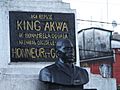
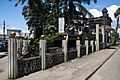
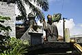
- Akwa is Douala's main business area. Bonanjo is where many government offices are located. The name "Plateau Joss" was historically used for the Akwa district. Many district and neighborhood names, like Akwa, come from the Douala family lines. For example, "bona" means "descendant of."
- Akwa main places
-
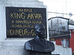
Akwa Kings Monument
-

Palais Dika Akwa
-
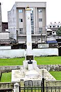
Akwa King tomb
-
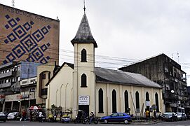
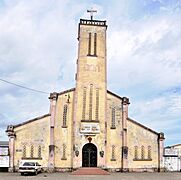
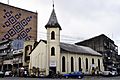
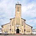
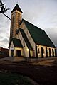
Bonalembe Baptist church
-
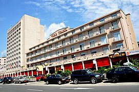
Akwa Palace

_Monument_des_roi_d%27akwa.JPG)
.JPG)


- Bali is a living area close to the Bonanjo administrative district.
- Bépanda is a very crowded neighborhood. Many people from West Africa and other parts of Cameroon live here. The University of Douala and a major telecommunications center are in Bépanda.
- Deido is an old neighborhood in the north-central part of the city. It has a main road junction called Le Rond-Point Deïdo. It also has the city's symbol, "the Njounjou" (meaning "the monster").
- Bonaberi is on the right side of the Wouri River. It used to be mostly for industries. Now, it's becoming a mix of homes and shops. The city's only two bridges connect it to the rest of Douala. It's also the main way to reach the English-speaking part of the country.
- Bonapriso is one of the richest areas in the city and even the country. It was once only for homes. Now, it has many shops, restaurants, and art galleries.
- Bonanjo is the administrative area. It has many large government offices, big companies, and banks. The buildings here are taller than in other parts of the city.
- Bonamoussadi is a main housing area in the northern part of the city. It used to be only for homes. Recently, many malls, supermarkets, restaurants, and nightclubs have opened there.
- Kotto is a modern neighborhood next to Bonamoussadi. It started growing in the 1980s with new housing projects. Now, it's a popular area for the city's growing middle and upper classes.
- New Bell is a historic neighborhood. It was created in the early 1900s when the Germans moved the native Duala people from Plateau Joss. Since then, it has been a home for new people arriving in the city. These newcomers come from all over Cameroon and other West African countries. Today, it is a very crowded neighborhood with difficult living conditions. Two of the city's main markets, Central Market and Marché Nkololoun, are in this area.
- New Bell main places
-
Church of Our Lady of Victories
-

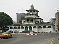
Central Mosque
-

NewBell High School


- Bassa is a large area in the eastern part of the city. It has many neighborhoods, some richer than others. These include Logbaba, Ndogpassi, Cité des Palmiers, and PK 8. It also has one of the city's two major industrial zones.
Douala's Architecture

_Monument_des_roi_d%27akwa.JPG)
_Temple_du_Centeneire.JPG)
Old pictures of Douala show the areas of Akwa (Plateau Joss) and the port from 1860 to 1960. There are not many old pictures of Bonaberi, Deido, and New Bell. Information about the city's history can be found in archives in Paris, Basel, Hamburg, Potsdam, Douala, and Yaoundé.
In 1896, during the German colonial period, the first city plan was made. This plan included a hospital, the governor's home, the justice building, the police station, and buildings for the port and customs. The Bonakouamouang Chimney also dates from this time. In 1904, construction began on the Villa Mandessi Bell. In 1905, the palace of King Manga Ndumbe Bell (also called la Pagode) was built. In 1906, a big plan for "Gross Douala" was created. In 1914, many people living in Bonanjo were moved to the new area of Neue Bell (New Bell).
Between 1925 and 1930, during the French colonial period, many new buildings were constructed. These included the chamber of commerce, a new justice building, a new railway station, the vault of the Kings Bell, and the Catholic Cathedral of Saints Peter and Paul. Building continued rapidly between 1930 and 1955. In 1955, the bridge over the Wouri River was built. The Mausoleum of the Kings Akwa was built in 1935. In 1947, the Temple of the Centenary was constructed.
In 1959, a new city plan (Plan Dorian) was designed. This plan still affects how Douala grows today. After Cameroon became independent in 1960, new plans for development were made. In 2005, a new city plan was designed. Roads and public drainage systems were fixed and created. Also in 2005, the Sawa-Beach Project was started. Terracotta bricks have been made in Douala since 1888.
Many of Douala's best restaurants, coffee shops, and French-style bakeries are along the city's main road. Along the waterfront, you can find many bars and bistros with views of the Gulf of Guinea. Many people from other countries, especially France or Lebanon, visit these places. Most of them work in the petroleum industry.
Culture in Douala
- Douala Maritime Museum: This museum shows the city's rich history with the sea. The building looks like a boat. It is in the administrative area of Bonanjo.
- Doual'art: This is an art gallery and center.
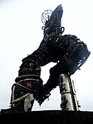
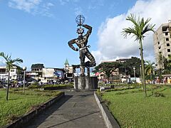
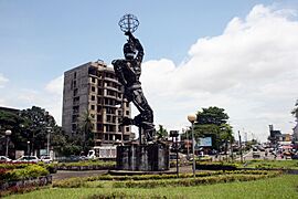
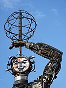
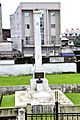
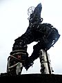
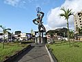
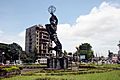
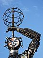
- La Nouvelle Liberté: This is a 39-foot (12m) tall sculpture by Joseph Francis Sumégné. It was put up in 2007. It is a permanent artwork made from recycled materials. It stands at a main roundabout in Douala.
- The Cathedral of St Peter and St Paul
- The Centennial Temple
- Images of the statue of Liberty in Douala
-
-

-
-
-
-

.JPG)


Places of Worship
Most people in Douala are Christian. The city has many churches from different Christian groups. These include the Roman Catholic Archdiocese of Douala (Catholic Church), the Evangelical Church of Cameroon, and the Presbyterian Church in Cameroon. There are also Muslim mosques.
A small group of people has started practicing Judaism in Douala, but they do not have a synagogue yet.
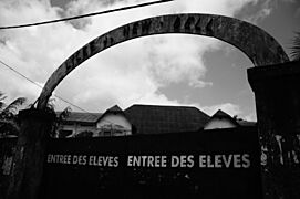
Education in Douala
Like most big cities in Cameroon, Douala has many nursery, primary, secondary, and high schools. In recent years, more and more private schools have opened. There is also a large informal education system. This helps many people who have only finished primary school or have no formal education. This type of learning is common in areas like cloth making, baking, construction, security, and car repair. People from these informal sectors often live in tougher conditions in neighborhoods like Ndokoti, Bepanda, Village, and Logbaba.
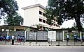
Douala is home to several higher education places. The most well-known is the University of Douala. There are also many professional schools, like the Douala Maritime Institute. Douala also has an aviation school called CAE Oxford Aviation Academy Douala.
-
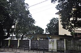
Lycée Joss Entrance
-
Interior of Lycée Joss
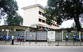
-
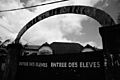
Lycée de New-Bell Entrance
-
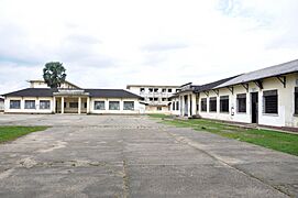
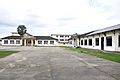
Interior of Lycée de New-Bell
-
Lycée de New-Bell Classrooms


_Lyc%C3%A9e_de_New-bell.JPG)

Transportation

.jpg)

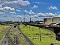
Douala is connected by train to cities like Yaoundé, Ngaoundéré, Kumba, and Nkongsamba. Douala has a fairly good road system compared to other cities in Cameroon. However, many roads have become damaged over the years. Recently, efforts have been made to fix the city's roads, especially in poorer neighborhoods.
A special bus system called BRT is planned for Douala. The first three lines are expected to open in 2024-2025.
The Douala International Airport is in the eastern part of the city. You can fly directly to several European cities, including Paris, Brussels, and Istanbul. There are also flights to other African cities like Abidjan, Brazzaville, Dakar, and Lagos. This airport is the busiest in the CEMAC region. It is the main base for Cameroon's national airline, Camairco. The airport needs updates because of old buildings and crowded areas.
The seaport can handle ships that need a depth of 27.8 feet (8.5 meters).
Economy
Douala has some oil resources and excellent farming conditions. This helps it have one of the better economies in Africa. However, it also faces challenges like many developing countries. These include a large government workforce and difficult weather like floods and storms.
Here are some key economic facts:
- GDP (Gross Domestic Product): This is the total value of goods and services produced. In 2006, it was about $42.2 billion.
- GDP growth rate: In 2006, the economy grew by 4.1%.
- Main export partners: Countries that buy goods from Douala include Spain (17.3%), Italy (13.8%), France (9.5%), and South Korea (8.1%).
- Main import partners: Countries that sell goods to Douala include France (21%), Nigeria (15%), and Belgium (6.3%).

Wealth and Poverty
Even though Douala is the main economic center of Cameroon, many people who live there face financial difficulties. Recent information shows that about 30% of the population lives in poverty. While this number is higher in rural areas, poverty is a growing issue in Douala because its population keeps increasing. Unlike people in rural areas who can grow their own food, people in Douala often don't have many ways to earn money.
Notable People from Douala
- Ibrahim Amadou (1993–), footballer
- Frank Angong (2002–), footballer
- Patrick Baudry (1946–), second French astronaut
- Clément Antoine Bayema (1988–), professional Cameroonian footballer
- Francis Bebey (1929–2002), author
- BeBe Zahara Benet (1980-), drag queen
- Hemley Boum (1973–), writer
- Jean-Alain Boumsong (1979–), footballer
- Louis Brody (1892–1951), German actor
- Manu Dibango (1933–2020), musician, saxophonist and singer
- Herman Dzumafo (1980-), footballer
- Angèle Etoundi Essamba (1962–), photographer
- Samuel Eto'o (1981–), footballer
- Kareyce Fotso (2010-), singer
- Kenny Kadji (born 1988), basketball player
- Alvine Kamaha, UCLA professor and physicist
- Anouk Aimee Takam Kenmoe (1979– ), footballer
- Christian Koloko (2000–), basketball player
- Narcisse Mouelle Kombi (1962– ), writer and politician
- Maka Kotto (1961–), Canadian politician
- Guy Kouemou (1970-), inventor and aerospace engineer
- Bobby Kamwa (2000-), footballer
- Jacques Kuoh-Moukouri (1909-2002), author and diplomat
- Thérèse Kuoh-Moukouri (1938–), feminist and author
- Véronique Mang (1984–), track athlete
- Marc Kibong Mbamba (1988–), footballer
- Christian Ngan (1983– ), entrepreneur, businessman and financier
- Paul-Georges Ntep (1992–), footballer
- Petit Pays (1967–), singer, dancer, author
- Jean-Pierre Dikongué Pipa (1940–), filmmaker
- Pascal Siakam (1994– ), basketball player - 2019 NBA Champion
- Pierre Womé (1979–), footballer
- Carlos Takam (1980-), professional boxer
Twin Towns and Sister Cities
Douala is connected to these cities around the world:
 Strasbourg, France
 Akhisar, Turkey
 Dakar, Senegal
 Newark, United States
- Philadelphia, United States
 Windhoek, Namibia
Images for kids
-
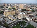
Panoramic view
-
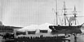
The German warship SMS Olga attacking Hickorytown, Cameroon (today Douala) on December 21, 1884
-
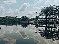
Lake Parcour Vita
-
Cameroon Petroleum Depot Company
-
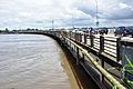
Bridge over the Wouri River
-
Akwa Kings Monument
-
Palais Dika Akwa
-
Akwa King tomb
-
Bonalembe Baptist church
-
Akwa Palace
-
Church of Our Lady of Victories
-
Central Mosque
-
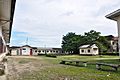
NewBell High School
-
Palace of the Kings Bell
-
Statue of King Akwa in front of the King Akwa Museum
-
Centennial Temple
-
-
-
-
-
-
-

Lycée Joss Entrance
-
Interior of Lycée Joss
-
Lycée de New-Bell Entrance
-
Interior of Lycée de New-Bell
-
Lycée de New-Bell Classrooms
-
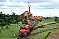
Gare de Bessengué, Douala's train station
-
Douala International Airport
-
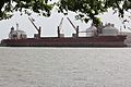
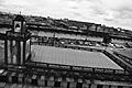
Douala seaport
-
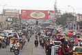
Mboppi market
See also
 In Spanish: Duala para niños
