Geography of Houston facts for kids
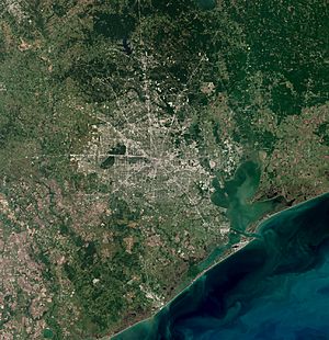
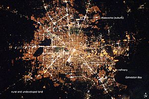
Houston is a very large city in the Southern United States. It's located near the Gulf of Mexico in Texas, about 50 miles (80 km) northwest of Galveston. Houston is one of the biggest cities in the U.S. by land area, covering about 600 square miles (1,550 square kilometers). Most of this area is land, with a small part being water.
Houston sits on a flat area called the Gulf Coastal Plain. Long ago, much of the city's land was marshes, forests, swamps, or prairies. You can still see these types of natural areas around the city today.
Because the land is very flat, flooding can be a big problem for people living in Houston. The city is only about 50 feet (15 meters) above sea level. Some areas have even sunk by 10 feet (3 meters) or more. This sinking happens because a lot of water is pumped from underground. To help with this, Houston now gets much of its water from lakes like Lake Houston and Lake Conroe.
Several slow-moving rivers, called bayous, flow through Houston. These include Buffalo Bayou, which goes through downtown, and its smaller branches: Brays Bayou, White Oak Bayou, and Sims Bayou. The Houston Ship Channel connects Buffalo Bayou to the Gulf of Mexico, allowing ships to travel to and from the city's busy port.
Houston is located about 165 miles (266 km) east of Austin and 250 miles (402 km) south of Dallas. It's also about 112 miles (180 km) west of the Louisiana border.
Contents
Houston's Land and Soil
Houston is mostly built on a type of land called the Northern Humid Gulf Coast Prairies. This area has layers of sand, silt, and clay underground. The surface is usually covered by grasslands with some oak trees.
The ground in Houston has many layers of red, gray, sandy brown, and black clay. These layers gently slope towards the southeast. These soils were formed by rivers like the Brazos and Trinity rivers. In the northern parts of Houston, the soil is mostly tan sand with less clay.
Deep underground, about 60,000 feet (18,000 meters) below the surface, there's a layer of salt. This salt layer is the main source of the salt domes you can find in the Houston area. Salt is lighter than other materials, so it slowly pushes up towards the surface, creating these domes. These domes can trap oil and gas, which is why places like Pierce Junction have been important oil fields.
Are There Earthquakes in Houston?
The Houston area doesn't usually have earthquakes. However, there are 86 known faults (cracks in the Earth's crust) in the area, including the Long Point–Eureka Heights fault system that runs through the city. Even though these faults exist, no major earthquakes have been recorded in Houston's history.
The ground in Houston can still move, but it's usually very slowly. This slow movement is called "fault creep" and doesn't cause the sudden shaking of an earthquake. This is because the clay in the ground prevents a lot of friction from building up.
Waterways in Houston
Houston is often called the "Bayou City" because of the many slow-moving, swampy rivers that flow through it. These waterways are very important for draining the flat land and preventing flooding. The city was actually founded where Buffalo Bayou and White Oak Bayou meet, a spot now known as Allen's Landing.
Major Bayous
Buffalo Bayou is the longest and largest bayou in Houston. It flows for 53 miles (85 km) through many parts of the city, including downtown. The wide eastern part of this bayou is called the Houston Ship Channel. This channel is very important for the Port of Houston and is home to many oil and gas processing plants. Buffalo Bayou also has many parks along its banks, which are great for walking and biking.
White Oak Bayou is a main branch of Buffalo Bayou. It starts in Jersey Village and flows southeast for 25 miles (40 km) through areas like Houston Heights.
Brays Bayou is another important branch to the south. It flows for 31 miles (50 km) through neighborhoods like the Texas Medical Center before joining Buffalo Bayou.
Two other important bayous, Greens Bayou and Sims Bayou, flow through other parts of Houston. Greens Bayou is 43 miles (69 km) long and flows through the northern part of Harris County. Sims Bayou is 23 miles (37 km) long and flows through the southern part of Houston.
Houston's many creeks and ditches are also a big part of its water system. All these waterways are key for flood control. To help with flooding, the United States Army Corps of Engineers has made many parts of the bayous wider and deeper. There are also two large reservoirs, Addicks Reservoir and Barker Reservoir, that hold extra water after heavy rains.
Cypress Creek drains a large area in northern Harris County. It flows for 52 miles (84 km) through suburban areas like Cypress and Spring. The Brazos River also flows near some of Houston's western suburbs.
Lakes and Bays
Houston doesn't have many natural lakes. Lake Houston is a large lake created in the 1950s by building a dam on the San Jacinto River. This lake, which covers about 11,854 acres (4,800 hectares), provides drinking water for the city. It's also a popular spot for recreation.
Galveston Bay is a very important part of the Greater Houston area. It's home to the Houston Ship Channel and a large fishing industry. It's also a great place for fun activities and seeing coastal wildlife. This large estuary covers about 600 square miles (1,550 square kilometers) and stretches 30 miles (48 km) inland from the coast. While Houston itself isn't directly on the bay, its city limits reach down to include the NASA Johnson Space Center and the Clear Lake community.
Clear Lake, which gives the Clear Lake community its name, is a tidal lake with slightly salty water. It's located on the western side of Galveston Bay and is fed by Clear Creek.
Water Underground
Underneath the Houston area are two important underground water sources called aquifers: the Chicot and Evangeline. These aquifers are made mostly of sand and clay and provide much of Houston's drinking water. Most of the city's water wells go down between 1,000 and 2,000 feet (300 to 600 meters).
For a long time, pumping water, oil, and gas from these aquifers caused the land in Houston to sink. This sinking is called land subsidence. Before 1942, Houston got all its water from underground wells. By the 1970s, some areas near the Houston Ship Channel had sunk by as much as 7 feet (2 meters). This led to the creation of the Harris–Galveston Coastal Subsidence District, which helped stop the sinking in the worst areas by encouraging the city to use more surface water (from lakes and rivers) instead of just groundwater.
How Houston is Organized
When Houston was founded in 1837, the city was divided into areas called "wards." Today, these wards have been replaced by nine City Council districts.
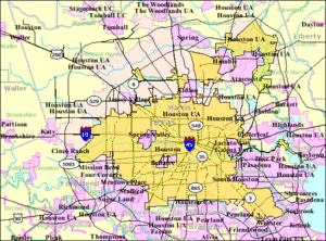
People often describe locations in Houston as being "inside" or "outside" Interstate 610, also known as "The Loop." Inside the Loop is the central part of the city, where you'll find the main business district. Many people who live inside the Loop enjoy an urban lifestyle. Wealthier areas inside the Loop are often found near Hermann Park, the Houston Museum District, Rice University, and the Texas Medical Center.
Areas outside the Loop include the airports, suburbs, and smaller towns near Houston. Another large road, Beltway 8 (or "The Beltway"), circles the city about 5 miles (8 km) farther out. Some parts of Beltway 8 are toll roads. A third ring road, State Highway 99 (the Grand Parkway), is still being built.
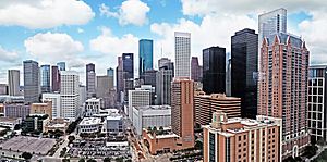
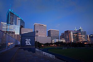
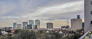
Houston is unique because it's the largest city in the U.S. without zoning laws. This means that different types of buildings (like homes, stores, and offices) can be built next to each other. Because of this, Houston has grown in an unusual way. Instead of just one main downtown area, there are five other major business districts throughout the city. These include Uptown, the Texas Medical Center, Greenway Plaza, Westchase, and Greenspoint. If you combined all these business districts, they would form one of the largest downtown areas in the United States! Houston also has the third-largest skyline in the country, but it's spread out over several miles.
 | Sharif Bey |
 | Hale Woodruff |
 | Richmond Barthé |
 | Purvis Young |


