Guilford, Connecticut facts for kids
Quick facts for kids
Guilford, Connecticut
|
||
|---|---|---|
| Town of Guilford | ||
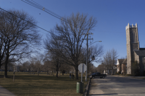
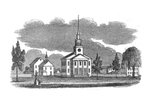
Guilford Green
|
||
|
||
| Motto(s):
"Discover A Piece Of Connecticut History"
|
||
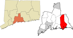
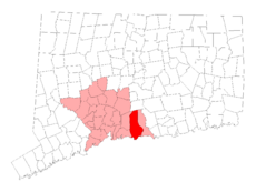 New Haven County and Connecticut New Haven County and Connecticut |
||
| Country | ||
| U.S. state | ||
| County | New Haven | |
| Region | South Central CT | |
| Settled | May 19, 1639 | |
| Established | October 15, 1644 | |
| Named for | Guildford, Surrey | |
| Government | ||
| • Type | Selectman-town meeting | |
| Area | ||
| • Total | 49.7 sq mi (128.7 km2) | |
| • Land | 47.1 sq mi (121.9 km2) | |
| • Water | 2.7 sq mi (6.9 km2) | |
| Elevation | 56 ft (17 m) | |
| Population
(2020)
|
||
| • Total | 22,073 | |
| • Density | 444.1/sq mi (171.51/km2) | |
| • Demonym | Guilfordian | |
| Time zone | UTC−5 (Eastern) | |
| • Summer (DST) | UTC−4 (Eastern) | |
| ZIP Code |
06437
|
|
| Area code(s) | 203/475 | |
| FIPS code | 09-34950 | |
| GNIS feature ID | 0213438 | |
Guilford is a town in New Haven County, Connecticut. It's located on the coast and near I-95. The town borders Madison, Branford, North Branford, and Durham. In 2020, about 22,073 people lived here.
Contents
History of Guilford
Early Days and Native Americans
Before Europeans arrived, the area of Guilford was called Menunkatuck. This was a village of the Quinnipiac people. They spoke a language called Quiripi, which is part of the Algonquian language family.
Around 1614, the Dutch explored this region. They claimed lands from the Delmarva Peninsula to Cape Cod. This included the Quinnipiac territory. However, the Dutch didn't have a strong presence here. This allowed English settlers to move into the area. The Dutch claims ended in 1674 with the Treaty of Westminster.
Pequot War and English Settlement
In June 1637, during the Pequot War, English soldiers and their Native American allies arrived near Menunkatuck. They were chasing the Pequot leader, Sassacus. At a place now called Sachems Head, they captured and executed three Pequot leaders.
In 1639, a group of 24 English Puritan families arrived from England. They were led by Rev. Henry Whitfield. They decided to settle near Menunkatuck. On June 1, 1639, during their journey, they wrote and signed the Plantation Covenant. This important document is remembered on a granite slab in town. On September 29, 1639, the colonists bought land for their settlement. They got the land from Shaumpishuh, the female leader of Menunkatuck.
Guilford joined the New Haven Colony in 1643. Later, in 1664, the New Haven Colony, including Guilford, became part of the Connecticut Colony.
How Guilford Got Its Name
The English settlement was first called Menunkatuck, just like the Native American village. On July 6, 1643, the name was changed to "Guilforde." No one knows exactly why the name changed. It's believed that Guilford was named after Guildford, England. Many of the first English settlers came from there. On old maps of Connecticut, the town is sometimes shown as "Gilford."
Historic Homes and the American Revolution
Guilford is known for having many historic homes. Some say it has the third-largest collection in New England. These homes date back to the 17th, 18th, and 19th centuries. There are five historic house museums you can visit. These include Dudley Farm and the Henry Whitfield House. Built in 1639, the Henry Whitfield House is the oldest stone house built by English settlers in North America. The Comfort Starr House (1695) is one of Connecticut's oldest wooden private homes.
In June 1781, during the American Revolution, a small fight happened. It was on Leete's Island between Loyalists and local soldiers.
Geography and Nature
Town Size and Location
Guilford covers about 49.7 square miles (128.7 square kilometers). Most of this area, about 47.0 square miles (121.9 square kilometers), is land. The rest, about 2.7 square miles (6.9 square kilometers), is water.
The main part of Guilford is called Guilford Center. It's in the southern part of town. This area is where U.S. Route 1 and Connecticut Route 77 meet. Interstate 95 also passes just north of the town center.
Mountains and Trails
The northwest side of Guilford has the Metacomet Ridge. This is a rocky mountain range that goes from Long Island Sound almost to Vermont. Important parts of this ridge in Guilford include Totoket Mountain. Its most famous peak is Bluff Head. There are also East Sugarloaf and West Sugarloaf peaks.
The Mattabesett Trail is 50 miles long and goes through Bluff Head. A shorter network of trails crosses the Sugarloaves. Guilford also has the Westwoods Trail System. This system has 39 miles (63 km) of trails on 1,200 acres (4.9 km²) of land.
Getting Around Guilford
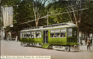
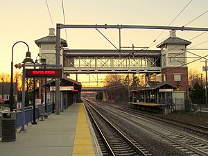
The Shore Line East train stops at Guilford station. You can take this train to places like Branford, East Haven, New Haven, and New London. The Connecticut Transit S bus also travels between Guilford and New Haven daily.
Communities in Guilford
Guilford has several main communities:
- Guilford Center (Guilford Green)
- Leete's Island
- North Guilford
- Nut Plains
- Shell Beach
- Sachem's Head
Other smaller areas include Guilford Lakes, Indian Cove, and Old Quarry.
Population Information
Guilford has grown quite a bit over the years.
| Historical population | |||
|---|---|---|---|
| Census | Pop. | %± | |
| 1820 | 4,131 | — | |
| 1850 | 2,653 | — | |
| 1860 | 2,624 | −1.1% | |
| 1870 | 2,576 | −1.8% | |
| 1880 | 2,782 | 8.0% | |
| 1890 | 2,780 | −0.1% | |
| 1900 | 2,785 | 0.2% | |
| 1910 | 3,001 | 7.8% | |
| 1920 | 2,803 | −6.6% | |
| 1930 | 3,117 | 11.2% | |
| 1940 | 3,544 | 13.7% | |
| 1950 | 5,092 | 43.7% | |
| 1960 | 7,913 | 55.4% | |
| 1970 | 12,033 | 52.1% | |
| 1980 | 17,375 | 44.4% | |
| 1990 | 19,848 | 14.2% | |
| 2000 | 21,398 | 7.8% | |
| 2010 | 22,375 | 4.6% | |
| 2020 | 22,073 | −1.3% | |
| U.S. Decennial Census | |||
In 2000, there were 21,398 people living in Guilford. Most residents (96.04%) were White. About 0.93% were African American, and 1.65% were Asian. About 2.13% of the population was Hispanic or Latino.
The average age in town was 42 years old. About 25.4% of the population was under 18.
Economy of Guilford
American Cruise Lines has its main office in Guilford. The town also has many small businesses. You can find many shops around the Guilford Green.
Education in Guilford
Public Schools
The Guilford Public Schools district provides education for students from kindergarten through high school.
- Elementary Schools: Guilford has four elementary schools: Calvin Leete, A.W. Cox, Melissa Jones, and Guilford Lakes.
- Middle Schools: Baldwin Middle School is for students in grades five and six. Adams Middle School is for students in grades seven and eight.
- High School: Guilford High School serves grades nine through twelve. It offers many academic courses, including Advanced Placement (AP) classes.
Public Library
The Guilford Free Library is a great resource for everyone. It has many books, digital media, and historical materials about Guilford. The library also hosts events, workshops, and activities. These programs help promote reading and learning for all ages.
Town Parks to Explore
The town government manages several parks for everyone to enjoy:
- Bittner Park: This park has 123 acres (0.50 km²) of woodlands. It also has a playground, lighted softball field, baseball and soccer fields, and a jogging path. There's a skate park and roller hockey area. In winter, you can even go ice skating.
- Chaffinch Island: Perfect for picnics, short walks, and seeing salt marshes.
- Chittenden Park: Features softball and soccer fields, bocce courts, and picnic areas. It also has an unsupervised beach.
- Jacobs Beach: A public saltwater swimming beach with a playground and volleyball courts. Non-residents can use it for a daily fee.
- Lake Quonnipaug: Offers public freshwater swimming, a picnic area, and a small boat launch.
- Long Hill: An 8-acre (0.032 km²) park with fields for baseball, football, soccer, lacrosse, and field hockey.
- Mill Pond: Great for supervised ice skating in winter and fishing.
- Nut Plains: Has a lacrosse/soccer field.
- Town Green: A central spot used for special events.
Notable Places in Guilford
Guilford is known for its beautiful farmland. It has avoided too much development compared to nearby towns. It also has many historic homes and sites.
- Bishop's Orchards
- Guilford Green
- Rothberg Institute For Childhood Diseases
- Westwoods Trails: A conservation area managed by the Guilford Land Conservation Trust.
Historic Buildings and Areas
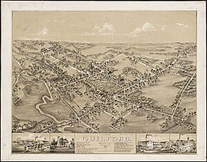
Guilford has one of the best-preserved central villages in the region. It has over 450 historic houses from the 17th to 19th centuries.
The town has a National Historic Landmark. It also has four areas and 11 individual buildings listed on the National Register of Historic Places. Plus, there are two local historic districts downtown with 226 buildings.
| Building | Image | First built | National Register of Historic Places listed | Current use | Notes |
|---|---|---|---|---|---|
| Henry Whitfield House |  |
1639 | Yes | House museum | Oldest house in Connecticut and the oldest stone house in New England. |
| Acadian House |  |
1670 | Yes | Residential | One of Connecticut's oldest surviving houses. Later used by Acadians after they were forced to leave Nova Scotia. |
| Elisha Pitkin House |  |
1690 | Yes | Residential | Moved to Guilford from East Hartford in 1955. |
| Comfort Starr House |  |
1695 | No | Residential | A classic New England saltbox home. |
| Pelatiah Leete House |  |
1710 | Yes | Residential | Oldest house connected to the important Leete family, who helped found New Haven Colony. |
| Hyland House |  |
1713 | Yes | House museum | Open to the public as a museum since 1918. |
| Jared Eliot House |  |
1723 | Yes | Residential | A well-preserved example of old house design. |
| Thomas Burgis II House |  |
1735 | Yes | Residential | One of Guilford's best and most documented colonial-era houses. |
| Sabbathday House |  |
1735 | Yes | Residential | One of only two "Sabbathday" houses left in town. Built for families to rest between church services. |
| Griswold House |  |
1764 | Yes | House museum | A museum with a saltbox house, blacksmith shop, barn, and more. |
| Falkner Island Light |  |
1802 | Yes | Lighthouse | Connecticut's second-oldest working lighthouse. Ordered by Thomas Jefferson. |
| Medad Stone Tavern |  |
1803 | Yes | House museum | An example of early 19th-century architecture. It was never actually used as a tavern. |
| First Congregational Church |  |
1830 | No | Church | The third church building for a group that started in 1643. |
Historic districts include:
- Guilford Historic Town Center
- Dudleytown Historic District
- Meeting House Hill Historic District (North Guilford)
- Route 146 Historic District (Branford and Guilford)
Other Unique Buildings
| Building | Image | Built | Current use | Notes |
|---|---|---|---|---|
| Junior Olsen House | 1951 | Residential | A modern home designed by artist and architect Tony Smith. Located in the Old Quarry neighborhood. | |
| Fred Olsen, Sr. House | 1953 | Residential | A modern home complex also designed by Tony Smith. In the Old Quarry neighborhood. | |
| "The spaceship" |  |
1987 | Condos | A unique condo building designed by architect Wilfred J. O. Armster. |
Famous People from Guilford
Many interesting people have connections to Guilford:
- Wilfred J. O. Armster (1938–2019), an architect.
- Humbert Allen Astredo (1929–2016), an actor known for Dark Shadows.
- Abraham Baldwin (1754–1807), a minister, patriot, and one of the founding fathers.
- Robert Elliott De Forest (1845–1924), a politician who was born in Guilford.
- Moses Gunn (1929–1993), an American actor who lived in Guilford.
- Fitz-Greene Halleck (1790–1867), an American poet.
- Samuel Johnson (1696-1772), an educator and first president of King's College (now Columbia University).
- William Leete (c. 1612–1683), a Guilford town clerk and Governor of the New Haven Colony and Colony of Connecticut.
- Frank Modell (1917–2016), a cartoonist.
- Aldo Parisot (1918–2018), a Brazilian-born American cellist.
- Shaumpishuh (died 1686), the Native American leader of Menunkatuck.
- Henry Whitfield (c.1590-c.1657), a founder of Guilford and Puritan minister.
Living Notable People
- Peter Halley (born 1953), an American artist.
- Jeffrey Ambroziak, a cartographer, inventor, and attorney.
- Jamie Arentzen (born 1970), an American guitarist.
- Mickey Curry, drummer for Bryan Adams.
- David DeMille, a physicist and professor at University of Chicago.
- Nick Fradiani (born 1985), winner of American Idol season 14, born in Guilford.
- Becki Newton, an actress from Ugly Betty and How I Met Your Mother, who grew up in Guilford.
- David Allen Sibley, an ornithologist and author.
- Jennifer Westfeldt, an actress and screenwriter, born in Guilford.
- Carl Zimmer, a science writer.
See also
 In Spanish: Guilford (Connecticut) para niños
 | Jessica Watkins |
 | Robert Henry Lawrence Jr. |
 | Mae Jemison |
 | Sian Proctor |
 | Guion Bluford |


