Harpers Ferry, West Virginia facts for kids
Quick facts for kids
Harpers Ferry, West Virginia
|
||
|---|---|---|
|
Town
|
||
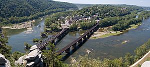
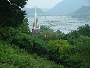
Aerial view of Harpers Ferry from Maryland Heights at the confluence of the Shenandoah (left) and Potomac rivers
|
||
|
||
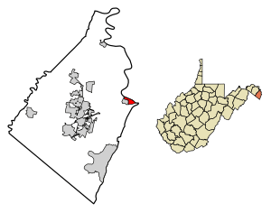
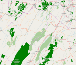
Location of Harpers Ferry in Jefferson County, West Virginia
|
||
| Country | United States | |
| State | West Virginia | |
| County | Jefferson | |
| Area | ||
| • Total | 0.62 sq mi (1.62 km2) | |
| • Land | 0.54 sq mi (1.39 km2) | |
| • Water | 0.09 sq mi (0.23 km2) | |
| Elevation | 509 ft (155 m) | |
| Population
(2020)
|
||
| • Total | 285 | |
| • Density | 527.10/sq mi (203.45/km2) | |
| Time zone | UTC-5 (Eastern (EST)) | |
| • Summer (DST) | UTC-4 (EDT) | |
| ZIP Code |
25425
|
|
| Area code(s) | 304 | |
| FIPS code | 54-35284 | |
| GNIS feature ID | 2390232 | |
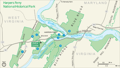
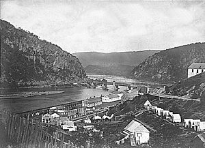
Harpers Ferry is a famous historic town in Jefferson County, West Virginia. It is located in the lower Shenandoah Valley. In 2020, about 269 people lived there. The town sits where the Potomac and Shenandoah rivers meet. This spot is also where the states of Maryland, Virginia, and West Virginia come together. Harpers Ferry is the easternmost town in West Virginia and its lowest point above sea level.
The town was first called Harper's Ferry, named after an 18th-century ferry owner. In 1891, the apostrophe was removed by the United States Board on Geographic Names. Harpers Ferry became famous in 1859 because of John Brown. He was an abolitionist who led a raid on the Harpers Ferry Armory. He hoped to start a slave rebellion, but his plan failed.
During the American Civil War, Harpers Ferry was very important. It was the northernmost point controlled by the Confederates at one time. The town changed hands many times because of its important location. Before the war, it was a busy center for making things and for transportation. After being mostly destroyed in the Civil War, Harpers Ferry now focuses on tourism.
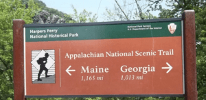
Today, Harpers Ferry is home to John Brown's Fort, which is West Virginia's most visited tourist spot. It also hosts the main office of the Appalachian Trail. The former campus of Storer College, a college for Black students started after the Civil War, is also here. Plus, one of the four national training centers for the National Park Service is in Harpers Ferry. Much of the lower town, which was ruined by the war and floods, has been rebuilt and saved by the National Park Service.
Contents
History of Harpers Ferry
Early Beginnings
In 1733, a person named Peter Stephens settled near "The Point." This is where the Potomac and Shenandoah rivers meet. He started a ferry service across the Potomac River. Fourteen years later, in 1747, Robert Harper traveled through the area. He saw how useful the two rivers could be for industry and transportation. Harper bought Stephens' rights to the land for 30 British guineas.
In April 1751, Harper bought 126 acres of land from Lord Fairfax. In 1761, the Virginia General Assembly gave Harper the official right to run his ferry. In 1763, the town was officially named "Shenandoah Falls at Mr. Harpers Ferry."
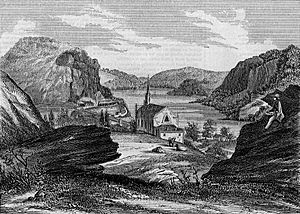
On October 25, 1783, Thomas Jefferson visited Harpers Ferry. He looked at "the passage of the Potomac through the Blue Ridge" from a rock now named after him. Jefferson called the view "perhaps one of the most stupendous scenes in nature."
George Washington also visited Harpers Ferry in 1785. He was president of the Patowmack Company, which worked to improve the Potomac River. In 1794, Washington suggested Harpers Ferry as a good place for a new United States armory and arsenal. Some of Washington's family moved to the area. His great-great-nephew, Colonel Lewis Washington, was even held hostage during John Brown's raid in 1859.
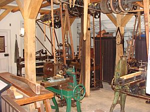
In 1796, the government bought 125 acres of land from Robert Harper's family. Building began on the United States Armory and Arsenal at Harpers Ferry in 1799. This was one of only two such places in the U.S. It made most of the small weapons for the U.S. Army. The town became an industrial center. Between 1801 and 1861, the armory made over 600,000 guns. It was destroyed during the Civil War to keep it from being captured.
Inventor Captain John H. Hall helped create the use of interchangeable parts in guns here. His M1819 Hall rifle was the first gun with parts that could be easily swapped. This was a big step in manufacturing. In 1833, the Chesapeake & Ohio Canal reached Harpers Ferry. A year later, the Baltimore & Ohio Railroad started service through the town.
John Brown's Raid
On October 16, 1859, John Brown, a person who wanted to end slavery, led a group of 21 men in a raid on the armory. Five of these men were Black. Brown hoped to use the captured weapons to start a slave uprising in the South. The first shot fired during the raid badly wounded Hayward Shepherd. He was a free Black man who worked for the B&O Railroad.
The noise from the shot alerted Dr. John Starry. He went to investigate and was stopped by Brown's men. Starry was allowed to leave, but instead of going home, he rode to nearby towns. He warned everyone about the raid.
When Starry reached Charles Town, church bells rang to wake people up. John Brown's men were quickly surrounded by local citizens and soldiers. They were forced to hide in the engine house next to the armory.
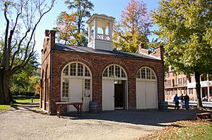
The secretary of war asked the Navy for help. Lieutenant Israel Greene led 86 Marines to the town. Lieutenant Colonel Robert E. Lee was on leave nearby and was put in charge of the Marines. Lt. J. E. B. Stuart was his assistant.
The Marines arrived by train on October 18. After talks failed, they stormed the engine house. They captured most of the raiders and killed a few. Only one Marine was hurt. Brown was tried for treason against Virginia. He was found guilty and hanged in nearby Charles Town. Dr. Starry's statement helped lead to his conviction. John Brown's raid was a major event that helped lead to the Civil War.
Harpers Ferry During the Civil War
The Civil War was very damaging for Harpers Ferry. The town changed hands eight times between 1861 and 1865. When Virginia left the Union in April 1861, the U.S. soldiers tried to burn the armory. They wanted to stop the Confederates from using its equipment. Local people saved the machinery, which the Confederate Army moved to its capital in Richmond. The U.S. Army never made weapons in Harpers Ferry again.
Harpers Ferry was very important because of its location on the railroad. It was also at the northern end of the Shenandoah Valley. Both Union and Confederate troops often moved through the town. The town's Union soldiers, about 14,000 of them, played a key role in the Confederate invasion of Maryland in September 1862. General Robert E. Lee did not want to go into Maryland without capturing Harpers Ferry. It was on his supply route and could block his escape if the invasion went badly.
Lee divided his army of about 40,000 soldiers into four parts. He used the mountains to hide three groups of soldiers under Stonewall Jackson. Their goal was to surround and capture the town.
The Battle of Harpers Ferry began with light fighting on September 13. Confederates tried to capture Maryland Heights to the northeast. Another group moved to capture Loudoun Heights south of town. After Confederate cannons fired on September 14 and 15, the Union soldiers surrendered. With 12,419 Union soldiers captured, this was the largest surrender of U.S. military people until World War II.
Because of the delay in capturing Harpers Ferry, Lee had to gather his troops in Sharpsburg. Two days later, he led his soldiers in the Battle of Antietam. This battle had the most deaths of any single day in U.S. military history.
By July 1864, the Union again controlled Harpers Ferry. On July 4, 1864, Union General Franz Sigel moved his troops to Maryland Heights. From there, he stopped Jubal Early from entering the town and driving the Union soldiers from Maryland Heights.
Harpers Ferry in the 20th Century
On August 15, 1906, the Niagara Movement held its first meeting in the United States. This group was led by W. E. B. Du Bois, a famous writer and scholar. The meeting happened at Storer College, which is now part of Harpers Ferry National Historical Park. This three-day meeting aimed to gain civil rights for African Americans. DuBois later called it "one of the greatest meetings that American Negroes ever held." People at the meeting walked from Storer College to the nearby Murphy farm. This was the site of the historic fort where John Brown's fight to free enslaved African Americans ended.
In 1944, most of the town became Harpers Ferry National Historical Park. It is managed by the National Park Service. Most of the homes in Harpers Ferry are historic. Some of them are listed on the National Register of Historic Places. In 1950, Harpers Ferry had 822 people living there.
Harpers Ferry in the 21st Century
On July 23, 2015, a fire broke out in downtown Harpers Ferry. It destroyed eight or nine businesses and two apartments in two old buildings. These buildings are now being rebuilt.
Studying Harpers Ferry's Past
The National Park Service has done a lot of archaeological work in Harpers Ferry. They have studied the town and Virginius Island in great detail. The journal Historical Archaeology even dedicated an entire issue in 1994 to Harpers Ferry. This shows how much history is hidden beneath the ground there.
Geography and Nature
Harpers Ferry covers about 0.61 square miles. Most of this is land, with a small part being water. Some areas are currently facing threats from new construction.
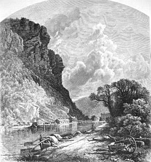
Thomas Jefferson wrote about Harpers Ferry in 1785. He said that "the passage of the Patowmac through the Blue Ridge is perhaps one of the most stupendous scenes in Nature." This means he thought it was an amazing natural sight.
From most of Harpers Ferry, you can still see a faded advertisement. It's for Mennen's Borated Talcum Toilet Powder. It was painted on the cliff face of Maryland Heights many years ago.
Climate
The weather in Harpers Ferry has hot, humid summers. Winters are usually mild to cool. The area gets about 20.7 inches of snow each year. According to the Köppen Climate Classification, Harpers Ferry has a humid subtropical climate. This means it has warm temperatures and plenty of rain throughout the year.
People of Harpers Ferry
| Historical population | |||
|---|---|---|---|
| Census | Pop. | %± | |
| 1850 | 1,747 | — | |
| 1860 | 1,339 | −23.4% | |
| 1880 | 764 | — | |
| 1890 | 958 | 25.4% | |
| 1900 | 896 | −6.5% | |
| 1910 | 766 | −14.5% | |
| 1920 | 713 | −6.9% | |
| 1930 | 705 | −1.1% | |
| 1940 | 665 | −5.7% | |
| 1950 | 822 | 23.6% | |
| 1960 | 572 | −30.4% | |
| 1970 | 423 | −26.0% | |
| 1980 | 361 | −14.7% | |
| 1990 | 308 | −14.7% | |
| 2000 | 307 | −0.3% | |
| 2010 | 286 | −6.8% | |
| 2020 | 269 | −5.9% | |
| U.S. Decennial Census | |||
Population in 2010
In 2010, Harpers Ferry had 286 people living there. There were 131 households, and 78 of these were families. The town had about 539 people per square mile. Most of the people were White (94%). About 4% were African American, and 1% were Native American. About 1% of the population was Hispanic or Latino.
In the households, 21% had children under 18. About 44% were married couples living together. The average household had 2.18 people. The average family had 2.69 people. The average age in town was 52 years old. About 17% of residents were under 18. About 23% were 65 years old or older. The town had slightly more females (50.7%) than males (49.3%).
Getting Around Harpers Ferry
Roads and Highways
The main road to Harpers Ferry is U.S. Route 340. This road goes east from Harpers Ferry to Frederick, Maryland. It also goes south to Greenville, Virginia. Harpers Ferry and Bolivar also have an alternate route of U.S. Route 340. This route follows Washington Street, High Street, and Shenandoah Street.
Train Travel
Amtrak offers train service to Harpers Ferry twice a day. This is on the Capitol Limited line, which runs from Chicago to Washington, D.C.. One train goes in each direction daily. Harpers Ferry is also served by MARC commuter rail. This train is on the Brunswick Line and goes from Martinsburg, West Virginia, to Washington.
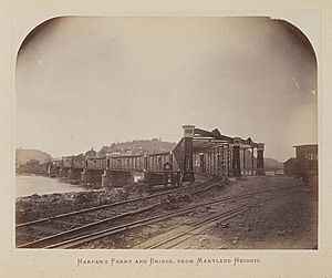
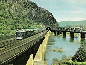
The town's train station is on the West Virginia side of the historic B&O railroad bridge. Harpers Ferry has a long history with trains. It was once served by the Baltimore and Ohio Railroad and many freight lines.
Famous People from Harpers Ferry
- Nathan Cook Brackett
- John Brown
- John Brown's raiders
- Drusilla Dunjee Houston
- Col. Edward M. Kirby
- Celeste Brackett Newcomer
- William Ridenour, state legislator
- Lewis Washington
See also
 In Spanish: Harpers Ferry (Virginia Occidental) para niños


