
Image: Somerset UK location map

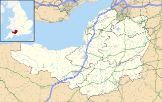
Description: Map of Somerset, UK with the following information shown: Administrative borders Coastline, lakes and rivers Roads and railways Urban areas Equirectangular map projection on WGS 84 datum, with N/S stretched 155% Geographic limits: West: 3.96W East: 2.12W North: 51.55N South: 50.80N
Title: Somerset UK location map
Credit: Ordnance Survey OpenData. Administrative borders and coastline data from Boundary-Line product. All other geographic data from Meridian 2 product. Inset derived from England location map.svg by Spischot.
Author: Nilfanion, created using Ordnance Survey data
Permission: This file is licensed under the Creative Commons Attribution-Share Alike 3.0 Unported license. Attribution: Contains Ordnance Survey data © Crown copyright and database right You are free: to share – to copy, distribute and transmit the work to remix – to adapt the work Under the following conditions: attribution – You must give appropriate credit, provide a link to the license, and indicate if changes were made. You may do so in any reasonable manner, but not in any way that suggests the licensor endorses you or your use. share alike – If you remix, transform, or build upon the material, you must distribute your contributions under the same or compatible license as the original. https://creativecommons.org/licenses/by-sa/3.0 CC BY-SA 3.0 Creative Commons Attribution-Share Alike 3.0 truetrue
Usage Terms: Creative Commons Attribution-Share Alike 3.0
License: CC BY-SA 3.0
License Link: https://creativecommons.org/licenses/by-sa/3.0
Attribution Required?: Yes
Image usage
More than 100 pages link to this image. The following list shows the first 100 page links to this image only. A full list is available.
- Athelney
- Athelney Abbey
- Axbridge
- Backwell
- Ballands Castle
- Barrow Gurney Nunnery
- Bat's Castle
- Bath, Somerset
- Berrow, Somerset
- Brean
- Brean Down Fort
- Bridgwater
- Bridgwater Castle
- Bridgwater Friary
- Bristol Airport
- Broadway, Somerset
- Bruton
- Buckland Priory
- Burnham-on-Sea
- Burnham-on-Sea Round Tower
- Burtle Priory
- Bury Castle, Brompton Regis
- Bury Castle, Selworthy
- Cadbury Castle, Somerset
- Cannington Priory
- Cary Castle
- Castle Batch
- Castle Cary
- Castle Neroche
- Chard, Somerset
- Charterhouse Camp
- Cheddar, Somerset
- Church of All Saints, Chipstable
- Church of All Saints, Norton Fitzwarren
- Church of St James, Curry Mallet
- Church of St James, Winscombe
- Church of St John the Baptist, Ashbrittle
- Church of St Mary, Berkley
- Churchill Methodist Church
- Clevedon
- Cockroad Wood Castle
- Compton Dundon
- Crewkerne
- Crewkerne Castle
- Cricket St Thomas
- Culbone Church
- Culverhay Castle
- Down End Castle
- Downside Abbey
- Dulverton
- Duncorn Hill
- Dunster Castle
- Dunster Priory
- East Somerset Railway
- Fairy Toot
- Farleigh Hungerford Castle
- Frome
- Glastonbury
- Hales Castle
- Ham Wall
- Harridge Wood
- Highbridge, Somerset
- Ilchester Friary
- Ilchester Nunnery
- Ilminster
- Keynsham
- Kilve Chantry
- Langport
- Leigh Woods, Somerset
- Locking Castle
- Long Ashton
- Longforth Farm
- Low Ham
- Midsomer Norton
- Minehead
- Montacute Castle
- Muchelney Abbey
- Nailsea
- Newton St Loe Castle
- North Petherton
- Nunney Castle
- Pagans Hill Roman temple
- Porlock Stone Circle
- Portishead
- Portishead, Somerset
- Portishead and North Weston
- Radstock
- Redhill, Somerset
- Rode, Somerset
- Shepton Mallet
- Somerton
- South Cadbury
- South Petherton
- Street, Somerset
- Taunton
- Watchet
- Wellington, Somerset
- Wells, Somerset
- Weston-super-Mare
- Wincanton
