La Cañada Flintridge, California facts for kids
Quick facts for kids
La Cañada Flintridge, California
|
|||
|---|---|---|---|
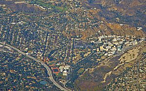
La Cañada Flintridge, the Foothill Freeway, and, on the right, the Jet Propulsion Laboratory (2014)
|
|||
|
|||
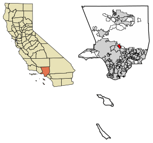
Location of La Cañada Flintridge in Los Angeles County, California.
|
|||
| Country | United States | ||
| State | California | ||
| County | Los Angeles | ||
| Incorporated | November 30, 1976 | ||
| Named for | Rancho La Cañada Frank Putnam Flint |
||
| Government | |||
| • Type | Council-manager | ||
| Area | |||
| • Total | 8.64 sq mi (22.39 km2) | ||
| • Land | 8.63 sq mi (22.35 km2) | ||
| • Water | 0.02 sq mi (0.04 km2) 0.20% | ||
| Elevation | 1,188 ft (362 m) | ||
| Population
(2020)
|
|||
| • Total | 20,573 | ||
| • Density | 2,384.17/sq mi (920.53/km2) | ||
| Time zone | UTC−8 (Pacific) | ||
| • Summer (DST) | UTC−7 (PDT) | ||
| ZIP Codes |
91011, 91012
|
||
| Area codes | 818 | ||
| FIPS code | 06-39003 | ||
| GNIS feature IDs | 1660845, 2411565 | ||
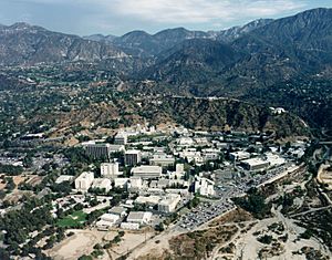
La Cañada Flintridge, often called just La Cañada, is a city in the foothills of the Verdugo Mountains in Los Angeles County, California. It is located in the Crescenta Valley and the western part of the San Gabriel Valley. This city is also home to NASA's famous Jet Propulsion Laboratory.
The city was formed on November 30, 1976, by joining two separate communities: La Cañada and Flintridge. In 2020, about 20,573 people lived here.
Contents
- A Look Back: The History of La Cañada Flintridge
- Geography: Where is La Cañada Flintridge?
- Demographics: Who Lives in La Cañada Flintridge?
- Arts and Culture: Fun Things to Do and See
- Education: Schools in La Cañada Flintridge
- Media: Local News
- Infrastructure: City Services
- Transportation: Getting Around
- Notable People: Famous Residents
- Sister Cities
- See also
A Look Back: The History of La Cañada Flintridge
The first people to live in this area were the Shoshone Native Americans.
People often shorten the city's name to "La Cañada." The full name, "La Cañada Flintridge," does not have a hyphen. This shows that the two communities joined together as one.
How Did La Cañada Get Its Name?
When Spain and Mexico controlled the area, it was known as Rancho La Cañada. The name "La Cañada" comes from a Spanish word meaning 'canyon' or 'ravine'.
In December 1933 and January 1934, the La Cañada Valley experienced severe flooding. This event is known as the Crescenta Valley flood (1933 and 1934).
What About Flintridge?
Flintridge was named after Frank P. Flint, a United States senator who developed the area.
Flintridge is in the southern part of the city. It covers the northern side of the San Rafael Hills. Even areas north of Foothill Boulevard were originally part of Flintridge. The Flintridge Riding Club and Flintridge Preparatory School are still located there.
When Did the Cities Join?
On November 30, 1976, the communities of Flintridge and La Cañada officially merged. They became one city called "La Cañada Flintridge."
In 2023, Forbes magazine ranked La Cañada Flintridge as one of the most expensive places to live in the United States.
Geography: Where is La Cañada Flintridge?
The city sits in the Crescenta Valley and the far western part of the San Gabriel Valley. To the north are the San Gabriel Mountains and Angeles National Forest. To the south are the San Rafael Hills.
Most of the city's water drains southeast towards the Arroyo Seco area in Pasadena. The western part of the city drains south towards Glendale. Both of these areas eventually flow into the Los Angeles River.
The city's elevation changes quite a bit. It is about 970 feet (296 meters) near Devil's Gate Dam. The highest neighborhood is about 2,400 feet (732 meters) high. The city limits even reach into the San Gabriel Mountains, going up to 3,440 feet (1,048 meters) along Mount Lukens Road.
In August 2009, the city was threatened by the Station Fire. Because of its location at the base of the San Gabriel Mountains and many California Live Oak trees, the city is considered a "very high fire hazard zone." It has a strong fire safety program to help prevent fires.

Climate: What's the Weather Like?
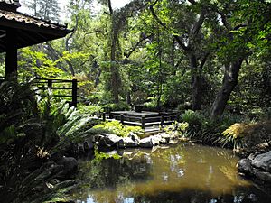
La Cañada Flintridge has a typical Southern California climate. Winters are mild, and summers are hot. Spring often has hazy days, while fall usually has clear weather.
August is usually the warmest month, with high temperatures in the low to mid-90s Fahrenheit (around 32-35°C). December and January are the coolest, with highs in the low to mid-60s Fahrenheit (around 16-18°C).
Most rain falls in winter, with about 21 inches (53 cm) per year. Summer rain is rare. The ocean's cooling effect is limited because the city is inland, behind several mountain ranges. This means summers are hotter and winters are often cooler than in coastal parts of Los Angeles.
Sometimes, strong winds called Santa Ana winds blow from the desert. These winds can make summer and fall days very hot. If the wind blows from the ocean, temperatures are much cooler. In winter, the highest parts of the city might see a little snow. Several ski resorts are about 30 miles (48 km) northeast of the city.
| Climate data for La Cañada Flintridge (Glendale) | |||||||||||||
|---|---|---|---|---|---|---|---|---|---|---|---|---|---|
| Month | Jan | Feb | Mar | Apr | May | Jun | Jul | Aug | Sep | Oct | Nov | Dec | Year |
| Record high °F (°C) | 93 (34) |
92 (33) |
96 (36) |
105 (41) |
102 (39) |
110 (43) |
110 (43) |
107 (42) |
110 (43) |
108 (42) |
98 (37) |
93 (34) |
110 (43) |
| Mean daily maximum °F (°C) | 63.8 (17.7) |
65.4 (18.6) |
70.5 (21.4) |
76.3 (24.6) |
77.2 (25.1) |
83.5 (28.6) |
89.5 (31.9) |
91.2 (32.9) |
89.3 (31.8) |
83.2 (28.4) |
70.5 (21.4) |
63.2 (17.3) |
77.0 (25.0) |
| Mean daily minimum °F (°C) | 42.3 (5.7) |
44.7 (7.1) |
46.9 (8.3) |
50.2 (10.1) |
53.1 (11.7) |
57.2 (14.0) |
61.3 (16.3) |
62.4 (16.9) |
59.8 (15.4) |
54.8 (12.7) |
47.5 (8.6) |
41.4 (5.2) |
51.8 (11.0) |
| Record low °F (°C) | 23 (−5) |
17 (−8) |
23 (−5) |
34 (1) |
37 (3) |
41 (5) |
45 (7) |
48 (9) |
44 (7) |
37 (3) |
29 (−2) |
26 (−3) |
17 (−8) |
| Average precipitation inches (mm) | 4.48 (114) |
5.00 (127) |
4.38 (111) |
1.22 (31) |
0.45 (11) |
0.21 (5.3) |
0.05 (1.3) |
0.21 (5.3) |
0.48 (12) |
0.65 (17) |
1.50 (38) |
2.46 (62) |
21.09 (534.9) |
Demographics: Who Lives in La Cañada Flintridge?
| Historical population | |||
|---|---|---|---|
| Census | Pop. | %± | |
| 1960 | 18,338 | — | |
| 1970 | 20,652 | 12.6% | |
| 1980 | 20,153 | −2.4% | |
| 1990 | 19,378 | −3.8% | |
| 2000 | 20,318 | 4.9% | |
| 2010 | 20,246 | −0.4% | |
| 2020 | 20,573 | 1.6% | |
| U.S. Decennial Census 1850–1870 1880-1890 1900 1910 1920 1930 1940 1950 1960 1970 1980 1990 2000 2010 2020 |
|||
La Cañada Flintridge first appeared in the U.S. Census in 1970 as an unincorporated community.
Population in 2020
In 2020, the population of La Cañada Flintridge was 20,573. The city is home to people from many different backgrounds.
| Race / Ethnicity (NH = Non-Hispanic) | Pop 2000 | Pop 2010 | Pop 2020 | % 2000 | % 2010 | % 2020 |
|---|---|---|---|---|---|---|
| White alone (NH) | 14,443 | 13,094 | 11,127 | 71.08% | 64.67% | 54.09% |
| Black or African American alone (NH) | 70 | 101 | 129 | 0.34% | 0.50% | 0.63% |
| Native American or Alaska Native alone (NH) | 24 | 4 | 24 | 0.12% | 0.02% | 0.12% |
| Asian alone (NH) | 4,167 | 5,181 | 6,408 | 20.51% | 25.59% | 31.15% |
| Native Hawaiian or Pacific Islander alone (NH) | 9 | 4 | 2 | 0.04% | 0.02% | 0.01% |
| Other race alone (NH) | 45 | 50 | 129 | 0.22% | 0.25% | 0.63% |
| Mixed race or Multiracial (NH) | 584 | 545 | 1,037 | 2.87% | 2.69% | 5.04% |
| Hispanic or Latino (any race) | 976 | 1,267 | 1,717 | 4.80% | 6.26% | 8.35% |
| Total | 20,318 | 20,246 | 20,573 | 100.00% | 100.00% | 100.00% |
Families and Households
In 2010, there were 6,849 households in La Cañada Flintridge. About 42% of these households had children under 18 living there. Most households (73.4%) were married couples. The average household had about 2.95 people.
The median age in the city was 45.9 years. About 26.3% of the population was under 18, and 15.7% was 65 or older.
Most homes (89.4%) were owned by the people living in them. The median household income in 2010 was $136,818. Only a small percentage of the population (3.2%) lived below the poverty line.
Arts and Culture: Fun Things to Do and See
- Jet Propulsion Laboratory (JPL): This NASA center is located at the eastern end of La Cañada Flintridge. It's a major research and development center for robotic space exploration in the United States.
- First Frisbee Golf Course: The very first Frisbee golf course is in Hahamongna Watershed Park. This park is across the street from La Cañada High School.
- Descanso Gardens: This beautiful garden has the largest collection of camellia flowers in North America.
- La Cañada Town Center: Opened in 2008, this shopping center has many stores and restaurants. The city hall moved into the former corporate offices of Sport Chalet here.
- Lanterman House: This museum and historical archive is one of the oldest homes in the area, built in 1915.
Education: Schools in La Cañada Flintridge
Public Schools
The La Cañada Unified School District (LCUSD) serves most of the city. It is known as one of the best school districts in California. In 2010, it had the second-highest Academic Performance Index (API) score in the state.
The district has three public elementary schools for grades K-6:
- La Cañada Elementary
- Palm Crest Elementary
- Paradise Canyon Elementary School
The public high school, La Cañada High School, also serves as a middle school for grades 7–8. It has been recognized as a "Blue Ribbon School" multiple times.
A small part of the city is served by the Glendale Unified School District. Students there attend Mountain Avenue Elementary, Rosemont Middle School, Anderson W. Clark Magnet High School, and Crescenta Valley High School.
Private Schools
La Cañada Flintridge also has several private schools:
- High Schools: St. Francis High School, Flintridge Sacred Heart Academy, and Flintridge Preparatory School.
- Elementary Schools: Crestview Preparatory (K-6), The Learning Castle (K-3), La Cañada Preparatory (grades 4–8), and St. Bede (K-8).
Media: Local News
The city's main newspaper is the La Cañada Outlook Valley Sun. This paper was formed when the La Cañada Outlook bought the La Cañada Valley Sun in 2020.
Infrastructure: City Services
Emergency Services
- Law Enforcement: The Los Angeles County Sheriff's Department (LASD) provides police services for La Cañada Flintridge. They operate the Crescenta Valley Station.
- Fire Department: The Los Angeles County Fire Department (LACoFD) has fire stations 19 and 82 in the city. There is also a station at JPL NASA. The city has strict fire safety rules and inspections to help prevent wildfires.
- Emergency Transportation: Care Ambulance Service handles emergency medical transport.
Transportation: Getting Around
La Cañada Flintridge is where the Angeles Crest Highway begins. This highway starts at Foothill Boulevard and climbs steeply into the San Gabriel Mountains.
There have been incidents with large trucks losing their brakes on the Angeles Crest Highway. In 2008, a truck carrying onions crashed after its brakes failed. In 2009, another truck carrying cars lost its brakes, causing accidents that resulted in two deaths and several injuries.
Because of these incidents, a law was signed in August 2009. This law bans heavy trucks with three or more axles from driving on the Angeles Crest Highway.
Notable People: Famous Residents
Many well-known people have lived in La Cañada Flintridge, including:
- Frances Arnold, Nobel Prize winner in Chemistry (2018)
- Angela Bassett, actress
- Chris Buck, animator and film director (known for Frozen)
- Adam Carolla, comedian and radio personality
- Kevin Costner, actor and director
- Miley Cyrus, actress and singer
- Donald Glover, actor and musician
- Ollie Johnston, famous Disney animator
- Jennifer Lee, screenwriter and film director (known for Frozen)
- Alfred Molina, actor
- Collin Morikawa, professional golfer
- Haley Joel Osment, actor
- Shohei Ohtani, MLB baseball player
- Vince Vaughn, actor
Sister Cities
La Cañada Flintridge has one sister city:
 Villanueva de la Cañada, Spain
See also
 In Spanish: La Cañada Flintridge para niños
 | John T. Biggers |
 | Thomas Blackshear |
 | Mark Bradford |
 | Beverly Buchanan |


