Mill Valley, California facts for kids
Quick facts for kids
Mill Valley, California
|
|
|---|---|
Mill Valley, California
|
|
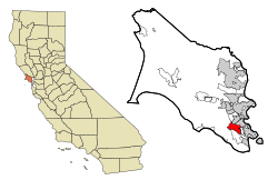
Location in Marin County and the state of California
|
|
| Country | United States |
| State | California |
| County | Marin |
| Incorporated | September 1, 1900 |
| Area | |
| • Total | 4.85 sq mi (12.55 km2) |
| • Land | 4.76 sq mi (12.34 km2) |
| • Water | 0.08 sq mi (0.22 km2) 1.74% |
| Elevation | 79 ft (24 m) |
| Population
(2020)
|
|
| • Total | 14,231 |
| • Density | 2,993.7/sq mi (1,155.88/km2) |
| Time zone | UTC−8 (Pacific) |
| • Summer (DST) | UTC−7 (PDT) |
| ZIP Codes |
94941, 94942
|
| Area codes | 415/628 |
| FIPS code | 06-47710 |
| GNIS feature IDs | 1659128, 2411109 |
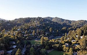
Mill Valley is a city in Marin County, California, United States. It is located about 14 miles (22 km) north of San Francisco. You can reach it by crossing the Golden Gate Bridge. The city is also about 52 miles (83 km) from Napa Valley. In 2020, about 14,231 people lived here.
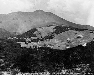
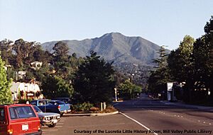
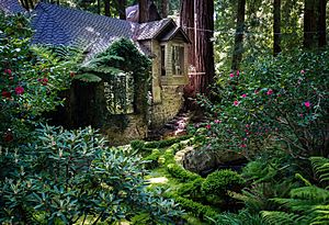
Mill Valley sits on the western and northern edges of Richardson Bay. It also lies on the eastern slopes of Mount Tamalpais. Beyond the flat coastal areas, the city spreads into narrow, wooded canyons. These canyons are mostly filled with redwood trees that have grown back after logging. The Mill Valley area (ZIP Code 94941) includes nearby communities like Almonte, Alto, Homestead Valley, and Strawberry. The famous Muir Woods National Monument is also very close to the city.
Contents
History of Mill Valley
Who were the first people in Mill Valley?
The first people to live in Marin County were the Coast Miwok. They arrived about 6,000 years ago. Their land covered all of Marin County and parts of southern Sonoma County. Over 600 of their village sites have been found. Fourteen of these sites are in the Mill Valley area. Nearby, you can see ancient rock carvings on Ring Mountain.
Before European settlers arrived, there were likely between 1,500 and 5,000 Coast Miwok people. By 1880, their population had dropped to about 60. Today, over 1,000 members of the Federated Indians of Graton Rancheria are registered. This group includes both Coast Miwok and Southern Pomo people.
In Mill Valley, on Locust Avenue, there is a plaque. It marks the spot believed to be the birthplace of Chief Marin in 1871. This village site was first found in 1907. Another important site was in the Manzanita area. It was under the Fireside Inn, a famous place during the Prohibition Era (when alcohol was illegal). This "roadhouse" was outside the city's "dry" limits. Shell mounds, which are piles of ancient shells, have been found near streams and Richardson Bay.
Many Coast Miwok people were taken to missions starting in 1776. They were taught the Catholic religion and lost their freedom. Sadly, many died from European diseases. Because of this, Mission San Rafael was built in 1817. Over 200 surviving Coast Miwok were moved there.
How did Mill Valley get started?
By 1834, California was controlled by the Mexican government. They took Miwok lands and gave them to Mexican soldiers or their families. These large land areas were called ranchos. The Miwok people who survived often worked for these new landowners. In 1834, John T. Reed received the first land grant in Marin. It was called Rancho Corte Madera del Presidio. West of that, Rancho Saucelito was given to William A. Richardson in 1838.
John Reed built the first sawmill in the county in the 1830s. It was on Cascade Creek, where Old Mill Park is now. The mill cut wood for the San Francisco Presidio. Reed also raised cattle and horses. He had a brickyard and a stone quarry. He sold animal skins and other products until he died in 1843. Richardson sold food to San Francisco during the Gold Rush.
Later, Richardson faced financial problems. Much of his land, including parts of what is now Mill Valley, went to his administrator, Samuel Reading Throckmorton. Throckmorton came to San Francisco in 1850. He acquired a large part of Rancho Saucelito in 1853-54. He built his own ranch, "The Homestead." Some of his land was rented to Portuguese settlers for dairy farming. Ranch "B" is one of the few remaining dairy farm buildings in Mill Valley today.
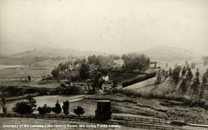
In 1873, Dr. John Cushing found 320 "lost" acres between the Reed and Richardson lands. He built a peaceful health retreat there. Later, his family turned it into the Blithedale Hotel. Other summer resorts soon opened in the canyon. People came to vacation, enjoying fishing, hiking, and horseback riding. Some even moved there and traveled to San Francisco for work.
The Tamalpais Land & Water Company was formed in 1889. They wanted to sell the Richardson land. Joseph Eastland, who was involved with the North Pacific Coast Railroad, helped extend the railroad into the area. The company hired engineer Michael M. O'Shaughnessy. He designed roads, paths, and water systems for the new city. He also set aside land for churches, schools, and parks.
On May 31, 1890, a big land auction was held. Nearly 3,000 people attended. Over 200 acres were sold. By 1892, there were two schools and some churches. Architects and builders also came to Mill Valley. Harvey A. Klyce designed many homes and public buildings. The area was known as "Eastland" and "Mill Valley."
The Mt. Tamalpais Scenic Railway opened in 1896. It ran from the town center all the way to the mountain summit. This railway was called "The Crookedest Railroad in the World." It brought many tourists to the mountain and later to Muir Woods. The railroad also had unique Gravity Cars. The tracks were removed in 1930 because more people were using cars.
How did Mill Valley grow in the 20th century?
By 1900, Mill Valley's population was almost 900. The city was officially incorporated. New clubs and events started, like the Outdoor Art Club (1902) and the Dipsea Race (1905). A big population boom happened after the 1906 Great Earthquake. Many people fled to Mill Valley from San Francisco and stayed. The population grew to over 1,000 permanent residents that year.
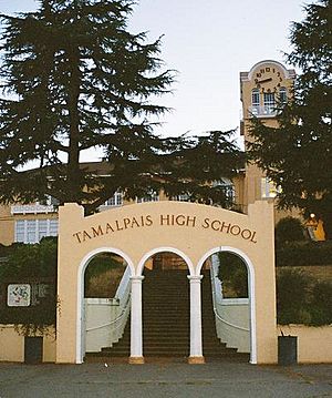
More roads were built, and sidewalks were poured. Tamalpais High School opened in 1908. The first city hall was built in 1908, and a library in 1910. The Post Office changed its name to "Mill Valley" in 1904. The first Mountain Play was performed on Mt. Tam in 1913.
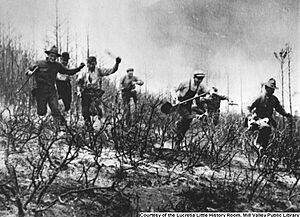
By the 1920s, most roads were paved. The population reached over 2,500. In 1929, a huge fire nearly destroyed the city. It burned much of Mt. Tam. The city was saved only when the wind changed direction. The fire and the rise of cars led to the end of the Mt. Tamalpais and Muir Woods Scenic Railway. The stock market crash of 1929 and the Great Depression also hurt tourism.
During the Great Depression, many famous landmarks were built. The Works Progress Administration and the Civilian Conservation Corps helped. These included the Mead Theater at Tam High and the rock seating at the Mountain Theater. The Golden Gate Bridge was also built from 1934-1937. This bridge helped increase Marin's population. Bus service replaced the trains. During World War II, Marinship brought many workers to Marin, and some moved to Mill Valley.
What is Mill Valley like today?
By 1950, Mill Valley still felt very rural, with a population of over 7,000. The military built the Mill Valley Air Force Station during the Korean War. In 1956, some famous writers, like Jack Kerouac, lived briefly in a house here. In the 1960s, the population grew quickly. The Mill Valley Fall Arts Festival became an annual event. A new, award-winning library opened in 1966.
In the 1970s, Mill Valley became known as a wealthy area. Many people who made money in San Francisco moved here. New schools and neighborhoods appeared. The city worked to protect its redwoods and open spaces. The Mill Valley Film Festival started in 1978.
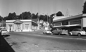
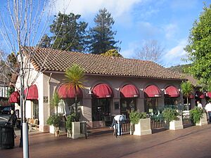
The 1980s and 1990s saw changes in local businesses. Many small shops closed. They were replaced by boutiques, upscale clothing stores, coffee shops, and art galleries. Downtown Plaza and Lytton Square were updated. The city's population grew to over 13,000. The Public Library expanded. It also joined MARINet, a group of Marin libraries. This allows people to easily find and borrow books from any Marin public library. The Old Mill was rebuilt in 1991.
The new millennium brought reflection as the city celebrated 100 years. A new Community Center opened in 2008. Mill Valley has a strong commitment to protecting its environment.
Geography and Nature
Mill Valley covers about 4.8 square miles (12.55 km2). Most of this is land, with a small amount of water. The city is located between Mt. Tamalpais to the west and the city of Tiburon to the east. Corte Madera is to the north, and the Golden Gate National Recreational Area is to the south.
Two streams flow from Mt. Tamalpais through Mill Valley to the bay. These are the Arroyo Corte Madera del Presidio and Cascade Creek. Mill Valley is surrounded by hundreds of acres of park lands. These include state, federal, and county parks. The city also has its own open-space reserves and parks. This means Mill Valley is surrounded by natural wilderness. This closeness to nature has made residents care deeply about protecting the environment.
Mill Valley has many beautiful natural features. These areas provide important habitat for fish, marine mammals, and other living things. You can visit places like Cascade Falls Park. This park is a natural forested area.
The Homestead Valley Land Trust helps protect many wildland areas. These are open to the public from sunrise to dusk. Several nature trails allow access to these areas. They also connect to nearby state and federal parks. These wildlands are home to many wild animals. This includes large predators like the coyote, the bobcat, and the cougar. When visiting, remember to stay on trails and keep dogs on leashes.
What is the climate like in Mill Valley?
Mill Valley has a mild Mediterranean climate. This means it has wet winters and very dry summers. Winter temperatures rarely drop below freezing. Summer temperatures rarely go above 90°F (32°C). Most of the rain falls from November to March.
California coastal fog often affects Mill Valley. This makes the humidity change a lot. In winter, humidity is usually around 70-90%. In summer, morning fog keeps humidity normal. But in the afternoon, after the fog clears, humidity often drops to about 30%. Mill Valley does not get a lot of clear sunny days. It usually has about 130 clear days a year.
| Climate data for Mill Valley, California | |||||||||||||
|---|---|---|---|---|---|---|---|---|---|---|---|---|---|
| Month | Jan | Feb | Mar | Apr | May | Jun | Jul | Aug | Sep | Oct | Nov | Dec | Year |
| Record high °F (°C) | 79 (26) |
79 (26) |
87 (31) |
96 (36) |
102 (39) |
110 (43) |
111 (44) |
106 (41) |
106 (41) |
101 (38) |
87 (31) |
77 (25) |
111 (44) |
| Mean daily maximum °F (°C) | 56 (13) |
61 (16) |
65 (18) |
71 (22) |
76 (24) |
82 (28) |
85 (29) |
84 (29) |
82 (28) |
75 (24) |
63 (17) |
56 (13) |
71 (22) |
| Mean daily minimum °F (°C) | 41 (5) |
43 (6) |
44 (7) |
46 (8) |
49 (9) |
52 (11) |
53 (12) |
54 (12) |
53 (12) |
50 (10) |
45 (7) |
41 (5) |
48 (9) |
| Record low °F (°C) | 20 (−7) |
21 (−6) |
27 (−3) |
31 (−1) |
23 (−5) |
39 (4) |
41 (5) |
40 (4) |
37 (3) |
30 (−1) |
26 (−3) |
18 (−8) |
18 (−8) |
| Average rainfall inches (mm) | 9.60 (244) |
9.10 (231) |
7.05 (179) |
2.56 (65) |
1.20 (30) |
0.24 (6.1) |
0.01 (0.25) |
0.12 (3.0) |
0.50 (13) |
2.33 (59) |
7.47 (190) |
7.29 (185) |
47.47 (1,206) |
| Source: http://www.weather.com/weather/wxclimatology/monthly/graph/94941 | |||||||||||||
Mill Valley also has "microclimates." These are small areas with different weather. Some canyons have steep, north-facing slopes and thick forests. These areas are cooler and wetter than other parts of town. This microclimate helps the Coastal Redwood forests grow. These redwoods are a big part of Mill Valley's history.
Population and People
| Historical population | |||
|---|---|---|---|
| Census | Pop. | %± | |
| 1910 | 2,551 | — | |
| 1920 | 2,554 | 0.1% | |
| 1930 | 4,164 | 63.0% | |
| 1940 | 4,847 | 16.4% | |
| 1950 | 7,331 | 51.2% | |
| 1960 | 10,411 | 42.0% | |
| 1970 | 12,942 | 24.3% | |
| 1980 | 12,967 | 0.2% | |
| 1990 | 13,038 | 0.5% | |
| 2000 | 13,600 | 4.3% | |
| 2010 | 13,903 | 2.2% | |
| 2020 | 14,231 | 2.4% | |
| U.S. Decennial Census | |||
What is the population like in Mill Valley?
In 2010, Mill Valley had 13,903 people. The population density was about 2,868 people per square mile. Most residents (88.8%) were White. About 5.4% were Asian. Around 4.5% of the population was Hispanic or Latino.
Most people (99.5%) lived in homes. There were 6,084 households. About 31% of households had children under 18. The average household had 2.27 people. The average family had 2.94 people.
The population included 23.7% under 18 years old. About 18.9% were 65 years or older. The average age was 46.6 years.
In 2000, the median household income was $90,794. The median family income was $119,669. The income per person was $64,179. About 4.5% of the population lived below the poverty line.
City Life and Neighborhoods
Mill Valley is a popular place to live for people who work in San Francisco. This is because it's a beautiful location near Mount Tamalpais and easy to get to. Over the last 30 years, home prices have gone up a lot. This has made it harder for some people to afford to live here.
This trend has also changed the businesses in Mill Valley. Some older, local shops have closed. They have been replaced by boutiques, fancy clothing stores, and art galleries.
In 2005, CNN/Money and Money magazine ranked Mill Valley as one of the "100 Best Places to Live in the United States." In 2007, Forbes magazine listed it as one of the "Most expensive zip codes in America."
Mill Valley still has its artistic side. It hosts galleries, festivals, and performances. However, there are fewer affordable homes now. This has affected some cultural spots. One affordable housing project was finished in 2008. It provided about 50 low-income apartments.
What are the neighborhoods in Mill Valley?
Strawberry is a community east of Mill Valley. Tamalpais-Homestead Valley is another nearby community. Smaller areas include Alto and Almonte. Muir Beach is in the Mill Valley School District.
Here are some neighborhoods in the Mill Valley area:
| Almonte | "Alto" Sutton Manor | Blithedale Canyon | Boyle Park | Cascade Canyon | Country Club | Downtown | East Blithedale Corridor |
| Edgewood Cypress | Enchanted Knolls | Eucalyptus Knolls | Homestead Valley | Kite Hill | Land of Peter Pan | Marin Terrace | Marin View |
| Middle Ridge | Mill Valley Heights | Mill Valley Meadows | Miller Avenue | Molino Edgewood | Muir Woods | Old Mill | Panoramic Highway |
| Scott Highlands | Scott Valley | Sequoia Valley | Shelter Bay | Shelter Ridge | Strawberry | Sycamore | Sycamore Park |
| Tam Junction | Tamalpais Valley | Tamalpais Park | Tennessee Valley | Vernal Heights | Warner Canyon |
City parks and recreation
Mill Valley has many parks for fun activities. These parks often have playgrounds and wooded trails. They also have areas for playing different sports.
Education in Mill Valley
Public schools in Mill Valley
Public schools in Mill Valley are run by the Mill Valley School District. There are five elementary schools. There is also one middle school, Mill Valley Middle School. This middle school has won the California Distinguished School Award four times.
The local high school is Tamalpais High School. It is part of the Tamalpais Union High School District. This district serves central and southern Marin County. There are also private schools in Mill Valley. North Bridge Academy helps students with dyslexia. Marin Horizon School serves students from pre-kindergarten to 8th grade.
Mill Valley Public Library
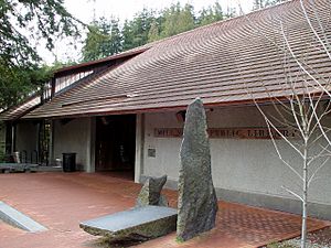
The city library is next to Old Mill Park. It has many nice places to read. It also offers free computer and Internet access. The library has started offering Museum Passes to residents. These passes give free entry to museums in the Bay Area.
The Mill Valley Public Library also has the Lucretia Hanson Little History Room. This room has thousands of books, photos, and stories. They all tell the history of California, Marin County, and Mill Valley.
Annual Events
Mill Valley hosts several annual events. Many of these attract people from all over the country and the world:
- Dipsea Race
- The Mountain Play
- Mill Valley Film Festival
Notable Residents
Many interesting people have lived in Mill Valley, including:
- Eve Arden, actress
- Michael Bloomfield, blues guitarist
- Dana Carvey, actor and comedian
- David Crosby, singer-songwriter
- Mariel Hemingway, actress
- Jon Hendricks, jazz singer
- Salem Ilese, singer-songwriter
- Snatam Kaur, singer and author
- Bridgit Mendler, singer-songwriter
- Van Morrison, singer-songwriter
- Kathleen Quinlan, actress
- Howard Rheingold, writer and teacher
- Kenny Rosenberg (born 1995), baseball pitcher
- Grace Slick, singer-songwriter
- Bob Weir, musician
See also
 In Spanish: Mill Valley (California) para niños


