
National Register of Historic Places listings in Cumberland County, Maine facts for kids

Did you know that many old buildings, bridges, and even islands in Maine are super important because of their history? The National Register of Historic Places is like a special list that helps protect these cool spots across the United States. When a place is on this list, it means it's recognized for its amazing history, architecture, or what it means to our culture.
In Cumberland County, Maine, there are over 240 places on this list! That's a lot of history to explore. Some of these places are even called "National Historic Landmarks," which means they are extra special and important to the whole country. Think of them as the "superstars" of historic places!
Many of these historic spots are in Portland, which has its own long list. But lots of other interesting places are found all over Cumberland County, outside of Portland. Let's check out a few of them!
Contents
Historic Buildings and Homes
Old School Buildings and Libraries
Many buildings that used to be schools or libraries are now historic places. They tell us about how people learned and shared knowledge a long time ago.
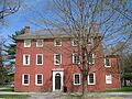
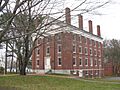
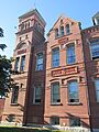
- The Academy Building at the University of Southern Maine in Gorham is one such place. It was built a long time ago and has seen many students come and go.
- The Art Gallery at the same university in Gorham is also on the list. Imagine all the art and history it holds!
- The Caswell Public Library in Harrison used to be a library. It's a great example of how communities valued reading and learning.
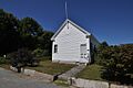
- The Dry Mills School in Gray is another old schoolhouse. It reminds us of what classrooms were like in the past.
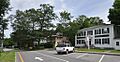
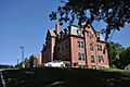
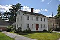
- In Westbrook, the St. Hyacinth School and Convent and the Old Westbrook High School are recognized. They show how education changed over the years.
- The Dalton Holmes Davis Memorial Library in Bridgton and the Steep Falls Library in Steep Falls are also important old libraries.
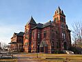
- The Pennell Institute in Gray now holds town offices, but it was once a school.
- The Winn Road School in Cumberland Center is another example of a historic school building.
Famous Houses and Estates
Many homes of important people or those with unique designs are protected.
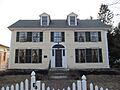
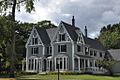
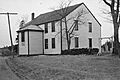
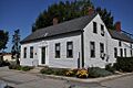
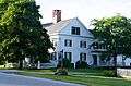
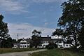
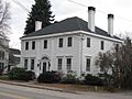
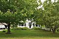
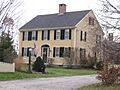
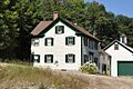
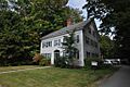
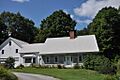
- The Lt. Robert Andrews House in Bridgton is an old home with a story.
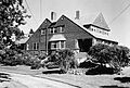
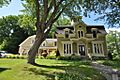
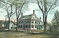
- The Baxter House in Gorham and the Baxter Summer Home on Mackworth Island in Falmouth belonged to Percival P. Baxter, a former governor of Maine who loved nature and helped create Baxter State Park.
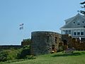
- Beckett's Castle in Cape Elizabeth sounds like something out of a fairy tale! It's a unique old house.
- The Capt. S.C. Blanchard House in Yarmouth is now a music center, showing how old buildings can find new life.
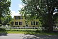
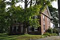
- The Henry Boody House in Brunswick is owned by Bowdoin College.
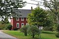
- The C.A. Brown Cottage in Cape Elizabeth is a charming old cottage.
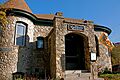
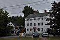
- The Burnell Tavern in Baldwin was once a place where travelers could stop and rest.
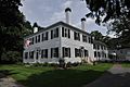
- The Camp Hammond in Yarmouth is another historic home.
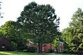
- The Parker Cleaveland House in Brunswick is a National Historic Landmark. Parker Cleaveland was a famous professor at Bowdoin College.
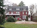
- The Benjamin Cleaves House in Bridgton is also a historic home.
- The John Dunlap House in Brunswick and the Deacon Andrew Dunning House in Harpswell are old family homes.
- The Isaac W. Dyer Estate in Gorham and the Dyer-Hutchinson Farm in Cape Elizabeth are examples of large historic properties.
- The Dyke Mountain Annex in Sebago is another interesting old building.
- The Falmouth House and Hall's Tavern in Falmouth are both historic. Taverns were like inns where people stayed and ate.
- The Farnsworth House in Bridgton is a historic home.
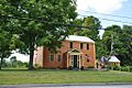
- The Fitch's General Store and House in Sebago shows what old general stores were like.
- The Goold House and Parson Smith House in Windham are also on the list.
- The Nathan Harris House in Westbrook is a historic home.
- The Nathaniel Hawthorne Boyhood Home in Raymond is where the famous writer Nathaniel Hawthorne lived as a boy. This is a very special place!
- The Richard Hunniwell House in Scarborough is another old home.
- The Intervale Farm in New Gloucester is a historic farm.
- The Elijah Kellogg House in Harpswell belonged to a well-known minister and author.
- The Stephen Longfellow House in Gorham is connected to the family of the famous poet Henry Wadsworth Longfellow.
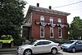
- The E.B. Mallett Office Building in Freeport was an important business building.
- The Richard Manning House in Casco is a historic home.
- The Manor House in Naples is a grand old building.
- The Maplewood Farm in Windham is another historic farm.
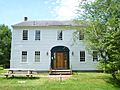
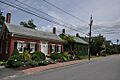
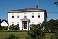
- The Daniel Marrett House in Standish is a very old and important home.
- The McLellan House in Gorham is also historic.
- The Merriconegan Farm in Harpswell is another historic farm.
- The Capt. Reuben Merrill House in Yarmouth and the Capt. Reuel and Lucy Merrill House in Cumberland Center belonged to sea captains.
- The Mitchell House in Yarmouth is a historic home.
- The Payson House at Thornhurst in Falmouth is another historic estate.
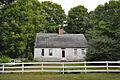
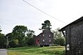
- The Peabody-Fitch House in Bridgton is an old home with a long history.
- The Sam Perley Farm in Naples is a historic farm.
- The William F. Perry House in Bridgton is a historic home.
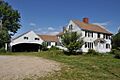
- The Pettengill House and Farm in Freeport is a beautiful old farm.
- The Capt. Greenfield Pote House in Freeport belonged to another sea captain.
- The Cushing and Hannah Prince House in Yarmouth is a historic family home.
- The Elisha Purington House in Falmouth is also on the list.
- The Jacob Randall House in Pownal is a historic home.
- The Richardson House in Brunswick is another old house.
- The Scribner Homestead in Harrison is a historic farm.
- The Seavey-Robinson House in South Portland is a historic home.
- The Thomas Skelton House in Falmouth is another old house.
- The Stone House in Bridgton is a unique historic home built of stone.
- The Harriet Beecher Stowe House in Brunswick is a National Historic Landmark. Harriet Beecher Stowe was a famous author who wrote "Uncle Tom's Cabin." She lived here while writing parts of her book.
- The Tarr-Eaton House in Harpswell Center is a historic home.
- The Vallee Family House in Westbrook is a historic home.
- The Valley Lodge in Baldwin was once a lodge for visitors.
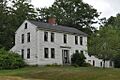
- The John and Maria Webb House in Bridgton is a historic home.
- The Watkins House and Cabins in Casco is another historic property.
Churches and Meetinghouses
Many old churches and meetinghouses are important because they show how communities gathered and practiced their faith.
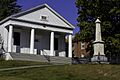
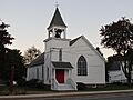
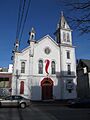
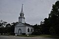
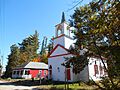
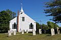
- The Central Parish Church in Yarmouth is a beautiful old church.
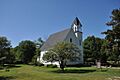
- The Cousins Island Chapel in Yarmouth is a small, historic chapel.
- The Dunstan Methodist Episcopal Church in Scarborough is an old church.
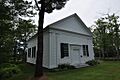
- The East Harpswell Free Will Baptist Church in Harpswell is a historic church.
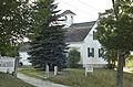
- The East Raymond Union Chapel in Raymond is another old chapel.
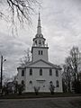
- The First Parish Church in Brunswick and the First Parish Congregational Church in Yarmouth are very old and important churches.
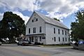
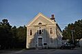
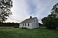
- The First Parish Meetinghouse in Standish was a place where the community gathered for both religious services and town meetings.
- The Friends Meetinghouse and the Friends School in Casco are historic Quaker buildings.
- The Harpswell Meetinghouse in Harpswell is a National Historic Landmark. It's one of the oldest meetinghouses in Maine.
- The Elijah Kellogg Church in Harpswell is another historic church.
- The North Yarmouth and Freeport Baptist Meetinghouse in Yarmouth is a historic place of worship.
- The Proprietors Meeting House and Parish House in South Buxton is a historic church complex.
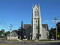
- The St. Paul's Episcopal Church in Brunswick is a beautiful historic church.
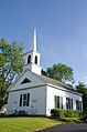
- The South Bridgton Congregational Church in Bridgton is a historic church.
- The Spurwink Congregational Church in Cape Elizabeth is a very old church.
- The Union Church in Naples and the Union Church in Harpswell are historic churches.
- The Universalist Meeting House in New Gloucester is another historic place of worship.
Historic Districts and Areas
Sometimes, a whole group of buildings or an area is considered historic because they tell a story together.
- The Auburn-Harpswell Association Historic District in Harpswell includes many historic buildings.
- The Brunswick Commercial Historic District in Brunswick shows what the town's main street looked like long ago.
- The Cumberland Mills Historic District in Westbrook was an important industrial area.
- The Federal Street Historic District and the Lincoln Street Historic District in Brunswick are neighborhoods with many historic homes.
- The Freeman Farm Historic District in Gray is a historic farm area.
- The Freeport Main Street Historic District in Freeport shows the historic center of the town.
- The Gorham Campus Historic District and the Gorham Historic District in Gorham include many historic buildings from the university and the town.
- The Great Falls Historic District in Windham is an area with historic buildings near a river.
- The Harraseeket Historic District in Freeport includes historic areas along the river.
- The New Gloucester Historic District in New Gloucester has many historic buildings in the town center.
- The Norton House Historic District in Falmouth is a historic neighborhood.
- The Paine Neighborhood Historic District in Standish is another historic area.
- The Pennellville Historic District in Brunswick is a historic area near the water.
- The Sabbathday Lake Shaker Village in New Gloucester is a National Historic Landmark and a very special place. It's the only active Shaker community in the world! Shakers are a religious group known for their simple lifestyle and beautiful craftsmanship.
- The South Street Historic District in Gorham is a historic street with many old homes.
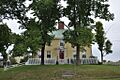
- The Standish Corner Historic District in Standish is the historic center of the town.
- The State Reform School Historic District in South Portland has historic buildings that were once part of a reform school.
Bridges, Lighthouses, and Other Structures
Not all historic places are buildings! Some are bridges, lighthouses, or other important structures.
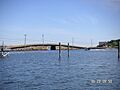
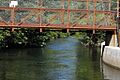
- The Androscoggin Swinging Bridge connects Topsham and Brunswick across the Androscoggin River. It's a unique bridge that swings!
- Babb's Bridge in Gorham is a historic covered bridge over the Presumpscot River. Covered bridges are very charming and old-fashioned.
- The Bailey Island Cobwork Bridge in Harpswell is a very special bridge. It's made of granite blocks fitted together without mortar, almost like a puzzle! It connects Bailey and Orrs islands.
- The Cumberland and Oxford Canal runs through Gorham, Standish, Westbrook, and Windham. Canals were important waterways for moving goods long ago.
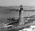
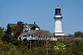
- Halfway Rock Light Station in Harpswell is a lighthouse out in Casco Bay. Lighthouses are important for guiding ships safely.
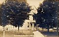
- The Little Mark Island Monument in Harpswell is a historic monument in Casco Bay.
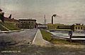
- The Portland Breakwater Light in South Portland and the Portland Headlight in Cape Elizabeth are famous lighthouses. Portland Headlight is one of the most photographed lighthouses in Maine!
- The Ram Island Ledge Light Station in Cape Elizabeth is another lighthouse in Portland Harbor.
- The Ryefield Bridge in Harrison is a historic bridge over the Crooked River.
- The Songo Lock in Naples is a historic lock that helps boats move between different water levels.
- The Spring Point Ledge Light Station in South Portland is another lighthouse in Portland Harbor.
- The Two Lights in Cape Elizabeth are a pair of historic lighthouses.
Other Interesting Historic Places
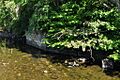
- Eagle Island in Harpswell is a National Historic Landmark. It was the summer home of Arctic explorer Robert Peary. Imagine living on your own island!
- The Great Chebeague Golf Club on Chebeague Island is a historic golf course.
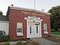
- The Grand Trunk Railroad Station in Yarmouth is an old train station. Railroads were super important for travel and trade.
- The Lakeside Grange No. 63 in Harrison is a historic grange hall, which was a meeting place for farmers.
- Mallett Hall in Pownal Center is the town hall.
- The Pownal Cattle Pound in Pownal is a historic enclosure where stray livestock were kept.
- The Portland Railroad Company Substation in Scarborough was part of the old electric railway system.
- The Richmond's Island Archeological Site in Cape Elizabeth is an important place for studying the past through artifacts found in the ground.
- The Old Scarborough High School in Scarborough is a historic school building.
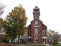
- The Stimson Memorial Hall in Gray is a historic community building.
- The Wales and Hamblen Store in Bridgton was a historic general store.
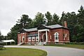
- The Walker Memorial Hall and Walker Memorial Library in Westbrook are historic community buildings.
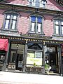
- The Warren Block in Westbrook is a historic commercial building.
These are just some of the many amazing historic places in Cumberland County, Maine. Each one has a unique story to tell about the past!
Images for kids
-

Academy Building, University of Southern Maine
-
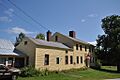
Lt. Robert Andrews House
-
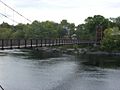
Androscoggin Swinging Bridge
-
Art Gallery, University of Southern Maine
-
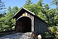
Babb's Bridge
-
Bailey Island Cobwork Bridge
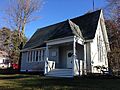
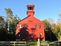
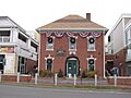
-
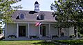
Bailey Island Library Hall
-
Baxter House
-
Capt. S.C. Blanchard House
-
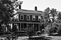
Henry Boody House
-
C.A. Brown Cottage
-

Brunswick Commercial Historic District
-
Burnell Tavern
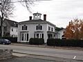
-
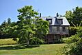
Camp Hammond
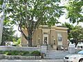
-
Caswell Public Library (Former)
-
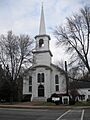
Central Parish Church
-
Parker Cleaveland House
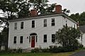
-
Benjamin Cleaves House
-
Cousins Island Chapel
-
Cumberland and Oxford Canal
-
Cumberland Mills Historic District
-
Dalton Holmes Davis Memorial Library
-
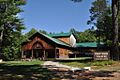
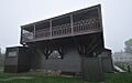
Deertrees Theatre
-
Dry Mills School
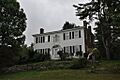
-
John Dunlap House
-
Deacon Andrew Dunning House
-
Dunstan Methodist Episcopal Church
-
Isaac W. Dyer Estate
-
Dyke Mountain Annex
-
Eagle Island
-
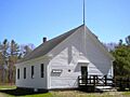
East Raymond Union Chapel
-
Federal Street Historic District
-
First Parish Church
-
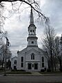
First Parish Congregational Church
-
First Parish Meetinghouse
-
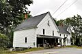
Fitch's General Store and House
-
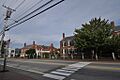
Freeport Main Street Historic District
-
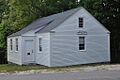
Friends Meetinghouse
-
Friends School
-
Gorham Campus Historic District
-
Gorham Historic District
-
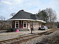
Grand Trunk Railroad Station
-
Great Falls Historic District
-
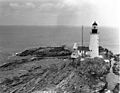
Halfway Rock Light Station
-
Harpswell Meetinghouse
-
Harraseeket Historic District
-
Nathan Harris House
-
Nathaniel Hawthorne Boyhood Home
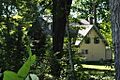
-
Winslow Homer Studio
-
Elijah Kellogg Church
-
Lakeside Grange #63
-
Lincoln Street Historic District
-
Stephen Longfellow House
-
Mallett Hall
-
E.B. Mallett Office Building
-
Richard Manning House
-
Manor House
-
Maplewood Farm
-
Daniel Marrett House
-
Massachusetts Hall, Bowdoin College
-
McLellan House
-
Merriconegan Farm
-
Mitchell House
-
New Gloucester Historic District
-
North Yarmouth Academy
-
North Yarmouth and Freeport Baptist Meetinghouse
-
Paine Neighborhood Historic District
-
Peabody-Fitch House
-
Pennell Institute
-
Pennellville Historic District
-
Sam Perley Farm
-
William F. Perry House
-
Pettengill House and Farm
-
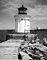
Portland Breakwater Light
-
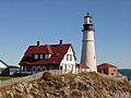
Portland Headlight
-
Portland Railroad Company Substation
-
Capt. Greenfield Pote House
-
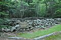
Pownal Cattle Pound
-
Cushing and Hannah Prince House
-
Proprietors Meeting House and Parish House
-
Ram Island Ledge Light Station
-
Jacob Randall House
-
Richardson House
-
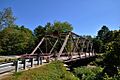
Ryefield Bridge
-
St. Hyacinth School and Convent
-
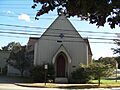
St. Paul's Episcopal Church
-
Scribner Homestead
-
Shaker Village
-

Parson Smith House
-
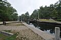
Songo Lock
-
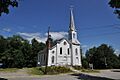
South Bridgton Congregational Church
-
South Street Historic District
-

Spring Point Ledge Light
-
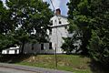
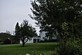
Spurwink Congregational Church
-
Standish Corner Historic District
-
Steep Falls Library
-
Stone House
-
Harriet Beecher Stowe House
-
Two Lights
-
Union Church (Naples)
-
Union Church (North Harpswell)
-
Vallee Family House
-
Valley Lodge
-
Wales and Hamblen Store
-

Walker Memorial Hall
-
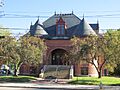
Walker Memorial Library
-
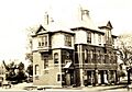
Warren Block
-
Watkins House and Cabins
-
John and Maria Webb House
-
Old Westbrook High School
-
Barrows-Scribner Mill


