
Otley facts for kids
Quick facts for kids Otley |
|
|---|---|
| Town | |
 Jubilee Clock Tower and Buttercross in the Market Place |
|

Otley
|
|
| Area | 4.59 sq mi (11.9 km2) |
| Population | 13,668 (2011 census) |
| • Density | 2,978/sq mi (1,150/km2) |
| OS grid reference | SE205455 |
| • London | 193 miles |
| Civil parish |
|
| Metropolitan borough | |
| Metropolitan county | |
| Region | |
| Country | England |
| Sovereign state | United Kingdom |
| Post town | OTLEY |
| Postcode district | LS21 |
| Dialling code | 01943 |
| Police | West Yorkshire |
| Fire | West Yorkshire |
| Ambulance | Yorkshire |
| EU Parliament | Yorkshire and the Humber |
| UK Parliament |
|
Otley is a lively market town in West Yorkshire, England. It sits right where the River Wharfe can be crossed easily. In 2011, about 13,668 people lived here.
The town is split into two main parts. South of the river is the older, historic town of Otley. To the north, you'll find Newall, which used to be a separate area. Otley is located in the lower part of Wharfedale, and the A660 road connects it to the city of Leeds.
Otley is part of the City of Leeds local government area. It's also in the Leeds North West area for the UK Parliament.
Contents
History of Otley
What's in a Name?
The name Otley comes from an old Saxon name, like Otto or Otta. The second part, leah, means a clearing in a woodland in Old English. So, Otley means "Otto's clearing." It was first written down as Ottanlege in 972. The nearby Chevin hill's name might come from an old Welsh word, Cefn, meaning "ridge."
Early Settlements
People have lived in the Wharfe valley around Otley for a very long time. Finds from the Bronze Age show settlements on both sides of the river. You can even see Bronze Age carvings on rocks on top of The Chevin, like the Knotties Stone.
The Chevin Forest Park has a long history of human activity. Ancient tools, rock carvings, and earthworks have been found there. In medieval times, this forest was used for grazing animals and getting wood and stone for buildings.
Saxon and Medieval Times
Most of Otley's early growth happened during Saxon times. The town was part of a large estate given to the Archbishops of York by King Athelstan. The Archbishops lived here and were the local rulers. Their palace was where the Manor House stands today.
After the Norman conquest in 1066, much of the area was damaged. The Saxon church was replaced by a Norman one, but it still has many Saxon carvings. In the 11th and 12th centuries, Otley was a small group of buildings around the manor house and the church. A stream called Calhead Beck (now underground) was important for water.
The town grew more in the 13th century. The Archbishops created special plots of land to attract merchants and traders. These plots formed the streets we see today, like Boroughgate and Kirkgate. Bondgate was for workers. A hospital for people with leprosy was built on the road to Harewood.
Besides farming, people in Otley quarried stone and made potash from bracken. Potash was used to make soap, which helped the fulling industry (cleaning woollen cloth). The Chevin provided stone, wood, and grazing land. The river offered reeds for thatching roofs.
The Industrial Revolution

The woollen industry changed a lot during the Industrial Revolution. Mills were built that used water power, then steam power. A cotton mill was built by the river in the late 1700s. Later, wool combing and spinning became important. By the mid-1800s, about 500 people worked in mills and other factories. A tannery (where leather is made) also opened.
New roads to Leeds and Bradford made trade much easier. Many houses were built, including the first terraced homes by the Otley Building Society in 1847. Otley railway station opened in 1865, connecting Otley to Leeds and Bradford. It was very busy, with 50 trains a day at its peak. However, it closed in 1965.

Otley became famous for making printing machines. The Wharfedale Printing Machine was invented here by William Dawson and David Payne. You can see an early example at Otley Museum. By 1900, over 2,000 people worked in seven machine shops, making printing machinery Otley's most important industry.
From the 20th Century Onwards
During the First World War, Otley had a special camp called Farnley Camp. It taught soldiers about explosives.
After the war, there was a big need for new homes. Otley Council started one of the first government-funded housing projects in 1920. These new homes were built in Newall, north of the river. The 1920s also saw homes getting sewer systems and electric streetlights.
More housing estates were built, and by 1955, Otley had over 1,000 council houses. Private housing also grew. However, many factories closed in the later 20th century, including the printing machine works in 1981.
How Otley is Governed
.jpg)
For a long time, the local ruler (lord of the manor) managed Otley. In 1864, the Otley Board was formed to run the town. Many public buildings were built after this. From 1894, Otley became an Urban District, which meant it had its own local government. It expanded to include Newall.
Since 1974, Otley has been a civil parish within the City of Leeds area. It has its own town council that looks after local matters. The town council and the Otley Museum used to be in the Otley Civic Centre until it closed in 2010.
Otley is part of the Leeds North West area for the UK Parliament. This means people in Otley vote for a Member of Parliament (MP) to represent them in the national government. Currently, Katie White is the MP.
Otley is also connected to the French town of Montereau-Fault-Yonne through a special friendship called "twinning."
Geography of Otley


Otley is about 28 miles (45 km) southwest of York and 10 miles (16 km) northwest of Leeds. It sits in the lower part of Wharfedale, a valley. The town has a seven-arched medieval bridge over the River Wharfe. Otley is surrounded by farmland. The older part of town is on the south side of the river. In the 20th century, Otley grew north of the river, with new areas like Newall.
The south side of the valley has a large hill called the Chevin. It's a gritstone escarpment (a long, steep slope). In 1944, a large area of the Chevin was given to the people of Otley. This area, now called Chevin Forest Park, has grown to 700 acres (283 hectares). The foundation stones for the Houses of Parliament in London came from a quarry on the Chevin.
East and west of Otley are flooded gravel pits. These are places where sand and gravel were dug out. The pits to the east are great for birdwatching. The ones to the west are used for angling (fishing) and sailing.
Nearby villages include Burley-in-Wharfedale and Menston to the west, and Pool-in-Wharfedale to the east. To the south are the towns of Guiseley and Yeadon.
Transport in Otley
In the past, roads around Otley were just tracks. This changed in the 18th century to help trade. By 1820, a regular post coach went to Leeds. New roads to Leeds and Bradford opened in the 1840s.
The first motor vehicles appeared in Otley around 1900. By 1930, bus companies were running services, and Otley bus station opened in 1939. Trolleybuses also ran here from 1915 to 1928.
Otley railway station opened in 1865 but closed in 1965. Part of the old railway line is now used for the town bypass. There are plans to turn the old trackbed into a cycleway, footpath, and horse riding route called the Wharfedale Greenway.
The main roads through Otley are the A660 to Leeds and the A65 to Ilkley and Skipton. The A6038 road goes to Guiseley and Bradford.
Otley bus station is managed by West Yorkshire Metro. Buses connect Otley to nearby towns and areas.
Notable Features of Otley
Otley Bridge and Riverside Parks

Otley Bridge is an old stone bridge with seven arches. It was first built in 1228 and rebuilt after a flood in 1673. In 1957, a special walkway was added for people to walk safely away from cars.
On the north side of the river, you'll find Wharfemeadows Park. This park has beautiful gardens and was given to the town in 1924. It used to have an outdoor swimming pool. On the south side, there's a smaller park called Tittybottle Park, which is popular with families. Further west is Manor Garth Park, which was once part of the manor house land.
About 1 kilometer (0.6 miles) east of the bridge is Gallows Hill. This was where medieval gallows (for executions) stood. The land nearby used to be a sewage works, but it was turned into the Gallows Hill nature reserve in the 1980s.
Market Place
Markets have been held in Otley since at least 1227. The current Market Place has been used since about 1800. Here you'll find the Buttercross, a covered area once used for farm produce. Today, it's a place for visitors to rest or for charity events.
The Jubilee Clock was put up in 1888. It has two plaques: one remembers local people who died in the Transvaal War, and the other thanks Belgian refugees who came to Otley during the First World War. Many buildings around the Market Place are very old and protected.
Education in Otley

Otley had a grammar school founded in 1607 by King James VI and I. It was called "The Grammar School of Prince Henry." The original building was rebuilt in 1840. It closed in 1878 and was later used as a courthouse. Today, it's a pub.
In 1918, the school was restarted, and in 1925, Prince Henry's Grammar School, Otley opened in its current location. Otley also has several primary schools for younger children.
Religion in Otley


Otley's first church was built around the early 600s, but it burned down. The Parish Church (All Saints) dates back to Saxon times. It has parts of two early Anglo-Saxon crosses. The current building is based on a Norman church from the 12th century. The church tower clock is from 1793.
In the churchyard, you can see the "Navvies' Monument." It's a copy of the entrance to Bramhope Tunnel and remembers those who died building it. Inside the church is the tomb of the grandparents of Thomas Fairfax, a famous general from the 1600s.
Other churches in Otley include the Bridge Church (originally Salem Chapel, built in 1826) and Our Lady and All Saints Roman Catholic Church, opened in 1851.
The Methodist preacher John Wesley often visited Otley in the 1700s. It's said his horse is buried in the churchyard, marked by a unique stone. Wesley Street is named after him.
Culture and Community
Otley has many cultural groups. It has five active Morris dance groups, who perform traditional English folk dances. There are also drama groups like the Otley Community Players and Otley Youth Theatre. The town has a poetry society and a Brass Band that performs at local events.
Otley hosts several annual events:
- The Otley Folk Festival in September.
- A Victorian Fayre in December.
- A carnival in June.
- The Otley Agricultural Show in May, which is one of the oldest one-day agricultural shows in the country. It celebrated its 200th anniversary in 2009.
- A beer festival in November.
Otley also has four Scout troops and an Army Cadet Force group.
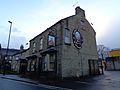
Hostelries (Pubs)
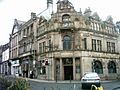
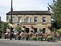
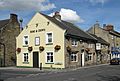
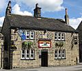
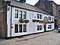
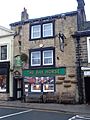
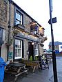
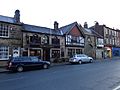
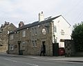
Otley has a long history of inns and pubs. In the past, places like the Black Horse Hotel were important stops for travelers. By 1900, there were over 30 inns. Otley is known for having many pubs, and some say it has the most per person in the UK!
Today, there are 20 pubs in the town. Some of the oldest buildings are still pubs, like the Red Lion (from 1745) and the Bowling Green (from 1757). Many of these old buildings are protected.
-
Black Horse Hotel
-
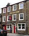
Red Lion
-
The Bowling Green
-
Rose and Crown
-
Old Cock
-
Black Bull
-
Bay Horse
-
The Junction Inn
-
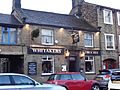
Whitakers
-
The White Swan
-
The Yeoman (formerly the Fountain)
-
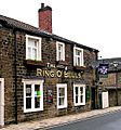
The Ring O'Bells (now the Otley Tavern)
-
The Cross Pipes


.JPG)
.JPG)
.JPG)
_001.JPG)
,_Gay_Lane,_Otley_(30th_December_2013)_001.JPG)


Otley in Films and TV
Otley is often used as a filming location. It's known as "Hotton" in the ITV show Emmerdale. Otley Courthouse was used as the old Police Station in ITV's Heartbeat. The show DCI Banks also filmed regularly in the town. Otley was also the setting for the drama series The Chase and The Bad Mother's Handbook.
Local Media
For local news and TV, Otley gets programmes from BBC Yorkshire and ITV Yorkshire.
Local radio stations include:
- BBC Radio Leeds (95.3 FM)
- Greatest Hits Radio Harrogate & The Yorkshire Dales (107.1 FM)
- Capital Yorkshire (105.6 FM)
- Heart Yorkshire (107.6 FM)
- Drystone Radio (102 FM)
- Rombalds Radio (online community station)
The local newspaper is the Wharfedale Observer.
Sports in Otley
Otley has many sports clubs:
- Otley Angling Club: Formed in 1897, this club manages fishing on the River Wharfe and a pond. They hold regular fishing matches.
- Otley Athletic Club: Meets at Otley Cricket Club.
- Otley Cricket Club: Founded in 1820, they play in the Airedale and Wharfedale Senior Cricket League. They have won the league title many times.
- Otley R.U.F.C. (Rugby): They play at Cross Green. This ground hosted a game in the 1991 Rugby World Cup. In 1979, the North of England team beat the All Blacks here!
- Otley Town Football Club: Has teams in various leagues and junior teams, including girls' teams.
- Otley Cycle Club: Founded in 1927. The famous cyclist Lizzie Deignan (formerly Armitstead) was born in Otley and is a patron of the club.
Otley has also been part of major cycling events:
- In 2014, the Tour de France Stage 1 passed through the town.
- In 2015, the final stage of the first Tour de Yorkshire came through Otley.
- In 2016, Otley was the starting point for the second stage of the Tour de Yorkshire.
Notable People from Otley

- Thomas Chippendale: A very famous cabinetmaker (someone who makes fine furniture). He was born in a cottage in Otley, and his statue stands near the old Grammar School he attended.
- J. M. W. Turner: A famous painter. He visited Otley many times and was inspired by the area. His painting Snow Storm: Hannibal and his Army Crossing the Alps is thought to be inspired by a storm over Otley's Chevin.
- Elizabeth Garnett: Born in Otley in 1839, she was a missionary and author who helped improve the lives of railway workers (navvies).
- Lizzie Deignan: A British champion cyclist.
- Nick Houghton: A high-ranking military officer who became the Chief of the Defence Staff.
- Julian Sands: A British actor.
- Mike Tindall: A former captain of the England rugby union team.
See also
 In Spanish: Otley para niños
