Squares of Savannah, Georgia facts for kids
The city of Savannah was planned in 1733 with a special design. It had four open squares at its heart. Each square was surrounded by blocks for homes and public buildings. This layout of a square and eight blocks was called a "ward."
The original plan, known as the Oglethorpe Plan, also included areas for gardens, farms, and small villages. After the first four wards were built, two more were added.
The first four squares were Johnson, Percival (now Wright Square), Decker (now Ellis Square), and St. James (now Telfair Square). More squares were added over time. By 1851, there were 24 squares.
Later, three squares were removed or changed a lot, leaving 21. But in 2010, Ellis Square was brought back, making a total of 22 squares today.
Most of Savannah's squares are named after important people or historical events. Many have statues, markers, or memorials. These monuments helped protect the squares from being torn down.
Today, this area is part of the Savannah Historic District. It is a special place that protects old buildings and the city's unique design.
Contents
- How Savannah's Squares Were Planned
- The First Four Squares (1733)
- Two More Early Squares
- Squares from the 1790s
- Squares from the 1800s
- Elbert Square: Mostly Gone
- Chippewa Square: Oglethorpe's Statue
- Orleans Square: German Heritage
- Lafayette Square: French Hero and Cathedral
- Pulaski Square: A Polish Hero
- Madison Square: President and Sergeant
- Crawford Square: The Smallest Square
- Chatham Square: Honoring a British Supporter
- Monterey Square: A Battle and a Book
- Troup Square: A Governor and a Dog Fountain
- Taylor Square: Honoring a Nurse and Educator
- Whitefield Square: The Last Square Built
- Forsyth Park: A Central Green Space
- Summary of Savannah's Squares
- See also
How Savannah's Squares Were Planned
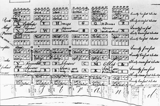
General James Oglethorpe founded Savannah in 1733. The squares were not just for beauty. They were also practical. Colonists used them for things like military training. The plan looked like military camps, which Oglethorpe knew well.
The design also helped prevent big fires. It was a response to the Great Fire of London in 1666, which spread quickly in crowded areas. Each square was the center of a new city ward.
The first four squares were Johnson, Percival (now Wright), Decker (now Ellis), and St. James (now Telfair). They formed a large square overlooking the Savannah River. The original plan actually called for six squares. As the city grew, more squares were added, eventually reaching 33.
However, some spots were used for Colonial Park Cemetery or never developed. When the city expanded south of Gaston Street, the square grid stopped. Forsyth Park became the main park for that area instead.
Most squares are about 200 feet (61 meters) wide from east to west. Their north-south length varies from 100 to 300 feet (30 to 91 meters). Wide, two-way streets usually cross through each square. Smaller one-way streets run along the north and south sides. This means traffic flows counterclockwise around the squares, like traffic circles.
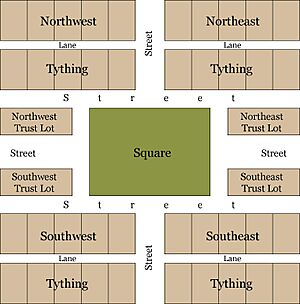
Each square is at the center of a ward, often sharing its name. The lots next to the squares were called "trust lots." These were for important public buildings like churches or schools. The rest of the ward was divided into four areas called tithings. Each tithing had ten residential lots for homes.
This plan is clear in old maps and even in modern aerial photos. Over time, some trust lots became homes, and some residential lots became businesses.
All the squares are part of the Savannah Historic District. This area is less than half a square mile. The five squares along Bull Street—Monterey, Madison, Chippewa, Wright, and Johnson—are very grand. They are sometimes called Savannah's "Crown Jewels." Other squares are simpler, like parks, but many also serve as memorials.
Experts have praised Savannah's city plan. Architect John Massengale called it "the most intelligent grid in America." The American Society of Civil Engineers recognized it as a National Historic Civil Engineering Landmark. In 1994, it was even considered for the UNESCO World Heritage List. The squares attract millions of tourists each year. They have also helped improve neighborhoods and bring life back to downtown Savannah.
The First Four Squares (1733)
James Oglethorpe designed the first four squares in 1733. This was the same year he founded the Georgia colony and the city of Savannah.
Johnson Square: Savannah's First Square
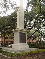
Johnson Square was the very first square in Savannah. It is still the largest of the 22 squares. It was named after Robert Johnson, who was a governor of South Carolina and a friend of General Oglethorpe.
Under the Nathanael Greene Monument in the square lies Revolutionary War hero General Nathanael Greene. Another square, Greene Square, is named after him.
Johnson Square has two fountains and a sundial. The sundial honors Colonel William Bull, who gave his name to Savannah's Bull Street.
The Johnson Square Business Center is another important building here. It was once called the Savannah Bank Building. Built in 1911, it was the city's first "skyscraper." Johnson Square is known as the financial area. Many banks and financial companies are located here.
Christ Church, often called "the Mother Church of Georgia," is also in Johnson Square. It was founded in 1733. Famous early leaders of the church included John Wesley and George Whitefield.
Wright Square: Honoring Leaders
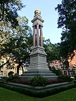
The second square was first called Perceval Square. It was named for John Perceval, 1st Earl of Egmont. He is believed to have named the Georgia colony after King George II. In 1763, it was renamed Wright Square to honor James Wright. He was the third and last royal governor of Georgia. It has also been known as Court House Square and Post Office Square. The Tomochichi Federal Building and U.S. Courthouse is next to it today.
This square is the burial place of Tomochichi. He was a leader of the Creek Native American nation. Tomochichi was a trusted friend of James Oglethorpe. He helped Oglethorpe when the colony was founded.
Ellis Square: A Place of Change
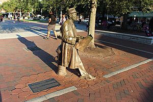
This square was originally called Decker Square. It was laid out in 1733. It was named after Sir Matthew Decker, an important person who helped fund the Georgia colony. Later, it was renamed for Sir Henry Ellis, the second Royal Governor of Georgia.
It was also known as Marketplace Square. From the 1730s to the 1950s, it was a busy center for trade. Four market houses stood here over the years. Sadly, it was also a place where people were bought and sold, which was a difficult part of history.
In 1954, the city allowed a parking garage to be built here. This meant the old market house was torn down. Many people were upset by this. Their anger helped start the historic preservation movement in Savannah. Groups like the Historic Savannah Foundation began working to save old buildings.
When the garage's lease ended in 2004, the city decided to bring Ellis Square back. It officially reopened on March 11, 2010. A bronze statue of Johnny Mercer was placed in the square. He was a famous songwriter from Savannah.
Telfair Square: Honoring a Family
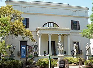
St. James Square was named after a green space in London, England. It was once a very fashionable neighborhood in early Savannah. In 1883, it was renamed Telfair Square. It is the only square named after an entire family. The Telfair family included Edward Telfair, a former Governor, and Mary Telfair, who helped create the Telfair Museum of Art.
The Telfair Academy building overlooks the western side of the square. The square also has tributes to the Girl Scouts of the USA, founded by Savannahian Juliette Gordon Low. Telfair Square is located on Barnard Street, between State and York Streets.
Two More Early Squares
Oglethorpe's original plan included six wards and squares. Lower New Square and Upper New Square completed his vision. These are now known as Reynolds and Oglethorpe Squares.
Reynolds Square: John Wesley's Mission
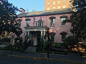
This square was first called Lower New Square and was laid out in 1734. It was later renamed for Captain John Reynolds, who was governor of Georgia in the mid-1750s.
In the square, there is a bronze statue of John Wesley. He was the founder of Methodism. Wesley lived in England for most of his life. But he came to Savannah from 1735 to 1738. During this time, he started the first Sunday school in America. The statue was put up in 1969 where his home is thought to have been. It shows Wesley preaching outdoors, as he did for Native Americans. This practice upset some church leaders who believed preaching should only happen inside a church.
Reynolds Square was also the site of the Filature. This building housed silkworms. It was part of an early, but unsuccessful, effort to start a silk industry in Georgia. The square is on Abercorn Street, between Bryan and Congress Streets.
The Olde Pink House (also known as Habersham House) is a famous building in the square.
Oglethorpe Square: Honoring the Founder
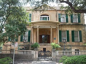
Upper New Square was created in 1742. It was later renamed to honor General James Oglethorpe, who founded Georgia. However, his statue is actually in Chippewa Square, not here.
The home of Georgia's first Royal Governor, John Reynolds, was once located here.
The Owens–Thomas House, a historic home, stands on the eastern side of the square today. The Presidents' Quarters Inn, a bed and breakfast, is also nearby.
The square has a pedestal honoring Moravian missionaries. They came to Savannah from 1735 to 1740, at the same time as John Wesley. They later moved to Pennsylvania.
Squares from the 1790s
Savannah grew quickly in the late 1700s. Six new wards were added in the 1790s. These expanded the city's grid. Because of less space, these new wards are a bit narrower than the first ones.
Washington Square: Honoring a President
Built in 1790, Washington Square was named in 1791 for George Washington. He was the first President of the United States and visited Savannah that year. It was one of only two squares named after a living person at the time.
Washington Square was once the site of the Trustees' Garden.
The square used to host huge New Year's Eve bonfires, but these stopped in the 1950s.
Franklin Square: A Restored Space
Franklin Square was designed in 1790. It is on the western side of town. It was named in 1791 for Benjamin Franklin. He helped the Georgia colony from 1768 to 1778 and passed away in 1790.
The square was removed in 1935 but was brought back in the mid-1980s. It includes a sculpture honoring Haitian soldiers.
Warren Square: A Revolutionary Hero
Warren Square was laid out in 1791. It was named for General Joseph Warren. He was a Revolutionary War hero who died at the Battle of Bunker Hill. Savannahians had sent British gunpowder to help the Americans at Bunker Hill. Savannah and Boston have a "sister city" relationship. Bostonians even sent supplies to Savannah after the Civil War. Warren Square is on Habersham Street, between Bryan and Congress Streets.
Columbia Square: A Symbol of America

Columbia Square was created in 1799. It is named for Columbia, a poetic symbol of the United States. It is on Habersham Street, between State and York Streets. In the middle of the square is a fountain. This fountain used to be at Wormsloe, the estate of Noble Jones, one of Georgia's first settlers. It was moved here in 1970 to honor his descendants. The fountain is sometimes called the "rustic fountain" because it has decorations of vines, leaves, and flowers.
Greene Square: Another Hero's Name

Greene Square was laid out in 1799. It is named for Revolutionary War hero General Nathanael Greene. He was one of George Washington's most effective generals.
Liberty Square: A Small Reminder
Liberty Square was created in 1799. It was named to honor the Sons of Liberty and the American victory in the Revolutionary War. It was located on Montgomery Street between State and York Streets. This square was paved over to improve Montgomery Street. A small part of it remains today. It is the site of the "Flame of Freedom" sculpture.
Squares from the 1800s
Savannah continued to grow in the first half of the 1800s. This led to a total of 24 squares in downtown Savannah.
Elbert Square: Mostly Gone
Elbert Square was laid out in 1801. It was named for Samuel Elbert, a Revolutionary soldier and Governor of Georgia. It was located on Montgomery Street between Hull and Perry streets. Like Liberty Square, it was paved over for street improvements. Today, only a small grassy area remains.
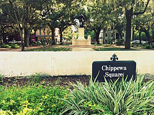
Chippewa Square: Oglethorpe's Statue
Chippewa Square was created in 1815. It honors American soldiers who died in the Battle of Chippawa during the War of 1812.
In the center of the square is the James Oglethorpe Monument. This statue was made by sculptor Daniel Chester French and unveiled in 1910. Oglethorpe faces south, towards where Spanish Florida used to be, with his sword drawn. Because of this statue, some people mistakenly call this "Oglethorpe Square."
A famous scene from the 1994 movie Forrest Gump was filmed on a park bench here.
Chippewa Square is also home to First Baptist Church (1833), the Philbrick-Eastman House (1844), and The Savannah Theatre (1818).
Orleans Square: German Heritage
Orleans Square was laid out in 1815. It celebrates General Andrew Jackson's victory at the Battle of New Orleans. In the middle of the square, the German Memorial Fountain honors early German immigrants to Savannah. It was installed in 1989. Orleans Square is on Barnard Street, between Hull and Perry Streets. It is next to the Savannah Civic Center.
Lafayette Square: French Hero and Cathedral
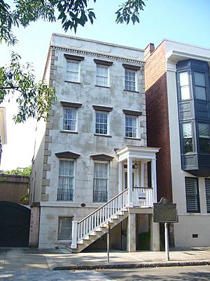
The square has a fountain that celebrates 250 years since Georgia was founded. It also has cobblestone sidewalks.
Next to the square is the beautiful Roman Catholic Cathedral Basilica of St. John the Baptist. Because of this, Lafayette Square is a big part of Savannah's Saint Patrick's Day celebrations. The water in the fountain is even dyed green for the holiday!
The Flannery O'Connor Childhood Home museum is in this area.
The square is named for Gilbert du Motier, Marquis de Lafayette. He was a French hero of the American Revolution who visited Savannah in 1825.
Pulaski Square: A Polish Hero
Pulaski Square was laid out in 1837. It is named for General Casimir Pulaski. He was a Polish-born Revolutionary War hero. He died from wounds received during the siege of Savannah in 1779. It is one of the few squares without a monument. General Pulaski's statue is actually in nearby Monterey Square.
Pulaski Square is known for its beautiful live oaks. It is located on Barnard Street, between Harris and Charlton Streets.
Madison Square: President and Sergeant

Madison Square was created in 1837. It was named for James Madison, the fourth President of the United States.
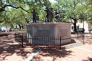
In the center of the square is the William Jasper Monument. This 1888 work honors Sergeant William Jasper. He was a soldier in the siege of Savannah. Even though he was badly wounded, he bravely saved his company's flag. Some Savannahians call this "Jasper Square" because of his statue.
Madison Square also has an old cannon from the Savannah Armory. These cannons mark the start of Georgia's first highways.
Crawford Square: The Smallest Square
Crawford Square was laid out in 1841. It was named for Secretary of the Treasury William Harris Crawford. He ran for president in 1824.
Even though Crawford is the smallest square, it is part of the largest ward. This ward includes the area of Colonial Park Cemetery.
During the time of Jim Crow laws, this was the only square where African-Americans were allowed to gather.
All squares once had fences, but this is the only one that still does. Crawford Square also has its original cistern. This was a water storage tank used for fighting fires long ago.
Chatham Square: Honoring a British Supporter
Chatham Square was laid out in 1847 and named in 1851 for William Pitt, 1st Earl of Chatham. He never visited Savannah, but he was an early supporter of the Georgia colony. Both Chatham Square and Chatham County are named after him.
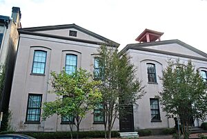
The square is sometimes called "Barnard Square" by locals. This is because of the Barnard Street School, which is now part of the Savannah College of Art and Design.
Monterey Square: A Battle and a Book
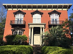
Monterey Square was created in 1847. It remembers the Battle of Monterrey (1846). In this battle, American forces captured the city of Monterrey during the Mexican–American War.
In the center of the square is an 1853 monument honoring General Casimir Pulaski.
Monterey Square is where Mercer House is located. This house was featured in John Berendt's 1994 book Midnight in the Garden of Good and Evil. The square and the house were also in the 1997 movie version of the book.
The square is also home to Congregation Mickve Israel. This synagogue, built in 1878, is one of the few Gothic-style synagogues in America.
Almost all the buildings around the square are original, except for the United Way Building.
Troup Square: A Governor and a Dog Fountain
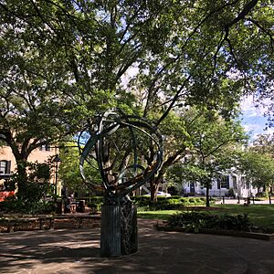
Troup Square was laid out in 1851. It is named for former Georgia Governor, Congressman, and Senator George Troup. It was one of only two squares named for a living person at the time. A large iron armillary sphere (a model of celestial objects) stands in the center. It is supported by six small metal turtles.
A special dog fountain is on the west side of the square. The Myers Drinking Fountain was a gift from Mayor Herman Myers in 1897. It was first in Forsyth Park. When it moved to Troup Square, its height was changed for dogs to use. It is now the site of an annual Blessing of the Animals.
The Unitarian Universalist Church is on the western side of the square. It is believed that James Lord Pierpont wrote the tune to "Jingle Bells" while he was the church's music director.
Taylor Square: Honoring a Nurse and Educator
Taylor Square was laid out in 1851. It was originally named for John C. Calhoun, a statesman and vice president. In 2023, it was renamed Taylor Square. This honors Susie King Taylor, who was the first black nurse during the American Civil War, an educator, and a writer.
The square is sometimes called Massie Square because of a nearby school.
The Wesley Monumental United Methodist Church, founded in 1868, is also here.
This is the only square that still has all of its original buildings.
It is believed that the square was built over a burial ground for enslaved people. About one thousand bodies might be buried there. In 2004, a skull was found by workers near the Massie Heritage Interpretation Center.
Whitefield Square: The Last Square Built
Whitefield Square was laid out in 1851. It was the final square built in the original grid.
It is named for the Rev. George Whitefield. He founded Bethesda Home for Boys, a program for children, in the 1700s. This home still exists today.
The square has a pretty gazebo in its center.
Andrew Bryan, who founded the First African Baptist Church, is buried in the square. Henry Cunningham, a minister of the Second African Baptist Church, is also buried here.
Forsyth Park: A Central Green Space
After 1851, Savannah continued to grow south of Gaston Street. However, the city stopped extending Oglethorpe's grid of squares. Instead, Forsyth Park was created. It is located just south of Monterey Ward. This large park was meant to serve the growing southern part of the city, much like the squares served their individual wards.
The original northern part of the park, with its famous fountain, was as big as an entire ward from the old city. The park later more than doubled in size. Other smaller parks have also been created in the southern areas of the city.
Summary of Savannah's Squares
| # | Name | Name Origin | Year Established | Intersection | Monuments | Landmarks | Status |
|---|---|---|---|---|---|---|---|
| 1. | Franklin | Benjamin Franklin | 1790 | Montgomery Street and West St. Julian Street |
Chasseurs volontaires de Saint-Domingue | First African Baptist Church | Restored after being nearly lost |
| 2. | Ellis | Henry Ellis, Governor of Georgia |
1733 | Barnard Street and West St. Julian Street |
Johnny Mercer, songwriter |
City Market | Lost in the 1950s; fully restored in 2010 |
| 3. | Johnson | Robert Johnson, Governor of South Carolina |
1733 | Bull Street and St. Julian Street |
Nathanael Greene, Major General |
Christ Church (Episcopal) | Preserved |
| 4. | Reynolds | John Reynolds, Governor of Georgia |
1734 | Abercorn Street and East St. Julian Street |
John Wesley, Methodist leader |
The Olde Pink House Lucas Theater |
Preserved |
| 5. | Warren | Dr. Joseph Warren, Major General |
1791 | Habersham Street and East St. Julian Street |
John David Mongin House Spencer House |
Preserved | |
| 6. | Washington | George Washington, U.S. President |
1790 | Houston Street and East Saint Julian Street |
Seaman's House | Preserved | |
| 7. | Liberty | Sons of Liberty | 1799 | 133 Montgomery Street | Flame of Freedom | County Courthouse | Mostly lost |
| 8. | Telfair | Edward Telfair, Governor of Georgia |
1733 | Barnard Street and West President Street |
Telfair Academy of Arts & Sciences Trinity Methodist Church |
Preserved | |
| 9. | Wright | James Wright, Governor of Georgia |
1733 | Bull Street and President Street |
William Washington Gordon, Founder of the Central of Georgia Railway Tomochichi, Creek Indian leader |
Lutheran Church of the Ascension Tomochichi Federal Building and U.S. Courthouse Old County Courthouse |
Preserved |
| 10. | Oglethorpe | James Oglethorpe, Founder of Savannah |
1742 | Abercorn Street and East President Street |
Owens-Thomas House, The Presidents' Quarters Inn, Moravian Monument |
Preserved | |
| 11. | Columbia | Columbia, American symbol |
1799 | Habersham Street and East President Street |
Wormsloe Fountain | Isaiah Davenport House Kehoe House |
Preserved |
| 12. | Greene | Nathanael Greene, Major General |
1799 | Houston Street and East President Street |
Second African Baptist Church | Preserved | |
| 13. | Elbert | Samuel Elbert, Governor of Georgia |
1801 | 237 Montgomery Street | Savannah Civic Center | Mostly lost | |
| 14. | Orleans | Battle of New Orleans | 1815 | Barnard Street and West McDonough Street |
German Societies Fountain | Harper Fowlkes House Savannah Civic Center |
Preserved |
| 15. | Chippewa | Battle of Chippawa | 1815 | Bull Street and McDonough Street |
James Oglethorpe, Founder of Savannah |
James Oglethorpe Monument First Baptist Church The Savannah Theatre |
Preserved |
| 16. | Crawford | William H. Crawford, U.S. Senator |
1841 | Houston Street and East McDonough Street |
Gazebo | Preserved | |
| 17. | Pulaski | Casimir Pulaski, Brigadier General |
1837 | Barnard Street and West Macon Street |
Francis Bartow House | Preserved | |
| 18. | Madison | James Madison, U.S. President |
1837 | Bull Street and Macon Street |
William Jasper, Sergeant |
Green-Meldrim House St. John's Episcopal Church Scottish Rite Temple Old Savannah Volunteer Guards Armory Sorrel Weed House |
Preserved |
| 19. | Lafayette | Marquis de La Fayette, Lieutenant General |
1837 | Abercorn Street and East Macon Street |
Semiquincentenary Fountain | Cathedral of Saint John the Baptist Hamilton-Turner Inn Andrew Low House |
Preserved |
| 20. | Troup | George Troup, Governor of Georgia |
1851 | Habersham Street and East Macon Street |
Armillary sphere | McDonough Row Houses Kennedy Row Unitarian Universalist Church |
Preserved |
| 21. | Chatham | William Pitt, 1st Earl of Chatham, U.K. Prime Minister |
1847 | Barnard Street and West Wayne Street |
Gordon Row | Preserved | |
| 22. | Monterey | Battle of Monterrey | 1847 | Bull Street and Wayne Street |
Kazimierz Pułaski, Brigadier General |
Congregation Mickve Israel Mercer House |
Preserved |
| 23. | Taylor | John C. Calhoun, U.S. Senator and U.S. vice-president (originally); renamed for Susie King Taylor in 2024 |
1851 | Abercorn Street and East Wayne Street |
Wesley Monumental Methodist Church Massie School |
Preserved | |
| 24. | Whitefield | George Whitefield, Great Awakening leader |
1851 | Habersham Street and East Wayne Street |
Gazebo | First Congregational Church | Preserved |
See also
- Sanborn Fire Insurance Maps of Savannah
 | Dorothy Vaughan |
 | Charles Henry Turner |
 | Hildrus Poindexter |
 | Henry Cecil McBay |


