Trinity County, California facts for kids
Quick facts for kids
Trinity County, California
|
||
|---|---|---|
| County of Trinity | ||
|
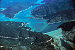
Images, from top down, left to right: Weaverville Historic District, Hayfork Creek, Trinity Lake, Weaverville Joss House State Historic Park
|
||
|
||
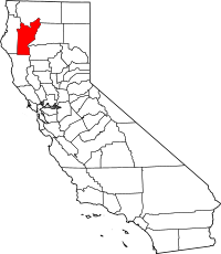
Location in the state of California
|
||
| Country | United States | |
| State | California | |
| Region | North Coast | |
| Incorporated | February 18, 1850 | |
| Named for | Trinity River | |
| County seat | Weaverville | |
| Largest community | Weaverville | |
| Government | ||
| • Type | Council–CAO | |
| Area | ||
| • Total | 3,208 sq mi (8,310 km2) | |
| • Land | 3,179 sq mi (8,230 km2) | |
| • Water | 28 sq mi (70 km2) | |
| Highest elevation | 9,037 ft (2,754 m) | |
| Population | ||
| • Total | 16,112 | |
| • Density | 5.0224/sq mi (1.9392/km2) | |
| GDP | ||
| • Total | $0.466 billion (2022) | |
| Time zone | UTC−8 (Pacific Time Zone) | |
| • Summer (DST) | UTC−7 (Pacific Daylight Time) | |
| Area code | 530 | |
| FIPS code | 06-105 | |
| GNIS feature ID | 277317 | |
| Congressional district | 2nd | |
Trinity County is a county in northwestern California. It is a wild and mountainous area. The county is covered in thick forests. It is named after the Trinity River. This river flows through the Salmon Mountains, Klamath Mountains, and other mountain ranges.
Trinity County is special because it has no official cities. Only two other counties in California are like this: Alpine and Mariposa. In 2020, about 16,112 people lived here. This makes it one of the least populated counties in California. The main town and county seat is Weaverville.
Contents
History of Trinity County
Trinity County has a long history. Native American groups like the Tsnungwe, Chimariko, and Wintu lived here first.
The county got its name from the Trinity River. In 1845, a man named Major Pierson B. Reading thought the river flowed into Trinidad Bay. He was mistaken, but the name "Trinity" (which means "Trinidad" in English) stuck.
Trinity County was one of California's first counties. It was created in 1850 when California became a state. Later, some parts of the county were given to Klamath County in 1852 and Humboldt County in 1853.
Solving the Mendocino County Border Mystery
In the 1850s, the California government said the border between Mendocino and Trinity Counties was the 40th parallel north. This is an imaginary line around the Earth. Both counties hired a surveyor named W.H. Fauntleroy to mark this line. He finished the job in 1872.
However, people doubted if his line was correct. In 1891, Mendocino County asked for a new survey. This new survey found the line was two miles north of Fauntleroy's line. This meant Trinity County had been controlling land that was actually in Mendocino County.
For years, both counties claimed this two-mile strip of land. They both tried to collect taxes from people living there. In 1907, Trinity County sued Mendocino County to settle the argument. A court ruled in favor of Trinity County. This was even though the land was south of the 40th parallel. The court said Fauntleroy's marked line was the official border. The state government later agreed with this decision. Today, the border follows Fauntleroy's original survey.
Geography and Nature
Trinity County covers about 3,208 square miles. Most of this is land, with only a small part being water. A big part of the county is covered by the Shasta-Trinity National Forest. It also includes the Trinity Alps Wilderness, which is the second largest wilderness area in California.
The county is very rugged and forested. Its highest point is Mount Eddy, which is over 9,000 feet tall. The Klamath Mountains cover most of the county.
Exploring Trinity County's Areas
Trinity County is divided into five main areas, called census tracts:
- Census Tract 1.01: This area includes towns like Douglas City, Lewiston, and Trinity Center. It has important features like Trinity Dam and Lake, Lewiston Dam and Lake, and the Trinity River. It is about 550 square miles and has a population density of 4.7 people per square mile.
- Census Tract 1.02: This tract includes most of Weaverville. It is the most populated area in the county, with 4,558 people. It covers 449 square miles. Here you can find the Weaver Basin, the Trinity Alps, and the upper Trinity River.
- Census Tract 2: This is the "Downriver" area. It includes communities like Junction City, Big Flat, and Burnt Ranch. The Trinity River and the Trinity Alps are major features here. About 2,024 people live in this area.
- Census Tract 3: This area has the towns of Hayfork, Hyampom, and Wildwood. It has 3,105 people in 600 square miles. Important features include the South Fork of the Trinity River and the Hayfork Valley.
- Census Tract 4: This is the largest area by size but has the fewest people, with 975 residents. The main town is Mad River. This area includes South Fork Mountain and the Mad River.
Weather and Seasons
Trinity County is a popular place for visitors, especially in summer. People come for camping, hiking, boating, rafting, hunting, and fishing.
Summers are usually sunny, warm, and very dry. There is little rain from June to September. Sometimes, there are thunderstorms in the highest mountains. Daytime temperatures in summer can be 85 to 100 degrees Fahrenheit. Nights are cooler, from 45 to 62 degrees.
Winters are cold and wet. It rains a lot in the valleys and snows a lot in the mountains. December, January, and February are the wettest months. Snowfall can range from almost none in lower areas to over 100 inches in places above 4,000 feet. Kalmia Lake, high in the Trinity Alps, is known for getting a huge amount of snow each winter.
Climate in Trinity County
Trinity County has a mediterranean climate. This means it has very warm, dry, and sunny summers. The nights are cool, so the temperature changes a lot between day and night. This is different from the mild coastal weather nearby in Humboldt County. Winters are chilly and wet.
The weather can vary a lot depending on how high up you are. For example, the county seat, Weaverville, has typical weather for the area.
Getting Around Trinity County
Main Roads
 State Route 299
 State Route 3
 State Route 36
Public Buses
Trinity Transit offers bus service on weekdays. Buses run on State Routes 3 and 299. You can connect to other services in Willow Creek and at the Redding Amtrak train station. There are also buses from Weaverville to Lewiston (Monday, Wednesday, Friday) and Hayfork (daily).
Airports
Trinity County has five small airports for general aviation. These are Trinity Center Airport, Weaverville Airport, Hayfork Airport, Hyampom Airport, and Ruth Airport. The closest large airport is Sacramento International Airport.
People of Trinity County
Population in 2020
In 2020, the population of Trinity County was 16,112 people. The table below shows the different racial and ethnic groups living in the county.
| Race / Ethnicity (NH = Non-Hispanic) | Pop 2000 | Pop 2010 | Pop 2020 | % 2000 | % 2010 | % 2020 |
|---|---|---|---|---|---|---|
| White alone (NH) | 11,271 | 11,518 | 11,374 | 86.55% | 83.55% | 70.59% |
| Black or African American alone (NH) | 54 | 45 | 66 | 0.41% | 0.33% | 0.41% |
| Native American or Alaska Native alone (NH) | 583 | 558 | 416 | 4.48% | 4.05% | 2.58% |
| Asian alone (NH) | 58 | 93 | 2,212 | 0.45% | 0.67% | 13.73% |
| Pacific Islander alone (NH) | 15 | 16 | 24 | 0.12% | 0.12% | 0.15% |
| Other Race alone (NH) | 13 | 20 | 106 | 0.10% | 0.15% | 0.66% |
| Mixed race or Multiracial (NH) | 511 | 577 | 977 | 3.92% | 4.19% | 6.06% |
| Hispanic or Latino (any race) | 517 | 959 | 937 | 3.97% | 6.96% | 5.82% |
| Total | 13,022 | 13,786 | 16,112 | 100.00% | 100.00% | 100.00% |
Population Changes Over Time
The population of Trinity County has changed over many years. Here's how it has grown or shrunk since 1850:
| Historical population | |||
|---|---|---|---|
| Census | Pop. | %± | |
| 1850 | 1,635 | — | |
| 1860 | 5,125 | 213.5% | |
| 1870 | 3,213 | −37.3% | |
| 1880 | 4,999 | 55.6% | |
| 1890 | 3,719 | −25.6% | |
| 1900 | 4,383 | 17.9% | |
| 1910 | 3,301 | −24.7% | |
| 1920 | 2,551 | −22.7% | |
| 1930 | 2,809 | 10.1% | |
| 1940 | 3,970 | 41.3% | |
| 1950 | 5,087 | 28.1% | |
| 1960 | 9,706 | 90.8% | |
| 1970 | 7,615 | −21.5% | |
| 1980 | 11,858 | 55.7% | |
| 1990 | 13,063 | 10.2% | |
| 2000 | 13,022 | −0.3% | |
| 2010 | 13,786 | 5.9% | |
| 2020 | 16,112 | 16.9% | |
| 2023 (est.) | 15,670 | 13.7% | |
| U.S. Decennial Census 1790-1960 1900-1990 1990-2000 2010-2020 |
|||
In 2000, there were 13,022 people living in the county. The population density was about 4 people per square mile. Most people were White (88.9%). About 4.9% were Native American and 4.0% were Hispanic or Latino.
The average age in the county was 45 years old. About 22.8% of the population was under 18. The median income for a household was $27,711. This means half of the households earned more, and half earned less. About 18.7% of the population lived below the poverty line.
Communities in Trinity County
Trinity County has several small towns and communities. Since there are no official cities, these are called "census-designated places" (CDPs).
Census-Designated Places (CDPs)
- Burnt Ranch: This is a small community on Highway 299. It's known for the Burnt Ranch Gorge on the Trinity River, which is great for whitewater rafting. The area is very steep and forested. It has a volunteer fire department and an elementary school. The name comes from a settler's ranch that was burned by Native Americans.
- Coffee Creek: This small town is a resort area on Highway 3, north of Trinity Lake. It's a starting point for trails into the Trinity Alps Wilderness. Many guest ranches and resorts are nearby. It has a store, a pizza place, and a campground.
- Douglas City: This is a medium-sized community near Highway 299 and the Trinity River. It has a store, a fire department, and an elementary school. There are also resorts along the river.
- Hayfork: This is the second-largest community in the county. It's in the Hayfork Valley, which is the biggest farming area in the county. Ranching is a big part of its economy. It used to be a logging town and a gold rush town. Hayfork has schools, grocery stores, and a gas station.
- Hyampom: This is the only CDP along the South Fork Trinity River. It's in the Hyampom Valley, another large farming area. Vineyards are an important part of its economy. The South Fork River is important for salmon and steelhead fish.
- Junction City: This is the largest community in the "Downriver" area. It's located where Canyon Creek meets the Trinity River. The Canyon Creek Trailhead, a popular entry point to the Trinity Alps, is nearby. It has an elementary school, a store, a cafe, and a fire department.
- Kettenpom: This is a fairly large community about 10 miles southwest of Ruth. It has a mix of dense forests and open areas.
- Lewiston: This is the third-largest community. It became bigger when the Trinity River Project built Trinity and Lewiston Dams. Today, it's a center for recreation on the Trinity River, including fishing, swimming, and rafting.
- Mad River: This community is not in the Trinity River area. It's on the Mad River where Highway 36 crosses it. The area has rolling hills and forests. It has a church, a fire department, and both an elementary and high school.
- Post Mountain: This community is on the north side of Highway 36. It's also known as Trinity Pines. It was officially recognized as a CDP in 2020.
- Ruth: This is another small community outside the Trinity River basin. It's in the Ruth Valley, south of Ruth Lake. Tourism around Ruth Lake is important to its economy. It has a church, a cafe, and many resorts.
- Salyer: This community is on the western edge of Trinity County. It's located where the Trinity River meets the South Fork. It was defined as a CDP in 2020.
- Trinity Center: This is the largest community on Trinity Lake. Tourism from the lake supports its economy. The original town was flooded by Trinity Lake in the 1950s and moved to its current spot. It has the busiest airport in the county.
- Trinity Village: Also known as Hawkins Bar, this community is in the Downriver area. Its economy is based on recreation on the Trinity River.
- Weaverville: This is the county seat and the largest community by far. It's located along Weaver Creek. It started as a Gold Rush town, and many historic buildings still stand. It has the oldest county courthouse. There was once a large Chinese community here. Today, a state park has the oldest Taoist temple in California, called the Joss House.
Other Small Communities
Former Towns
Some towns in Trinity County no longer exist. Here are a few:
| City | Year
incorporated |
Year
dissolved |
Fate |
|---|---|---|---|
| Helena, California | 1851 | 1950s | Became private property |
| Canon City, California | 1851 | 1891 | Only a historical marker remains |
| Dedrick, California | 1890 | 1941 | Only a historical marker remains |
| Deadwood, Trinity County, California | 1881 | 1915 | Nothing remains of the former town |
Schools in Trinity County
Trinity County has several school districts for students from kindergarten through 12th grade.
Unified School Districts
These districts serve all grades from kindergarten to 12th grade:
- Klamath-Trinity Joint Unified School District
- Mountain Valley Unified School District
- Southern Trinity Joint Unified School District
- Trinity Alps Unified School District (This district serves some areas for all grades, and others only for high school grades 9-12.)
Elementary School Districts
These districts serve elementary school students:
- Burnt Ranch Elementary School District
- Coffee Creek Elementary School District
- Douglas City Elementary School District
- Junction City Elementary School District
- Lewiston Elementary School District
- Trinity Center Elementary School District
Community Population Ranking (2020)
This table shows the population of communities in Trinity County based on the 2020 census. † county seat
| Rank | City/Town/etc. | Municipal type | Population (2020 Census) |
|---|---|---|---|
| 1 | † Weaverville | CDP | 3,667 |
| 2 | Post Mountain | CDP | 3,032 |
| 3 | Hayfork | CDP | 2,324 |
| 4 | Lewiston | CDP | 1,222 |
| 5 | Douglas City | CDP | 868 |
| 6 | Junction City | CDP | 658 |
| 7 | Round Valley Reservation (partially in Mendocino County) | AIAN | 454 |
| 8 | Salyer | CDP | 389 |
| 9 | Mad River | CDP | 361 |
| 10 | Trinity Village | CDP | 278 |
| 11 | Ruth | CDP | 254 |
| 12 | Burnt Ranch | CDP | 250 |
| 13 | Hyampom | CDP | 241 |
| 14 | Trinity Center | CDP | 198 |
| 15 | Coffee Creek | CDP | 152 |
Images for kids
See also
 In Spanish: Condado de Trinity (California) para niños
 | Sharif Bey |
 | Hale Woodruff |
 | Richmond Barthé |
 | Purvis Young |


