Westchester County, New York facts for kids
Quick facts for kids
Westchester County
|
|||
|---|---|---|---|
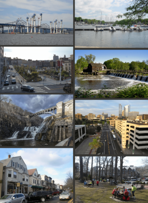
Clockwise from top: the original Tappan Zee Bridge and replacement; Mamaroneck Harbor; Philipsburg Manor; downtown White Plains; downtown Scarsdale; shops in Katonah; the New Croton Dam; Larkin Plaza in Yonkers
|
|||
|
|||
| Etymology: Chester, England | |||
| Country | United States | ||
| State | New York | ||
| Founded | November 1, 1683 | ||
| County seat | White Plains | ||
| Largest city | Yonkers | ||
| Area | |||
| • Total | 500 sq mi (1,280 km2) | ||
| • Land | 430 sq mi (1,100 km2) | ||
| • Water | 69 sq mi (180 km2) | ||
| Population
(2020)
|
|||
| • Total | 1,004,457 |
||
| • Density | 2,000/sq mi (800/km2) | ||
| Demonym(s) | Westchesterite | ||
| Economics | |||
| • Median income | $114,651 (2018-2022) | ||
| Gross Domestic Product | |||
| • Total | US$88.166 billion (2022) | ||
| Time zone | UTC−5 (North American EST) | ||
| • Summer (DST) | UTC−4 (EDT) | ||
| ZIP Codes |
105xx–108xx
|
||
| Area code(s) | 914 | ||
| Congressional districts | 16th, 17th | ||
| FIPS code | 36-119 | ||
| GNIS feature ID | 974157 | ||
Westchester County is a county in the southeastern part of New York. It borders the Long Island Sound to the east and the Hudson River to the west. It is the most populated county north of New York City.
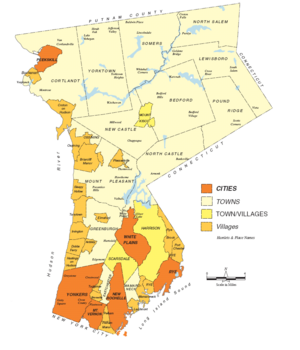
In 2020, Westchester County had a population of over 1 million people. This was its highest count ever. The county covers about 450 square miles (1,165 km²). It includes six cities, 19 towns, and 23 villages.
Westchester County was created in 1683. It was named after Chester, England. The main government center, or county seat, is White Plains. The biggest city in the county is Yonkers, with over 211,000 residents. The county is part of the Hudson Valley region.
Westchester County is known for being a wealthy area. In 2021, the average household income was over $105,000. However, it also had some of the highest property taxes in the United States in 2013.
The county is a central part of the New York metropolitan area. It is located just north of New York City. It also borders Putnam County to the north, Connecticut to the east, and Rockland County and New Jersey across the Hudson River to the west. Westchester was one of the first large suburban areas to grow, especially in the late 1800s.
Westchester County has many ways to get to New York City, including roads and public transportation. Many big companies have their main offices here, like IBM, Mastercard, PepsiCo, and Regeneron Pharmaceuticals. Students from Westchester high schools often win awards in science and engineering competitions.
Contents
History of Westchester County
Long ago, in the 1500s and 1600s, Native American groups lived in what is now Westchester County. They were part of the Algonquian peoples, also known as the Lenape. They called their land "Lenapehoking." Different tribes lived here, including the Manhattans, Weckquaesgeek, and Siwanoy.
The first European explorers to visit were Giovanni da Verrazzano in 1524 and Henry Hudson in 1609. Dutch settlers arrived in the 1620s, followed by English settlers in the 1640s. Westchester County was one of the first twelve counties in the New York colony, formed in 1683. By 1775, it was the richest and most populated county in the colony.
The American Revolutionary War caused a lot of damage to the county. But after the war ended in 1783, the county quickly recovered. In 1788, it was divided into 20 towns. By 1798, about 24,000 people lived there.
Two big changes in the early 1800s helped Westchester grow a lot. First, the Croton Dam and Aqueduct were built from 1837 to 1842. This amazing engineering project brought water to New York City. Second, railroads arrived in the 1840s. These railroads, like the New York and Harlem Railroad, helped towns grow. The population shifted more towards the southern part of the county. By 1860, the county had 99,000 people, with Yonkers being the largest city.
After the American Civil War, many wealthy people built large homes, called estates, in Westchester. The county's transportation and workforce also attracted factories, especially along the Hudson River. In the late 1800s, parts of Westchester became part of New York County, which later became Bronx County.
In the 1900s, Westchester changed from a rural area to the suburban county it is today. The Bronx River Parkway, finished in 1925, was the first modern highway of its kind in North America. Parks and parkways helped communities grow. After World War II, more homes were needed. Apartment buildings appeared in cities, and single-family homes continued to be built. By 1950, the population was over 625,000.
Major highways were built in the 1950s and 1960s. The construction of the Tappan Zee Bridge also led to more growth in the county.
Geography of Westchester County
Westchester County is located in the New York metropolitan area. It is north of New York City and south of Upstate New York. Putnam County is to its north. The Hudson River is on its west side, and the Long Island Sound and Fairfield County, Connecticut, are on its east side.
The county covers about 500 square miles (1,295 km²). Most of this is land (430 sq mi or 1,114 km²), and about 14% is water. The southern border of Westchester is close to Manhattan, New York City. Large parks like Pelham Bay Park and Van Cortlandt Park create a natural barrier between Westchester and the Bronx.
Long Island Sound Shoreline
Westchester's shoreline along the Long Island Sound has many rocks, marshes, and wetlands. There are also some natural and man-made sand beaches. Parks along the shore offer access to beaches and nature areas. Several large harbors are found here, including Milton Harbor in Rye and harbors in Mamaroneck and New Rochelle.
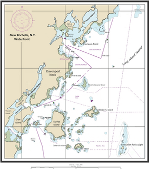
Many islands are off the Long Island Sound shore, mostly near New Rochelle. Davids Island used to be a U.S. Army base. Glen Island is now a county park with a beach. Huckleberry Island has one of the largest bird nesting areas in the western Long Island Sound.
Hudson River Waterfront
The widest part of the Hudson River is between Westchester and Rockland County, north of Croton Point. This area was once called the Tappan Zee. The Hudson River in Westchester has tides and is a mix of fresh and salt water.
Two bridges cross the Hudson River in Westchester. The Bear Mountain Bridge is in Cortlandt. The Tappan Zee Bridge is in Tarrytown. Parks along the river offer access to important sites.
The Hudson River waterfront is changing. Old industrial areas are becoming places with homes, shops, and parks. This is happening in cities like Yonkers, Hastings-on-Hudson, and Tarrytown. In 2004, the county started building the Westchester RiverWalk. This path will be 51.5 miles (82.9 km) long and will let people walk along the Hudson River from New York City to Putnam County. Over 32 miles of the path are already open.
The highest point in Westchester County is 987 feet (301 meters) high. It is called "Bailey" and is in Mountain Lakes Park. The lowest point is sea level, along both the Hudson River and Long Island Sound.
Water Systems
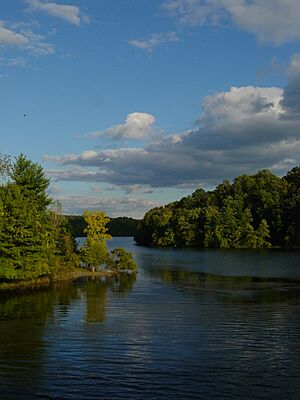
Westchester County has six main water areas, called watersheds. These include the Long Island Sound, Bronx, Hudson, and Croton River basins. There are also about 60 smaller water areas. Many streams flow through the county, like the Bronx River, Hutchinson River, and Saw Mill River.
The county has several large reservoirs. The Croton system and the Kensico Reservoir are very important for New York City's water supply. These reservoirs and lakes in northern Westchester provide a lot of New York City's drinking water.
Westchester County's climate is a mix of humid subtropical and humid continental. Winters are cold and wet, with more snow in higher, inland areas. Summers are hot inland but cooler near the coast. The county gets a good amount of rain. Snowfall is more common in most of Westchester than in New York City.
Population and People
Westchester County is home to a diverse population. In 2020, the county's population was 1,004,457.
In 2010, about 57.4% of the people were non-Hispanic White. About 15.6% were African American, and 5.4% were Asian. People of Hispanic or Latino background made up 21.8% of the population. Most people (71.7%) spoke only English at home. Spanish was spoken by 14.4% of residents.
The average age in 2010 was 38 years old. About 25% of the population was under 18.
By 2018, the population had grown to 967,612. About 25.6% of the people living in Westchester were born in other countries. The average household had 2.71 people. About 33.3% of residents spoke a language other than English at home.
Communities in Westchester
Westchester County has six cities, 19 towns, and 23 villages.
Cities in Westchester often have smaller areas within them, like neighborhoods. Some of these areas are very old, dating back to the 1600s.
The six cities in the county are:
| Name | Population | Area (mi2) | Density (Pop. per mi2) |
Founded/first incorporated |
Notes |
|---|---|---|---|---|---|
| Yonkers | 195,976 | 20.3 | 10,818.2 | 1646 / 1854 | 3rd most populated city in New York State |
| New Rochelle | 77,062 | 13.2 | 6,973.5 | 1688 / 1899 | 7th most populated city in New York State |
| Mount Vernon | 67,292 | 4.4 | 15,288 | 1664 / 1853 | 8th most populated city in New York State |
| White Plains | 56,853 | 9.9 | 5,820 | 1721 | 11th most populated city in New York State, also Westchester county seat |
| Peekskill | 23,583 | 5.5 | 5,189.7 | 1684 / 1816 | 29th most populated city in New York State |
| Rye | 15,720 | 20.0 | 2,710 | 1660 / 1904 | 37th most populated city in New York State, also the name of a town |
Any land in the county that is not a city is part of a town. A town can have one or more villages, or no villages at all. Yonkers is the largest city by population. Mount Vernon is the most crowded city.
Some towns and villages share the same name, which can be confusing. For example, the town of Rye is separate from the city of Rye. The village of Mamaroneck is in two different towns.
Areas within towns that are not part of a village are called "hamlets" or "unincorporated areas." These hamlets do not have their own local government and rely on the town for services.
Economy and Jobs
Westchester County is close to New York City, so many large companies have their headquarters here. Some of these include:
- Mastercard in Purchase
- PepsiCo in Purchase
- IBM in Armonk
- Regeneron Pharmaceuticals in Tarrytown
High Technology
Westchester is part of "Tech Valley," a name for the eastern part of New York State. This area aims to be a leader in technology, like Silicon Valley. Many tech companies are located here.
Biotechnology
Westchester County has also become a growing center for biotechnology. This field uses biology to create new products and technologies. In 2016, over $1 billion was planned for new projects in this area. In 2017, plans were announced for a large biotechnology center in Valhalla. This center is expected to create 12,000 new jobs.
Education in Westchester
Westchester County has 48 public school districts. It also has almost 120 private schools and 14 colleges and universities. Many high schools in the county are ranked among the best in New York State and the United States.
Public schools get most of their money from local property taxes. In 2013, the average property tax bill in Westchester County was about $13,842, which was the highest in the United States. In 2018, 28 of the top 100 school districts in New York State were in Westchester County.
Culture and Fun
Historic Places
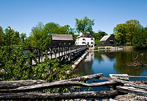
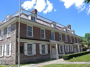
The Timothy Knapp House, built around 1670, is the oldest building still standing in Westchester. Philipse Manor Hall and the Old Dutch Church of Sleepy Hollow were also built in the late 1600s. Philipse Manor Hall is in Yonkers and is a historic site you can visit.
Many places in the county are recognized as National Historic Landmarks. These include:
- The Aaron Copland House
- The Armour-Stiner House
- The Boston Post Road Historic District
- The Elephant Hotel
- The John Jay Homestead
- Kykuit (the Rockefeller Estate)
- Lyndhurst
- Old Croton Aqueduct
- Old Dutch Church of Sleepy Hollow
- Philipse Manor Hall
- Philipsburg Manor House
- Playland (an amusement park)
- St. Paul's Church
- Sunnyside (Washington Irving's home)
- Van Cortlandt Manor
Libraries
Westchester County has a library system with 38 public libraries. There are also 25 college and special libraries.
Other Fun Places
- Caramoor Center for Music and the Arts in Katonah
- Donald M. Kendall Sculpture Gardens in Purchase
- The Hudson River Museum in Yonkers
- The Jacob Burns Film Center in Pleasantville
- Katonah Museum of Art in Katonah
- New Roc City in New Rochelle (an entertainment complex)
- Teatown Lake Reservation in Ossining (a nature preserve)
- Westchester County Center in White Plains (an arena for events)
African American History
Westchester County has 14 sites on its African American Heritage Trail. This trail was created in 2004 to highlight important places in African American history.
Safety and Emergency Services
Westchester County has 42 local police departments. These departments often work together and with state and federal police.
The county also has many emergency services. There are 58 fire departments and 42 ambulance services. The Westchester County Department of Emergency Services helps to dispatch (send out) EMS and fire departments. They also provide training and support for these groups.
Media and News
Here are some of the news and media outlets in Westchester County:
- Print and Online
- The Daily Voice, a news website for Westchester and Fairfield Counties.
- The Journal News, a daily newspaper and news website for Westchester, Rockland, and Putnam.
- The Westchester County Press, a newspaper made in White Plains.
- Westchester Magazine, a magazine and website about news, culture, and lifestyle in Westchester County.
- Television and Radio
- News 12 Westchester, a local TV news station.
- WHUD (100.7 FM), a radio station in Peekskill.
- WRNN-TV, a TV news station in Rye Brook.
- WVIP (93.5 FM), a radio station in New Rochelle.
- WVOX (1460 AM), a radio station in New Rochelle.
Getting Around Westchester

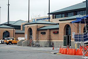
Westchester County has many roads and bridges. Its closeness to New York City means there is often a lot of traffic.
The transportation routes have shaped how the county has grown. Cities and towns have developed most along these routes. There are five main north-south roads and three east-west roads.
Main Roads

 I-87 / New York Thruway
 I-95
I-95 I-287
I-287 I-684
I-684 US 1
US 1 US 6
US 6 US 9
US 9 US 202
 Bronx River Parkway
 Cross County Parkway
 Hutchinson River Parkway
 Saw Mill River Parkway
 Sprain Brook Parkway
 Taconic State Parkway
Major Bridges
The Tappan Zee Bridge crosses the Hudson River between Tarrytown in Westchester and South Nyack in Rockland County. This bridge cost $4 billion and was built from 2013 to 2017. It replaced an older bridge in the same spot. About 20 miles (32 km) upstream, the Bear Mountain Bridge also crosses the Hudson River.
Public Transportation
Westchester County Airport serves the county and is near White Plains. Bus service is provided by the Bee-Line Bus System. These buses travel within Westchester and to/from the Bronx, Manhattan, and Putnam County.
You can also take a ferry across the Hudson River. NY Waterway operates a ferry service between Ossining in Westchester and Haverstraw in Rockland County.
Trains
Amtrak trains stop at Croton-Harmon, New Rochelle, and Yonkers. Commuter train service is provided by Metro-North Railroad. Metro-North has three lines in the county: the Hudson, the Harlem, and the New Haven lines. These lines connect Westchester to New York City and other areas.
See also
 In Spanish: Condado de Westchester para niños
 | Isaac Myers |
 | D. Hamilton Jackson |
 | A. Philip Randolph |


