
Broken Top facts for kids
Quick facts for kids Broken Top |
|
|---|---|
 |
|
| Highest point | |
| Elevation | 9,177 ft (2,797 m) NAVD 88 |
| Geography | |
| Location | Deschutes County, Oregon, U.S. |
| Parent range | Cascade Range |
| Topo map | USGS Broken Top |
| Geology | |
| Age of rock | Pleistocene |
| Mountain type | Stratovolcano |
| Volcanic arc | Cascade Volcanic Arc |
| Last eruption | About 100,000 years ago |
Broken Top is a large volcano that has been shaped by glaciers. It is a type of volcano called a stratovolcano, which means it's tall and cone-shaped. Broken Top is found in the Cascade Range in Oregon, U.S..
It sits southeast of the Three Sisters mountains. This volcano is part of the Three Sisters Wilderness area. It is about 20 miles (32 km) west of Bend, Oregon in Deschutes County. The volcano stopped erupting around 100,000 years ago. Over time, glaciers have worn down its cone, showing what's inside. Two glaciers, Bend and Crook Glacier, are still on the mountain.
Many different plants and animals live in this area. It often gets a lot of snow and sometimes rain. Temperatures can change a lot between summer and winter. Broken Top is a popular spot for hiking, climbing, and scrambling (a mix of hiking and climbing).
Contents
Discover the Geography of Broken Top
Broken Top is located in the Cascade Volcanic Arc. This is a chain of volcanoes in Oregon. It is part of the Cascade Range. The mountain is inside the Three Sisters Wilderness in Deschutes County. Broken Top stands at 9,177 feet (2,797 meters) tall.
Explore the Three Sisters Wilderness
The Three Sisters Wilderness is a huge natural area. It covers 281,190 acres (1,137.9 km2). This makes it the second-largest wilderness area in Oregon. It was set aside by the United States Congress in 1964. To the north, it touches the Mount Washington Wilderness. To the south, it meets the Waldo Lake Wilderness.
This area has 260 miles (420 km) of trails. You can find many forests, lakes, waterfalls, and streams here. Whychus Creek starts in this wilderness. The Three Sisters and Broken Top make up about one-third of this wilderness. This part is called the Alpine Crest Region. It ranges from about 5,200 feet (1,600 meters) to 10,358 feet (3,157 meters) high. This region has the most visited glaciers, lakes, and meadows.
Weather and Wildfires Around Broken Top
The weather around Broken Top changes a lot. This is because of something called a rain shadow. Air from the Pacific Ocean rises over the western side of the Cascade Range. As it rises, it cools and drops its moisture as rain or snow. The higher you go, the more rain or snow you get.
Once the air passes over the mountains, it goes down the eastern side. This makes the air warmer and drier. On the western slopes, it can rain from 80 to 125 inches (200 to 320 cm) each year. On the eastern slopes, it rains from 40 to 80 inches (100 to 200 cm). Summer temperatures can reach 80 to 90 °F (27 to 32 °C). In winter, they can drop to -20 to -30 °F (-29 to -34 °C).
Before people settled here in the late 1800s, wildfires often burned through the forests. This was especially true for the ponderosa pine forests on the eastern slopes. For the last 100 years, people have tried to stop fires. This has caused forests to become very thick. At higher elevations, these thick forests can catch fire easily in summer. This puts people and homes at risk.
In the 2000s, wildfires have become bigger and more common. For example, in September 2012, lightning started a fire. It burned 41 square miles (106 km2) in the Three Sisters Wilderness. The area was closed until May 2013. In August 2017, officials closed a large part of the wilderness. This was due to 11 lightning-caused fires, including the Milli Fire. Because of more fires, officials now plan for them. They even set controlled fires to protect habitats.
The Fascinating Geology of Broken Top

Broken Top is a complex stratovolcano. This means it's a volcano built up of many layers of hardened lava, ash, and rock. It is located northwest of Ball Butte and southeast of South Sister. Broken Top is 9,186 feet (2,799 meters) tall. It has a volume of about 10 cubic kilometers (2.4 cubic miles).
Like other volcanoes in the Cascades, Broken Top was formed by magma. This magma came from deep underground. It was created when the Juan de Fuca Plate slid under the North American Plate. This process is called subduction. The mountain was also shaped by the changing climate during the Pleistocene Epoch. During this time, many ice ages happened. Glaciers moved and carved out the mountains.
Broken Top is part of the High Cascades. This is the eastern part of the Cascade Range. Other volcanoes here include the Three Sisters, Belknap Crater, Mount Washington, Black Butte, Three Fingered Jack, and Mount Bachelor. These mountains formed at the end of the Pleistocene. They sit on top of older volcanoes. The area around the Three Sisters is very active. It has many volcanoes close together. This is unusual for the Cascades.
The area from the Three Sisters to Broken Top and Mount Bachelor is about 193 square miles (500 km2). It has at least 50 places where lava has erupted. This lava is mostly rhyolitic and rhyodacitic rock.
East of Broken Top is the Tumalo volcanic center. This area is 115.8 square miles (300 km2). It has similar lava deposits. The Tumalo volcano also sent out ash and rock during powerful eruptions. These eruptions were like the eruption of Vesuvius that destroyed Pompeii. These deposits spread all the way to the town of Bend.
Broken Top's Eruptive History

Broken Top started erupting about 300,000 years ago. This was during the middle of the Pleistocene epoch. Its first eruptions were of basaltic andesite lava. This lava built up a base shield. The center of the volcano has oxidized rock. This rock was pushed into by dikes and sills. The rocks that made up this cone were all similar. They contained plagioclase, olivine, two types of pyroxene, and magnetite.
The volcano kept erupting off and on until 150,000 years ago. It erupted silicic lava, including obsidian. Much of the current cone is made of mafic lava flows. These include andesite, dacite, rhyodacite, and pyroclastic flows (fast-moving hot gas and volcanic rock). These deposits reach from the volcano's side to its top. They also extend to Todd Lake Volcano.
Another set of rhyodacitic lava domes stretches for 10 kilometers (6.2 miles). They run from south of Broken Top to Demaris Lake in the north. But some of these were covered by lava from the South Sister volcano. In total, Broken Top erupted between 7 to 10 cubic kilometers (1.7 to 2.4 cubic miles) of lava. Most of the volcano's cone came from its main opening. But it also grew from side vents and smaller parasitic cones around it. These side vents produced basalt and andesite. The parasitic vents erupted scoria.
Broken Top's volcanic crater is now 0.8 kilometers (0.50 miles) wide. It was likely formed when the ground sank. This created a bowl shape that filled with lava. Over time, the volcano's center changed due to hot water. This can be seen in several cirques (bowl-shaped hollows). Glaciers have also greatly eroded the summit cone. It now looks like an amphitheatre opening to the southeast. Because of this erosion, you can see inside the volcano. This helps scientists understand it. The erosion has destroyed the original top of the mountain. It has also removed much of its inside. This reveals layers of purple, red, and black scoria. It also shows yellow, brown, and orange pumice.
Glaciers and Flash Floods

During the late Pleistocene, glaciers covered almost all of Broken Top. Only the very tops of Tumalo Mountain and Broken Top were not buried. There is no sign that the volcano erupted under the ice.
Today, the Bend Glacier and Crook Glacier are still on the mountain. They are at elevations of 7,762 feet (2,366 meters) and 8,209 feet (2,502 meters). These small glaciers are shrinking fast. They have gotten much smaller in the last few decades.
When glaciers from the Little Ice Age melted in the 1900s, water filled the empty spaces. This formed lakes held back by moraines (piles of rock left by glaciers). These lakes are more common here than anywhere else in the contiguous United States.
The area has a history of flash floods. One happened at Broken Top on October 7, 1966. A forest ranger studied the event. He found it started from a lake on Broken Top. This lake was at 8,000 feet (2,400 meters) high and covered 11 acres (4.5 hectares). The lake is at the foot of Crook Glacier and fed by Bend Glacier. It seems that glacial ice fell into the lake. This caused a big wave that broke through the moraine. About 50,000,000 US gallons (190,000,000 liters) of water drained out. The flood was 10 to 15 feet (3.0 to 4.6 meters) deep. It rushed down the mountain's eastern and southern sides. It reached the Cascade Lakes Scenic Byway. The flood carried logs, rocks, and mud. It covered a large part of the Sparks Lake meadow basin with silt. It left behind at least 10,000 to 20,000 short tons (9,100 to 18,100 tonnes) of sediment in the lake and meadow.
Other Volcanic Cones Nearby
Todd Lake volcano is at the southern base of Broken Top. It erupted a type of andesite lava. Its lava flows are now visible. They are covered with red scoria from another vent. This volcano started erupting as Broken Top stopped. Their lava layers overlap.
As glaciers melted, basaltic cinder cone volcanoes formed south of Todd Lake. This happened as Cayuse Crater was forming. Cayuse Crater is a younger volcano that formed 11,000 years ago. It is also on Broken Top's southern side. It is made of basaltic lava and scoria. It erupted after Broken Top stopped. This suggests it formed from a magma chamber closer to South Sister. Cayuse Crater has a double rim. Its southern wall was broken by lava flows. It also has two smaller cones to the northwest. More recent activity formed basaltic lava flows, cones, and ash. These are mixed with glacial deposits.
Ball Butte is another cone nearby. It is 2,466 meters (8,091 feet) high. It is considered a part of Broken Top. There are also many smaller cones in the area. They helped build Ball Butte over time. They also produced red scoria. They formed hot springs and fumaroles (openings that release steam and gases). The remains of a large scoria cone near Bend Glacier were mostly destroyed by ice. It has volcanic bombs up to 8 feet (2.4 meters) long.
During the late Pleistocene, six cinder cones erupted between Broken Top and Tumalo Mountain. They likely came from the same magma source.
Recent Discoveries and Potential Dangers
In 1925, an early study suggested that Broken Top, the Three Sisters, and other mountains were parts of a huge collapsed volcano. This ancient volcano was called Mount Multnomah. The idea was that it collapsed to form a caldera, like Crater Lake. But in the 1940s, another scientist, Howel Williams, showed that Multnomah never existed. He proved that each volcano had its own history.
Later, in 1978, geologist Edward Taylor studied Broken Top. He found that the current cone was built on basaltic andesite lavas. Over time, dikes and sills pushed into the volcano. This formed a cone made of different lavas. These included basaltic andesite, dacite, and rhyodacite. It also had ash and rock from explosive eruptions.
Broken Top and the nearby South Sister pose some dangers. There is a danger zone about 12 miles (19 km) around them. A landslide at Broken Top, or an eruption from South Sister, could cause a lahar. Lahars are fast flows of water, rock, and mud. They could rush down river valleys. Smaller landslides are more likely. They can still cause damage and start lahars. Larger landslides would likely happen if magma moved underground. These would be detected by special sensors.
An eruption from South Sister would threaten nearby life. The danger zone extends 2 to 10 kilometers (1.2 to 6.2 miles) from the volcano tops. During an eruption, ash could pile up in Bend. Mudflows and pyroclastic flows could rush down the mountain. They would threaten anything in their path.
Over the last 100 years, five or more lahars have happened. They occurred at the Three Sisters and Broken Top. They were caused by glaciers melting quickly or lakes breaking their banks. These lahars only affected undeveloped areas. They traveled less than 6 miles (9.7 km) from where they started. Future dam failures could cause similar events. They would likely only affect the 12-mile (19 km) danger zone. But some, like those from Carver Lake, could reach farther.
Fun Activities at Broken Top

Broken Top and the Three Sisters are popular for hiking and mountaineering. The United States Forest Service requires permits to visit from Memorial Day (May 31) until early September. Dogs must be on leashes on certain trails from July 15 to September 15. Horses are not allowed. Ice axes are needed for safety during winter climbing.
Motor vehicles, bicycles, motorboats, and helicopters are generally not allowed in the Three Sisters Wilderness. This is part of the National Wilderness Preservation System rules. From Memorial Day to October 31, you need a permit to enter the area. These permits are free. For a special area called Obsidian, you need a specific pass. These passes are only given out at certain Ranger Districts. No vehicles are allowed in this area.
The hiking trail on Broken Top starts at the Green Lakes Basin. This trailhead is east of Bend. The trail is 12 miles (19 km) long. It gains 3,450 feet (1,050 meters) in elevation. You can scramble up the mountain. This means it's a mix of hiking and easy climbing. The Broken Top trail connects with the Green Lakes Trail. It runs for 0.8 miles (1.3 km) to Crater Creek. Part of the trail goes right by the volcano and Crook Glacier. There is also an unofficial trail up the moraine of Crook Glacier. You can reach the northern slopes of Broken Top from trails north of Tam McArthur Rim. The southern slopes can be reached from trails near Crater Creek.
Images for kids
-
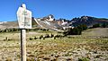
Wilderness boundary on the south side of Broken Top

