
Clapham facts for kids
Quick facts for kids Clapham |
|
|---|---|
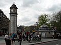
.jpg) Clapham Common Station and clock |
|

Clapham
|
|
| OS grid reference | TQ296754 |
| London borough | |
| Ceremonial county | Greater London |
| Region | |
| Country | England |
| Sovereign state | United Kingdom |
| Post town | LONDON |
| Postcode district | SW4, SW8, SW9, SW11, and SW12 |
| Dialling code | 020 |
| Police | Metropolitan |
| Fire | London |
| Ambulance | London |
| EU Parliament | London |
| UK Parliament |
|
| London Assembly |
|

Clapham is a lively area in south west London, England. Most of it is in the London Borough of Lambeth. However, some parts, like the big park called Clapham Common, stretch into the nearby London Borough of Wandsworth. It's a well-known place with a long and interesting past.
Contents
Clapham's History
How Clapham Began
The main road in Clapham today, called Clapham High Street, follows an old Roman road. A special stone found nearby tells us about this road. The stone was put up by a man named Vitus Ticinius Ascanius around the 1st century CE. This ancient stone was discovered in 1912 and can now be seen near the old Clapham Library.
The name Clapham comes from an Old English phrase. It means 'homestead or enclosure near a hill'. The name was first written down around the year 880 as Cloppaham.
Clapham is also mentioned in the Domesday Book, a famous survey from 1086. It was called Clopeham back then. The land was owned by Geoffrey de Mandeville. At that time, Clapham had enough land for six ploughs and five acres of meadow.
A very old church, which was part of Merton Priory, used to stand where St Paul's is now. Most of this church was taken down in 1774. A new church, Holy Trinity, was built the next year near Clapham Common.
Clapham in the 17th to 19th Centuries
In the late 1600s, large country houses started to appear in Clapham. By the 1700s and early 1800s, rich business people from the City of London loved living here. They built many grand homes around Clapham Common and in the area known as the Old Town.
Samuel Pepys, a famous diarist, spent his last two years in Clapham. He lived with his friend William Hewer until he passed away in 1703.
Elizabeth Cook, the wife of the famous explorer Captain James Cook, also lived on Clapham Common for many years. Other well-known people who lived here include Palace of Westminster architect Sir Charles Barry and novelist Graham Greene.
A special group called the Clapham Sect lived around the Common in the late 1700s and early 1800s. They were wealthy business people who believed in helping others. They were very important in campaigns to end slavery and child labour. They also worked to improve prisons. Famous members included William Wilberforce and Henry Thornton. They helped start the Church Mission Society in 1799.
In 1848, Clapham was described as one of the "most respectable" villages near London.
Clapham in the 20th and 21st Centuries
When railways arrived, Clapham became a popular place for people who worked in central London. Clapham High Street railway station opened in 1862. The underground City and South London Railway reached the area in 1900.
By 1900, Clapham was no longer just for the very rich. Many of the grand old houses were pulled down by the mid-1900s. However, some beautiful 18th and 19th-century homes still stand around the Common and in the Old Town. Today, Clapham has many different types of homes. These range from large Georgian houses to Victorian homes and even social housing estates built in the 1930s and 1960s.
In the early 1900s, Clapham was seen as a typical suburb. This is where the phrase "man on the Clapham omnibus" comes from, meaning an ordinary person. By the 1980s, Clapham started to become more popular and expensive. Its closeness to central London led to more middle-class people moving in. Today, Clapham is generally a well-off area.
Clapham's Location and People
Where is Clapham?
Clapham covers most of the SW4 postcode area. Historically, it also included parts of SW8, SW9, and SW12. Clapham Common is shared between the London Borough of Lambeth and the London Borough of Wandsworth. Lambeth Council is in charge of managing the Common.
In 2011, the Clapham area had about 40,850 people living there. For local government, Clapham is divided into three areas in Lambeth: Clapham Common and Abbeville, Clapham Town, and Clapham East.
Sometimes, parts of southern Battersea are mistakenly called Clapham. This is because of the name of Clapham Junction railway station. The station was originally called Battersea Junction, which was closer to its actual location.
Who Lives in Clapham?
According to the 2021 census, Clapham has a population of 48,478 people. The largest group is White, making up 64% of the population. Black people make up 19%. Clapham is also home to one of the biggest communities of Australians in London.
Clapham Common: A Green Oasis
_-_geograph.org.uk_-_190145.jpg)
Clapham Common is a huge green space, about 220 acres in size. It has many paths, three ponds, and a Victorian bandstand. There are also lots of old trees, including horse chestnuts and a long row of London plane trees. Many beautiful Georgian and Victorian houses look out over the Common.
The important Holy Trinity Clapham is also on the Common. This 18th-century church is famous for its link to the Clapham Sect.
Clapham Town includes Clapham High Street, which is a busy area. It also has residential streets like Clapham Manor Street, home to Clapham Leisure Centre. Venn Street has a cinema, restaurants, and a food market every weekend.
Clapham's Neighbourhoods
Clapham South
This area gets its name from the tube station. It doesn't have strict boundaries from the rest of Clapham. It mainly has residential buildings, and it includes large parts of Clapham Common.
Clapham North
Clapham North is on both sides of Clapham Road. It borders the area called 'Stockwell'. There's a sign that marks the boundary between Clapham and Stockwell. The northern part of Clapham includes the Sibella conservation area, which is a protected historic area.
Getting Around Clapham (Transport)
Clapham has a large bus network that connects it to many parts of south and central London. It also has three underground (tube) stations and two railway stations.
There are two railway stations in the area on London Overground's East London line:
- Clapham High Street
- Wandsworth Road
London Underground's Northern line goes through Clapham, with three stations:
- Clapham North (opened as Clapham Road in 1900, changed its name in 1926)
- Clapham Common
- Clapham South
In 2012, the Overground East London Line was extended to Clapham High Street and Wandsworth Road stations. This means you can travel directly from Clapham to places like Shepherds Bush, Canada Water, Shoreditch, and Highbury and Islington.
Clapham Junction is one of the biggest train hubs in England. You can catch frequent trains to London Victoria and London Waterloo from there.
Shopping in Clapham
Clapham has several places to shop and eat:
- Clapham Old Town: This area has pubs and restaurants.
- Clapham High Street: A main street with many shops.
- Abbeville Road: And the Clapham South area.
- Nightingale Lane: Located near the edges of Clapham South.
- Clapham Road: Features a variety of different shops.
Sports in Clapham
The football club Clapham Rovers F.C. was once based in Clapham. They won the FA Cup in 1880.
Famous People from Clapham
Many interesting people have lived in Clapham over the years:
- Henry Allingham – a very old person who lived a long time
- John Amaechi – a writer and basketball player
- Kingsley Amis – a novelist
- Leslie Ash – an actress
- Natasha Bedingfield – a singer
- Jo Brand – a comedian, born in Clapham
- Jeremy Brett – an actor
- Angela Carter – a writer
- Henry Cavendish – a scientist
- John Cole – a cricketer and army officer
- Brian Dowling – a TV presenter
- Huw Edwards – a newsreader
- Sarah Ferguson – a member of the Royal family
- Graham Greene – a famous author
- Ainsley Harriott – a chef
- Lena Headey – an actress
- Damon Hill – a racing driver
- Paul Kaye – an actor
- John Keegan – a historian
- Marie Kendall – a music-hall star
- Miriam Margolyes – an actress
- Heather Mills – a model
- Chris O'Dowd – an actor
- Samuel Pepys – a famous diarist
- Eric Prydz – a musician
- Claude Rains – an actor
- Corin Redgrave – an actor
- Vanessa Redgrave – an actress
- Margot Robbie – an actress
- Mark Steel – a comedian
- Lytton Strachey – a writer
- Mark Thomas – a comedian
- Polly Toynbee – a journalist
- Dennis Waterman – an actor
- Vivienne Westwood – a fashion designer
- William Wilberforce – a leader in ending slavery
- Holly Willoughby – a television presenter
- Patrick Wolf – a singer-songwriter
Images for kids
-
Clapham Common Station and clock
See also
 In Spanish: Clapham para niños
