
Encino, Los Angeles facts for kids
Quick facts for kids
Encino
|
|
|---|---|

Encino Commons in Encino, 2010
|
|

Encino as mapped by the Los Angeles Times
|
|

Encino, Los Angeles
Location in San Fernando Valley

Encino, Los Angeles
Location in the Los Angeles metropolitan area
|
|
| Country | United States |
| State | California |
| County | Los Angeles |
| City | Los Angeles |
| Named for | Rancho Los Encinos |
| Elevation | 774 ft (235.9 m) |
| Population
(2022)
|
|
| • Total | 53,155 |
| Time zone | UTC-8 (PST) |
| • Summer (DST) | UTC-7 (PDT) |
| ZIP code |
91316, 91436
|
Encino is a neighborhood located in the San Fernando Valley area of Los Angeles, California. It's known for its tree-lined streets and a mix of homes and businesses.
Contents
What's in a Name?
The name Encino comes from the Spanish word for "holm oak." This type of oak tree is also called an evergreen oak. The Spanish name was inspired by the original Tongva language name for the local village, which meant "the place of the oaks."
A Look Back in Time


In 1769, Spanish explorers were the first Europeans to explore inland California. They traveled through the Sepulveda Pass and spent two nights at a Tongva village. This village was called Siutcanga, meaning "the place of the oaks." It was located near what is now Los Encinos State Historic Park.
A missionary with the expedition, Fray Juan Crespi, named the valley "The Valley of St. Catherine of Bologna of the Oaks." Over time, only the word "Encino" (meaning "oak") remained.
Later, in 1845, a large farm called Rancho Los Encinos was created. This land used to belong to the Mission San Fernando. The name Encino comes from this historic rancho.
Who Lives in Encino?
In 2022, about 53,155 people lived in Encino. The neighborhood is about 9.5 square miles (24.6 square kilometers) in size.
The average age of people living in Encino is around 42 years old. Many residents are 50 or older.
Most people in Encino are White (80.1%). Other groups include Latinos (8.5%), Asians (4.9%), and Blacks (2.4%). About 32.8% of residents were born outside the United States. Many of these people came from Iran and Russia.
The average household income in Encino is quite high, around $78,529 per year. Most homes (61.6%) are owned by the people who live in them, while 38.4% are rented.
Where is Encino?
Encino is located in the middle of the southern San Fernando Valley. It's also on the northern side of the Santa Monica Mountains.
It shares borders with several other neighborhoods:
- To the north: Reseda, Lake Balboa, and the Sepulveda Basin
- To the east: Sherman Oaks
- To the south: Brentwood
- To the west: Tarzana
Weather in Encino
| Climate data for Encino, Los Angeles, California | |||||||||||||
|---|---|---|---|---|---|---|---|---|---|---|---|---|---|
| Month | Jan | Feb | Mar | Apr | May | Jun | Jul | Aug | Sep | Oct | Nov | Dec | Year |
| Mean daily maximum °F (°C) | 67 (19) |
69 (21) |
71 (22) |
76 (24) |
79 (26) |
86 (30) |
92 (33) |
94 (34) |
90 (32) |
83 (28) |
74 (23) |
68 (20) |
79 (26) |
| Mean daily minimum °F (°C) | 43 (6) |
44 (7) |
45 (7) |
47 (8) |
51 (11) |
55 (13) |
58 (14) |
59 (15) |
57 (14) |
52 (11) |
45 (7) |
42 (6) |
50 (10) |
| Average precipitation inches (mm) | 3.96 (101) |
4.28 (109) |
3.51 (89) |
0.83 (21) |
0.28 (7.1) |
0.06 (1.5) |
0.01 (0.25) |
0.17 (4.3) |
0.26 (6.6) |
0.50 (13) |
1.30 (33) |
2.08 (53) |
17.24 (438.75) |
Jobs and Businesses


Encino has many jobs in health care, social services, and professional services. These include accounting, financial services, real estate, and legal jobs. There are about 3,800 businesses in Encino. They employ around 27,000 people.
Getting Around
Encino has public transportation options to help people travel.
- The Balboa Station is part of the Metro G Line.
- The Encino Park and Ride offers 160 parking spaces. From here, you can take buses to places like Downtown Los Angeles, LAX (the airport), Pasadena, and Thousand Oaks.
Learning in Encino
Many adults in Encino have a four-year college degree or even a master's degree.
Public Schools
The Los Angeles Unified School District (LAUSD) serves Encino.
- Hesby Oaks Leadership Charter School (Kindergarten to 8th grade)
- Encino Charter Elementary School
- Emelita Street Elementary School
- Fred E. Lull Special Education Center
- Lanai Road Elementary School
Encino does not have its own public high schools. Students usually attend Birmingham High School in Lake Balboa or Reseda High School in Reseda.
Private Schools

- Sage Academy (elementary)
- Westmark School
- Holy Martyrs Armenian High School/Ferrahian
- Crespi Carmelite High School
- Our Lady of Grace School (elementary)
- Los Encinos School (elementary)
- Saint Cyril of Jerusalem (elementary)
- Valley Beth Shalom Day School
- International School of Los Angeles (Lycee International de Los Angeles)
Fun and Games
Encino has many parks and places for recreation.
- The Los Encinos State Historic Park is 5 acres (2 hectares) large. It has old buildings, a small museum, and picnic areas.
- The Sepulveda Dam Recreation Area is in Encino. It includes the Woodley Worel/Magnus Cricket Complex for cricket games.
- You can also find the Encino Golf Course and the Balboa Golf Course here.
- The Balboa Sports Complex has lighted baseball fields, basketball courts, a children's play area, and tennis courts. It also has an indoor gym.
- The Sepulveda Basin Off-leash Dog Park is a great place for dogs to run free. It has 6.5 acres (2.6 hectares) for large dogs and a smaller area for small dogs.
- The Sepulveda Garden Center is a community garden. It has about 16 acres (6.5 hectares) of land with 420 garden plots.
Famous People from Encino
Many well-known people have lived in Encino! Here are just a few:
A–K
- Bud Abbott, comedian
- Steve Allen, actor
- Don Ameche, actor
- Marc Anthony, singer
- David Arquette, actor
- Scott Baio, actor
- Colleen Ballinger, actress
- Reggie Bush, former NFL player
- Johnny Cash, country singer
- Dana Carvey, actor-comedian
- James Charles, makeup artist
- Olivia Culpo, model
- Lenny Dykstra, athlete
- Annette Funicello, actress
- Clark Gable, actor
- Selena Gomez, singer and actor
- Dave Grohl, musician
- Alyson Hannigan, actress
- George Harrison, musician
- David Hasselhoff, actor and singer
- Ron Howard, actor, director
- Ice Cube, rapper and actor
- Samuel L. Jackson, actor
- Victoria Justice, actress and singer
- Wiz Khalifa, rapper
- Lisa Kudrow, actress
L–Z
- Nick Lachey, singer
- Martin Lawrence, actor and comedian
- Carole Lombard, actress
- Julie London, actress
- Sean McVay, football coach
- Leighton Meester, actress and singer
- Idina Menzel, singer
- Graham Nash, singer
- Candace Parker, basketball star
- Chris Paul, NBA player
- Logan Paul, YouTuber
- Tom Petty, singer-songwriter
- Richard Pryor, actor and comedian
- Sally Ride, astronaut (born in Encino)
- Jenni Rivera, singer
- Mickey Rooney, actor
- Ashlee Simpson, singer and actress
- Slash, musician
- Kenny Smith, NBA player
- John Travolta, actor
- Steve Vai, guitarist
- Frankie Valli, singer
- John Wayne, actor
- Pete Wentz, musician
- John Wooden, basketball coach
Cool Places to Visit

- The Encino Velodrome is an outdoor track for bicycle racing. It has been open since 1961.
- Los Encinos State Historic Park has old buildings, a small museum, and picnic areas. It's a great place to learn about the area's history.
- The Sepulveda Basin Recreation Area is a huge park. It has golf courses, tennis courts, soccer fields, baseball fields, and bike paths. There's also a lake surrounded by about 2,000 cherry trees that bloom beautifully in spring.
- Encino Park was created around 1937. It has a playground, basketball courts, and tennis courts.
- For over a thousand years, a giant California live oak tree stood in Encino. It was known as the Encino Oak Tree. Some people think Encino was named after this very tree. Sadly, the tree died in 1998 during a big storm. Today, there's a monument to the tree where it once stood, at Ventura Boulevard and Louise Avenue.
Images for kids
-
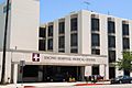
Encino Hospital Medical Center, Ventura Boulevard
-
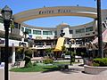
Encino Place, Ventura Boulevard
-
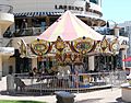
Children's carousel at Encino Place
-
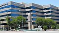
Coldwell Banker, Encino Executive Plaza, Ventura Blvd. and Hayvenhurst
-
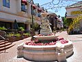
Statuary on Ventura Boulevard
-
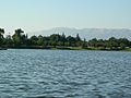
Lake Balboa, an artificial lake in Encino's Balboa Park
-
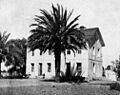
Rancho Los Encinos, part of the town's original namesake, 1900


See also
 In Spanish: Encino (Los Ángeles) para niños
