List of ancient woods in England facts for kids
Imagine walking through a forest that has been around for hundreds of years, even before your great-great-grandparents were born! These special places are called ancient woods. This list tells you about some of the biggest and oldest forests in England. To be on this list, a wood must be larger than 10 hectares (that's about 25 football fields!). They are listed by county, from A to Z.
Contents
- Ancient Woods in England
- Bedfordshire's Old Woods
- Berkshire's Old Woods
- Bristol's Ancient Woodland
- Buckinghamshire's Old Woods
- Cambridgeshire's Old Woods
- Cheshire's Old Woods
- City of London's Ancient Woodland
- Cornwall's Old Woods
- Cumbria's Old Woods
- Derbyshire's Old Woods
- Devon's Old Woods
- Dorset's Old Woods
- Durham's Old Woods
- East Riding of Yorkshire's Old Woods
- East Sussex's Old Woods
- Essex's Old Woods
- Gloucestershire's Old Woods
- Greater London's Old Woods
- Greater Manchester's Old Woods
- Hampshire's Old Woods
- Herefordshire's Old Woods
- Hertfordshire's Old Woods
- Isle of Wight's Old Woods
- Kent's Old Woods
- Lancashire's Old Woods
- Leicestershire's Old Woods
- Lincolnshire's Old Woods
- Merseyside's Old Woods
- Norfolk's Old Woods
- North Yorkshire's Old Woods
- Northamptonshire's Old Woods
- Northumberland's Old Woods
- Nottinghamshire's Old Woods
- Oxfordshire's Old Woods
- Rutland's Old Woods
- Shropshire's Old Woods
- Somerset's Old Woods
- South Yorkshire's Old Woods
- Staffordshire's Old Woods
- Suffolk's Old Woods
- Surrey's Old Woods
- Tyne and Wear's Old Woods
- Warwickshire's Old Woods
- West Midlands' Old Woods
- West Sussex's Old Woods
- West Yorkshire's Old Woods
- Wiltshire's Old Woods
- Worcestershire's Old Woods
- See also
Ancient Woods in England
Bedfordshire's Old Woods
About 6.2% of Bedfordshire is covered by woodlands. Most of this (about 4,990 hectares) is made up of broad-leaved trees like oak and ash. Experts believe there are about 1,468 hectares of ancient woodland in Bedfordshire, dating back to at least the year 1600.
This list focuses only on the woods larger than 10 hectares. All of these bigger woods are special places called Sites of Special Scientific Interest (SSSI). This means they are protected for their wildlife or geology. Together, these woods cover 628 hectares. Five of the eight woods listed here are found along a line of wooded sandstone that crosses the county.
| No. | Name | Public Access | Location | Area (Ha) | Area (Acres) | Special Status |
|---|---|---|---|---|---|---|
| 1 | Hanger Wood | No | 52°08′02″N 0°32′52″W / 52.1339°N 0.5477°W SP 995494 |
24 | 59 | SSSI |
| 2 | King's and Baker's Woods | Yes | 51°57′23″N 0°39′30″W / 51.9563°N 0.6582°W SP 923295 |
212 | 524 | SSSI, National Nature Reserve (NNR), Wildlife Trust |
| 3 | Kingswood, Houghton Conquest | Yes | 52°03′01″N 0°28′39″W / 52.0503°N 0.4775°W TL 045402 |
26 | 64 | SSSI, Local Government |
| 4 | Maulden Wood | Yes | 52°02′14″N 0°17′45″W / 52.0371°N 0.2957°W TL 170390 |
149 | 368 | SSSI, Forestry Commission |
| 5 | Odell Great Wood | Yes | 52°13′15″N 0°35′56″W / 52.2209°N 0.599°W SP 958590 |
86 | 212 | SSSI, Local Government |
| 6 | Potton Wood | Yes | 52°08′09″N 0°10′20″W / 52.1359°N 0.1721°W TL 252502 |
85 | 210 | SSSI, Forestry Commission |
| 7 | Southill Lake And Woods | No | 52°04′18″N 0°20′12″W / 52.0718°N 0.3367°W TL 141428 |
25 | 62 | SSSI |
| 8 | Swineshead Wood | Yes | 52°17′21″N 0°26′45″W / 52.2891°N 0.4459°W TL 061668 |
21 | 52 | SSSI, Woodland Trust |
Berkshire's Old Woods
Berkshire has a lot of woodland, covering about 18,304 hectares, which is 14.5% of its total land. The ancient woods listed here are all 10 hectares or larger, adding up to about 2,403 hectares. A big part of this area is Windsor Great Park and Forest, located near the borders with Surrey and Buckinghamshire. This park has huge areas of heathland and open parkland too.
In the eastern part of Berkshire, you'll find woodlands on the southern side of the Chiltern Hills. Most of the woods on this list are in West Berkshire. They follow the line of the chalk hills across the county.
| No. | Name | Public Access | Location | Area (Ha) | Area (Acres) | Special Status |
|---|---|---|---|---|---|---|
| 1 | Ashridge Wood | No | 51°30′08″N 1°16′52″W / 51.5023°N 1.281°W SU500784 |
16 | 40 | SSSI |
| 2 | Bisham Woods | Yes | 51°33′27″N 0°46′00″W / 51.5574°N 0.7666°W SU856850 |
84 | 208 | SSSI, Woodland Trust |
| 3 | Bowdown and Chamberhouse Woods | Yes | 51°23′07″N 1°16′12″W / 51.3854°N 1.2699°W SU509654 |
67 | 166 | SSSI, Wildlife Trust |
| 4 | Catmore and Winterly Copses | No | 51°23′27″N 1°27′45″W / 51.3909°N 1.4624°W SU375659 |
25 | 62 | SSSI |
| 5 | Combe Wood And Linkenholt Hanging | No | 51°18′59″N 1°29′21″W / 51.3164°N 1.4891°W SU357576 |
108 | 267 | SSSI |
| 6 | Coombe Wood, Frilsham | No | 51°27′28″N 1°13′01″W / 51.4579°N 1.217°W SU545735 |
20 | 49 | SSSI |
| 7 | Enborne Copse | No | 51°23′32″N 1°22′45″W / 51.3923°N 1.3791°W SU433661 |
12 | 30 | SSSI |
| 8 | Great Thrift Wood | No | 51°29′46″N 0°44′48″W / 51.496°N 0.7467°W SU871782 |
14 | 35 | SSSI |
| 9 | Irish Hill Copse | No | 51°24′02″N 1°25′09″W / 51.4006°N 1.4192°W SU405670 |
16 | 40 | SSSI |
| 10 | Kennet Valley Alderwoods | No | 51°24′18″N 1°25′35″W / 51.4051°N 1.4263°W SU400675 |
55 | 136 | SSSI |
| 11 | King's Copse | No | 51°25′53″N 1°10′17″W / 51.4315°N 1.1714°W SU577706 |
14 | 35 | SSSI |
| 12 | Redhill Wood | No | 51°22′44″N 1°23′37″W / 51.3789°N 1.3936°W SU423646 |
30 | 74 | SSSI |
| 13 | Snelsmore Common | Yes | 51°26′10″N 1°20′23″W / 51.4361°N 1.3396°W SU460710 |
103 | 255 | SSSI, Local Government |
| 14 | Windsor Forest And Great Park | Yes | 51°26′54″N 0°38′55″W / 51.4482°N 0.6487°W SU940730 |
1777 | 4391 | SSSI, Crown Estate |
Bristol's Ancient Woodland
The city of Bristol has only one large area of ancient woodland. This is part of the Avon Gorge SSSI. Most of this woodland is actually in the neighbouring county of Somerset.
Buckinghamshire's Old Woods
About 9.4% of Buckinghamshire is covered by woodland. Some of the notable ancient woods include:
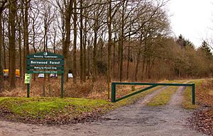
- Bernwood Forest
- Burnham Beeches
- Hollington Wood
- Jones Hill Wood
Cambridgeshire's Old Woods
The ancient woods listed here are all larger than 10 hectares. Almost all of them are also SSSIs, meaning they are protected for their special natural features. These woods are not spread evenly across the county. The fenland areas in the northeast have very few. However, there are many in the south, closer to Suffolk. More woods are found in the western half of the county, with three located near Peterborough.
| No. | Name | Public Access | Location & map links | Area (Ha) | Area (Acres) | Special Status |
|---|---|---|---|---|---|---|
| 1 | Aversley Wood | Yes | 52°25′25″N 0°17′28″W / 52.4236°N 0.2911°W TL163820 |
61 | 151 | SSSI, Woodland Trust |
| 2 | Balsham Wood | No | 52°07′19″N 0°19′11″E / 52.1219°N 0.3196°E TL589496 |
35 | 85 | SSSI |
| 3 | Bedford Purlieus NNR | Yes | 52°35′00″N 0°27′49″W / 52.5833°N 0.4635°W TL042995 |
208 | 514 | SSSI, National Nature Reserve (NNR), Forestry Commission |
| 4 | Brampton Wood | Yes | 52°19′02″N 0°16′13″W / 52.3172°N 0.2703°W TL180702 |
132 | 326 | SSSI, Wildlife Trust |
| 5 | Buff Wood | Yes | 52°08′10″N 0°07′36″W / 52.1361°N 0.1268°W TL283503 |
16 | 39 | SSSI, Wildlife Trust |
| 6 | Carlton Wood | No | 52°09′02″N 0°24′58″E / 52.15051°N 0.4161°E TL654530 |
10 | 25 | SSSI |
| 7 | Gamlingay Wood | Yes | 52°09′57″N 0°11′08″W / 52.1658°N 0.1855°W TL242535 |
46 | 114 | SSSI, Wildlife Trust |
| 8 | Hardwick Wood | Yes | 52°11′57″N 0°01′13″W / 52.1991°N 0.0203°W TL354575 |
17 | 42 | SSSI, Wildlife Trust |
| 9 | Hayley Wood | Yes | 52°09′33″N 0°06′51″W / 52.1593°N 0.1141°W TL291529 |
52 | 129 | SSSI, Wildlife Trust |
| 10 | Kingston Wood and Outliers | No | 52°10′06″N 0°03′50″W / 52.1684°N 0.064°W TL325540 |
49 | 121 | SSSI |
| 11 | Langley Wood | No | 52°03′24″N 0°20′33″E / 52.0567°N 0.3424°E TL607424 |
31 | 77 | SSSI |
| 12 | Little Paxton Wood | No | 52°15′26″N 0°17′14″W / 52.2572°N 0.2872°W TL170635 |
45 | 111 | SSSI |
| 13 | Madingley Wood | No | 52°13′00″N 0°02′57″E / 52.2168°N 0.0493°E TL401596 |
15 | 38 | SSSI |
| 14 | Monks Wood NNR | No | 52°24′18″N 0°14′15″W / 52.4049°N 0.2375°W TL200800 |
170 | 420 | SSSI, National Nature Reserve (NNR) |
| 15 | Out and Plunder Woods | No | 52°10′03″N 0°25′33″E / 52.1674°N 0.4258°E TL660549 |
28 | 69 | SSSI |
| 16 | Over and Lawn Woods | No | 52°06′35″N 0°23′15″E / 52.1097°N 0.3876°E TL636484 |
45 | 111 | SSSI |
| 17 | Perry Woods | No | 52°17′06″N 0°20′15″W / 52.2849°N 0.3375°W TL135665 |
67 | 165 | SSSI |
| 18 | Ten Wood | No | 52°10′31″N 0°25′56″E / 52.1754°N 0.4321°E TL664558 |
17 | 42 | SSSI |
| 19 | Thorpe Wood | Yes | 52°34′22″N 0°17′28″W / 52.5729°N 0.2912°W TL159986 |
12 | 28 | SSSI, Wildlife Trust |
| 20 | Warboys and Wistow Woods | No | 52°25′11″N 0°05′18″W / 52.4196°N 0.0883°W TL301819 |
42 | 103 | SSSI |
| 21 | Waresley Wood | No | 52°10′37″N 0°09′21″W / 52.177°N 0.1558°W T 262548 |
62 | 153 | SSSI |
| 22 | Weaveley and Sand Woods | No | 52°10′21″N 0°12′31″W / 52.1724°N 0.2086°W TL226542 |
76 | 188 | SSSI |
| 23 | West, Abbot's and Lound Woods | No | 52°35′54″N 0°26′11″W / 52.5983°N 0.4364°W TF060012 |
51 | 126 | SSSI |
Cheshire's Old Woods
Only about 4% of Cheshire is covered by woodland, which is half the national average. Since 1994, the Mersey Community Forest has been working to plant new trees and manage existing woodlands better. Cheshire has fewer ancient woodlands, and they are often smaller than in other counties. Many of these old woods are found in steep valleys called cloughs. Most of Cheshire's ancient woodlands are smaller than 10 hectares. In fact, 65% of them are smaller than 5 hectares. The list below only includes ancient woodlands larger than 10 hectares.
| No. | Woodland | Public access | Location | Area (ha) | Area (acre) | Special Status |
|---|---|---|---|---|---|---|
| 1 | Peckforton Woods | Yes | SJ 523577 | 54 | 133 | SSSI |
| 2 | Roe Park Woods | Yes | SJ 860585 | 34.6 | 85 | SSSI, Wildlife Trust |
| 3 | Wettenhall and Darnhall Woods | No | SJ 640624 | 52.6 | 130 | SSSI |
| 4 | Wimboldsley Wood | No | SJ 675642 | 19 | 47 | SSSI |
City of London's Ancient Woodland
Sadly, there are no ancient woodlands left within the actual City of London. However, the City of London Corporation helps manage large areas of woodland in other places. These include Epping Forest in Essex, Highgate Wood in Greater London, and Burnham Beeches in Buckinghamshire.
Cornwall's Old Woods
About 7.5% of Cornwall is covered by woodland. Here are some of its ancient woods:
- Steeple Woods - 16.2 Hectares (40 acres)
- Devichoys Wood - 16 Hectares (40 acres)
Cumbria's Old Woods
About 9.5% of Cumbria's land is woodland. A well-known ancient wood here is:
Derbyshire's Old Woods
- Shining Cliff Wood53°04′01″N 1°30′16″W / 53.06691°N 1.50450°W
Devon's Old Woods
Dorset's Old Woods
- Duncliffe Wood
- Holt Heath
- Powerstock Common
- Thorncombe Wood
Durham's Old Woods
- Brignall Banks SSSI
- Castle Eden Dene SSSI and National Nature Reserve (NNR)
- Hawthorn Dene SSSI
- Hesleden Dene
- Deepdale Wood
- Pontburn Woods
- Derwent Gorge SSSI and National Nature Reserve (NNR)
East Riding of Yorkshire's Old Woods
- Burton Bushes in Beverley Westwood
East Sussex's Old Woods
About 16.7% of East Sussex is covered by woodland.
Essex's Old Woods
- Epping Forest
- Hadleigh Woods
- Hockley Woods SSSI
- Hatfield Forest SSSI
- Nevendon Bushes
- Norsey Wood
Gloucestershire's Old Woods
About 11.2% of Gloucestershire is covered by woodland.
Greater London's Old Woods
- Bluebell Wood
- Cherry Tree Wood
- Coldfall Wood
- Highgate Wood
- Lesnes Abbey Woods
- Oxleas Wood SSSI
- Queen's Wood
- Ruislip Woods National Nature Reserve (NNR)
- Great North Wood
- Scratchwood
Greater Manchester's Old Woods
Hampshire's Old Woods
About 17.7% of Hampshire is covered by woodland, making it a very green county.
Herefordshire's Old Woods
Hertfordshire's Old Woods
About 9.5% of Hertfordshire's land is woodland.
- Ashridge Estate
- Benington High Wood
- Birchanger Wood, near Bishop's Stortford
- Broxbourne Woods National Nature Reserve (NNR), near Broxbourne
- Bush Wood
- Knebworth Woods
- Northaw Great Wood
- Sherrardspark Wood, near Welwyn Garden City
- Whippendell Wood, 160 acres, Watford
Isle of Wight's Old Woods
In 2014, a new list of all identified ancient woodland sites on the Isle of Wight was created.
- Brading Wood, part of the Brading Marshes RSPB reserve
- Parkhurst Forest
Kent's Old Woods
About 10.6% of Kent is wooded. This county actually has more ancient woodland than any other county in England!
- Barrows Wood, Trundle Wood and High Wood around Wormshill
- Chattenden Woods and Lodge Hill SSSI
- Cobham Woods
- Combwell Wood
- Darenth Wood SSSI
- East Blean Woods National Nature Reserve (NNR)
- Ham Street Woods National Nature Reserve (NNR)
- Parsonage Wood SSSI
- Robins Wood SSSI
- South Blean
- West Blean National Nature Reserve (NNR)
- Westerham Wood SSSI
- Yockletts Bank SSSI
Lancashire's Old Woods
- Boilton, Nab, Red Scar & Tun Brook woods, Preston
Leicestershire's Old Woods
It's thought that about 2% of Leicestershire is ancient woodland. Half of this has been replanted with new trees in recent times. There are over 100 woods in Leicestershire believed to be ancient. The places listed below are all larger than 10 hectares, and almost all of them are SSSIs.
Besides a group of woods near Hinckley in the southwest, the other woods are found in three main areas. In East Leicestershire, close to Rutland, are the woods near Leighfield Forest. This was once a huge Royal Forest. Northwest of Leicester are the woods of Charnwood Forest. Further west, you'll find woods in the coal mining areas near the Derbyshire border.
| No. | Woodland | Public access | Location | Area (ha) | Area (acre) | Special Status |
|---|---|---|---|---|---|---|
| 1 | Allexton Wood | No | 52°35′10″N 0°47′23″W / 52.5862°N 0.7896°W SP 821994 |
26 | 64 | SSSI |
| 2 | Buddon Wood, Quorn | No | 52°43′31″N 1°10′20″W / 52.7253°N 1.1723°W SK560145 |
45 | 111 | SSSI |
| 3 | Burbage and Sheepy Woods | Yes | 52°32′34″N 1°20′01″W / 52.5429°N 1.3335°W SP 453941 |
52 | 128 | SSSI, Local Government |
| 4 | Cloud Wood, Breedon | Yes | 52°47′19″N 1°22′59″W / 52.7886°N 1.3831°W SK 417214 |
35 | 86 | SSSI, Wildlife Trust |
| 5 | Dimminsdale | Yes | 52°47′33″N 1°26′33″W / 52.7925°N 1.4424°W SK 377 218 |
16 | 40 | SSSI, Wildlife Trust |
| 6 | Eye Brook Valley Woods | Yes (part) | 52°33′26″N 0°46′17″W / 52.5573°N 0.7713°W SP 834962 |
68 | 168 | SSSI, Wildlife Trust |
| 7 | Grace Dieu Wood | No | 52°44′56″N 1°21′14″W / 52.7489°N 1.354°W SK437170 |
52 | 128 | SSSI, National Forest |
| 8 | Hangingstone and Out Woods | Yes (part) | 52°44′37″N 1°14′35″W / 52.7437°N 1.243°W SK 512165 |
88 | 217 | SSSI, Local Government |
| 9 | Launde Big Wood and Launde Park Wood | Yes | 52°37′35″N 0°50′20″W / 52.6263°N 0.8388°W SK 787038 |
80 | 198 | SSSI, Wildlife Trust |
| 10 | Martinshaw Wood | Yes | 52°39′36″N 1°14′51″W / 52.6601°N 1.2474°W SK510072 |
103 | 255 | Woodland Trust |
| 11 | Owston Woods | No | 52°39′02″N 0°50′01″W / 52.6505°N 0.8337°W SK 790065 |
141 | 348 | SSSI |
| 12 | Pasture and Asplin Woods, Breedon | No | 52°47′25″N 1°22′11″W / 52.7903°N 1.3697°W SK 426216 |
42 | 104 | SSSI |
| 13 | Skeffington and Tilton Woods (Leighfield Forest) | No | 52°37′00″N 0°52′07″W / 52.6167°N 0.8685°W SK 767027 |
153 | 378 | SSSI |
| 14 | Swithland Wood | Yes | 52°42′27″N 1°12′13″W / 52.7075°N 1.2037°W SK 539125 |
75 | 185 | SSSI |
Lincolnshire's Old Woods
- Bradley and Dixon Woods, Grimsby 53°32′N 0°08′W / 53.53°N 0.13°W
- Legbourne Wood, Legbourne, Louth 53°19′42″N 0°03′19″E / 53.32839966°N 0.05528353°E
- Stapleford Woods, Stapleford, North Kesteven53°05′57″N 0°42′54″W / 53.099217°N 0.714969°W
- Reddings Woods, Kirkby on Bain, Lincolnshire, East Lindsey 53°08′46″N 0°09′18″W / 53.146°N 0.155°W
Merseyside's Old Woods
- Dibbinsdale, Wirral Hundred, Merseyside
Norfolk's Old Woods
North Yorkshire's Old Woods
- Grass Wood, Wharfedale54°05′06″N 2°01′04″W / 54.0851°N 2.0177°W
- Nidd Gorge, Knaresborough54°00′50″N 1°29′13″W / 54.014°N 1.487°W
Northamptonshire's Old Woods
The ancient woods in Northamptonshire are mostly found in the south and west of the county. This area borders Buckinghamshire, Oxfordshire, and Bedfordshire. Many of these woods are looked after by the Forestry Commission, while others are privately owned. They often grow on limestone soils in higher areas and have many different types of plants and animals.
- Hazleborough Wood, part of Whittlewood Forest
- Royal Forest of Rockingham
- Salcey Forest
- Whittlewood Forest
- Yardley Chase SSSI
Northumberland's Old Woods
- Allen Banks and Steward Gorge
- Whittle Dene
Nottinghamshire's Old Woods
- Sherwood Forest 53°12′16″N 1°04′22″W / 53.2045°N 1.0728°W
Oxfordshire's Old Woods
Oxfordshire's ancient woods are grouped in three main areas. In the south, you'll find woods in the Chiltern Hills. Another group is located east of Oxford. The Cotswolds woods, on the western side of the county, include those in the Royal Forest of Wychwood.
Oxfordshire has almost 18,000 hectares of woodland in total (6.9% of its area). Two-thirds of this is in woods larger than 10 hectares. About 1,839 hectares of woodland are covered by the 17 ancient woods listed below. Many smaller woods (under 10 hectares) also exist and might be ancient, but they are not included in this list. This list focuses on woods over 10 hectares that have SSSI status.
| No. | Woodland | Public access | Location & map link | Area (ha) | Area (acre) | Special Status |
|---|---|---|---|---|---|---|
| 1 | Aston Rowant Woods | Yes (part) | 51°40′46″N 0°55′00″W / 51.6794°N 0.9166°W SU750984 |
26 | 64 | SSSI |
| 2 | Bear, Oveys and Great Bottom Woods | No | 51°33′02″N 1°00′07″W / 51.5506°N 1.0019°W SU693840 |
45 | 111 | SSSI |
| 3 | Bould Wood | No | 51°52′55″N 1°38′02″W / 51.882°N 1.634°W SP253205 |
52 | 128 | SSSI |
| 4 | Harpsden Wood | Yes | 51°31′03″N 0°54′17″W / 51.5174°N 0.9046°W SU761804 |
35 | 86 | SSSI, Woodland Trust |
| 5 | Holly Wood LNR | No | 51°47′08″N 1°08′56″W / 51.7856°N 1.149°W SP588100 |
16 | 40 | SSSI |
| 6 | Holton Wood | No | 51°46′03″N 1°07′39″W / 51.7674°N 1.1276°W SP603080 |
68 | 168 | SSSI |
| 7 | Lambridge Wood | No | 51°33′17″N 0°56′34″W / 51.5546°N 0.9427°W SU734845 |
52 | 128 | SSSI |
| 8 | Out Wood | No | 51°53′03″N 1°24′31″W / 51.8843°N 1.4086°W SP408208 |
88 | 217 | SSSI |
| 9 | Pishill Woods | No | 51°36′19″N 0°58′08″W / 51.6052°N 0.969°W SU715901 |
80 | 198 | SSSI |
| 10 | Sarsgrove Wood | No | 51°54′59″N 1°33′29″W / 51.9164°N 1.558°W SP305243 |
103 | 255 | SSSI |
| 11 | Stanton Great Wood | No | 51°46′45″N 1°08′57″W / 51.7793°N 1.1491°W SP588093 |
141 | 348 | SSSI |
| 12 | Sturt Copse | No | 51°49′56″N 1°25′15″W / 51.8322°N 1.4209°W SP400150 |
42 | 104 | SSSI |
| 13 | Waterperry Wood | No | 51°46′35″N 1°07′28″W / 51.7764°N 1.1245°W SP605090 |
153 | 378 | SSSI |
| 14 | Whitecross Green and Oriel Woods | No | 51°49′30″N 1°07′35″W / 51.825°N 1.1265°W SP603144 |
75 | 185 | SSSI, Wildlife Trust |
| 15 | Woodeaton Wood | No | 51°47′51″N 1°20′56″W / 51.7976°N 1.3488°W SP450112 |
976 | 2412 | SSSI |
| 16 | Wychwood | No | 51°50′23″N 1°31′10″W / 51.8398°N 1.5195°W SP332158 |
530 | 1309 | SSSI, Wildlife Trust |
| 17 | Wytham Woods | No | 51°46′17″N 1°19′54″W / 51.7715°N 1.3318°W SP462083 |
61 | 151 | SSSI |
Rutland's Old Woods
- Burley Wood
- Prior's Coppice
Shropshire's Old Woods
- Wyre Forest National Nature Reserve (NNR) (also found in Worcestershire)
Somerset's Old Woods
Somerset is a county with rolling hills like the Blackdown Hills, Mendip Hills, Quantock Hills, and Exmoor National Park. It also has large flat areas known as the Somerset Levels. Many of the woodlands here are protected as SSSIs, and some are managed by wildlife trusts. Woodlands cover about seven percent of the county's land.
| Woodland | Public access | Coordinates and map link | Area (ha) | Area (acre) | Special Status | More Information |
|---|---|---|---|---|---|---|
| Aller and Beer Woods | No | 51°04′15″N 2°51′07″W / 51.0707°N 2.8520°W | 56.9 | 141 | SSSI | |
| Asham Wood | No | 51°12′45″N 2°25′25″W / 51.2124°N 2.4237°W | 140.6 | 347 | SSSI | |
| Cheddar Wood | Permit required | 51°17′36″N 2°47′50″W / 51.2932°N 2.7973°W | 86.9 | 215 | SSSI | |
| Cogley Wood | No | 51°06′32″N 2°25′32″W / 51.1090°N 2.4256°W | 60.7 | 150 | SSSI | |
| Dunkery and Horner Woods | Yes | 51°09′43″N 3°35′15″W / 51.1619°N 3.5874°W | 1604 | 3964 | SSSI, National Nature Reserve (NNR) | |
| Edford Woods and Meadows | No | 51°14′05″N 2°28′52″W / 51.2347°N 2.4812°W | 54.3 | 134 | SSSI | |
| Great Breach and Copley Woods | No | 51°05′06″N 2°42′55″W / 51.0851°N 2.7152°W | 64.8 | 160 | SSSI | |
| Harridge Wood | No | |||||
| Hawkcombe Woods | No | 51°12′06″N 3°35′36″W / 51.2017°N 3.5933°W | 101 | 250 | Proposed NNR | |
| North Exmoor | Yes | 51°10′25″N 3°43′04″W / 51.1736°N 3.7179°W | 12005.3 | 29666 | SSSI | |
| Leigh Woods | Yes | 51°27′47″N 2°38′21″W / 51.4631°N 2.6392°W | 155.4 | 384 | SSSI, National Nature Reserve (NNR) | |
| Limebreach Wood | No | 51°26′59″N 2°46′11″W / 51.4498°N 2.7698°W | ||||
| Longleat Woods | No | 51°11′25″N 2°17′41″W / 51.1903°N 2.2947°W | 249.9 | 618 | SSSI | |
| Long Dole Wood and Meadows | No | 51°18′13″N 2°33′39″W / 51.3036°N 2.5608°W | 9.8 | 24 | SSSI | |
| Neroche Forest | No | 50°56′15″N 3°02′12″W / 50.9375°N 3.0367°W | ||||
| Postlebury Wood | No | 51°11′08″N 2°22′24″W / 51.1856°N 2.3734°W | 87 | 215 | SSSI | |
| Prior's Park & Adcombe Wood | No | 50°56′50″N 3°06′09″W / 50.9471°N 3.1026°W | 103.6 | 256 | SSSI | |
| Sparkford Wood | No | 51°02′44″N 2°33′12″W / 51.0455°N 2.5534°W | 8.4 | 21 | SSSI | |
| Thurlbear Wood and Quarrylands | No | 50°59′01″N 3°02′29″W / 50.9837°N 3.0413°W | 26.7 | 66 | SSSI | |
| Towerhouse Wood | No | 51°26′39″N 2°45′22″W / 51.4441°N 2.7561°W | ||||
| Twinhills Woods and Meadows | No | 51°11′11″N 2°38′02″W / 51.1863°N 2.6338°W | 21.2 | 52 | SSSI | |
| Weston Big Wood | Yes | 51°28′17″N 2°47′10″W / 51.4713°N 2.7860°W | 37.48 | 93 | SSSI |
South Yorkshire's Old Woods
- Bagger Wood53°31′08″N 1°32′35″W / 53.519°N 1.543°W
- Beeley Wood53°25′47″N 1°31′32″W / 53.42972°N 1.52556°W
- Watchley Crags53°33′32″N 1°16′37″W / 53.55886°N 1.27681°W
Staffordshire's Old Woods
- Cannock Chase SSSI
Suffolk's Old Woods
- Arger Fen and Spouses Grove
- Assington Thicks
- Bradfield Woods National Nature Reserve (NNR)
- Bull's Wood
- Calves Wood
- Foxburrow Wood (Suffolk)
- Palant's Grove
- Snakes Wood
- Staverton Park and the Thicks
- Wolves Wood
Surrey's Old Woods
About 22.4% of Surrey is covered by woodland. This makes it the most wooded county in England!
Tyne and Wear's Old Woods
- Thornley Wood SSSI
- Derwent Walk Country Park woods
- Stanley Burn Wood
- Snipes Dene Wood, part of Gibside SSSI
- Lands Wood, Winlaton Mill
Warwickshire's Old Woods
- Bush Wood
- Rough Hill Wood
- Ryton Wood SSSI
West Midlands' Old Woods
- Sutton Park SSSI
- Rough Wood
West Sussex's Old Woods
About 18.9% of West Sussex is woodland.
- Titnore Wood
- Kingley Vale National Nature Reserve (NNR)
- Worth Forest
West Yorkshire's Old Woods
- Batty's Wood53°49′12″N 1°33′37″W / 53.820061°N 1.560144°W
Wiltshire's Old Woods
Worcestershire's Old Woods
- Grafton Wood
- Laight Rough
- Pepper Wood
- Shrawley Wood
- Wyre Forest (also found in Shropshire)
See also
- Ancient Woodland
- English land law
- Forest of Lyme
 | Kyle Baker |
 | Joseph Yoakum |
 | Laura Wheeler Waring |
 | Henry Ossawa Tanner |


