Malheur County, Oregon facts for kids
Quick facts for kids
Malheur County
|
|
|---|---|
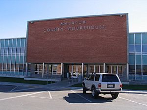
Malheur County Courthouse in Vale
|
|
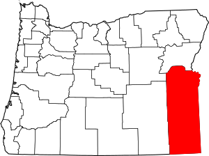
Location within the U.S. state of Oregon
|
|
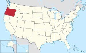 Oregon's location within the U.S. |
|
| Country | |
| State | |
| Founded | February 17, 1887 |
| Named for | Malheur River |
| Seat | Vale |
| Largest city | Ontario |
| Area | |
| • Total | 9,930 sq mi (25,700 km2) |
| • Land | 9,888 sq mi (25,610 km2) |
| • Water | 42 sq mi (110 km2) 0.4%% |
| Population
(2020)
|
|
| • Total | 31,571 |
| • Estimate
(2023)
|
32,044 |
| • Density | 3.1794/sq mi (1.2276/km2) |
| Time zones | |
| primary | UTC−7 (Mountain) |
| • Summer (DST) | UTC−6 (MDT) |
| southern fifth | UTC−8 (Pacific) |
| • Summer (DST) | UTC−7 (PDT) |
| Congressional district | 2nd |
Malheur County is one of the 36 counties in the state of Oregon. In 2020, about 31,571 people lived here. Its main town, called the county seat, is Vale. The biggest city in the county is Ontario.
The county got its name from the Malheur River, which flows through it. The word "malheur" comes from French and means "misfortune" or "tragedy." Malheur County is part of a larger area that includes Ontario and is also connected to the Boise area. It is considered part of Eastern Oregon.
Contents
History of Malheur County
Malheur County was officially created on February 17, 1887. It was formed from the southern part of Baker County. The first people to settle here were miners and ranchers in the early 1860s.
A big change happened in 1863 when gold was discovered. This brought more people to the area, leading to new towns and farms. Later, in the 1890s, many Basque people moved to the region. They mostly worked with sheep, raising them for wool and meat.
Geography of Malheur County
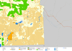
Malheur County is a very large area. It covers about 9,930 square miles (25,700 square kilometers). Most of this area, about 9,888 square miles (25,600 square kilometers), is land. Only a small part, about 42 square miles (109 square kilometers), is water.
It is the second-largest county in Oregon by size. It is also the only county in Oregon that is mostly in the Mountain Time Zone.
Neighboring Counties
Malheur County shares its borders with several other counties:
- Grant County (to the northwest)
- Baker County (to the north)
- Washington County, Idaho (to the northeast)
- Payette County, Idaho (to the east)
- Canyon County, Idaho (to the east)
- Owyhee County, Idaho (to the east)
- Humboldt County, Nevada (to the south)
- Harney County (to the west)
Protected Natural Areas
Some parts of Malheur County are protected natural areas:
- Deer Flat National Wildlife Refuge (a small part)
- Malheur National Forest (a small part)
- Whitman National Forest (a small part)
Major Highways
Many important roads run through Malheur County:
 I-84
I-84 US 20
US 20 US 26
US 26 US 30
US 30
 US 30 Bus.
 US 95
US 95 OR 52
OR 52 OR 78
OR 78 OR 201
Railroads in the County
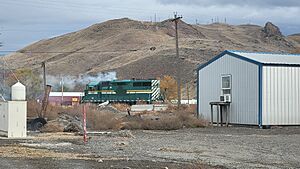
The main railroad in Malheur County is the Oregon Eastern Railroad. This train line connects Ontario to the Celatom Plant in Vale. It is a part of what used to be a much larger railroad system.
Time Zones in Malheur County
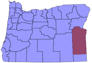
Malheur County is special because it has two different time zones. Most of the county is in the Mountain Time Zone. However, a small area in the southern part of the county is in the Pacific Time Zone. This is because that southern part is closer to Winnemucca, Nevada, which uses Pacific Time.
Population and People
| Historical population | |||
|---|---|---|---|
| Census | Pop. | %± | |
| 1890 | 2,601 | — | |
| 1900 | 4,203 | 61.6% | |
| 1910 | 8,601 | 104.6% | |
| 1920 | 10,907 | 26.8% | |
| 1930 | 11,269 | 3.3% | |
| 1940 | 19,767 | 75.4% | |
| 1950 | 23,223 | 17.5% | |
| 1960 | 22,764 | −2.0% | |
| 1970 | 23,169 | 1.8% | |
| 1980 | 26,896 | 16.1% | |
| 1990 | 26,038 | −3.2% | |
| 2000 | 31,615 | 21.4% | |
| 2010 | 31,313 | −1.0% | |
| 2020 | 31,571 | 0.8% | |
| 2023 (est.) | 32,044 | 2.3% | |
| U.S. Decennial Census | |||
In 2020, the population of Malheur County was 31,571 people. The county's population density was about 3.2 people per square mile. In 2010, about 31.5% of the people living in Malheur County were of Hispanic or Latino background.
Economy and Jobs
Most of Malheur County, about 94%, is rangeland. The government's Bureau of Land Management controls a large part of this land. In the northeast part of the county, there are many farms that use irrigation to grow different crops. Tourism is also an important part of Malheur County's economy.
The two biggest employers in the county are:
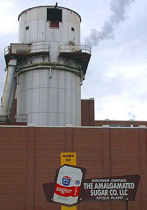
- Heinz in Ontario, which processes potatoes for brands like Ore-Ida.
- The Snake River Correctional Institution, a large prison located near Ontario.
Towns and Communities
Cities in Malheur County
- Adrian
- Jordan Valley
- Nyssa
- Ontario (the largest city)
- Vale (the county seat)
Census-Designated Places
These are areas that are like towns but are not officially incorporated as cities:
Small Villages and Hamlets
Other Communities
These are smaller, unincorporated communities:
- Basque
- Beulah
- Burns Junction
- Cairo
- Crowley
- Danner
- Harper
- Ironside
- Jamieson
- McDermitt, Nevada-Oregon
- Owyhee
- Riverside
- Rockville
- Rome
- Westfall
Ghost Towns
These are towns that used to exist but are now abandoned:
- Inskip Station
- Jonesboro
- Leslie Gulch
- Malheur City
- Payette Junction
- Wildhorse
Education in Malheur County
Schools for Kids (K-12)
Malheur County has several school districts:
- Adrian School District 61
- Annex School District 29 (students often go to Weiser High School in Idaho)
- Arock School District 81
- Burnt River School District 30J
- Harper School District 66
- Huntington School District 16J
- Jordan Valley School District 3
- Juntura School District 12 (elementary school only)
- McDermitt School District 51 (sends students to a school in Nevada)
- Nyssa School District 26
- Ontario School District 8
- Vale School District 84
There is also a special kind of public school called a charter school in Ontario, called Four Rivers Community School (4RCC).
Private schools in Ontario include:
- Treasure Valley Christian School
- St. Peter Catholic School
The very first school in the county, Eldorado School, opened in 1869.
Colleges and Higher Education
Treasure Valley Community College is located in Ontario. This college offers classes for students after high school.
Public Libraries
The Emma Humphrey Library is in Vale. The Ontario Community Library is in Ontario.
Error: no page names specified (help). In Spanish: Condado de Malheur para niños


