Milford Lake facts for kids
Quick facts for kids Milford Lake |
|
|---|---|

|
|
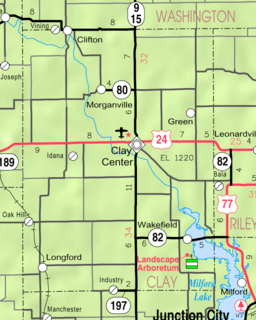
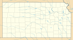
| Location | Geary / Clay / Dickinson counties in Kansas |
| Coordinates | 39°05′00″N 096°53′52″W / 39.08333°N 96.89778°W |
| Type | Reservoir |
| Primary inflows | Republican River |
| Primary outflows | Republican River to Kansas River |
| Basin countries | United States |
| Surface area | 15,700 acres (6,400 ha) |
| Max. depth | 65 ft (20 m) |
| Surface elevation | 1,148 ft (350 m) |
| Settlements | Junction City, Wakefield, Milford |
Milford Lake, also known as Milford Reservoir, is the biggest man-made lake in Kansas. It covers about 15,700 acres (64 km2) of water. Imagine a lake this big, created by people!
Around 33,000 acres (130 km2) of land around the lake is managed for fun activities. This land is also protected to keep its natural beauty and history safe. About 70% of this land is open for public hunting.
Contents
Building Milford Lake: A Big Project
Milford Lake was planned to help with many things. It was approved by the Flood Control Act in 1954. Its main jobs were to stop floods, provide water, keep water clean, help with navigation, and offer places for recreation and wildlife.
Construction of the Milford Dam started on July 13, 1962. It was built on the Republican River by the United States Army Corps of Engineers. This is a group that builds and manages important public works projects.
The dam is made of a huge amount of earth, about 15 million cubic yards! It has a special "uncontrolled spillway" on one side. This means it doesn't have gates like some dams, so water flows over it naturally when the lake gets too full. Normally, the lake holds about 388,000 acre-feet of water.
Moving Towns and Homes
Many different companies worked on building the lake. They had to build new roads and change old ones. They also moved railroad lines, city buildings in Wakefield and Milford, and even power and gas lines. Old cemeteries were moved too.
Sadly, two towns, Alida and Broughton, disappeared because of the lake. Their houses were either moved, torn down, burned, or buried.
In Alida, there was a large grain elevator. A local doctor wanted to turn it into a hotel. But studies showed the elevator wouldn't be safe once the lake filled up. It took six explosions over two days to finally bring it down!
Broughton was a busy town with two railroads. It had a stockyard, grain elevator, post office, school, church, and many homes. Even though the town is gone, people who remember it still hold an annual picnic.
Parts of Wakefield and Milford were moved to higher ground. Farms were taken apart, and trees were cleared from areas that would soon be underwater.
The Lake Fills Up
The lake began to fill on January 16, 1967. Six months later, on July 13, it reached its normal water level. Milford Lake was officially dedicated in May 1968. Lyndon B. Johnson, who was the President of the United States at the time, was supposed to come but couldn't make it.
Over the years, Milford Lake has saved a lot of money by preventing floods. It has prevented over $921 million in flood damage. This includes $250 million during the big flood season of 1993. The dam and reservoir cost about $49.7 million to build.
Milford Lake and Floods
This area has a long history of floods. Big floods happened in 1849, 1869, 1903, 1935, 1951, and 1993. Floods have happened almost every year since records began.
Before Milford Dam was Built
Long ago, Native Americans spoke of a huge flood in 1781. The 1849 flood was one of the first big ones reported by early European settlers. An old man who saw it as a boy said that many buffalo drowned and were washed into treetops. Because of a hard frost, their bodies were preserved, and people ate them until spring. When the bodies thawed, it might have caused a cholera outbreak.
The 1869 flood caused many deaths. Whole families were swept away. Some survivors clung to trees for hours, hoping for rescue. One story tells of a baby tied in a shirt to a tree, surrounded by water. Rescuers couldn't reach the baby for five hours because the current was too strong.
The 1935 flood had the highest combined water flow ever recorded for the Republican and Smokey Hill rivers. These rivers meet in Junction City, Kansas to form the Kansas River. A sudden, heavy rainstorm in Nebraska sent a wall of water down the Republican River. In Milford, eight boxcars were flipped over, and the train station was washed away. The Republican River even cut a new path near Alida.
The Great Flood of 1951 was the last major flood before Milford Dam was built. It caused about $6.5 million in damage in the Fort Riley and Junction City areas. After this disaster, local newspapers asked the government to build dams on the rivers to prevent future floods.
After Milford Dam was Built
The 1993 flood was the first major flood after Milford Lake Dam was finished. Many people who fought the flood believe it would have been much worse than the 1951 flood without the dam. The dam system helped a lot, reducing the loss of lives and property.
In 1993, there had been a lot of rain across the entire Midwest for months. The ground was completely soaked and couldn't absorb any more water. Rivers and levees were full. It kept raining. Lakes upstream closed their gates to avoid making the flooding worse downstream. But eventually, the rivers, levees, and lakes couldn't hold any more water. This led to the Great Flood of 1993, which was as big as the 1951 flood.
Milford Dam was built to protect the Kansas River Basin. Water from Milford Lake flows into the Kansas River at Junction City. The Kansas River then flows into the Missouri River at Kansas City. Finally, the Missouri River empties into the Mississippi River, which carries Milford Lake's water all the way to the Gulf of Mexico.
During the 1993 flood, Milford Dam held back floodwaters for weeks. The lake level rose 32 feet (9.8 m) above normal. At this point, the focus changed to protecting the dam itself. All new water flowing in had to be released. On July 19, 1993, the dam gates were fully opened, releasing water at a very fast rate. Rain continued, and the lake kept rising until water flowed over the uncontrolled spillway. The spillway is designed to guide the water safely back into the river below the dam.
Water flowed through the spillway for two weeks, reaching a maximum depth of 6 feet (1.8 m). This powerful rush of water washed away tons of soil, many trees, and part of the 244 Spur Highway. The pooling water from the spillway also threatened to damage U.S. Highway 77. To protect it, a culvert on State Highway 57 was intentionally broken. This allowed the floodwaters to drain back into the Republican River.
Throughout the entire flood, the dam worked as it was designed. It held back floodwaters, which greatly reduced damage downstream. Even with the highest water release, the riverbank right below the dam was damaged by erosion. In 1996-1997, repairs were made. The river channel was dug deeper by 12 feet (3.7 m) to prevent future damage during very high water releases. The removed rock was used to build a protective barrier. The riverbanks were reshaped and reinforced with rock.
People of Milford Lake Region
The Milford Lake area has almost always had people living in it. Places with lots of food, steady water, good weather, and varied land have always attracted humans. Here's a look at the people who lived in the Milford Lake region before the 1800s.
- Paleo-Indians (Big game hunters): These were the first people, living here 8,000 to 10,000 years ago. They hunted large animals.
- Archaic Indians (Hunter/Gatherers): From 6,000 BC to 0 AD, these groups hunted animals and gathered plants for food.
- Early Ceramic (Plains Woodland) (Farmers): Around 0 to 1000 AD, people started farming native plants. By 200 AD, some groups in the "Kansas City area" were growing corn.
- Middle Ceramic (Village farmers) (Advanced Farmers): From 1000 to 1500 AD, people started growing beans, corn, and squash. These groups were early ancestors of the Pawnee people.
- Late Ceramic (Kaw [Kansa] arrived) (New Arrivals): In the late 1700s and early 1800s, the Kaw (Kansa) Indians arrived. The Spanish introduced horses, changing how people hunted and traveled. The French gave the Kansa Indians their name. A map from 1784 shows a Kansa village near where the Washington Street bridge is in Junction City today.
The Bogan Site: An Ancient Village
Milford Lake has many important historical sites on government land, both old and more recent. The most famous is the Bogan Site. This was a small village with earthlodges, built and lived in by the Republican River Pawnee Indians.
The village was likely used in the late 1700s and possibly early 1800s. Because it was small and few items were found, it was probably only lived in for a short time. The village was built on a high hilltop overlooking the Republican River valley. This was a great spot to defend against enemies. A strong wall surrounded the village for protection.
In 1930, a local amateur archeologist did some digging at the Bogan Site. But he wrote down the wrong location, so the site was "lost" until 1964, when the Milford Lake Project was underway. In 1964, the University of Nebraska tested the site. Then, in 1967, the Kansas Historical Society studied it further. This was the last archeological study done at the Bogan Site.
The 1967 study found that the village had been completely destroyed by fire. Even the protective wall, or palisade, was burned. The wall was built by setting tall posts vertically in a trench around the village. Dirt was then filled in to hold the posts steady.
One house was dug up. Its floor was covered with clay. Posts that held up the walls and roof were set in three circles. The inner circle had 6 posts, the middle had 28, and the outer circle had 60 posts.
This house was about 44 feet (13 m) across. The frame of each house was covered with willow branches, thatched grass, and then sod (grass and soil). Evidence from two other house sites also showed they had been burned.
Eighty-one artifacts were found at the Bogan Site. Six of these are on display at the Milford Visitor Center.
It's possible the village was abandoned before it was fully settled. This would explain why the protective wall was so big, but there were only three houses. Building the wall took a lot of hard work. Trees were not common in Kansas back then, so people and horses likely had to bring trees from far away to build the wall and houses.
At the time of the Bogan Site, Kansa Indians had moved into Kansas and were known enemies of the Pawnee. It's not known if the Kansa Indians burned the village or if it was destroyed by a prairie wildfire.
No evidence of food stored in underground pits was found, and few artifacts were recovered. The Pawnee might have already left the village, or they might have been on a long hunting trip and taken all their valuable items with them when the village was destroyed.
The Bogan Site is the third Pawnee village found along the Republican River. The other two are the Kansas Monument Site (a 10-acre (40,000 m2) site near Republic, KS) and the Hill Site (a 25-acre (100,000 m2) site near Red Cloud, NE).
 | Aurelia Browder |
 | Nannie Helen Burroughs |
 | Michelle Alexander |


