
Milton Malsor facts for kids
Quick facts for kids Milton Malsor |
|
|---|---|
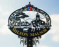
 Village sign erected 30 July 2014 |
|

Milton Malsor
|
|
| Population | 761 (2011 census) 713 (2001 census) |
| OS grid reference | SP734556 |
| • London | 66 miles (106 km) |
| Civil parish |
|
| Unitary authority |
|
| Ceremonial county | |
| Region | |
| Country | England |
| Sovereign state | United Kingdom |
| Post town | NORTHAMPTON |
| Postcode district | NN7 |
| Dialling code | 01604 |
| Police | Northamptonshire |
| Fire | Northamptonshire |
| Ambulance | East Midlands |
| EU Parliament | East Midlands |
| UK Parliament |
|
Milton Malsor is a village in West Northamptonshire, England. In 2011, about 761 people lived there.
The village is located 4 miles (6.4 km) south of Northampton town centre. It's also about 45 miles (72 km) south-east of Birmingham and 66 miles (106 km) north of central London. A major road, the M1 motorway, is only 2 miles (3.2 km) to the east. The area of Milton Malsor is about 1,650 acres (670 ha). It stretches from the M1 motorway in the north to the West Coast Main Line railway in the south.
Contents
- What's the History of Milton Malsor?
- How is Milton Malsor Governed?
- What is the Geography of Milton Malsor?
- Who Lives in Milton Malsor?
- What Businesses and Services are in Milton Malsor?
- What are the Landmarks in Milton Malsor?
- How to Get Around Milton Malsor?
- What About Education in Milton Malsor?
- What are the Religions in Milton Malsor?
- What is the Culture and Community Like?
- Images for kids
- See also
What's the History of Milton Malsor?

The name of the village comes from old English words. Middel means "Middle" and tun means "farm" or "settlement". The second part of the name, "Malsor," was added much later. It comes from a powerful local family called the Malsoures or Malesoures.
Milton Malsor was first written about in the Domesday Book of 1086. This book was created during the time of William the Conqueror. It shows that the village had two large estates, called manors. Two men, William Peverel and Goisfrid Alselin, owned land in Milton as part of their larger areas of control.
How is Milton Malsor Governed?
.jpg)
Milton Malsor has a Parish Council. This council has nine members who are chosen every four years. The last election was in 2015. The Parish Council looks after the local area. This area includes parts of the M1 motorway and major roads like the A508 and A43.
The local council for the village is now West Northamptonshire. Before 2021, it was part of the South Northamptonshire district. The person who represents the village in the UK Parliament is Chris Heaton-Harris. He is a member of the Conservative Party. He has been the Member of Parliament for the Daventry Parliamentary Constituency since 2010.
What is the Geography of Milton Malsor?

The fields around Milton Malsor tell a story about England's past. For example, a field called 'the Leys' still shows signs of old farming methods from the 1700s. Back then, land was divided into strips before it was enclosed into larger fields. The soil in the area is mostly sandy. This is because it used to be the bed of an ancient river.
You can see signs of sand and clay being dug up from the ground. This happened a lot in the 1800s and 1900s to help build new towns and industries. For instance, the small industrial area on Gayton Road is on an old clay quarry. The playing fields on Collingtree Road are on old sand quarries.
Discoveries in the Sand Quarries
In 1965, a worker found a shiny object while digging in a sand quarry. It turned out to be an ancient Bronze Age pot called a Cinerary Urn. This pot was used to hold ashes after someone was cremated.
There is also an area near the village that has been set aside for digging up sand. This sand is good for making mortar, which is used in building. Even though it's close to the village, it hasn't been developed yet.
Local Streams and Canals
A stream flows through the village. You can see it from Collingtree Road and Rectory Lane. In 1998, this stream flooded and caused some minor damage to houses. The stream eventually joins the River Nene near Upton.
The Grand Union Canal and its Northampton arm also pass nearby. This canal was built in 1815. There's a marina close to the road to Gayton. The canal has 17 locks that help boats travel downhill into Northampton and connect to the River Nene.
Who Lives in Milton Malsor?
The 2011 United Kingdom census showed that 761 people lived in the village. This was an increase from 713 people in 2001. In 2011, there were 359 males and 402 females. The average age of people living in the village was 41.1 years. There were 311 homes in the village.
New housing in the village is usually limited to filling in empty spaces. For example, 14 new houses were built in Chestnut Close in 2008. There was also a smaller project of 6 homes started in 2010. In 2010, a plan for 25 new houses was turned down. This was because it was outside the village boundary and went against local rules.
What Businesses and Services are in Milton Malsor?

.jpg)
Milton Malsor used to have two pubs. "The Greyhound" is on Towcester Road and has a large restaurant. "The Compass" on Green Street has been closed since 2020.
The village has a retirement home for older people called Holly House. There are also 26 flats and bungalows for older people provided by South Northants Homes Ltd.
You can find a shop and a former post office in the High Street. The modern village hall, which was updated in 2008, is also there. The Northampton Hilton Hotel is about 1.5 miles away in the nearby village of Collingtree.
Milton Malsor has two small industrial areas. The larger one is on Gayton Road. The smaller one is called 'Maple Court' and is near the M1 bridge. There are also offices in the old Rectory building and in the converted Hope Brewery.
A mobile library visits the village every two weeks. The closest regular library is about a mile north, near a large Tesco supermarket. There are three working farms in the area, including one that raises free-range eggs.
What are the Landmarks in Milton Malsor?

Much of Milton Malsor is a conservation area. This means it has special rules to protect its historic look. The village has many traditional stone cottages. Many of these have thatched or pantiled roofs. There are over 30 listed buildings in the village. These are buildings that are officially recognized as important and protected.
Some notable buildings include:
- Milton House (early 1700s) and Manor Cottage (1777) on Rectory Lane.
- Mortimers (early 1700s) on Rectory Lane. This house was once lived in by Revd Samuel Wathen Wigg, who started the Northampton Saints Rugby Football Club.
- Milton Malsor Manor (1500s) on Rectory Lane. James Harrington, who wrote the famous book "The Commonwealth of Oceana," used to live here. There's a blue plaque on the building to remember him.
- The Old Rectory on Rectory Lane, now used as offices.
- The Church of the Holy Cross on Collingtree Road. This Church of England church dates back to the 1100s.
- The Baptist Chapel (1827) on Green Street.
- Milton Parochial Primary School on Green Street.
- Milton Manor House on Malzor Lane (not to be confused with The Manor in Rectory Lane). This house has a special staircase from the 1600s.
- The War Memorial (around 1920) on the Village green.
- The Village Pound on High Street, which has been there since at least 1686.
- The Greyhound Public House on Towcester Road.
- The former Hope Brewery on Towcester Road, now offices.
- You can enjoy good views from the public footpath across the field called "The Leys" in Rectory Lane.
- Public footpaths in the village are clearly marked with green signs.
How to Get Around Milton Malsor?
Northamptonshire is a central hub for transport in the UK. The Northampton Loop of the West Coast Main Line railway runs through the area. This line carries trains from Northampton to London Euston.
The closest train stations are:
- Northampton (4 miles north)
- Milton Keynes Central (14 miles south)
- Wellingborough (12 miles east) on the Midland Main Line (with links to Sheffield, Leicester, and London St Pancras).
Travel times by road (without heavy traffic) are:
- Central London: 75 minutes
- Birmingham: 45 minutes
- Manchester: 120 minutes
- Oxford: 50 minutes
Travel times by train from Northampton (peak times):
- To Central London (Euston): 55 minutes
- To Birmingham: 65 minutes
Several airports are easy to reach, including Heathrow, Gatwick, Stansted, Birmingham Airport, Luton, and East Midlands. The village also has bus services to Northampton, Towcester, and Milton Keynes.
Railway Accidents Near Milton Malsor
There were two train accidents near the village in the late 1960s.
On April 18, 1967, a goods train had a wagon come off the tracks south of the village. This caused more wagons to derail further north. Some of these wagons moved onto another track and were hit by a passenger train going about 70 mph. Two passenger coaches came off the tracks, and one fell onto its side. All 45 passengers and crew were safely taken off the train. 21 people were hurt, but only two needed to stay in the hospital overnight. The driver of the passenger train was seriously injured but recovered well.
Local villagers helped out a lot during this accident. The report on the incident mentioned that "members of the Women's Institute of this village were quick to organise refreshment for those involved in the accident and their rescuers." The accident happened because of a broken spring on the goods train.
A similar accident happened on December 31, 1969, about a mile further south. Sadly, the driver of the passenger train in that accident was killed.
What About Education in Milton Malsor?
.JPG)
Milton Parochial Primary School is on Green Street. In 2007, it had 110 students. Many of these students came from the southern part of Northampton. A report from 2010 said, "This is a good school. The pupils make good progress and achieve well because the teaching is effective."
There is also a "Crazy 4 Kids After School and Holiday Club" located at the primary school. This club offers care for children after school and during holidays. The village is in the catchment area for Campion Secondary School in Bugbrooke. This school is about 6 miles (10 km) away, and students are taken there by bus every day.
What are the Religions in Milton Malsor?
The village has a church called the Holy Cross. It is a Church of England church and is part of the Peterborough Diocese. Since 2010, this church has been grouped with four other churches, including those in Blisworth and Stoke Bruerne. There is also a Baptist Chapel on Green Street. A joint church newsletter is delivered to homes about once a month.
What is the Culture and Community Like?
Milton Malsor has many active social groups. These include:
- A Women's Institute that meets every month.
- A village football club, Milton FC, with its own team and a reserve team.
- Indoor bowls and badminton groups that meet regularly at the village hall.
- A village historical society that holds meetings about local history.
- An art club that meets at the village hall during school terms.
The village also has a Scouts group, called 1st Collingtree and Milton Malsor Scouts. There is also a Brownies group. Both groups meet at the village hall during school terms.
Images for kids
-
Village sign erected 30 July 2014
See also
 In Spanish: Milton Malsor para niños
