Muck, Scotland facts for kids
| Gaelic name | Eilean nam Muc |
|---|---|
| Meaning of name | "sea pig", from Gaelic muc, "pig", a short form of muc-mhara, "whale". |
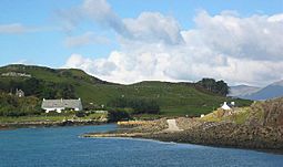 Port Mòr, from the harbour |
|
| OS grid reference | NM408794 |
| Coordinates | 56°50′N 6°15′W / 56.83°N 6.25°W |
| Physical geography | |
| Island group | Small Isles |
| Area | 559 ha (2.16 sq mi) |
| Area rank | 70 |
| Highest elevation | Beinn Airein, 137 m (449 ft) |
| Administration | |
| Sovereign state | United Kingdom |
| Country | Scotland |
| Council area | Highland |
| Demographics | |
| Population | 27 |
| Population density | 4.8/km2 (12/sq mi) |
| Largest settlement | Port Mòr |
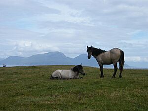
Muck (/ˈmʌk/; Scottish Gaelic: Eilean nam Muc) is the smallest of the four main islands in the Small Isles. These islands are part of the Inner Hebrides in Scotland. Today, much of Muck is used for grazing animals. People living here use wool from sheep to make rugs and clothes.
Muck has several old monuments and places for visitors to stay. The island has a small population of 27 people. They are served by one school, Muck Primary School & Nursery. The MacEwen family owns the island.
Contents
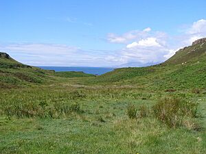
Exploring Muck's Landscape
How Muck Was Formed
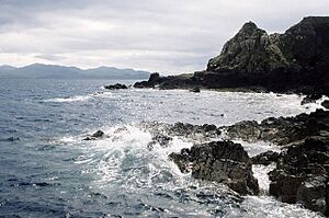
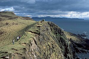
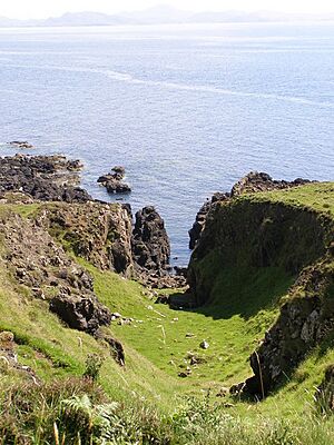
The island of Muck is mostly made of basalt rock. This rock was formed from ancient lava flows during the Palaeocene era. You can also find other types of lava rock, called hawaiite, along the south coast. These rocks are part of a larger formation seen on nearby Eigg island.
The lava flows have cracks called dykes. These dykes are made of basalt and dolerite. They generally run from the northwest to the southeast. There are also some faults (cracks in the Earth's crust) on the island.
Muck's Location and Size
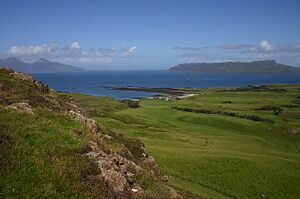
Muck is close to the other Small Isles: Canna, Rùm, and Eigg. The island is about 2.5 miles (4 km) long from east to west. The tallest hill on Muck is Beinn Airein, which is 137 meters (449 feet) high.
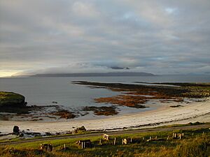
In 2011, 27 people lived on Muck. Most of them live near the harbour at Port Mòr. The only other settlement is a farm at Gallanach. A single road, about 2.5 km (1.5 mi) long, connects these two places. Muck is also known for its many seals. You can often see porpoises swimming in the waters around the island.
Getting Around and Island Life
Travel and Transport
A causeway and slipway were built at Port Mòr in 2005. This allows vehicles to get on and off the Caledonian MacBrayne ferry, the MV Lochnevis. This ferry connects Muck and the other Small Isles to the mainland port of Mallaig. The journey takes about 2.5 hours. Visitors usually cannot bring their own vehicles to the Small Isles.
During summer, another ferry, the MV Sheerwater, sails from Arisaig. Arisaig is about 10 miles (16 km) south of Mallaig.
Island Amenities
Muck does not have a church, a shop, or a post office. It is also unique among Scottish islands of its size because it does not have a post box. Until 1970, the island had no electricity. Diesel generators provided power at first. In 1999, two large wind turbines were built to provide electricity.
There is a hotel called Gallanach Lodge. You can also find other places to stay for holidays on the island.
What's in a Name?
The English name "Muck" comes from the Gaelic word muc. In 1785, James Boswell thought this meant "Sow's Island." However, it is now believed that the name refers to the many porpoises around the island. Porpoises were sometimes called muc-mhara, meaning "sea-pig." The island's owner in Boswell's time did not like the name. He tried to convince people that the real name was "Isle of Monk."
Muck's Past: A Journey Through Time
Early Days on Muck
People might have lived on Muck as far back as the Neolithic Era (New Stone Age). A tool called a thumbnail scraper was found at Toaluinn. A dagger from the Bronze Age (800-400 BC) was also found. There are several old burial mounds, called cairns, near Port Mòr.
During the Iron Age, a natural rock formation near Port Mòr was made into a fort. It was called Caistel nan Duin Bhan. A thick wall was built around its top. This fort was used until medieval times.
Local stories say that Columba, an Irish saint from the 6th century, visited Muck. He was Christianizing the region from his base on Iona. A field near the old graveyard in Kiel was called Dail Chill Fionain. This means "the field of Finnian's Church," referring to Columba's teacher. The remains of an old chapel are in the graveyard. The name of Glen Martin is also said to come from a hermit who lived there long ago.
Viking Times and Island Ownership
In the 9th century, Vikings took over the Small Isles and other parts of Scotland. They created the Kingdom of the Isles. At first, the only sign of Vikings on Muck was place names like Godag. Later, some remains of a building from this time were found. The Kingdom of the Isles became part of the Norwegian king's lands.
Later, a leader named Somerled made the Kingdom of the Isles independent. After he died, his family split the kingdom. The MacRory family ruled the area that included the Small Isles. In 1209, the MacRory family gave Muck to the Bishop of the Isles.
The Bishop's Island
Not much is known about how the Bishop managed Muck. In 1266, the Scottish king bought the whole Kingdom of the Isles. However, the Bishop still had a lot of power over Muck. In 1549, a church official named Donald Monro wrote about Muck. He said it was "very fertile and fruitful of cornes and grassing for all store." He also noted it was good for fishing and had a good harbour. He mentioned that the island belonged to the Bishop of the Isles.
The Bishop's records from 1561 show that the MacIans were his tenants on Muck. The MacIans were powerful landowners from the nearby mainland. Muck was a very fertile island, so it was a desirable place to live.
Changes in Ownership and Life
The MacIans had a long-standing feud with the MacLeans of Duart. In 1588, some ships from the Spanish Armada found safety with the MacLeans. The MacLeans used this chance to attack the Small Isles. The MacIans fought them off.
The Scottish reformation brought big changes to religion. Many people became Presbyterians. In 1617, the Bishop of the Isles sold Muck to Lachlan Maclean, the laird of Coll. Lachlan quickly removed the MacIans from Muck. He then gave the island to his younger son, Hector.
In 1650, the MacIans sought revenge. They landed on Muck at night to steal cattle. Hector Maclean shot at them, and one of the MacIans shot back, killing Hector. Hector had a son, who continued the line of the "MacLeans of Muck." They remained powerful landowners for a long time.
Health and Prosperity
In the 1700s, Muck had both Presbyterians and Roman Catholics. The MacLean landowners began to pressure tenants to change their religion. In 1773, Samuel Johnson and James Boswell heard about the laird's efforts to help his people. Johnson wrote that the laird had protected his people from smallpox by vaccinating eighty of them. This was a big help, as smallpox was very dangerous. The laird also brought in skilled workers like a smith and a tailor when needed.
Johnson also described Muck as a valuable island. It was about two miles long and three-quarters of a mile wide. He noted that it was mostly farmland. The laird kept half the land for himself. The other half supported 160 people who paid their rent with crops.
However, a later laird, Lachlan, got into debt. In 1802, he sold Muck to the leader of Clan Ranald. During the Napoleonic Wars, the price of kelp (seaweed) went up a lot. The Clan Ranald leader made tenants' plots smaller. This forced them to work harvesting kelp to survive.
In 1813, Muck was sold again to Colonel Alexander MacLean for a high price. But when the Napoleonic Wars ended, the price of kelp crashed. People could no longer afford their rents. In 1826, Colonel MacLean decided to replace his tenants with sheep. Many islanders moved to Canada or other parts of Scotland. By 1835, most had left.
Farming and Fishing Changes
In the late 1830s, the island was leased to John Cameron, a famous cattle-drover. He brought cattle to the island instead of sheep. Later, James Thorburn took over the lease and brought sheep back. Thorburn built roads and a threshing machine.
Muck was sold to Captain Swinburne in 1851. Swinburne invested in fishing. He built stone walls and a pier at Port Mòr. When not working on the farm, islanders fished in the Rockall area. The Thorburns successfully introduced Cheviot sheep.
In 1878, the Weir family became the farm tenants. They turned it into a dairy farm, making cheese. In 1891, Muck became part of the county of Inverness.
In 1896, Muck was sold to Robert Lawrie Thomson. He also owned Eigg. When Thomson died in 1913, Muck went to his brother, John MacEwen. John died in 1916, and Muck was left to his nephew, William Ivan Lawrence MacEwen. He left the Royal Navy and learned about farming. He took over the farm in 1922. His family has owned the island ever since. In the 1970s, the family built the hotel at Port Mòr. Today, a Trust set up by the MacEwen family manages Muck.
Prince of Muck Documentary
On May 18, 2022, BBC Four showed a documentary called Prince of Muck. It was about Lawrence MacEwen, who was the laird of the island. The documentary was shown nationally just two days after MacEwen passed away at age 81. Prince of Muck received a great review in The Telegraph. The reviewer called it a "film of elegiac brilliance."
 | Lonnie Johnson |
 | Granville Woods |
 | Lewis Howard Latimer |
 | James West |


