Namur (province) facts for kids
Quick facts for kids Namur |
|||
| Province of Belgium | |||
|
|||
| Country | |||
|---|---|---|---|
| Region | |||
| Capital | Namur | ||
| - coordinates | 50°28′N 4°52′E / 50.467°N 4.867°E | ||
| Highest point | Croix-Scaille | ||
| - location | Gedinne, Dinant, Namur | ||
| - elevation | 504 m (1,654 ft) | ||
| - coordinates | 49°57′03″N 4°50′44″E / 49.95083°N 4.84556°E | ||
| Area | 3,666 km² (1,415 sq mi) | ||
| Population | 491,285 (1 January 2017) | ||
| Density | 134 /km² (347 /sq mi) | ||
| Subdivisions | 3 Arrondissements 38 Municipalities |
||
| Governor | Denis Mathen | ||
| Timezone | CET (UTC+1) | ||
| - summer (DST) | CEST (UTC+2) | ||
| Postal codes | 5000–5999 | ||
| ISO 3166-2 | BE-WNA | ||
Namur (which is Namen in Dutch and Nameur in Walloon) is a province in Belgium. It shares a border with France. This province is one of the five provinces that make up Wallonia. Wallonia is the southern part of Belgium where most people speak French.
Contents
History of Namur Province
How Namur Became a Province
The story of Namur province began in 1795. At that time, the Austrian Netherlands and the Principality of Liège joined the French Republic. They became part of an older French area called Sambre-et-Meuse.
Namur in the Kingdom of the Netherlands
When the First French Empire ended, the Sambre-et-Meuse area was dissolved. It was replaced by the Province of Namur. This happened when the United Kingdom of the Netherlands was formed. The province of Namur was officially created by the Kingdom's Constitution on August 24, 1815.
Joining the Kingdom of Belgium
The United Kingdom of the Netherlands came to an end after the Belgian Revolution in 1830. After this, the province of Namur became a part of the new Kingdom of Belgium.
Geography of Namur Province
Where is Namur Located?
The province of Namur is located in Wallonia. It borders several other Walloon provinces. These are Hainaut, Walloon Brabant, Liège, and Luxembourg. Namur also shares a border with France.
Size and Population of Namur
The total area of Namur province is about 3,666 square kilometers (1,415 square miles). Many people live here, with a population density of about 131 people per square kilometer.
Highest Point and Capital City
The highest point in the province is a place called Croix-Scaille. It is 504 meters (1,654 feet) above sea level. The main city and capital of the province is Namur. Other important cities in the province include Dinant, Philippeville, Gembloux, Ciney, and Andenne.
Administrative Divisions of Namur
How Namur is Organized
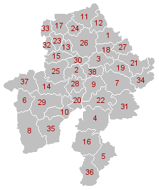
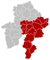
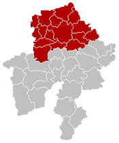
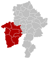
The province of Namur is split into three main areas called arrondissements. These arrondissements are further divided into a total of 38 smaller areas called municipalities. Each municipality has its own local government.
| Dinant | Namur | Philippeville |
|---|---|---|
|
|
|
Population Changes by Area
This table shows how the number of people living in each arrondissement has changed over the years. The numbers are from January 1st of each year.
| Arrondissement | 2007 | 2008 | 2009 | 2010 | 2011 | 2012 |
|---|---|---|---|---|---|---|
| Dinant | 104,017 | 104,719 | 105,378 | 105,998 | 107,099 | 107,593 |
| Namur | 294,320 | 296,494 | 298,835 | 301,472 | 304,287 | 306,672 |
| Philippeville | 63,646 | 64,167 | 64,392 | 64,811 | 65,449 | 65,840 |
| Province of Namur | 461,983 | 465,380 | 468,605 | 472,281 | 476,835 | 480,105 |
See also
 In Spanish: Provincia de Namur para niños
 | Shirley Ann Jackson |
 | Garett Morgan |
 | J. Ernest Wilkins Jr. |
 | Elijah McCoy |


