Otsego Lake (New York) facts for kids
Quick facts for kids Otsego Lake |
|
|---|---|
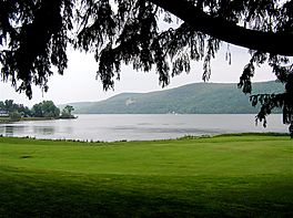
Southwest end of Otsego Lake
|
|
| Location | Otsego County, New York, United States |
| Coordinates | 42°45′23″N 74°53′46″W / 42.7564°N 74.8961°W |
| Type | Lake |
| Primary inflows | Hayden Creek, Shadow Brook, Trout Brook, Cripple Creek, Leatherstocking Creek, Willow Brook, Mohican Brook, Brookwood Creek, Glimmer Glen Creek |
| Primary outflows | Susquehanna River |
| Catchment area | 74 sq mi (190 km2) |
| Basin countries | United States |
| Max. length | 7.8 mi (12.6 km) |
| Surface area | 4,046 acres (16.37 km2) |
| Average depth | 82 ft (25 m) |
| Max. depth | 167 ft (51 m) |
| Water volume | 117,000,000,000 US gal (440,000,000 m3) |
| Residence time | 3 years |
| Shore length1 | 20.3 mi (32.7 km) |
| Surface elevation | 1,194 feet (364 m) |
| Islands | Sunken Island (sunken), Eel Island (sunken) |
| Settlements | Cooperstown |
| 1 Shore length is not a well-defined measure. | |
Otsego Lake is a beautiful lake in Otsego County, New York. It covers about 4,046-acre (16.37 km2) of water. This lake is super important because it's where the Susquehanna River begins! It's also the biggest lake in Otsego County.
At the southern end of the lake, you'll find the charming Village of Cooperstown. On the northeastern side, there's Glimmerglass State Park, home to Hyde Hall, a huge mansion built way back in 1817. The famous Glimmerglass Opera house, which opened in 1987, is on the western shore.
Long, long ago, between 10,000 and 12,000 years ago, giant glaciers shaped this valley. Otsego Lake formed when a huge chunk of ice carved out the Susquehanna River Valley. As the glaciers slowly melted, they filled the valley with water, creating the lake we see today.
The lake gets its name from the Iroquois Native Americans who lived here centuries ago. Otsego comes from a Mohawk or Oneida word meaning "place of the rock." This refers to a large boulder near where the lake's water flows out, which is now called Council Rock.
People in New York care a lot about Otsego Lake. Many groups work to protect its water quality and natural beauty. For example, State University of New York at Oneonta (SUNY Oneonta) has a special field station here for research. The lake is a popular spot for fun activities like fishing and boating.
Contents
Exploring Otsego Lake's Geography
Otsego Lake is about 7.8 miles (12.6 km) long and covers 4,046 acres (16.37 km2). Its water is usually 82 feet (25 m) deep, but in some spots, it can reach an amazing 167 feet (51 m)! The northern part of the lake is in the town of Springfield, and the southern part is in the town of Otsego. The eastern side touches the town of Middlefield.
The lake is the starting point for the Susquehanna River. This river flows south through New York, Pennsylvania, and Maryland. Finally, it empties into the Chesapeake Bay. A dam built in 1905 helps control the lake's water level.
Hidden Sunken Islands
Did you know there are sunken islands in Otsego Lake? Sunken Island is a sandy spot underwater near the western shore. It's about six miles (9.7 km) north of Cooperstown. People believe it's what's left of an island mentioned in old stories by writer James Fenimore Cooper. Today, it's several feet below the surface and marked with buoys to keep boats safe.
Another sunken island, Eel Island, is about seven miles (11 km) north of Cooperstown. It's much deeper than Sunken Island.
Beautiful Bays and Points
Otsego Lake has many interesting bays and points along its shores.
- Blackbird Bay is on the southwest end, right in Cooperstown.
- Just north of Blackbird Bay is Muskrat Cove, also called Rat Cove.
- Waterlily Bay is on the west side, about 2.5 miles (4.0 km) from the lake's southern end.
- At the very northern end is Hyde Bay, named after the Hyde family. Glimmerglass State Park is located here.
There are also many named points:
- Brookwood Point is on the southwest side.
- About one mile (1.6 km) north is Three Mile Point.
- Then comes Five Mile Point, where Mohican Brook flows into the lake.
- Just north of Five Mile is Six Mile Point.
- Continuing north, you'll find Hutter Point.
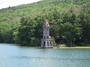
On the east side, near the lake's outlet, is Point Judith. This point is home to the historic Kingfisher Tower. It was once called Two Mile Point but was renamed after Judith Hutter from the book The Deerslayer.
- About one mile (1.6 km) north is Point Florence.
- Then comes Cherry Tree Point.
- About one mile (1.6 km) further north is Gravelly Point.
- Just north of Gravelly is Peggs Point.
- On the north end, west of Hyde Bay, is Clarke Point.
Mountains Around the Lake
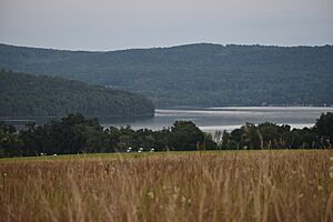
Several mountains surround Otsego Lake, each with its own story:
- Mount Wellington is on the north end, east of Hyde Bay. It's nicknamed "The Sleeping Lion" because it looks like a lion lying down when viewed from Cooperstown. It was named by George Hyde Clarke after a famous British general.
- Red House Hill is on the west side, west of Six Mile Point.
- Mount Ovis is on the west side, behind the Farmer's Museum. It was named around 1813 by James Fenimore Cooper's grandfather, who raised some of the first imported Merino sheep there.
- Mount Vision is on the east side, near the south end. Judge Cooper named it because it's where his father first saw the lake.
Otsego Lake's Fascinating History
The history of Otsego Lake is a mix of natural changes and human events.
How Glaciers Shaped the Lake
About 10,000 to 12,000 years ago, during the Wisconsin glaciation, a huge glacier slowly moved through this area. It carved out the valley where Otsego Lake now rests. As the glacier melted, it filled the valley with water. The glacier also exposed limestone in the area, which now flows into the lake. This limestone helps protect the lake from the harmful effects of acid rain.
You can still see signs of the glacier around the lake. These include hills made of rock and dirt (called moraines and drumlins) and layers of clay and sand. There's even evidence that the lake used to be much higher, forming what scientists call "Lake Cooperstown."
People and the Lake Through Time
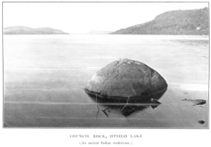
Before Europeans arrived, Iroquois Native Americans lived around Otsego Lake. The name Otsego comes from their language, meaning "place of the rock." This refers to "Council Rock," a large boulder near the lake's outlet. This rock is believed to have been a meeting place for Native Americans before the American Revolutionary War. Today, it's part of Council Rock Park in Cooperstown, open for everyone to enjoy.
In 1779, during the American Revolutionary War, General James Clinton and his soldiers did something amazing. They hauled 208 boats and supplies from the Mohawk River to Otsego Lake. They built a temporary dam at the lake's outlet to raise the water level. Then, they broke the dam, riding the floodwaters down the river to meet another general. This event is famous and even mentioned in James Fenimore Cooper's book The Pioneers.
In 1785, William Cooper settled at the south end of the lake and founded Cooperstown. One time, when food was scarce, a huge number of fish (probably American shad) appeared in the Susquehanna River. People used simple nets made of twigs to catch thousands of them, saving the community from hunger.
Between 1817 and 1834, the grand Hyde Hall was built at the north end of the lake. It's now a New York State Historic Site and a National Historic Landmark. A historic wooden covered bridge, Hyde Hall Bridge, was built in 1825 over the Shadow Brook, a stream flowing into the lake.
In the late 1800s, steamboats became popular on the lake, carrying passengers and goods. The last commercial steamboat stopped running in 1933.
In 1870, a fish hatchery was built at Three Mile Point. Thousands of fish were raised and released into the lake over the years. In 1968, SUNY Oneonta got access to the lake to build a research facility. Around the same time, the Otsego County Conservation Association (OCCA) was formed by people worried about water quality. SUNY Oneonta and OCCA still work together to keep the lake healthy. Glimmerglass State Park opened in the late 1960s.
In 1999, the entire lake and surrounding area, about 15,000-acre (61 km2), became part of the Glimmerglass Historic District. This district includes many historic features, like Hyde Hall.
Understanding the Lake's Geology
Otsego Lake is similar to the famous Finger Lakes because glaciers also carved them out. However, Otsego Lake is much higher up, at 1,194 feet (364 m), compared to the Finger Lakes, which are around 400 feet (120 m). Also, the Finger Lakes flow into Lake Ontario, but Otsego Lake is part of the Susquehanna River system.
The lake is known for being very deep in some places. It also has shallow areas, especially where streams flow into it. These shallow spots are where dirt and sand from the streams settle. This can slowly fill up parts of the lake over a long time. Sometimes, this even affects fish, like lake trout, whose spawning beds can get covered in silt.
The water in Otsego Lake takes about three years to completely refresh itself. Most of the water flows into the Susquehanna River. The lake is rich in nutrients, which helps plants grow. However, because the lake is so deep, these nutrients don't cause as many problems as they might in shallower lakes. Most of Otsego Lake stays clear and healthy, though some shallow bays might have more plant growth.
Protecting Otsego Lake's Watershed
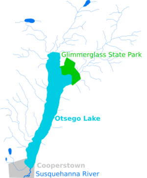
The area of land that drains into Otsego Lake is called its watershed. It covers about 75 square miles (190 km2) and includes parts of several towns and counties. This watershed is the very beginning of the huge 27,510-square-mile (71,300 km2) Susquehanna River watershed.
The lake provides drinking water for Cooperstown and people living along its shores. Scientists from SUNY Oneonta regularly check the lake's water. They found that streams flowing into the lake are the main source of phosphorus, a nutrient that can cause too much plant growth. Rain, snow, and even old septic systems also contribute.
Keeping Otsego Lake Healthy
Many efforts are made to keep Otsego Lake clean and healthy.
- A fish hatchery operated on the lake's west shore starting in 1870. It stocked over a million fish, including whitefish and salmon.
- In 1935, the New York State Conservation Department studied the lake's plants, fish, and water quality.
- Since 1968, SUNY Oneonta's Biological Field Station (BFS) has been doing important research on the lake.
- The Otsego County Conservation Association (OCCA) also works to improve water quality. They often team up with SUNY Oneonta.
- The Otsego Lake Association, a non-profit group, helps make sure the Otsego Lake Watershed Management Plan is followed.
In 2001, workers removed about 2,000 cubic yards (1,500 m3) of material from Clarke Pond at the lake's northwest end. They also fixed an old dam to help catch sediment. From 2002 to 2003, four wetlands in the watershed were restored. These projects help keep the lake water clean.
Since 1999, Cooperstown has used lighted buoys to mark a "no-wake zone" 200 feet (61 m) from shore. This means boats must go slowly near the edges of the lake to protect the shoreline and wildlife. Divers from the BFS install and remove these buoys every year.
Dealing with Invasive Species
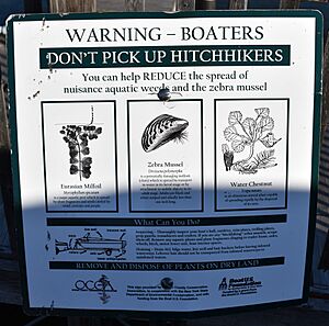
One big challenge for Otsego Lake is dealing with invasive species. These are plants or animals that are not native to the area and can harm the local ecosystem.
- Zebra mussels arrived in Otsego Lake in 2007. By 2010, they covered many areas where lake trout lay their eggs. These mussels can block eggs and make them easy targets for predators. They have also harmed native freshwater clams.
- Other invasive species found in the lake include eurasian milfoil, japanese knotweed, purple loosestrife, curly leaf pondweed, rusty crayfish, and starry stonewort.
- In August 2020, scientists found quagga mussels in the lake, which are similar to zebra mussels and can also cause problems.
To fight these invaders, Cooperstown started a boat inspection system in 2003. From May to October, all boats and trailers entering the lake are checked. If a boat has been in other waters, it's cleaned at a washing station to prevent spreading invasive species. The town of Springfield also has a similar program.
Stopping Pollution
Pollution is another concern for Otsego Lake. When Glimmerglass State Park first opened, its wastewater system allowed some pollutants into the lake. A new, better system was built by 1977, which greatly reduced pollution.
However, between 1988 and 1994, pollution increased again due to old septic systems and farm runoff. Because of this, a ban on detergents containing phosphates was put in place. Phosphates are nutrients that can cause too much algae to grow.
In 1998, Cooperstown switched from using sand to salt on its streets in winter. This change significantly reduced phosphorus runoff into the lake. Also, old septic systems around the lake were a problem. In 2005, a program began to inspect these systems. If a system was failing, the owner had to replace it to protect the lake.
Fun Activities at Otsego Lake
Otsego Lake is a fantastic place for outdoor fun and relaxation!
Fishing Adventures
Fishing is very popular on Otsego Lake. Fishermen often try to catch lake trout, walleye, and yellow perch. The lake also has a large population of smallmouth bass. Other fish you might find include brown trout, rock bass, largemouth bass, chain pickerel, Otsego bass, bluegill, redfin pickerel, pumpkinseed, and landlocked atlantic salmon.
Each year, thousands of young fish are added to the lake, including brown trout, lake trout, and walleye. Landlocked atlantic salmon are stocked every two years.
There are boat launches at both the north and south ends of the lake. The south end launch is in Cooperstown and open to everyone. The north end launch is for Springfield residents only. During the summer, there are even bass fishing tournaments!
Scientists have found that yellow perch and walleye populations have grown stronger. This is because an invasive fish called the alewife disappeared, reducing competition for food.
Cool Swimming Spots
There are several great places to go swimming in Otsego Lake:
- Three Mile Point is a public beach about three miles from Cooperstown on the western shore. It has changing rooms, picnic areas, and a pavilion.
- Fairy Springs is another swimming area, one mile from Cooperstown on the eastern shore. It's open from May to September and also has changing rooms and picnic spots.
- Public Landing is at the northern end of the lake. This spot is only for residents of the Town of Springfield.
- Glimmerglass State Park at the north end offers a beach, many picnic areas, and pavilions.
Lakefront Park in Cooperstown
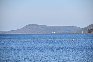
Lakefront Park is a lovely spot in Cooperstown right on the lake. You can sit on benches and enjoy the view, or listen to concerts held on the stage in summer. From the park, you can see Mount Wellington at the other end of the lake, looking like a "sleeping lion." The park also has docks where people can rent space to tie up their boats.
Otsego Lake in Famous Stories
Otsego Lake has inspired many writers!
The famous 19th-century American writer James Fenimore Cooper called the lake Glimmerglass in his novels. It was a main setting in his books The Pioneers, The Deerslayer, and Home as Found. He mentioned real places like Council Rock, Hutters Point, Gravelly Point, and Sunken Island in his stories. In The Deerslayer, Gravelly Point is where a character named Deerslayer has a dramatic encounter with a Huron Indian.
Otsego Lake is also mentioned in The Secret of Mirror Bay, a book from the popular Nancy Drew Mystery Stories series. In the story, Nancy Drew and her friends visit a cabin at Mirror Bay in Cooperstown to solve a mystery!
See also
 | Georgia Louise Harris Brown |
 | Julian Abele |
 | Norma Merrick Sklarek |
 | William Sidney Pittman |


