
Pittsfield, Massachusetts facts for kids
Quick facts for kids
Pittsfield
|
||
|---|---|---|

Park Square in downtown Pittsfield in 2014
|
||
|
||
| Motto(s): | ||

Location in Berkshire County and the state of Massachusetts.
|
||

Pittsfield, Massachusetts
Location in Massachusetts

Pittsfield, Massachusetts
Location in the United States
|
||
| Country | United States | |
| State | Massachusetts | |
| County | Berkshire | |
| Settled | 1752 | |
| Incorporated (town) | 1761 | |
| Incorporated (city) | 1891 | |
| Named for | William Pitt, 1st Earl of Chatham | |
| Government | ||
| • Type | Mayor–council | |
| Area | ||
| • Total | 42.46 sq mi (109.98 km2) | |
| • Land | 40.47 sq mi (104.81 km2) | |
| • Water | 1.99 sq mi (5.17 km2) | |
| Elevation | 1,039 ft (317 m) | |
| Population
(2020)
|
||
| • Total | 43,927 | |
| • Density | 1,085.47/sq mi (419.10/km2) | |
| Time zone | UTC−5 (Eastern) | |
| • Summer (DST) | UTC−4 (Eastern) | |
| ZIP Code |
01201
|
|
| Area code(s) | 413 | |
| FIPS code | 25-53960 | |
| GNIS feature ID | 0607643 | |

Pittsfield is the biggest city and the county seat of Berkshire County, Massachusetts, in the United States. It's the main city in the Pittsfield, Massachusetts Metropolitan Statistical Area, which covers all of Berkshire County. In 2020, Pittsfield had a population of 43,927 people. Even though its population has gone down recently, Pittsfield is still the third-largest city in Western Massachusetts. Only Springfield and Chicopee are larger.
In 2017, Pittsfield and Berkshire County were ranked as the number-one medium-sized community in the country for the arts. This ranking came from the Arts Vibrancy Index, put together by the National Center for Arts Research.
Contents
History of Pittsfield
The Mohicans, a Native American group, lived in Pittsfield and the areas around it until the early 1700s. Their population greatly decreased due to wars and diseases brought by European settlers. Many Mohicans moved west or were forced to live on the edges of their traditional lands.
In 1738, a rich man from Boston named Col. Jacob Wendell bought 24,000 acres of land. This land was originally called "Pontoosuck," a Mohican word meaning "a field or haven for winter deer." He bought it to divide and sell to new settlers. He teamed up with Philip Livingston and Col. John Stoddard, who also had claims to land there.
In 1743, a group of armed militia men came to clear the land. However, the danger of Native American resistance during King George's War made them leave. The land remained empty of English settlers for several more years.
Soon, many colonists arrived from Westfield, Massachusetts, and a village started to grow. In 1753, it was officially named Pontoosuck Plantation. Key settlers included Solomon Deming and his wife, who were among the first and longest-living colonists.
Pittsfield became an official town in 1761. The Royal Governor, Sir Francis Bernard, named it Pittsfield after the British politician William Pitt. By 1761, there were 200 residents in the new Township of Pittsfield.
By the end of the American Revolutionary War, Pittsfield's population grew to almost 2,000. One notable resident was Colonel John Brown. In 1776, he was one of the first to accuse Benedict Arnold of being a traitor, years before Arnold actually joined the British side.
Pittsfield became a farming area because of the many streams flowing into the Housatonic River. Mills were built to produce lumber, flour, paper, and textiles. In 1807, Merino sheep from Spain were brought in, making the area a major center for wool manufacturing in the United States. This industry was very important to the local economy for almost 100 years.
.png)

By the late 1800s, Pittsfield was a busy city. In 1891, it officially became the City of Pittsfield. Around this time, William Stanley Jr. moved his Electric Manufacturing Company to Pittsfield. He then created the first electric transformer. Stanley's company later became the famous General Electric (GE).
Thanks to GE's success, Pittsfield's population grew to over 50,000 by 1930. GE used to employ more than 13,000 people in Pittsfield. However, with changes and moves in GE's transformer and aerospace businesses, the workforce dropped to under 700. In 2015, SABIC, which owned GE Advanced Materials, announced it would move its headquarters from Pittsfield.
Today, General Dynamics uses many of the old GE buildings and is growing its workforce. Their success comes from government contracts for advanced information systems. In 2018, Massachusetts Governor Charlie Baker and other officials started a $13.7 million project. This project aims to build a new center for life sciences and advanced manufacturing in Pittsfield.
Presidential Incident in 1902
On September 3, 1902, President Theodore Roosevelt was visiting Pittsfield. While traveling in a horse-drawn carriage, it crashed head-on with a trolley. Roosevelt, Governor Winthrop Murray Crane, and a presidential secretary were thrown into the street. Sadly, Roosevelt's bodyguard, William Craig, was killed. He was the first Secret Service agent to die while protecting a president. Roosevelt was bruised but okay. The trolley driver was later found responsible for the accident.
Baseball History in Pittsfield

In 2004, a historian found an old rule from Pittsfield dating back to 1791. This rule banned playing "baseball" within 80 yards of the new meeting house. If this document truly refers to a game like modern baseball, it would be the earliest known mention of the game in America. You can find this document on the Pittsfield Library's website.
For a long time, people thought baseball was invented in 1839 by Abner Doubleday in Cooperstown, New York. This idea led to the opening of the National Baseball Hall of Fame there. However, many historians now believe that baseball didn't really start in one specific place.
The first college baseball game ever played was in Pittsfield in 1859. Amherst beat Williams College with a score of 73–32.

Ulysses Frank Grant, an African American baseball player, was born in Pittsfield in 1865. He played in the International League and for other teams in the 1800s.
Professional baseball was played at Pittsfield's Wahconah Park from 1894 to 2003. Many teams played there, including the Pittsfield Red Sox in the 1960s, with future famous players like Carlton Fisk. Later, the Pittsfield Cubs played there, featuring stars like Mark Grace.
Since 2012, Wahconah Park has been home to the Pittsfield Suns. They are part of the Futures Collegiate Baseball League, which is a summer league for college baseball players.
Several famous baseball players are from Pittsfield:
- Mark Belanger, a great shortstop for the Baltimore Orioles.
- Turk Wendell, a relief pitcher for the New York Mets.
- Tom Grieve, an outfielder for the Texas Rangers.
Pittsfield loves baseball at all ages. The city has two Little League teams, Pittsfield American and National, who are very strong in their league. In 2022, the Pittsfield 13U Babe Ruth team made it to the World Series Championship game. Pittsfield also hosted the 2023 Babe Ruth 15U New England Regional Tournament at Wahconah Park.
Both high schools in Pittsfield are known for their strong baseball and softball teams. Taconic High School won state championships in 2017 and 2019. In 2022, they were the top seed in their division. They beat city-rival Pittsfield High three times that year. However, Pittsfield High later upset Taconic in the Division III Sweet 16 game.
Geography of Pittsfield

Pittsfield is located at 42°27′N 73°15′W. The city covers about 42.46 square miles. About 4.70% of this area is covered by water. Pittsfield is surrounded by several towns, including Lanesborough to the north and Lenox to the south. It is about 135 miles west of Boston and 39 miles east of Albany, New York.
Most of Pittsfield's population lives in about a quarter of the city's land. Pittsfield is where the east and west branches of the Housatonic River meet. This river flows south towards Long Island Sound. The city is nestled between the Berkshire Hills to the east and the Taconic Range to the west.
Pittsfield State Forest is in the western part of the city. It's an 11,000-acre park with trails for hiking and cross-country skiing. It also has camping, picnic areas, and a beach for swimming.
Pittsfield is a major crossroads for two U.S. Highways: Route 7 and Route 20. These two roads join together in the city. The nearest interstate highway, Interstate 90 (the Massachusetts Turnpike), is about 10 miles south.
You can travel to Pittsfield by train at the Joseph Scelsi Intermodal Transportation Center. This center also serves as a hub for local buses. Freight trains also use the rail lines here. For air travel, the Pittsfield Municipal Airport offers flights for private and chartered planes. The closest airport with national flights is Albany International Airport.
Climate in Pittsfield
Pittsfield has a humid continental climate. This means it has four distinct seasons. Winters are cold due to the city's high elevation (1,039 feet). On average, Pittsfield gets 73 inches of snow each year. Temperatures can drop to 0°F or colder about 13 times a year.
Summers are usually warm and pleasant. Temperatures reach 90°F only about six times a year. The highest temperature ever recorded was 101°F in July 1926. The lowest was -26°F in February 1943. Pittsfield has measurable rain or snow on about 173 days each year.
| Climate data for Pittsfield Municipal Airport, Massachusetts, 1991–2020 normals, extremes 1925–present | |||||||||||||
|---|---|---|---|---|---|---|---|---|---|---|---|---|---|
| Month | Jan | Feb | Mar | Apr | May | Jun | Jul | Aug | Sep | Oct | Nov | Dec | Year |
| Record high °F (°C) | 65 (18) |
73 (23) |
81 (27) |
91 (33) |
94 (34) |
100 (38) |
101 (38) |
100 (38) |
95 (35) |
85 (29) |
78 (26) |
67 (19) |
101 (38) |
| Mean maximum °F (°C) | 53.8 (12.1) |
53.1 (11.7) |
62.5 (16.9) |
78.0 (25.6) |
85.0 (29.4) |
87.6 (30.9) |
88.9 (31.6) |
87.4 (30.8) |
84.5 (29.2) |
75.0 (23.9) |
66.1 (18.9) |
57.5 (14.2) |
90.5 (32.5) |
| Mean daily maximum °F (°C) | 30.1 (−1.1) |
33.1 (0.6) |
41.7 (5.4) |
55.2 (12.9) |
67.0 (19.4) |
74.6 (23.7) |
79.3 (26.3) |
77.6 (25.3) |
70.4 (21.3) |
58.3 (14.6) |
46.6 (8.1) |
35.5 (1.9) |
55.8 (13.2) |
| Daily mean °F (°C) | 22.0 (−5.6) |
24.1 (−4.4) |
32.4 (0.2) |
44.5 (6.9) |
55.7 (13.2) |
63.9 (17.7) |
68.7 (20.4) |
67.1 (19.5) |
59.7 (15.4) |
48.4 (9.1) |
37.9 (3.3) |
28.2 (−2.1) |
46.1 (7.8) |
| Mean daily minimum °F (°C) | 13.9 (−10.1) |
15.0 (−9.4) |
23.1 (−4.9) |
33.8 (1.0) |
44.4 (6.9) |
53.1 (11.7) |
58.0 (14.4) |
56.5 (13.6) |
48.9 (9.4) |
38.5 (3.6) |
29.2 (−1.6) |
20.9 (−6.2) |
36.3 (2.4) |
| Mean minimum °F (°C) | −7.0 (−21.7) |
−2.8 (−19.3) |
4.7 (−15.2) |
21.6 (−5.8) |
30.7 (−0.7) |
39.8 (4.3) |
47.9 (8.8) |
45.6 (7.6) |
34.7 (1.5) |
24.1 (−4.4) |
14.5 (−9.7) |
2.5 (−16.4) |
−8.7 (−22.6) |
| Record low °F (°C) | −22 (−30) |
−26 (−32) |
−10 (−23) |
10 (−12) |
24 (−4) |
31 (−1) |
40 (4) |
32 (0) |
23 (−5) |
14 (−10) |
−1 (−18) |
−23 (−31) |
−26 (−32) |
| Average precipitation inches (mm) | 2.67 (68) |
2.52 (64) |
3.08 (78) |
3.38 (86) |
3.79 (96) |
4.58 (116) |
4.18 (106) |
3.82 (97) |
4.50 (114) |
4.56 (116) |
3.52 (89) |
3.63 (92) |
44.23 (1,122) |
| Average snowfall inches (cm) | 18.2 (46) |
19.3 (49) |
13.4 (34) |
3.1 (7.9) |
0.0 (0.0) |
0.0 (0.0) |
0.0 (0.0) |
0.0 (0.0) |
0.0 (0.0) |
0.1 (0.25) |
3.5 (8.9) |
15.2 (39) |
72.8 (185.05) |
| Average precipitation days (≥ 0.01 in) | 12.1 | 11.8 | 13.0 | 13.5 | 14.1 | 14.9 | 14.8 | 14.7 | 13.4 | 13.5 | 12.2 | 13.4 | 161.4 |
| Source 1: NOAA | |||||||||||||
| Source 2: National Weather Service | |||||||||||||
Housatonic River and Environmental Cleanup
The Housatonic River flows through Pittsfield. In the late 1800s, many factories were built along the river. In 1890, William Stanley Jr. started the Stanley Electric Manufacturing Company in Pittsfield. This company made electrical parts like transformers. In 1903, General Electric (GE) bought Stanley Electric. GE then ran three large factories in Pittsfield, making transformers, weapons, and plastics.
Environmental Issues
In the mid-1900s, the Housatonic River and its nearby areas became polluted. This was due to chemicals called polychlorinated biphenyls (PCBs) and other harmful substances. These were released from the GE facility in Pittsfield. The polluted area is known as the General Electric/Housatonic River Site. It includes the GE factory, the river, its banks, and other areas affected by GE's operations.
The highest levels of PCBs in the Housatonic River are found from the GE plant in Pittsfield down to Woods Pond in Lenox, Massachusetts. Birds and fish living in and around the river have high levels of PCBs in their bodies.
Cleanup Efforts and Progress

Starting in 1991, the U.S. Environmental Protection Agency (EPA) began legal actions to clean up the General Electric/Housatonic River Site. In 1996, the EPA ordered GE to remove highly polluted sediments and soil. The site was added to the Superfund list in 1997, which means it's a very polluted area needing major cleanup.
A big step happened in 1999. The EPA, the state, GE, and the city agreed on a plan to clean up Pittsfield and the Housatonic River. This agreement was worth over $250 million. Between 2005 and 2018, GE finished cleaning and restoring 10 factory areas in the city. They continue to check and maintain these areas.
However, the cleanup of the polluted river areas downstream is still ongoing. In 2020, the EPA approved the final cleanup plan. Some groups appealed this plan, concerned about a new landfill for the waste. In 2022, the appeal was denied, and the EPA continued planning the new PCB disposal facility. In July 2023, a court rejected another challenge to the cleanup plan.
Over the years, the EPA, state agencies, the City, and GE have completed one of the largest cleanups in the country. The first half-mile of the Housatonic River next to the GE factory was cleaned by 2002. By 2007, $90 million was spent cleaning a 1.5-mile section of the river. Tests showed that PCB levels in the river were reduced by about 99% after the cleanup. GE also removed polluted soil from 27 homes along the river. By 2019, GE had finished cleaning and restoring the 10 factory areas in the city. They are still inspecting and maintaining these sites.
Pittsfield's Population and People
| Historical population | ||
|---|---|---|
| Year | Pop. | ±% |
| 1790 | 1,992 | — |
| 1800 | 2,261 | +13.5% |
| 1810 | 2,665 | +17.9% |
| 1820 | 2,768 | +3.9% |
| 1830 | 3,559 | +28.6% |
| 1840 | 3,747 | +5.3% |
| 1850 | 5,872 | +56.7% |
| 1860 | 8,045 | +37.0% |
| 1870 | 11,112 | +38.1% |
| 1880 | 13,364 | +20.3% |
| 1890 | 17,281 | +29.3% |
| 1900 | 21,766 | +26.0% |
| 1910 | 32,121 | +47.6% |
| 1920 | 41,763 | +30.0% |
| 1930 | 49,677 | +18.9% |
| 1940 | 49,684 | +0.0% |
| 1950 | 53,348 | +7.4% |
| 1960 | 57,879 | +8.5% |
| 1970 | 57,020 | −1.5% |
| 1980 | 51,974 | −8.8% |
| 1990 | 48,622 | −6.4% |
| 2000 | 45,793 | −5.8% |
| 2010 | 44,737 | −2.3% |
| 2020 | 43,927 | −1.8% |
| 2022* | 43,310 | −1.4% |
| * = population estimate. Source: United States Census records and Population Estimates Program data. Source: |
||
In 2000, Pittsfield had 45,793 people living in 19,704 households. Pittsfield is the most populated city in Berkshire County. It is also the 27th largest city or town in Massachusetts. The city had about 1,124 people per square mile, making it the most densely populated place in Berkshire County.
In 2017, most of the people in Pittsfield were white (87.4%). There were also black (4.7%), Asian (2.0%), and Native American (0.4%) residents. About 6.0% of the population identified as Hispanic or Latino.
The largest ancestry groups in Pittsfield include:
About 7.3% of the population were immigrants. The most common countries of origin for immigrants were Ecuador, China, Mexico, and the Dominican Republic.
In 2010, about 27.3% of households had children under 18. About 42.9% were married couples. The average household had 2.26 people, and the average family had 2.89 people.
The median age in Pittsfield in 2010 was 40 years old. About 23.2% of the population was under 18. About 18.6% were 65 years or older. The median income for a household was $35,655. About 11.4% of the population lived below the poverty line.
Education in Pittsfield
Pittsfield has a public school system with over 6,000 students. There are eight elementary schools, two middle schools, and two high schools. The high schools are Pittsfield High School and Taconic High School. Both high schools offer special programs for learning job skills. Students from nearby Richmond also attend these high schools.
Pittsfield used to have two private Catholic schools, but they have both closed recently.
Pittsfield is home to the main campus of Berkshire Community College. It also has a campus for Mildred Elley. The closest state college is the Massachusetts College of Liberal Arts in North Adams. The nearest state university is Westfield State University. Private colleges nearby include Williams College and Bard College at Simon's Rock. Pittsfield also has the Berkshire Music School, where you can take music lessons.
Things to See and Do in Pittsfield
Culture and Arts

Pittsfield is the center of the Berkshires, a historic area known for its culture. This region includes Tanglewood, where the Boston Symphony Orchestra performs in the summer. Many buildings in Pittsfield are listed on the National Register of Historic Places.
Downtown Pittsfield has many interesting places:
- The historic Colonial Theatre
- The Berkshire Museum
- The Beacon Cinema (a movie theater)
- The Barrington Stage Company
- The Berkshire Athenaeum (library)
- Wahconah Park (baseball stadium)
- Hebert Arboretum (a nature area)
In recent years, downtown Pittsfield has been greatly improved. There are new restaurants, apartments, and cultural attractions.

The Colonial Theatre, built in 1903, was called a National Historic Treasure in 1998. Over $22 million was spent to fix up this 100-year-old theater. It's one of the few theaters of its kind left from the Vaudeville era. People say it has "one of the finest acoustical theaters in the world."
The Barrington Stage Company, which won a Tony Award, has also invested a lot in its downtown Pittsfield stage. They also developed other smaller stages. William Finn, who leads their Musical Theatre Lab, wants to make Pittsfield the "epicenter of the musical theater universe."
Pittsfield has some of the oldest homes in the Berkshires, dating back to the mid-1700s. It also has many historic neighborhoods from the late 1800s and early 1900s. Some small, family-run farms still exist in Pittsfield, though some land has been developed.
Other cultural places to visit include:
- Arrowhead, the home of famous author Herman Melville. He wrote Moby Dick here between 1850 and 1863.
- The Silvio O. Conte National Archives and Records Administration.
Outdoor Fun and Recreation
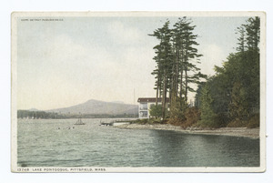
Pittsfield has several country clubs, like the Pontoosuc Lake Country Club. The city is home to two large lakes, Onota and Pontoosuc. Both are great for swimming, boating, and fishing. The Berkshire Rowing and Sculling Society is located on Onota Lake.
Canoe Meadows Wildlife Sanctuary is in Pittsfield. It's a 264-acre area of woods, fields, and wetlands. It's cared for by the Massachusetts Audubon Society. Bousquet Ski Area and Summer Resort offers skiing in winter and water slides and go-karts in summer.
Pittsfield State Forest is an 11,000-acre park. It has trails for hiking and cross-country skiing, camping, and picnic areas. There's also a swimming beach. Berry Pond, the highest body of water in Massachusetts, is at the top of Pittsfield State Forest.
The Berkshire Bike Path Council is working to extend the Ashuwillticook Rail Trail. This is a 10.8-mile paved trail just north of Pittsfield. The plan is to extend it through Pittsfield and south to Lenox and Great Barrington.
Getting Around Pittsfield

Downtown Pittsfield is where two major U.S. Highways meet: US 7 and US 20.
You can travel to Pittsfield by train using Amtrak's Lake Shore Limited service. There's also a seasonal Berkshire Flyer train from New York City. These trains arrive at the Joseph Scelsi Intermodal Transportation Center.
Local buses are provided by the Berkshire Regional Transit Authority.
Media in Pittsfield
Newspapers
- The Berkshire Eagle: This is the main daily newspaper for the Pittsfield area.
- Hill Country Observer: A monthly newspaper that covers a wider region.
Television
Pittsfield is part of the Albany television market. You can watch local channels like MyNetworkTV affiliate WNYA and NBC affiliate WNYT. Cable TV subscribers in Pittsfield can also watch public, educational, and government (PEG) channels provided by Pittsfield Community Television (PCTV). These channels offer local programming 24 hours a day.
Radio
Pittsfield has several radio stations:
- 1110 kHz WUPE (Oldies music)
- 1340 kHz WBRK (Adult Standards music)
- 1420 kHz WBEC (Talk radio)
- 89.7 MHz WTBR-FM (Rock music)
- 95.9 MHz WBEC-FM (Top 40 music)
- 101.7 MHz WBRK-FM (Adult Contemporary music)
- 104.3 MHz WRRS-LP (Radio Reading Service)
- 106.1 MHz W291CH (Relays WFCR, the local NPR station)
You can also pick up radio signals from nearby cities like North Adams, Great Barrington, and Springfield, as well as from Albany, New York.
Businesses in Pittsfield
Pittsfield is home to several important businesses:
- SABIC-Innovative Plastics: This company used to be part of General Electric and makes advanced plastic materials.
- General Dynamics Mission Systems: This facility was originally part of General Electric and works on defense systems.
- Interprint Incorporated: A company located on the Pittsfield-Richmond border.
- The Moscow Ballet: A national touring dance company known for its Great Russian Nutcracker show.
- Pittsfield Generating Facility: A power plant that uses natural gas.
- The Berkshire Humane Society: This organization helps animals and offers pet adoption services.
Famous People from Pittsfield
- Elizabeth Banks: An actress known for films like The Hunger Games.
- Mark Belanger: A Gold Glove winning shortstop for the Baltimore Orioles.
- Roger E. Broggie: Chosen by Walt Disney as the first Imagineer, helping create Disneyland.
- Silvio O. Conte: A well-known congressman.
- Art Ditmar: A pitcher for the Philadelphia and Kansas City Athletics and New York Yankees.
- Marshall Field: Founded the famous Chicago department stores, Marshall Field's.
- Daniel Fox: Helped invent Lexan plastic.
- Frank Grant: A 19th-century African American baseball player.
- Tom Grieve: A player and general manager for the Texas Rangers.
- Gene Hermanski: A baseball player for the Brooklyn Dodgers.
- Oliver Wendell Holmes Sr.: A famous poet who spent summers in Pittsfield.
- Hung Huynh: Winner of the reality TV show Top Chef Season 3.
- Herman Melville: The author who wrote Moby-Dick while living at Arrowhead in Pittsfield.
- Adrian Pasdar: An actor.
- Brian Piccolo: A Chicago Bears football player, whose story was told in the movie Brian's Song.
- Emily Robison: A musician and member of the Dixie Chicks.
- Richard Salwitz: A musician with the J Geils Band.
- William Stanley Jr.: Invented the first alternating current electrical transformer.
- Turk Wendell: A relief pitcher in Major League Baseball.
- Jack Welch: A former CEO of General Electric.
- Robin Williams: A famous actor who had a summer home in Pittsfield.
- Stephanie Wilson: An astronaut.
See also
 In Spanish: Pittsfield (Massachusetts) para niños
