
Plaquemines Parish, Louisiana facts for kids
Quick facts for kids
Plaquemines Parish
|
||
|---|---|---|

Plaquemines Parish Courthouse
|
||
|
||

Location within the U.S. state of Louisiana
|
||
 Louisiana's location within the U.S. |
||
| Country | ||
| State | ||
| Founded | 1807 | |
| Named for | Louisiana French word for persimmons | |
| Seat | Pointe à la Hache | |
| Largest community | Belle Chasse | |
| Area | ||
| • Total | 2,567 sq mi (6,650 km2) | |
| • Land | 780 sq mi (2,000 km2) | |
| • Water | 1,787 sq mi (4,630 km2) 70% | |
| Population
(2020)
|
||
| • Total | 23,515 | |
| • Density | 30.15/sq mi (11.64/km2) | |
| Time zone | UTC−6 (Central) | |
| • Summer (DST) | UTC−5 (CDT) | |
| Congressional district | 1st | |

Plaquemines Parish is a special kind of county called a parish in the U.S. state of Louisiana. It's located at the very end of the Mississippi River where it meets the Gulf of Mexico.
About 23,515 people lived here in 2020. The main town, or parish seat, is Pointe à la Hache. The biggest community is Belle Chasse. This parish was created way back in 1807.
Plaquemines Parish is part of the larger New Orleans area. It has faced a lot of damage from strong storms, especially Hurricane Katrina in 2005.
History of Plaquemines Parish
The name "Plaquemines" comes from a French Creole word. This word was taken from the Atakapa language, piakimin. It means "persimmon," which is a local fruit. The French built a military post here because there were so many persimmon trees. Later, the name was used for the whole parish and a nearby bayou.
Early Settlements and River Pilots
The first European settlement was La Balize. The French built a simple fort there by 1699, near the mouth of the Mississippi River. "La Balize" means "seamark" in French. It was a tall wooden structure that helped guide ships. By 1721, the French built one that was about 62 feet (19 meters) tall.
As more ships used the river, river pilots became very important. These pilots knew all about the river's tricky currents and sandbars. They lived at La Balize with their families. The village was often destroyed by storms and rebuilt. But a hurricane in 1860 destroyed it for good. The pilots then moved upriver and built a new town called Pilottown. Today, pilots still use Pilottown for work, but they usually live with their families in bigger towns.
Fort Jackson and Parish Borders
Fort Jackson is an important historical site. It was built in 1822. General Andrew Jackson, a hero from the War of 1812, suggested building it. During the American Civil War, in 1861, Fort Jackson was a key defense for New Orleans. It guarded the mouth of the Mississippi River for the Confederates. The U.S. Army also used it as a training base during World War I (1917–1918).
Plaquemines is one of only two parishes in Louisiana that has kept its original borders since 1807. The other is St. Bernard Parish.
20th Century Changes
Plaquemines Parish is important for shipping because it covers the last 70 miles (110 km) of the Mississippi River. This area has several oil refineries. It also helps support offshore oil rigs. Plaquemines Parish was the first place in the U.S. to use large containers for international cargo. The parish is also home to the southernmost point in Louisiana.
In the early 1900s, Plaquemines was famous for its citrus fruits. Farmers shipped huge harvests by railroad and the Mississippi River. Fishing, especially for oysters, has also been a big part of the parish's economy.
From 1924 to 1969, a powerful politician named Leander Perez controlled Plaquemines and St. Bernard parishes. He was known for fixing elections and keeping strict racial segregation. After he died, his sons took over. But by 1980, other politicians started to win local elections.
Civil Rights Movement
The fight for African Americans to register to vote in Plaquemines Parish started in 1946. Dr. Rev. Percy Murphy Griffin led this effort. With help from lawyers, Griffin and 26 African Americans formed a group to fight Perez's rules. In 1953, they started a voter registration drive. In 1954, Irene Griffin became the first Black woman to register to vote in the parish.
Their group also filed lawsuits against Leander Perez. In 1966, they worked to integrate public schools. The Civil Rights Act of 1964 made legal segregation illegal. The Voting Rights Act of 1965 helped ensure that African Americans could vote freely. After 1965, Black citizens in Louisiana could fully participate in politics.
Hurricanes and Flooding
Plaquemines Parish has often been hit by floods.
- The August 1901 hurricane caused 4 feet (1.2 meters) of water in Buras.
- The Great Hurricane of 1915 caused huge damage. Many levees broke, and a 12-foot (3.7-meter) storm surge flooded the area. Hundreds of people died, and many were left homeless and hungry. The old courthouse was destroyed, but a new one was built quickly.
- During the Great Mississippi Flood of 1927, leaders used dynamite to break a levee at Caernarvon. This was done to save New Orleans from flooding. But it caused massive floods in Plaquemines and St. Bernard parishes, destroying farms and homes.
- In 1965, Hurricane Betsy flooded many buildings, including the courthouse, and caused nine deaths.
- In 1969, Hurricane Camille also hit parts of Plaquemines Parish. Storm surges over 10 feet (3 meters) and winds over 100 miles per hour (160 km/h) devastated towns like Buras and Venice.
Hurricane Katrina hit Louisiana on August 29, 2005. It was one of the worst disasters in U.S. history. Most of Plaquemines Parish was severely damaged. Towns like Pointe à la Hache, Port Sulphur, and Venice suffered huge damage. Levees broke, and the storm surge was over 20 feet (6 meters) high. Most people had left, but at least three people died.
Scientists believe that without major efforts, Plaquemines Parish could lose 55% of its land in the next 50 years due to rising sea levels.
Geography of Plaquemines Parish
Plaquemines Parish is the largest parish in Louisiana by total area. It covers about 2,567 square miles (6,648 square kilometers). Most of this area, about 70%, is water. The parish is bordered by the Gulf of Mexico to the south and southeast.
Main Roads
 Louisiana Highway 23
 Louisiana Highway 39
Neighboring Parishes
- Orleans Parish (north)
- St. Bernard Parish (northeast)
- Jefferson Parish (west)
Protected Natural Areas
Historic Places
Plaquemines Parish has three important U.S. National Historic Landmarks:
There are also five other sites in the parish listed on the National Register of Historic Places. One of these is Woodland Plantation. This old mansion has been shown on the label of Southern Comfort liqueur since the 1930s. Today, Woodland Plantation is a bed and breakfast.
Communities in Plaquemines Parish

Plaquemines Parish does not have any official cities or towns. Instead, it has many communities.
Main Communities
- Belle Chasse
- Boothville
- Buras
- Empire
- New Orleans Station
- Pointe à la Hache (parish seat)
- Port Sulphur
- Triumph
- Venice
Other Communities
- Bohemia
- Braithwaite
- Carlisle
- Dalcour
- Davant
- Duvic
- Grand Ecaille
- Ironton
- Jesuit Bend
- Orchid
- Phoenix
- Pilottown
- Port Eads
- West Pointe à la Hache
Old Communities (now gone)
Climate
Plaquemines Parish has a humid subtropical climate. This means it has mild winters and long, hot, and humid summers. It gets a lot of rain all year. The average temperature is usually above 50°F (10°C).
People of Plaquemines Parish
| Historical population | |||
|---|---|---|---|
| Census | Pop. | %± | |
| 1820 | 2,354 | — | |
| 1830 | 4,489 | 90.7% | |
| 1840 | 5,060 | 12.7% | |
| 1850 | 7,390 | 46.0% | |
| 1860 | 8,494 | 14.9% | |
| 1870 | 10,552 | 24.2% | |
| 1880 | 11,575 | 9.7% | |
| 1890 | 12,541 | 8.3% | |
| 1900 | 13,039 | 4.0% | |
| 1910 | 12,524 | −3.9% | |
| 1920 | 10,194 | −18.6% | |
| 1930 | 9,608 | −5.7% | |
| 1940 | 12,318 | 28.2% | |
| 1950 | 14,239 | 15.6% | |
| 1960 | 22,545 | 58.3% | |
| 1970 | 25,225 | 11.9% | |
| 1980 | 26,049 | 3.3% | |
| 1990 | 25,575 | −1.8% | |
| 2000 | 26,757 | 4.6% | |
| 2010 | 23,042 | −13.9% | |
| 2020 | 23,515 | 2.1% | |
| U.S. Decennial Census 1790–1960 1900–1990 1990–2000 2010–2013 |
|||
In 2020, the population of Plaquemines Parish was 23,515.
- About 58.5% of the people were White (not Hispanic).
- About 20.7% were Black or African American.
- About 1% were Native American.
- About 4.4% were Asian.
- About 9.5% were Hispanic or Latino (of any race).
- About 5.6% were from two or more races.
In 2019, the average income for a household was about $57,204 per year. About 18.2% of the people in the parish lived below the poverty line.
Most people in the parish are Christian. The largest group is Roman Catholic. Many people also belong to non-denominational Christian churches.
Economy of Plaquemines Parish
Plaquemines Parish has a large seafood industry. It ships millions of pounds of shrimp, crab, oysters, and fish every year. The parish also grows a lot of citrus fruits and has plant nurseries. However, saltwater getting into the land is a problem for these farms. The seafood and citrus industries were hurt by Hurricane Katrina in 2005.
Plaquemines Parish is also the biggest crude-oil producing parish in Louisiana. In 2012, it produced over 14 million barrels of oil.
The Plaquemines Port is one of the largest ports in the United States. It mostly handles shipping within the country. The port is managed by a special board from the Plaquemines Parish Council.
New Energy Sources
While oil and gas are still very important, Plaquemines Parish is looking into renewable resources for energy. The parish government is working with others to invest in hydrokinetic energy and wind energy.
Hydrokinetic energy uses the movement of water. The Mississippi River flows very strongly here, especially at the Head of Passes. This makes it a great place for tidal turbines. These turbines would be placed deep in the river, away from ships and fish. Several companies are planning to install these turbines.
The parish is also thinking about putting wind turbines at the mouth of the Mississippi River. This area has very strong winds, making it excellent for producing wind power. One company has suggested building a large wind farm in Barataria Bay. This farm would send energy to the community of Myrtle Grove.
Education in Plaquemines Parish
The Plaquemines Parish School Board runs the public schools in the parish. Students can also attend Nunez Community College for higher education.
Notable People from Plaquemines Parish
- Dan Alexander
- Irene Griffin
- Billy Nungesser
- Leander Perez
- Chris Henry
Images for kids
-
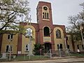
Plaquemines Parish Courthouse
-

Flag of Plaquemines Parish, Louisiana
-
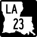
Louisiana Highway 23 sign
-
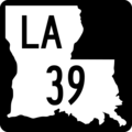
Louisiana Highway 39 sign
-

Map of Plaquemines Parish with municipal labels
.svg)
.svg)
See also
 In Spanish: Parroquia de Plaquemines para niños
