Rice County, Minnesota facts for kids
Quick facts for kids
Rice County
|
|
|---|---|

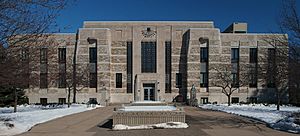
Rice County Courthouse
|
|

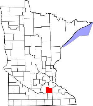
Location within the U.S. state of Minnesota
|
|
 Minnesota's location within the U.S. |
|
| Country | |
| State | |
| Founded | March 5, 1853 |
| Named for | Henry Mower Rice |
| Seat | Faribault |
| Largest city | Faribault |
| Area | |
| • Total | 516 sq mi (1,340 km2) |
| • Land | 496 sq mi (1,280 km2) |
| • Water | 20 sq mi (50 km2) 3.9%% |
| Population
(2020)
|
|
| • Total | 67,097 |
| • Estimate
(2023)
|
67,948 |
| • Density | 135.3/sq mi (52.2/km2) |
| Time zone | UTC−6 (Central) |
| • Summer (DST) | UTC−5 (CDT) |
| Congressional districts | 1st, 2nd |
Rice County is a place in the south-central part of Minnesota, a state in the United States. In 2020, about 67,097 people lived there. The main city and government center of the county is Faribault.
Rice County is part of the Faribault-Northfield area. This area is also connected to the larger Minneapolis-St. Paul region.
Contents
History of Rice County
Rice County was officially started on March 5, 1853. It was named after Henry Mower Rice. He was a fur trader who helped create the Minnesota Territory. He also played a big part in its growth and development.
Geography and Nature
The land in Rice County has gentle, rolling hills. Most of the land is used for farming. Many lakes are also scattered across the county.
The Cannon River flows through the middle of the county. It moves northeast towards the Mississippi River at Red Wing. The Straight River flows north into the county from Steele County. It joins the Cannon River in Faribault. The North Fork of the Zumbro River starts in the southeast part of Rice County. It flows east into Goodhue County and eventually reaches the Mississippi River.
The highest point in the county is about 1,263 feet (385 meters) above sea level. Rice County covers about 516 square miles (1,336 square kilometers). Most of this, 496 square miles (1,285 square kilometers), is land. The remaining 20 square miles (52 square kilometers) is water.
Main Roads in Rice County
Neighboring Counties
- Dakota County - northeast
- Goodhue County - east
- Dodge County - southeast
- Steele County - south
- Waseca County - southwest
- Le Sueur County - west
- Scott County - northwest
Protected Natural Areas
- Cannon Lake Wilderness Area
- Cannon River Trout Lily Scientific and Natural Area
- Faribault State Wildlife Management Area
- Nerstrand Big Woods State Park
- River Bend Nature Area
- Sakatah Lake State Park (part)
- Shager Park
- Townsend Woods Scientific and Natural Area
- Whitney Island Scientific and Natural Area
Lakes in Rice County
- Cannon Lake
- Caron Lake
- Cedar Lake
- Circle Lake
- Crystal Lake
- Duban Lake
- Dudley Lake
- Fox Lake
- French Lake
- Hatch Lake
- Horseshoe Lake (part)
- Hunt Lake
- Kelly Lake
- Mazaska Lake
- Metogga Lake
- Mud Lake
- Phelps Lake
- Rice Lake
- Roberds Lake
- Sakatah Lake (part)
- Shields Lake
- Sprague Lake
- Union Lake
- Weinberger Lake
- Wells Lake
- Willing Lake
People of Rice County
| Historical population | |||
|---|---|---|---|
| Census | Pop. | %± | |
| 1860 | 7,543 | — | |
| 1870 | 16,083 | 113.2% | |
| 1880 | 22,481 | 39.8% | |
| 1890 | 23,968 | 6.6% | |
| 1900 | 26,080 | 8.8% | |
| 1910 | 25,911 | −0.6% | |
| 1920 | 28,307 | 9.2% | |
| 1930 | 29,974 | 5.9% | |
| 1940 | 32,160 | 7.3% | |
| 1950 | 36,235 | 12.7% | |
| 1960 | 38,988 | 7.6% | |
| 1970 | 41,582 | 6.7% | |
| 1980 | 46,087 | 10.8% | |
| 1990 | 49,183 | 6.7% | |
| 2000 | 56,665 | 15.2% | |
| 2010 | 64,142 | 13.2% | |
| 2020 | 67,097 | 4.6% | |
| 2023 (est.) | 67,948 | 5.9% | |
| U.S. Decennial Census 1790-1960 1900-1990 1990-2000 2010-2020 |
|||
Population in 2020
In 2020, the U.S. Census counted the different groups of people living in Rice County.
| Group | Number | Percent |
|---|---|---|
| White (not Hispanic) | 51,523 | 76.8% |
| Black or African American (not Hispanic) | 4,353 | 6.5% |
| Native American (not Hispanic) | 297 | 0.44% |
| Asian (not Hispanic) | 1,554 | 2.32% |
| Pacific Islander (not Hispanic) | 10 | 0.02% |
| Other/Mixed (not Hispanic) | 2,577 | 3.84% |
| Hispanic or Latino | 6,783 | 10.11% |
Parks and Fun Places
- Ackman Park, about 3 miles (5 km) west of Faribault
- Albers Park in Webster
- Caron Park in Cannon City
- Falls Creek Park, about 1 mile (1.6 km) east of Faribault
- Heron Island in Shieldsville
- Hirdler Park, about 10 miles (16 km) west of Faribault
- Kalina Park in Wheatland
- King Mill Park in Faribault
Communities in Rice County
Cities
- Dennison (partly in Goodhue County)
- Dundas
- Faribault (the county seat)
- Lonsdale
- Morristown
- Nerstrand
- Northfield (partly in Dakota County)
Special Places (Census-designated)
Small Towns and Areas (Unincorporated)
Townships (Local Areas)
- Bridgewater Township
- Cannon City Township
- Erin Township
- Forest Township
- Morristown Township
- Northfield Township
- Richland Township
- Shieldsville Township
- Walcott Township
- Warsaw Township
- Webster Township
- Wells Township
- Wheatland Township
- Wheeling Township
Education in Rice County
Many school districts serve the children of Rice County:
- Faribault Public School District
- Kenyon-Wanamingo School District
- Medford Public School District
- New Prague Area Schools
- Northfield Public School District
- Tri-City United School District
- Waseca Public School District
- Waterville-Elysian-Morristown Public School District
The state also runs special schools here:
- Minnesota State Academy for the Blind
- Minnesota State Academy for the Deaf
There is one private school:
For older students, there is a college:
- South Central Community College
The main library is:
See also
 In Spanish: Condado de Rice (Minnesota) para niños
 | Victor J. Glover |
 | Yvonne Cagle |
 | Jeanette Epps |
 | Bernard A. Harris Jr. |

