United States Exploring Expedition facts for kids
The United States Exploring Expedition (1838–1842) was a big journey of discovery and mapping in the Pacific Ocean and nearby lands. It was led by the United States. People sometimes called it the U.S. Ex. Ex. or the Wilkes Expedition, named after its commander, Lieutenant Charles Wilkes.
This expedition was super important for science in the United States, especially for a new field called oceanography, which is the study of the ocean. During the trip, the explorers sometimes had conflicts with people on the Pacific islands.
Contents
Getting Ready for the Big Trip
The idea for this expedition started way back in 1828. President John Quincy Adams asked for money to send a ship to explore the Pacific. But it took eight years for Congress to finally approve the funding! In 1836, President Andrew Jackson officially approved the voyage.
Who Led the Expedition?
At first, Commodore Thomas ap Catesby Jones was supposed to lead the expedition. But he got tired of all the delays and quit in 1837. Then, in 1838, United States Navy Lieutenant Charles Wilkes was chosen to lead. He was known for being good at mapping the sea (hydrography), measuring the Earth (geodesy), and studying Earth's magnetic field (geomagnetism).
Who Went on the Journey?
The expedition included many scientists! There were naturalists (who study nature), botanists (who study plants), a mineralogist (who studies minerals), a taxidermist (who prepares animal specimens), and a philologist (who studies languages).
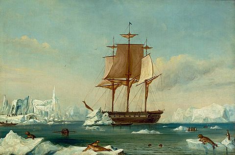
They traveled on several ships:
- Two large sloops-of-war: USS Vincennes and USS Peacock.
- A brig: USS Porpoise.
- A full-rigged ship called Relief, which carried supplies.
- Two smaller schooners: Sea Gull and USS Flying Fish.
On August 18, 1838, the ships set sail. They headed towards the Madeira Islands, using the ocean winds to help them.
Ships and People on Board
The expedition had almost 350 men. Some of them worked on different ships during the journey.
The Expedition Ships
- USS Vincennes – a sloop-of-war, the main ship.
- USS Peacock – another sloop-of-war.
- USS Relief – a supply ship.
- USS Porpoise – a brig.
- USS Sea Gull – a schooner.
- USS Flying Fish – another schooner.
- USS Oregon – a brig that joined later.
Main Leaders
- Charles Wilkes – The commander of the whole expedition and of the Vincennes.
- Cadwalader Ringgold – Commander of the Porpoise.
- Andrew K. Long – Commander of the Relief.
- William L. Hudson – Commander of the Peacock.
- Samuel R. Knox – Commander of the Flying Fish.
- James W. E. Reid – Commander of the Sea Gull.
Many other officers helped lead the ships and carry out the mission. They included lieutenants and midshipmen who were learning to be officers.
Scientific Team
The scientists were a very important part of the expedition. They studied and collected samples of nature.
- Alfred T. Agate – An artist who drew many things they saw.
- William Brackenridge – Assistant botanist.
- Joseph P. Couthouy – A conchologist (studied shells).
- James D. Dana – A mineralogist and geologist (studied rocks and the Earth).
- Horatio Hale – A philologist (studied languages).
- Titian Peale – A naturalist.
- Charles Pickering – A naturalist.
- William Rich – A botanist.
Journey of Discovery
First Part of the Trip
The expedition arrived at the Madeira Islands in September 1838 and then at Porto Praya in October. The ships then sailed to Rio de Janeiro, Brazil. The supply ship Relief was very slow, taking 100 days to arrive! While in Rio, they set up a place to repair and refit their ships.
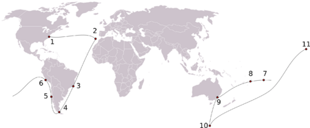
They left Rio in January 1839 and sailed south. They reached Orange Harbor near Hoste Island in February. Here, they met the Fuegians, local people of the area. Wilkes sent a smaller group even further south to try and go beyond where Captain Cook had explored.
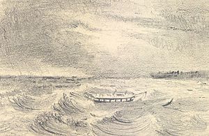
The Flying Fish reached 70° south latitude in March, which was very far south for that time. After that, the ships met up in Valparaíso in May. Sadly, the Sea Gull schooner was reported missing. In June, they went to San Lorenzo for repairs. Wilkes sent the Relief supply ship back home.
Leaving South America in July, the expedition reached the Tuamotu Group in August and Tahiti in September. They then visited Samoa and New South Wales, Australia.
Discovering Antarctica
In December 1839, the expedition sailed from Sydney into the Antarctic Ocean. On January 16, 1840, they reported seeing the Antarctic continent! This was a huge discovery. Two men, Henry Eld and William Reynolds, on the Peacock saw Eld Peak and Reynolds Peak.
On January 19, Reynolds saw Cape Hudson. By February 12, the Vincennes had mapped about 800 miles (1,300 km) of coastline. Wilkes announced they had "discovered the Antarctic Continent." This area was named Wilkes Land. They mapped about 1,500 miles (2,400 km) of the Antarctic coast before heading north again on February 21.
Exploring Pacific Islands
In February 1840, some of the expedition members were in New Zealand when the Treaty of Waitangi was first signed. After repairs in Sydney, some ships went to Tonga in April. They met King Josiah and Chief George before sailing to Fiji in May.
In Fiji, they signed a trade agreement. The expedition also captured a man named Vendovi, who was believed to be responsible for an attack on American sailors in 1836. Vendovi was taken to the US but died soon after.
In July 1840, two members of the expedition, Lieutenant Underwood and Wilkes' nephew, were killed on Malolo Island in western Fiji. The Americans believed it was an attack. In response, sixty sailors landed and attacked the local people. About eighty Fijians were killed, and two villages were burned.
The Return Journey
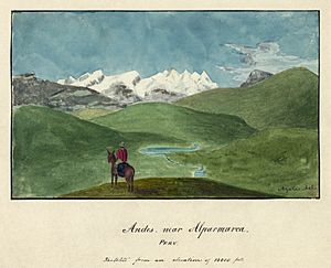
After three months of mapping, the squadron met up again in August. The Vincennes and Peacock sailed to the Sandwich Islands (now Hawaii). On the way, Wilkes named the Phoenix Group and stopped at Palmyra Atoll, making them the first scientists to visit it.
In Hawaii, they were welcomed by the governor and King Kamehameha III. The expedition mapped Kauai, Oahu, Hawaii, and the peak of Mauna Loa.
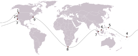
On April 5, 1841, the ships left Honolulu. The Porpoise and Vincennes headed for the Pacific Northwest. The Peacock and Flying Fish went to re-map Samoa and other islands like Jarvis Island, Enderbury Island, and the Tokelau Islands. They also mapped several islands in Tuvalu and the Gilbert Islands.
Challenges in the Pacific Northwest
In April 1841, the Peacock and Flying Fish surveyed Drummond's Island. Lieutenant Hudson heard that a ship had been wrecked there and its crew killed. He sent a small group to search the island. When one of his crew members went missing, the local people started to arm themselves. The Americans returned to their ship. The next day, they decided to attack the island. About 700 local warriors fought back, but the Americans won. Twelve local people were killed, and two villages were destroyed.
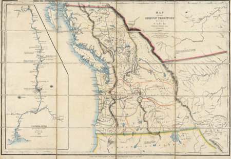
The Vincennes and Porpoise reached Cape Disappointment on April 28, 1841. They then sailed north to Strait of Juan de Fuca, Port Discovery, and Fort Nisqually. Wilkes explored the area, naming places like Eagle Harbor and Port Ludlow.
The Peacock and Flying Fish arrived off Cape Disappointment on July 17. However, the Peacock got stuck while trying to enter the Columbia River and was lost. Luckily, everyone was saved and made it to Baker's Bay. They set up a temporary camp called "Peacockville."
Wilkes then sent the Vincennes to San Francisco Bay. He also sent a group of 39 men overland to explore the area, including Mount Shasta and the Sacramento River. They arrived in Sausalito on October 23.
The expedition then mapped San Francisco and its rivers. They left on October 31, arriving in Honolulu on November 17. They visited Wake Island and returned to New York on June 10, 1842, by way of the Philippines, Borneo, Singapore, Polynesia, and the Cape of Good Hope.
Throughout the expedition, Wilkes had a difficult relationship with his officers. He acted like a captain even though he was only a lieutenant, which bothered many others. When he returned to America, he faced a court-martial (a military trial) but was only found guilty of illegally punishing men.
Why Was This Expedition Important?
The Wilkes Expedition was very important for the growth of science in the 1800s in America. Many of the plants, animals, and other items found helped start the collections at the new Smithsonian Institution.
The scientists on the expedition explored 280 islands, mostly in the Pacific, and mapped over 800 miles (1,300 km) of Oregon. They collected more than 60,000 plant and bird specimens! They also collected seeds from 648 different plant species, which were later planted across the country. Dried plant specimens went to the United States National Herbarium, which is now part of the Smithsonian. Live plants were placed in a new greenhouse in 1850, which later became the United States Botanic Garden.
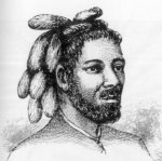
Alfred Thomas Agate, the artist, drew many pictures of traditional cultures, like the clothes and tattoos of people from the Ellice Islands.
A collection of artifacts from the expedition also went to the National Institute for the Promotion of Science, which was a group that came before the Smithsonian Institution. These artifacts became some of the first items in the Smithsonian's collection.
What Was Published?
After the expedition, Wilkes spent many years preparing the expedition's report. He wrote a multi-volume book called Narrative of the United States exploring expedition. This book described the customs and conditions of many places that were little-known at the time. Other scientists also wrote reports on things like animals, geology, and crustaceans.
The Smithsonian Institution later made digital copies of the five-volume narrative and the scientific books. Unfortunately, some of the specimens collected were lost or damaged over time.
See also
 In Spanish: Expedición Wilkes para niños


