
History of Trumbull, Connecticut facts for kids

Trumbull, Connecticut, is a town in Fairfield County, Connecticut, located in the New England region of the United States. Long ago, it was home to the Golden Hill Paugussett Indian Nation. English settlers arrived in the 1630s during a time called the Great Migration, making Trumbull part of the larger coastal settlement of Stratford.
In May 1725, farmers in the northwest part of Stratford asked to create their own separate village. They wanted to name it Nickol's Farms, but in October 1725, the new area was called Unity.
By 1744, Unity joined with another area called Long Hill to form the Society of North Stratford. This new group could manage its own religious and educational matters. However, for important government decisions like making laws or setting taxes, people still had to travel to Stratford for town meetings. For some, this was an overnight journey.
After trying for ten years, the Connecticut General Assembly finally gave North Stratford full town rights in October 1797. The new town was named Trumbull, honoring Jonathan Trumbull (1710–1785). He was a strong supporter of George Washington during the Revolutionary War and served as Connecticut's governor.
Contents
Trumbull's Early Days

Native American History
For thousands of years before the English arrived in the late 1630s, the Golden Hill Paugussett Indian Nation lived in the Trumbull area. They lived along the Pequonnock River and around a natural lake they called Mischa Lake, now known as Pinewood Lake.
As the English settlement of Stratford grew, the Native Americans began to ask for payment for their land. In the 1650s, the Stratford settlers bought land from the Paugussett people. However, as more settlements grew, relations between the English and the Native Americans became difficult.
In 1652, the Colony of Connecticut made rules to control Native Americans, even fining or jailing them for walking near English homes on Sundays. Today, the Golden Hill Paugussett Indian Nation still has a small reservation in the Nichols part of Trumbull. It is the oldest continuous reservation in Connecticut and the smallest in the United States.
Colonial Settlement
How Trumbull Began
Trumbull was first settled as part of "Cupheag," a Native American word for "harbor." This coastal settlement was started in 1639 by Puritan leader Reverend Adam Blakeman and about 35 families. They came from England seeking religious freedom. The main village was built where the Housatonic River meets Long Island Sound. In 1643, the settlement was renamed Stratford.
Stratford was one of many towns founded in the American colonies during the Great Migration of the 1630s. During this time, Puritan families left England to escape political and religious problems. Some settlers had even moved to the Netherlands first, but then came to the New World when their children started adopting Dutch culture.
Like other Puritan towns, early Stratford had leaders who were both church and town officials. Their goal was to create perfect religious communities, far from the influence of kings or other authorities.
By the mid-1650s, the Golden Hill Paugussett Indian Nation asked for payment for their land. This led the court to set the town boundary on May 15, 1656. It included all the land 12 miles inland from Long Island Sound, covering all of present-day Trumbull.
The English continued to buy land from the Native Americans. The last major land purchase for the western part of Trumbull, called the Long Hill purchase, was completed in April 1662.
Town Growth and Spreading Out
In 1661, the town allowed settlers to claim common land in the woods, as long as it was not within two miles of the town meeting house. They couldn't live there without permission. By the 1670s, more people were allowed to live further out, and the town stopped keeping track of these "outlivers."
In 1670, a "three mile" or "woods division" was made. This divided common land located between three and six miles from the Stratford meeting house, which included land in the lower part of Trumbull. Each piece of land was laid out to have a share of water, woods, and meadows. These grants were often a quarter-mile wide and one mile long, about 170 acres.
By 1685, some families complained that they weren't getting their land grants fast enough. The court ordered the town to divide all common land between two and six miles from the Stratford meeting house. The full division of common land in Trumbull wasn't finished until 1800.
The Nichols Area
The area now called Nichols, in southeastern Trumbull, was first known as Mischa Hill, named after a Native American who lived there. In the late 1660s, it was called Lt. Joseph Judson's Farm. After Judson and others left to start the town of Woodbury in 1672, it was called Old Farms. In the early 1700s, it became Nickol's Farms, then part of Unity in 1725, and North Stratford in 1744.
It's believed that Abraham Nichols made the first permanent settlement in Trumbull around 1690 or 1700. He bought or traded land to get several farms and large pieces of land starting in 1696. His land was located at or near the "Old farm" or "Judson's farms."
Some of Abraham Nichols' farm stayed in the Nichols family for four centuries. The last of the Nichols line, Florence Nichols, married George Woods. After their deaths, the property was sold to the town of Trumbull in 1974. The 13-acre Woods homestead was renamed Abraham Nichols Park and is now home to the Trumbull Historical Society.
Farming Life
Early Stratford farmers lived in the main village and traveled to their farms, which were one to three miles away. The Nichols and White Plains areas were the first parts of Trumbull to be farmed and settled. This was because they had fertile soil, spring-fed ponds, and natural meadows, and were close to the main village. Many early settlers would have a farm in the countryside and also a house in the village.
First Farmers
Many of the first people to own land in Trumbull were original founders of Stratford. Some of the first families to live permanently in Trumbull included the Beach, Beardsley, Booth, Curtiss, Hawley, Judson, and Nichols families.

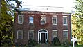
Before 1686, Zachariah Curtiss built a farmhouse on the south side of Mischa Hill. His farm was on land given to him as part of the "three-mile division" and land from his father.
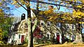
Ephraim Hawley, who owned slaves, built his farmhouse just south of Zachariah Curtiss, on the eastern part of his land grant. He likely built his house before becoming a freeman in 1687.
The road connecting the Curtiss and Hawley farms to Stratford Village (about 2.5 miles south) became known as the Farm Highway, which is today's Connecticut Route 108. This highway was completed in 1696, making it one of Connecticut's oldest documented English highways.
American Revolution Times
In 1773, Robert Hawley became Captain of the North Stratford or Second Train Band, a local militia group. In November 1777, Hawley was also part of a committee to provide supplies for the Continental soldiers.
On March 12, 1778, the North Stratford parish raised money and over 200 pounds of cheese and ham for their residents serving in the southern army. This included two enslaved men, Nero Hawley and Caesar Edwards, who were stationed at Valley Forge under General George Washington.
Huldah Hawley, born in 1755, lived to be 101 years old. She loved to tell stories about the Revolution. She recalled a time when two companies of French soldiers, led by General Rochambeau, camped for a whole winter on Mountain Hill in Nichols' Farms. This high bluff offered a view of Long Island Sound for 70 miles and was used to watch for British ships. Huldah said the soldiers made her cook for them, and she gave them food because she was afraid. French coins have since been found near their camp in Abraham Nichols Park.
From June 28 to June 30, 1781, during the war, French army units called Lauzun's Legion camped in North Stratford (now Trumbull). They marched south to protect the main French army, which was heading to help General George Washington at the Siege of Yorktown.

Benjamin Silliman was born in a tavern in Trumbull. His mother had fled their home in Fairfield to escape 2,000 invading British troops who were burning the town. This happened a few months after Silliman's father, General Gold Selleck Silliman, was taken prisoner by the British in May 1779.
A big celebration called "A Great Jubilee Day" was held on May 26, 1783, at the North Stratford meeting house to mark the end of the Revolutionary War. This celebration included feasting, prayers, speeches, toasts, and militia groups performing with cannons.
American Civil War
During the American Civil War, a local military company called Company C of the 8th Connecticut Infantry Regiment was formed in Trumbull. It was led by Captain Charles E. Plumb and was disbanded after the war in 1871.
Becoming a Town


In May 1725, farmers in the northwest part of Stratford, at Nickol's Farms, wanted their own church. They asked for permission to form their own village. The government approved their request in October 1725 and named the new village "Unity." The Unity Congregational Church was founded in 1730. The Unity Burial Ground still exists today.
In May 1740, farmers on Long Hill were also granted their own parish and money for education.
In 1744, the Unity parish and the Long Hill parish asked to combine and become the Society of North Stratford. The government approved this new town called North Stratford. North Stratford remained a village under Stratford's control for 53 years.
After the Revolutionary War, the people of North Stratford felt they were large enough and too far from Stratford to attend town meetings. They asked the Connecticut General Assembly to become an independent town. After several tries, their request was granted in October 1797. On November 20, 1797, the first town meeting was held. The new town was named after Jonathan Trumbull, Connecticut's governor during the Revolutionary War and a trusted advisor to George Washington.
Community and Churches
Historic Burial Grounds
Unity Burial Ground

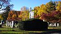
The Unity Burial Ground is a historic cemetery located in White Plain, north of where the first church in Unity parish was built. The cemetery was started in 1730, and the first person buried there was 7-year-old Samuel Bennitt in 1731. There are over 110 gravestones and 90 unmarked stones.
Christ Episcopal Church and Tashua Burial Ground


Christ Episcopal Church and Tashua Burial Ground is a historic site in the Tashua section of Trumbull. It includes an Episcopal Church building and a cemetery. The site was founded in 1760 and added to the National Register of Historic Places in 2001. The current church building was started in 1826 and is believed to have been designed by Alexander Jackson Davis. It was officially dedicated in 1847.
The church is an example of Carpenter Gothic style, which is a type of Neo-Gothic architecture. Christ Church still has the original Bible and Book of Common Prayer it received from England in 1762. The church is still active today. The graveyard dates back to 1766 and has 241 burial plots.
Gregory's Four Corners Burial Ground

Gregory's Four Corners Burial Ground is a historic cemetery just over the Monroe town line. It was started in 1761. It is famous for being the burial place of Hannah Cranna, who was often called the "Wicked Witch of Monroe."
Pine Brook Country Club

In 1930, Benjamin Plotkin bought Pinewood Lake and the land around it. He built forty cabins and an auditorium with a revolving stage and named it the Pine Brook Country Club. Plotkin wanted the club to be a summer resort where people could stay and enjoy theater shows.
Pine Brook is best known for becoming the summer rehearsal home for a very important group in American theater history. The Group Theatre was formed in New York City in 1931. This group of actors, directors, and writers created plays about real-life topics, changing theater and film forever. In 1944, Pine Brook Country Club was sold and became the Pinewood Lake Association.
Businesses and Work
Roads
Farm Highway
On December 7, 1696, the Farm Highway, which is today's Nichols Avenue (Connecticut Route 108), was laid out by Stratford officials. It was a wide road, about 198 feet, near Broadbridge Brook. This road connected the farms to the main village.
When the Colony of Connecticut approved the Parish of Unity in October 1725, they called the Farm Highway "Nickol's Farms Road." The Nichols Avenue part of Route 108 in Trumbull is considered the third-oldest documented highway in Connecticut.
White Plains Road
In February 1694, Thomas Lake bought land near the Pequonnock River. By 1705, White Plains Road, today's Route 127, was laid out past Lake's house to a large rock called Pulpit Rock. The first meetings of the Trumbull Congregational Church, started in 1730, were held at Pulpit Rock on White Plains Road.
Merritt Parkway
The Merritt Parkway was built directly through Trumbull in the late 1930s. Trumbull has the newest original Parkway underpass (Frenchtown Road, built in 1942) and the oldest Parkway overpass (at White Plains Road, built in 1934). The White Plains Road Overpass was designed before the Parkway idea was fully adopted and cost $47,532.
George Dunkelberger, who designed all 69 original Parkway bridges, once sketched a favorite Parkway scene. He chose the Park Avenue Underpass in Trumbull, with other bridges in the distance. This sketch was used on the cover of the 1940 Highway Commissioner's Report and on Connecticut's Anniversary Plate in 1943.
Industries
Mills
In August 1697, John Seeley suggested building a gristmill (a mill for grinding grain) on the Pequonnock River. It took until July 1704 to finish building it.
In January 1703, Ebeneezer Curtiss, James Lewis, and Edmund Lewis were given permission to build a sawmill near Mischa Hill.
In January 1722, Gideon and Ephraim Hawley agreed to rebuild a mill on the Pequonnock River.
Reuben Fairchild and his brothers built the Fairchild Paper Mill in 1826. They were helped by Andrew Tait, who learned papermaking in Scotland. The Fairchild Paper Mill was the first mill to make white note paper. The company also had a boarding house for its female workers. The mill was located near what is now Fairchild Memorial Park. The word Pequonnock in the Native American Paugussett language meant "place of slaughter" or "place of destruction."
Mines
The first mention of minerals at Saganawamps, or the Old Mine Park Archeological Site, is from 1757. Around 1818, Ephraim Lane took rock samples from Saganawamps to Yale University Professor Benjamin Silliman. Silliman identified tungsten, tellurium, topaz, and fluorite. In 1837, the first tungsten ore in the United States was found at the mine.
Manufacturing
Reuben Fairchild, a cabinet maker, started making saddletrees (parts of saddles) with his brother Eben around 1810 in Nichols Farms. In 1817, they moved their business to Bridgeport.
George R. Nichols and his brother David Stiles Nichols started making coaches in the 1840s. They mostly sold to Texas and the Southern states. Their company faced big losses during the Civil War. Their Mexican coaches were very well-known.
Harvey Hubbell, like famous inventors Edison and Ford, created new products and improved manufacturing. The first Harvey Hubbell, father of the company's founder, was a partner in clothing manufacturing firms. The second factory was started in Trumbull in 1860, near the Hubbell farm on Main Street in Long Hill.
Housatonic Railroad
From 1840 to 1931, a 15-mile section of the Housatonic Railroad ran along the Pequonnock River. It had stations in Bridgeport, Trumbull, Long Hill, and other towns. The railroad also owned the Parlor Rock Amusement Park in Trumbull. Later, the railroad tracks were removed and replaced with Connecticut Route 8. North of Trumbull, the old railway became the Pequonnock River Valley State Park.
Learning in Trumbull
The idea of public education started early in Trumbull. In 1716, officials voted to give money to farmers in Long Hill, Fairchilds, and Nichols Lakes so they could educate their children.
Five school districts were created in November 1761. Each district had its own committee. The districts were named Nichol's Farm, Daniel's Farm, Long Hill, White Plain, and Cutler's Farm. In 1762, Long Hill was split into Upper Long Hill and Lower Long Hill. Tashua School was first mentioned in 1769.
In 1795, a meeting was held to set the boundaries for eight school districts: Nichol's Farms, White Plain, Daniel's Farm, Booth's Hill, Long Hill South, Long Hill North, Tashua, and Mount Moria. The descriptions of these new districts used landmarks like houses, roads, and geographical spots.
Historic Places in Trumbull
Many places in Trumbull are listed on the National Register of Historic Places. This means they are important historical sites.
- Christ Episcopal Church and Tashua Burial Ground – 5170 Madison Ave. (added May 25, 2001)
- David Mallett Jr. House – 420 Tashua Road (added March 20, 1986)
- Kaatz Icehouse – 255 Whitney Ave. (added October 19, 1977)
- Nichols Farms Historic District – Center Road, 1681–1944 Huntington Turnpike, 5–34 Priscilla Place, and 30–172 Shelton Road (added September 20, 1987)
- Old Mine Park Archeological Site (added 1990)
Trumbull's Population Over Time
| Population change in Trumbull during the 19th century | ||||||||||
|---|---|---|---|---|---|---|---|---|---|---|
| Year | 1800 | 1810 | 1820 | 1830 | 1840 | 1850 | 1860 | 1870 | 1880 | 1890 |
| Population | 1,291 | 1,241 | 1,232 | 1,242 | 1,204 | 1,309 | 1,474 | 1,335 | 1,323 | 1,453 |
| Source: | ||||||||||
| Population change in Trumbull since 1900 | ||||||||||||
|---|---|---|---|---|---|---|---|---|---|---|---|---|
| Year | 1900 | 1910 | 1920 | 1930 | 1940 | 1950 | 1960 | 1970 | 1980 | 1990 | 2000 | 2010 |
| Population | 1,587 | 1,642 | 2,597 | 3,624 | 5,294 | 8,641 | 20,379 | 31,394 | 32,989 | 32,016 | 34,243 | 36,018 |
| Source: | ||||||||||||
Famous People from Trumbull

Helicopter inventor Igor Sikorsky lived in Trumbull from 1928 to 1951. He moved his aircraft manufacturing company to Stratford. The Sikorsky Manufacturing Company later became part of United Aircraft and Transport (now United Technologies Corporation). The company built flying boats, like the S-42 "Clipper," which Pan Am used for flights across the Atlantic Ocean.
Sikorsky also kept working on vertical flight. In 1929, he applied for a patent for a "direct lift" aircraft. On June 27, 1931, he filed for another patent for a "direct lift aircraft," and received it in 1935. His design led to the first (tethered) flight of the Vought-Sikorsky VS-300 on September 14, 1939, with the first free flight on May 26, 1940.
Sikorsky's success with the VS-300 led to the R-4, which became the world's first mass-produced helicopter in 1942. Sikorsky's final design, with one main rotor and one tail rotor, is still used in most helicopters today.
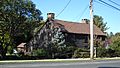
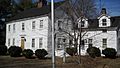
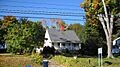
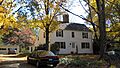
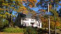
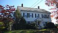
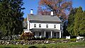
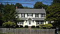
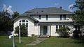
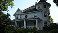
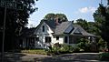
Images for kids
-
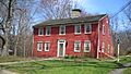
Ephraim Hawley House built around 1683
-
John Wildman House built around 1745
-
Zachariah Curtiss House built around 1721
-
Samuel French House built around 1736
-
Daniel Beach House built around 1750
-
Daniel Hawley House built around 1756
-
Captain Beardsley House built around 1756
-
John Wheeler House built around 1770
-
Joseph Plumb House built around 1780
-
Dr. Elijah Middlebrook House built around 1824
-
Joel Curtis House built around 1840
-
Nichols Farms Burial Ground established 1850
-
Igor Sikorsky's home from 1928–1934
-
Igor Sikorsky's home from 1934–1945
-
Igor Sikorsky's home from 1945–1948
-
Igor Sikorsky's home from 1948–1951


