Waterways of West Virginia facts for kids
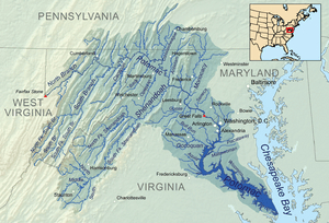
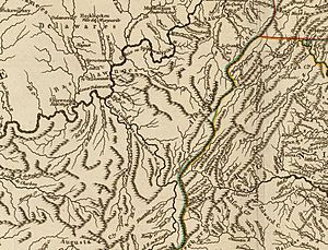
West Virginia's waterways begin high in the Allegheny Mountains. These mountain areas collect rainwater, which then flows into small streams. These streams often rush through deep, narrow valleys called hollows. As they leave the hollows, these streams join together to form larger rivers. People have lived and traveled on these waterways for a very long time, even before West Virginia became a state.
Contents
Early European Settlements and River Crossings
In 1709, some people from Switzerland asked the King of England for land near what is now Harpers Ferry and Shepherdstown. They wanted to start a Swiss colony, but it never happened.
However, British fur traders set up an outpost called Fort Conolloways (now Tonolloways) around 1695. It was near the Potomac River, where different Native American tribes lived.
In 1720, the Treaty of Albany set the Blue Ridge Mountains as the western border for white settlements. By 1739, Thomas Shepherd had built a flour mill powered by water from the Potomac River. He, along with others, founded Shepherdstown.
The first official ferry crossings in what would become West Virginia were established in the mid-1700s. One ferry crossed the Potomac River in 1748. Another, run by Robert Harper, started in 1761 across the Shenandoah River at Harpers Ferry. These ferries were the first government-approved ways for people to cross the rivers for business.
Early River Travel
For many years, European explorers heard stories about a "beautiful River" that was very large and deep. By 1670, they had a good description of this river. French missionaries learned from Native Americans that this river was called "Ohio" in the Iroquois language and "Mississippi" in the Ottawa language. Both names mean "beautiful river."
Around 1691-1692, a Dutchman named Arnoult Vielle traveled down the Ohio River as far as the "Falls of Ohio." He was one of the first Europeans to explore this river. In 1694, he returned to New York with many Shawnee and other Native Americans, carrying valuable beaver furs from the Ohio River Valley.
In 1699, another report mentioned that twelve men and some Native Americans had traveled from New York up the Susquehanna River to the Ohio River. Arnoult Vielle is considered the first well-documented European to boat on the Ohio River.
Buffalo Skin Canoes
Old stories mention canoes made of animal skins in the Kanawha River area. A fur trader named James Le Tort, Sr., moved his trading post to Letart Falls by 1740. His trade involved areas around the Little Kanawha and Mill Creek.
Native American groups, including the Cherokee and Delaware, lived in the Kanawha region during the 1700s. A statue in Mingo Flats honors the Mingo Indians, who were the first people to live near the Monongahela, Potomac, Greenbrier, Elk, Tygart, and Gauley rivers.
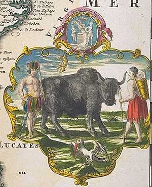
In 1742, John Peter Salling and a few others traveled across West Virginia. They went down the New River and then the Kanawha to the Ohio River. They traveled in a boat made of buffalo skins. This shows that buffalo skin boats were used in West Virginia.
Birch Bark Canoes
Before Europeans arrived, Native Americans used rivers to transport goods like corn, beans, and seashells. Later, frontier traders used canoes to carry mountain spices like ginger, spearmint, and peppermint. They also transported medicinal plants like ginseng and slippery elm.
Other goods included Kanawha red salt, crude oil from Elizabeth, and sulfur and saltpeter from the New River. Saltpeter was used to make gunpowder, but processing it was often illegal due to English rules.
These goods were canoed to trading posts. From there, horse-trains carried them over mountains to larger rivers, where they were loaded onto bigger boats and shipped to the coast.
The eastern part of West Virginia has many rivers that flow into the Potomac. A trading post was built in 1721 at the meeting point of the Conococheague Creek and the Potomac River. This opened an important route into the wilderness. Charles Poke's trading post, dating from 1731, also sent goods from the forest along this route.
This old east-west mountain trail, which crossed the Seneca Trail, generally follows today's U.S. Route 50 to the Potomac River. In northern West Virginia, local trails and waterways connected to Nemacolin's Trail, which started at Redstone Old Fort.
In 1729, a French engineer named Chaussegros de Léry boated down the Allegheny and Ohio rivers. In 1739, another group of canoes explored the Ohio River. They found "elephant-like bones" (mastodon bones), which became a big topic of conversation in the colonies.
Official surveyors, like George Washington and Captain Crawford, also traveled the rivers in large birchbark canoes. They often had doctors with them to visit fur collection villages. Reports and letters were sent by these boaters to Fort Henry (now Wheeling) and Fort Pitt (now Pittsburgh).
In 1771, Simon Kenton had a trading house at the mouth of the Elk River in what is now Charleston. Surveyors like Mr. Taylor and George Washington conducted their first surveys here around 1770. Native American canoe porters, who helped carry goods, were rarely mentioned in these journals.
In April 1774, Captain Hanson surveyed the Kanawha and Ohio rivers. His journal mentions finishing a canoe and seeing other canoes. He also reported that Native Americans were on both sides of the Ohio River and planned to fight. He surveyed land for Colonel Washington and heard about battles between settlers and Native Americans.
Before dams were built in 1885, Wheeling was known as the "head of dry navigation" during droughts. The path between locations was used for quick travel, sometimes overnight. Officials and friendly scouts could canoe more quickly to Fort Henry and downriver. Large construction materials for forts were often moved on rafts called flatboats.
The Shawnee word for canoe was "Olagashe." The Ohio River was called "Spaylaywitheepi" by the Shawnee. The Iroquois called the Kanawha River "Kahnawáʼkye," meaning "waterway" or "transport-way." "Kaháwa'" means "boat" or "canoe." "Uhíyu'" means "the beautiful river," referring to the Ohio River. The name "Kentucky" comes from a Mohawk word meaning "among the meadows."
Flat Boats
George Washington and Christopher Gist's raft was destroyed by ice on the Allegheny River in 1753. They had to walk off the island the next morning. Washington also wrote about coal burning on a ridge in Mason County.
The era of civilian flatboats on the Ohio River began around 1778. Colonel Brodhead, in command at Fort Pitt, helped clear hostile groups on the upper Ohio River. This made it safer for new settlers from Europe to build flatboats and travel to their new homes. Many settlers came down the Ohio from Pittsburgh and Wheeling, building their flatboats there.
By 1800, a type of flatboat called an "arc" was used as a houseboat, complete with a fireplace. One was recorded anchored near the Boone trading post at Kanawha Harbor.
Kanawha salt was transported downriver on flatboats in larger amounts. In 1782, Jacob Yoder launched a flatboat from the Monongahela River with produce. He reached New Orleans, drifting through Spanish territory. The crews then walked back to their homes on the Ohio River. Shipping coal on West Virginia rivers began around 1803.
Fort Nelson (Louisville) and Fort Washington (Cincinnati) were common stops. The population of western Virginia was about 100,000 in 1810. Flatboats continued to be useful for decades, even with old river jetties. They were used on the Ohio River into the 20th century. However, they were hard to maneuver through early dam locks and were eventually replaced by steamboat barges.
Mississippi River Pirogue
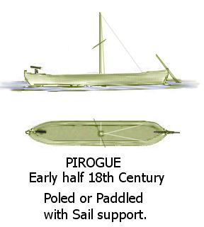
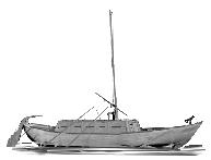
Larger pirogues were common on the lower Mississippi River. Early ones were carved from cypress and sycamore trees, sometimes nearly 50 feet long and 5 feet wide. These French pirogues often had small sails to help with propulsion. As carpenters arrived, they began building them with planks and flat bottoms. Spanish boats on the Mississippi River were similar.
On August 12, 1749, French officer Celeron de Bienville and his canoes met two canoes with four Englishmen. The next day, he met several pirogues guided by Iroquois, who were hunting on rivers in the western Kanawha region.
Of the Great Kanawha River, he wrote on August 18: "This river carries canoes for forty leagues without encountering rapids, and has its source near Carolina. The English of this government come by treaty to the Belle Rivière."
Pioneers along the river built square-sided canoes using boards. This construction was similar to their flat-bottomed rowboats used for fishing and transporting local goods. The smaller, lighter canoe shape was better for one person to cross gentle rapids and paddle upstream on the Ohio River.
Pirogue Mail Carrier
The Northwest Ordinance was passed in 1787, setting up rules for new territories. In 1787, pirogues began carrying mail on the upper frontier rivers. The new United States government paid boaters to deliver mail along the Ohio River every two weeks. They stopped at settlements in West Virginia and Ohio.
To be a pirogue mail carrier, a person needed excellent boating and swimming skills and had to be good at surviving on the frontier. The mail pouch was strapped securely to the carrier's body in case of an accident. Fort Henry in Wheeling was the main collection point for pirogue mail carriers.
Military Boats and Early Packet Trade
Because of attacks from Native Americans and river pirates, eastern investors demanded action. This led to the Northwest Indian War. A new army and boats were built to support them. Keelboats, ranging from 50 to 100 tons, became important. Major Craig of Fort Pitt wrote about these well-built boats in 1792.
By 1793, Major Craig had control of the upper West Virginia rivers. This led to the first regular packet line on the Ohio River. It was a weekly keelboat trip between Cincinnati and Pittsburgh, with stops at other river settlements. Cincinnati merchant Jacob Meyers started this "Line" because individual trips had been dangerous and taken about a month.
Keelboat Mail Carriers
In June 1794, an advanced mail route was set up with a relay system. Six rowers and a few passengers traveled between Maysville, Gallipolis, Marietta, and Wheeling. Government mail carriers relayed between their two assigned towns on a one-week schedule. Passengers were encouraged to carry their own food and a weapon for protection.
Schooners and Brigantines
In 1792, builders in Pittsburgh constructed a 120-ton schooner called Amity and a 250-ton ship called Pittsburgh. These ships were loaded with flour and sent to places like St. Thomas in the Virgin Islands and Philadelphia. In 1793, two brigantines, the 200-ton Nanina and the 350-ton Louisianna, sold coal as ballast in Philadelphia. The largest was the 400-ton brigantine Western Trader.
Before 1803, the 70-ton schooner Dorcus & Sally was built at Wheeling, and the 130-ton Mary Avery was built at Marietta. The 100-ton schooner Nancy was launched at Wheeling in 1808. These ships were built before the era of paddlewheelers.
The ships' hulls were made from long, wild black walnut timber, which was lighter but as strong as the oak timber used on the east coast. Some shipbuilders from Rhode Island moved to the river's old-growth forests to build ships. A few of these walnut-hulled schooners were sold with their cargo. Some were even used as gun cutters (escort/patrol boats) by US privateers during the War of 1812. One was seen in the Caribbean.
In January 1845, the 350-ton barque Muskingum, built in Marietta, was welcomed in Liverpool, England. This was a happy moment for Ohio River crews. The largest ship built was the 850-ton Minnesota in Cincinnati for a New Orleans owner. A steamboat delivered it.
Before the Civil War, a few locally built ships traveled to Africa and back to the Kanawha region. These larger ships moved during spring floods. Their cargo included flour, smoked beef, salted pork, glass-wares, iron, black walnut furniture, wild cherry, yellow birch, and various beverages. Much of the bulk cargo was stored in flat-bottomed "jonboats" above the hold. During this time, sorghum and Kentucky tobacco were exported in larger amounts from farms in western Virginia.
Early Steamboats and Civil War Fleet
In 1811, Robert Fulton built the first commercial paddle-wheel steamboat, the New Orleans, in Pittsburgh. Captain Nicholas Roosevelt sailed it down the Ohio to New Orleans. However, it could not navigate back upriver. This side-wheel driven boat had a low-pressure boiler.
The machine-powered river transportation industry grew with the steam-engine works in Pittsburgh, which started in 1812. This shop built engines for early stern-wheel steamboats like the Comet, launched in 1813. These steamboats slowly replaced keelboats.
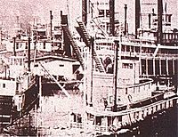
In 1816, Captain Henry Shreve built the George Washington in Wheeling. This stern-wheel driven vessel set the pattern for future steamboats. He named the passenger cabins "staterooms" after U.S. states. The Valley Forge, launched in 1839, was the first large iron steamboat on the upper Ohio Valley.
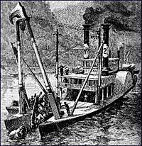
According to Dr. Hale's Early History of the Kanawha River Valley, the first steamboat to try navigating the Great Kanawha River was the Robert Thompson in 1819. It reached Red House Shoals but could not go further due to strong currents. Local tradition says horses were sometimes used to pull vessels over shoals. A "horse handler" on board some steamboats would manage these horses during droughts. This person was a blacksmith and boat mechanic, also helping with the boiler and paddlewheel system. Henry Shreve designed the first steam-powered snagboat, The Heliopolis, in 1829. Its double-hull design became the standard until the early 1900s.
Hale also states that in 1820, the Andrew Donnally, a steamboat built by salt makers from Charleston, made the first successful trip to Charleston. Later, the salt industry and other factories grew along the rivers. The salt industry had barrel works at Crooked Creek, providing containers for whiskey, nails, and barrels for salted pork and cheese. Fruit and chicken crate-making firms were also in the navigable tributaries.
River trade methods improved as new types of freight, like bricks and glass, increased. This happened decades before showboats became popular and before railways connected with Ohio River bridges after the Civil War.
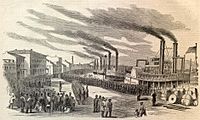
During the American Civil War, Fort Union at the mouth of the Little Kanawha River in Parkersburg was the Union Army's supply center. Since there were no railroad bridges across the Ohio River, this depot connected eastern factories' rail lines to steamboat packets. These packets carried supplies west under the command of Quartermaster Charles Conley. Parkersburg was also a recruiting center for the 9th West Virginia Infantry, who often protected packetboats and river crossings. Many recruits came from river worker families.
River workers and a fleet of barges and civilian packets helped evacuate salt miners, residents, and the civilian government during the "Confederate Overrun of Charleston, West Virginia." Confederate General William W. Loring pushed back Union Colonel Joseph A. J. Lightburn. The Confederates were mainly after Kanawha Salt, which was moved south by horse-pack trains for weeks to process meat.
Much of the 9th West Virginia Infantry was stationed at Point Pleasant until January 1863 to guard the packets and refugees. Other regiments also patrolled until Charleston was retaken a few months later. Confederate Brigadier General Albert G. Jenkins attacked along the Ohio River, targeting the Baltimore & Ohio Railroad and Union supply packets. His cavalry used "dragoon tactics," rushing in, dismounting to attack, and then rushing away.
Morgan's Raid brought the US Navy to the state's shores. River workers involved in the Battle of Buffington Island served on the Alleghany Belle. The Magnolia, Imperial, Alleghany Belle, and Union were armed privateer ships. Lt Commander Leroy Fitch's fleet included tinclads and ironclads like the Brilliant, Fairplay, Moose, Reindeer, St. Clair, Silver Lake, Springfield, Victory, Naumkeag, and Queen City. These were part of the U.S. Navy Mississippi Fleet Command. The ironclad USS Naumkeag patrolled the Kanawha Harbor area. The Springfield guarded from Pomeroy towards Letart Islands. The Victory's cannonballs have been found near Leading Creek, Ohio. Its patrol was from Middleport, Ohio, to Eight Mile Island. The Ravenswood crossing saw skirmishes during the Battle of Buffington Island. Newspapers called this routing "The Calico Raid" because soldiers took personal goods from stores and houses.
After the war, the steamboat Mountain Boy transported government officials and documents to Charleston from Wheeling. The steamboats Emma Graham and Chesapeake moved state officials and documents back to Wheeling in 1875. After a public vote in August 1887, steamboats were again used to move the state government and records back to Charleston. In May 1885, the sternwheeler "Chesapeake" moved officials, and the ward barge "Nick Crewley," pushed by the steam towboat "Belle Prince," carried state records and the library.
Early Floods
The flood of January 9, 1762, destroyed much of Fort Pitt at the meeting point of the Allegheny, Monongahela, and Ohio rivers. The water reached 39.2 feet above normal. Major George Washington described the normal water level as 20 or 25 feet below the land. Other major floods occurred in 1806 (37.1 feet), 1810 (35.2 feet), and 1816 (36.2 feet). Not all floods started in the Ohio Valley; some came from the state's tributary rivers.
The first recorded flood on the Ohio River along West Virginia's shores was in 1768. Mingo survivors said it was the highest they had ever known, sweeping away their village near Steubenville, Ohio. The "Great Pumpkin Flood" happened in 1811. After days of rain, the river rose very quickly, washing away buildings and debris, including a large pumpkin crop.
The 1832 flood was very destructive because more people had invested in development along the river. Government-encouraged homesteads were built on flood plains, not accounting for such high water levels. The 1852 flood was one foot lower than 1832, but steamboats could navigate over islands without grounding. With more industry along the river, this flood was the first to cause major financial losses for wealthy investors.
The Spring flood of 1860 was about 40 feet above normal. Many muddy fields could not grow vegetables or grain before the first frost. The following year, 1861, saw even higher water levels in the fall. These floods and harsh winters ruined farm crops and two seasons of income. This added to the hardships of the early Civil War. Civil groups sometimes took farmers' remaining seeds. Local small boats found little produce to deliver to river town markets. Support from the Union supply depot at Parkersburg Logistics Center in 1862 helped reestablish local produce procurement. This encouraged local farmers to support the Union and some river workers to join the army.
Waterway Decisions by US Congress
The US Congress has many records about waterways. For example, on December 22, 1834, people from Kanawha County asked for a law to hold court sessions in Charleston instead of Lewisburg. The Vice-President presented resolutions from Virginia's legislature asking for money to complete a water route between the Mississippi Valley and the Atlantic Ocean. This involved connecting the James River and the Greenbrier River, and improving the New, Greenbrier, and Kanawha rivers.
On January 13, 1859, a motion was made to consider a plan to supply water to the Ohio River. On March 31, 1870, a resolution was submitted to Congress to survey and examine a communication line from the Chesapeake Bay to the mouth of the Kanawha River. This was to include ways to transport military supplies west in case of war. The commercial needs of the Mississippi River were also considered.
In 1873, West Virginia citizens asked Congress for help to improve the Little Kanawha River. Further improvements to the Kanawha River were also requested. Gradually, the continental railway system and the Great Lakes connecting to the upper Mississippi River became Congress's main focus in the latter half of the 19th century.
The U.S. Government stopped maintaining the Little Kanawha system of locks and dams in 1937. In 1912, eleven commercial boats traveled the river. The steam packet Louise made daily trips between Parkersburg and Creston. Along with log float operators, as many as ten commercial gasoline boats operated on the river.
Kanawha River Dams
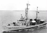
The United States Army Corps of Engineers (USACE) started building modern dams on the Kanawha River in the late 1880s. Ten French System roller dams, called Chanoine dams, were finished in 1898. These dams allowed commercial navigation on the Kanawha River all year round for 90 miles, from Boomer to Point Pleasant at the river's mouth. This helped shipyards expand to build ocean-going military vessels. In 1921, the General John McE. Hyde was built in Charleston. It was used in World War II. Its sister ship, the General Frank M. Coxe, was finished in 1922 and served as an Army transport vessel.
In the 1930s, the ten Chanoine dams were replaced with four High Lift German Roller System dams. This decade saw a big increase in military shipbuilding. These dams are located at Gallipolis Ferry, Winfield, Marmet, and London. During droughts, they ensure at least a 12-foot deep navigation channel over old shoals.
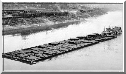
In 1989, the USACE began building larger and longer lock chambers. Today, most tows (groups of barges pushed by a boat) no longer need to break apart to pass through locks, which means less waiting time. Some tows can be up to 800 feet long, and some claim 1000-foot long tows have been made. Smaller pleasure boats can navigate as far as the Kanawha Falls' public access park. The Robert C. Byrd Locks and Dam at Gallipolis Ferry has a public museum with artifacts.
Summary
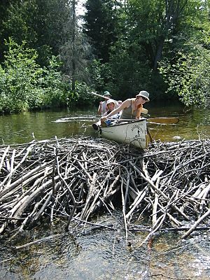
As eastern tanneries needed more beaver furs, they often arrived at "the Point" by canoe and raft from the Kanawha region. Isaac Vanbibber and Daniel Boone's trading post was set up around 1790 at the mouth of Crooked Creek at Point Pleasant. By the early 1800s, steel traps made beaver hunting more efficient, and beavers became scarce within two decades. Fewer beaver dams meant many creek "lakes" drained. This led to a shift towards exporting other natural resources and changes to the riverbanks. The next century saw farms built on these naturally "drained" wetland creek bottoms.
A network of local produce exchange developed between farmers' landings and major town markets along the rivers. For example, in the 1880s, the paddlewheelers Courier and Express carried mail, local produce, and passengers between Wheeling and Parkersburg daily.
Kanawha Harbor had a lot of freight and passenger traffic after the "Old War" of the 1790s. Kanawha salt production, followed by coal and timber, was moved from West Virginia streams to other regions. Several riverside locations were used for early Industrial Revolution keelboat building in the Kanawha region, including Leon, Ravenswood, Murraysville, and on the Little Kanawha River.
Earlier in the 19th century, steamboat building and machine repair were located in Wheeling and Parkersburg, then later in Point Pleasant and Mason City. Wooden coal barges were built on the Monongahela River near Morgantown, on the Coal River, and some on the Elk River near Charleston, before metal barges became common.
For example, Kanawha Harbor's boat building increased after a horse-drawn logging tram with special block and tackle was used for hillside harvesting. Later, this tram and other steam machinery were used to collect timber for railroad ties during railway construction along the Kanawha River, which finished around 1880. This connected farmers' small steamboat landings along the rivers to the railway system. Many railroad spurs were built throughout West Virginia, connecting mines to riverboats' barges and coal-tipples.
- Classics of American Colonial History
- "THE DISCOVERY, SETTLEMENT And present State of KENTUCKE"(Page 100-103)--1784 Mr John Filson (1747–1788)
- The Appalachian Indian Frontier; "The Edmond Atkin Report and Plan of 1755", edited by Wilbur R. Jacobs, Lincoln, University of Nebraska Press, 1967
- History of the James River and Kanawha Company by Wayland Fuller Dunaway


