Protohistory of West Virginia facts for kids
The protohistoric period of West Virginia was a time when Native American groups first met Europeans. This period started in the mid-1500s. European traders brought new goods to the coasts of North America. These items then traveled inland through Native American trade routes. During this time, Native American groups faced many changes. There was more fighting between tribes, and populations dropped quickly. Many traditional ways of life disappeared, and some Native American groups moved or died out.
Written records about the West Virginia area began later, around the late 1600s or early 1700s. These early writings often described the area as having very few people. This might have been because of wars fought by the Iroquois to control the fur trade. It could also be due to terrible new diseases brought by Europeans. Native Americans had no protection against these illnesses.
Contents
Ancient Cultures of West Virginia
During a warm period called the Medieval Warm Period (900–1200 CE), Native American groups in eastern and southern North America changed how they lived. They started using bows and arrows and growing corn. This led to larger populations and more settled farming communities.
Later, during the Little Ice Age (1500s to 1800s), the weather became harsh. There were bad droughts and cold winters. These conditions put a lot of stress on the larger groups. They had to compete for fewer resources like timber, good farmland, and game animals. These groups were already struggling when Europeans arrived in the 1500s. Europeans brought better weapons and diseases that Native Americans could not fight off. Many of these early groups are now only known through what archaeologists have found.
Fort Ancient and Monongahela Peoples
Groups from the Fort Ancient and Monongahela cultures lived in the western part of West Virginia. They also lived in nearby parts of Pennsylvania, Maryland, Ohio, and Kentucky. These groups settled along the Ohio River and its smaller rivers. Later Fort Ancient (1400 to 1750) and Late Monongahela (1580 to 1635) peoples started joining their villages together. They built stronger defenses like wooden palisades around their settlements. Archaeologists think this means there was more fighting between groups. Smaller villages joined larger ones for safety.
These cultures were quite similar. They were both influenced by the Mississippian cultures from the south and west. Archaeologists have found interesting trade items from Mississippian regions in Fort Ancient and Monongahela villages. These items include shell gorgets from Tennessee and special pots. These goods traveled through old Native American trade routes.
European items have also been found at sites in West Virginia, like Buffalo, Rolf Lee, and Clover Site. These sites have European metal objects that date back to after 1550. These objects came from Spanish, French, and English explorers. They began exploring the eastern coast and Gulf Coast of the United States in the 1500s.
One famous expedition that left behind objects was the de Soto Entrada in the early 1540s. This group met many Late Mississippian groups. De Soto's journey lasted almost four years, covering a huge area from Florida to Texas. Many of the Native American groups encountered by Europeans died out later. This was either due to European diseases, which sometimes killed 90% of Native Americans, or from wars. For example, the Iroquois fought to control the fur trade.
Native American Groups in History
When Europeans first arrived, this region was home to groups speaking different major language families. These groups shared similar ways of life. However, their languages had become different over thousands of years. Archaeological cultures like Monongahela and Fort Ancient might have been groups of tribes. These tribes did not all speak the same language. The main language groups in West Virginia were Central Algonquian, Iroquoian, and Ohio Valley Siouan.
In the 1600s, Native American groups had not yet formed the large "tribes" we know from later history. Many tribal names used in books today do not fit the 1600s. Often, tribal names were combinations of smaller groups. These smaller groups had been weakened by wars and disease. They joined together for safety. Also, groups were known by many different names. This made it hard to identify them. Sometimes, enemies gave a group a name in a different language. Then, Europeans wrote these names down in French, English, Dutch, or Spanish. This led to different spellings and confusion.
Algonquian Groups
The Algonquian peoples were one of the largest Native American language groups. They had hundreds of tribes. They were most common in the New England area. The Central Algonquian languages are a part of the larger Algonquian family. These languages are grouped because they were spoken near each other. At the time Europeans arrived, the Iroquois Confederacy was often at war with its Algonquian neighbors. They forced other tribes out of Iroquois lands.
Shawnee
The Shawnee were a very mobile tribe. Early European explorers met them in many places. They lived from Delaware and Pennsylvania to the Ohio Valley region in West Virginia, Kentucky, and Ohio. They also lived in Tennessee and Georgia. The Savannah River in Georgia is named after them. The tribe had several independent groups called "septs." These included the Mekoche, Pekowi, Chalahgawtha, Hathawekela, and Kispoko.
The Shawnee might have originally lived in the West Virginia, Ohio, and Kentucky areas. They could be descendants of the Fort Ancient or Monongahela cultures. Some early Shawnee villages have been found at places that were once Fort Ancient sites. Their mobile lifestyle might have been because the Iroquois Confederacy pushed them from their homelands. The Shawnee were often fighting the Iroquois Confederacy. The Iroquois were moving into the Ohio Valley to control the fur trade. The Shawnee, led by Tecumseh, fought with the British in the War of 1812. After the war, they were moved west of the Mississippi River.
Some Shawnee villages traded with the Spanish. Kentucky comes from an Iroquois word, kentáke, meaning "where prairies are." Another Shawnee village was called "kenta aki" by the Iroquois, meaning "place of level land." Some interesting artifacts from this time have been found. These include Basque kettle parts and brass items.
The Shawnee attacked the Onondaga in the winter of 1661–1662. The Onondaga had also attacked a Shawnee village eight years earlier. In April 1663, the Susquehannock village on the upper Ohio River was attacked by the Seneca, Cayuga, and Onondaga. Later, in 1774, a treaty allowed a group of Shawnee, led by Chief Cornstalk’s sister Nonhelema, to live near the Mouth of the Kanawha River.
Chief Cornstalk told a story about young Kentucky warriors. They mistakenly attacked "Spiritual or Holy People" in southwest Kentucky. The elders said the trophies were not Spanish. This story was also told by other Shawnee to surveyors in the 1770s. The old Chief explained why they moved their towns to the Scioto valley in western Ohio. This policy also applied to hunting in West Virginia.
Some Mohican or Eastern Lenape groups, like the Ouabano, traded with the Spanish before the French arrived. In 1692, some Shawnee from the Lower Ohio Valley joined the Minisink villagers of the Delaware. An early journal from 1671 mentions an abandoned Mohican village on the Kanawha-New River area. On modern maps, Big and Little Loup creeks are found near Alloy bottom, below the Kanawha Falls.
Delaware Chief Bull's old town, the son of Teedyuscung, was in Braxton County from 1754 to 1772. They later moved to the White River. Some of their descendants still live in West Virginia today.
Iroquoian Groups
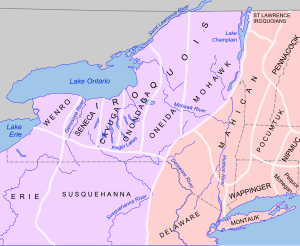
The Iroquoian languages share a common history and culture. Over time, they developed into different languages. Archaeological findings show that Iroquois ancestors lived in the Finger Lakes region from at least 1000 CE. These languages include Mohawk, Huron-Wyandot, Neutral, Erie, and Cherokee. The members of the Iroquois Confederacy (Seneca, Onondaga, Oneida, Cayuga, and Mohawk) speak Iroquoian languages that are different from other Iroquoian speakers.
In 1649, the Huron and Petun groups were forced out by war parties from the Iroquois Confederacy. Many survivors formed the Wyandot tribe. The languages of these groups were not well recorded. These groups were called Atiwandaronk by the Huron, meaning 'they who understand the language'. After uniting, the Iroquois invaded the Ohio River Valley in present-day Kentucky. They did this to find more hunting grounds. One idea is that the Iroquois pushed tribes like the Quapaw and Ofo out of the region around 1200 CE. However, Robert La Salle listed the Mosopelea among the Ohio Valley peoples defeated by the Iroquois in the early 1670s. These Siouan-speaking groups settled in the Midwest by 1673. They created what became their historical territories. Just as the Iroquois displaced the Siouan peoples, the Siouan peoples displaced less powerful tribes they met in the Midwest, like the Osage.
Iroquoian culture was matrilineal. This means that several families of girls and brothers from the same mother's side shared a longhouse. A married man moved into his wife's longhouse. Unlike the Iroquois Confederacy in New York, West Virginia did not have large, central Native American governments. The early Iroquoian and Shawnee cultures in West Virginia were similar to the St. Lawrence Iroquoians. By the 1300s, a distinct St. Lawrence Iroquoian culture had built fortified villages and brought corn to the St. Lawrence valley.
Susquehannock
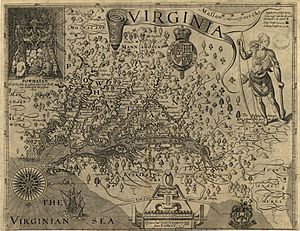
The Susquehannock were known by many names. The English called them Susquehannock, meaning "people of the muddy river." The French called them Andastes. The Dutch and Swedes called them Minquas. The English in Pennsylvania called them Conestogas. Their own name for themselves is not known. The Susquehannock were divided into two groups: the White Minquas and the Black Minquas. The White Minquas lived along the Susquehanna River from Pennsylvania to southern New York. The Black Minqua lived in parts of West Virginia (Grant, Hampshire, and Hardy counties) and Maryland. They shared the Potomac River as a border. They might have been part of the Erie people. They were strong enemies of the Iroquois Confederacy, fighting for control of the fur trade.
Erie
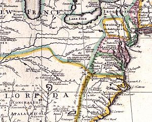
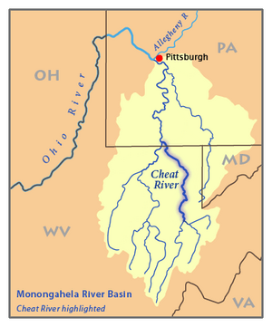
The Erie people or Cat Nation are the earliest tribal group mentioned in records for the northern region of West Virginia. A 1642 map shows a river in the Allegheny Mountains that separated French and Virginian lands. Another map from 1657 shows the same river.
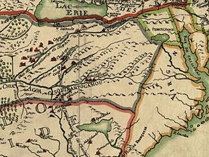
The Erie people also appear on a map from August 31, 1650. This map shows them in the New River-Holston divide area. They were called Rickahockans or Ricahecrians. This name meant "from beyond the mountains" in an eastern Virginia Algonquian language. These groups have been identified in different ways, including as ancient Cherokee or a division of the Cat Nation.
Neutrals
The Chonnonton, or "people of the deer," were called the Neutral Nation by Europeans. Samuel de Champlain first named them this in 1615 because they were at peace with the Iroquois Confederacy and the Hurons. The Hurons called them Attiwandaronk, meaning "people whose speech is a little different." They lived in southwestern Ontario and across the Niagara River in Western New York. They had trade and war agreements with many surrounding Iroquoian-speaking peoples.
In the early 1600s, the Neutrals became very organized. They might have even been a new chiefdom. This chiefdom had ten tribes with a ruling council. It was led by a warrior-priest-chief named Tsouharissen ("Child of the Sun"). Like other groups, their farming of corn helped them grow a large population. They were the biggest native society in the area in the mid-1600s. They may have had as many as 40,000 people and 4,000 to 6,000 warriors. They might have even started to semi-domesticate white tail deer. Early reports say they kept deer in pens to manage them for the valuable fur and skin trade.
The chiefdom ended in 1646 when Tsouharissen died. In 1651, the Iroquois Confederacy destroyed their old enemies. By 1671, the Neutrals are no longer mentioned in historical records.
These early Iroquois or proto-Iroquoians were part of an earlier trade network south of the Huron in the French Canadian region. The Iroquois League destroyed the Neutral Nation's trade network by 1653. The Rickohockans arrived in Virginia soon after this. Both the Rickahockans and later Westo were known for being aggressive and warlike. They were thought to have been forced out of Lake Erie by the Iroquois League. About 700 to 900 warriors arrived in the early Virginia colonial trade area.
Siouan Groups
Language and historical records suggest that Siouan peoples might have come from the south. They migrated over a thousand years ago from North Carolina and Virginia to Ohio. Some groups continued down the Ohio River to the Mississippi River and up the Missouri River. Others went across Ohio to Illinois, Wisconsin, and Minnesota, where the Dakota lived. Ohio Valley Siouan is a group of related Siouan languages. These included the Ofo, Biloxi, and Tutelo languages. The Tutelo language was a group of similar dialects spoken by the Tutelo, Monacan, Manahoac, and Nahyssan groups. They also included the Occaneechi in what is now Virginia and West Virginia.
Mosopelea
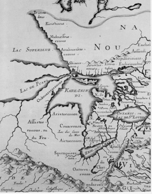
A map from 1684 shows tribal villages of the eastern Siouan Mosopelea group. These villages had been destroyed in the central Ohio River region. On August 5, 1684, the New York Iroquois were encouraged to take control of the Ohio Valley. This was to establish New York trade with the French from the lower Ohio Valley. The first recorded Albany Trade began with the Vielle of Albany during an expedition in 1692–94. Virginians were already trading with groups in West Virginia at this time.
Mohetans
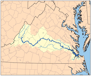
The Mohetans were the earliest Native American tribe reported by Virginians in central West Virginia. They were found during the Batts and Fallams' 1671 Expedition. This expedition also found signs that other colonists had been in the area before them. Earlier writers thought the Mohetan were a northern Cherokee group. Today, scholars believe they were Eastern Siouan. A guide from the Sapony River reported hearing a drum and a gunshot to the north. This might have been in the Greenbrier or Gauley River valleys. A Mohetan runner met the Virginian and Siouan group. He wanted to know if they planned to attack. He was given ammunition for his European gun. This happened before Bacon's Rebellion, a Virginia farmers' uprising against local tribes in 1676.
Monetons and Monecans
The Monetons traded with the Tomahitans from the Holston River Valley. Today, many agree that the Monetons were Eastern Siouan. They might have been a western branch of the Virginia Monacan Indian Nation. However, this idea is less certain when looking at the archaeology of Eastern Tennessee and the late Clover Phase in West Virginia (1550-1650). The Occaneechi language was likely their main trade language. This group allowed other tribes to live with them.
From 800 to 900 CE, the latest Woodland farmers experienced milder weather and started growing corn. Around 1250, the Monacan Indian Nation were driven by enemies from the northwest into the Piedmont James River region of Virginia. There, they found hunter-gatherer people who did not grow corn. Monacan stories say they taught the Doeg how to farm corn. The Doeg's language is similar to Piscataway or Nanticoke.
Other Historic Groups
Many Native American groups lived in this area besides the Algonquian, Iroquois, and Sioux. For example, the Occhenechees, also known as the Occaneechi, were middlemen in the regional trade network. Another group, the Ocanahonon, dressed like Europeans. They carried curved swords at a village ten days west of the mountains by 1607. Archaeological sites of the Ocanahonon have been found in the Ohio Valley. These sites have both gun and knife parts. Trade goods found here were likely from tribes trading with each other.
Canaragay
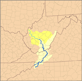
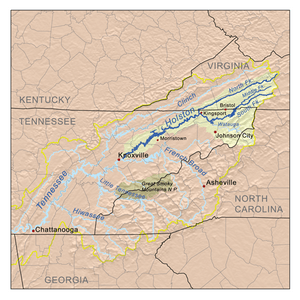
The Canaragay lived near the New River (Kanawha River) watershed in northwestern North Carolina. This part of the Appalachian Mountains has rivers that flow to the Gulf of Mexico, the Atlantic Ocean, and the Ohio Valley. The west side of the divide has the Holston River. This area is now part of the Kingsport–Bristol Metropolitan Statistical Area.
John Lederer, working for the governor of Virginia, explored the Appalachians in 1669 and 1670. He reached the mouth of the Kanawha River. He reported no fighting in the Kanawha Valley from the early "Cherokee People." He later settled in western Maryland and traveled to the Potomac area. The Iroquoian groups in Virginia, like the Nottoway, Meherrin, and Susquehanna, called themselves Chiroenhaka. In the north, this group was called Mingo or Mengwe. John Lederer's guide on his journey to southwest Virginia and North Carolina was a Susquehanna.
Tomahitans
The Tomahitans developed from either the Yuchi or the Cherokee from eastern Tennessee. Both the Hernando de Soto Expedition in 1542 and the Captain Juan Pardo Expedition in 1568 met the ancient Uchi, also called the Chisca. In western North Carolina, Hernando Moyano attacked and burned the Chisca village of Maniatique in 1567.
The Shawnee later settled near the Savannah River. The Carolina Algonquians had lived in southern lowlands for almost six hundred years. In 1727, a group of southern Cherokee visited Charleston, South Carolina. They called the Tomahitans old enemies of their allies, the Yamasee.
Kanawha
Kanawha canoemen moved trade along the Ohio Valley and its rivers. The Messawomeake moved trade from here across the Allegheny Mountains in early history. Kaháwa means "boat" (canoe) in the local Iroquois dialect. Chief Cornstalk's Shawnee word for canoe was "Olagashe." The Iroquois called the Kanawha River "Ka(ih)nawáˀkye," meaning "waterway." The Canawagh (Kanawhas) were last reported as a group in 1774 in the St. Albans area. They reportedly joined other Iroquois or mixed with Shawnee moving to the Potomac near trade posts.
In 1669, the Iroquois warned the French that the Andastes would threaten them if they traveled down the Ohio River. The Maryland Accokeek Creek site (1300–1650 CE) is linked to the historic Piscataway Indians. For several centuries, there were no archaeological sites of established Piscataway in the Ohio Valley or West Virginia. The Piscataway moved to Conoy Island in Maryland in 1699. Later researchers said that "Kanawha" was not an Algonquian Shawnee word. However, West Virginia does have Algonquian phrases.
White traders started setting up trading houses in the Ohio, Allegheny, and Monongahela valleys in 1717. A fur trader named Michael Bezallion recorded his trip from Illinois country up the Ohio to Philadelphia in 1717. The Iroquois built a town at Kanaugha before 1748. The French built a fort nearby before the French and Indian War. James Le Tort, Sr. moved his trading house to near the Letart Falls by 1740. A French Canadian officer, Céloron de Blainville, met English traders with canoes on August 12, 1749. Trade items found in this area date back to at least the 1600s.
Hudson's Trading Post Inn and canoe landing appeared on a map in 1807. Colonial maps from this time show the upper Ohio River as an extension of the Alleghany River. A Delaware Indian story says that the Allegheny Indians were defeated. They were allowed to cross the Allegheny River to reach the east coast, which became their homeland.
Oniasantkeronons
The Oniasantkeronons were likely from the Kanawha River area. The hills south of the Kanawha have had several names. The ruins of a square fort at the mouth of Bull Creek on the Coal River have been found. This is thirty miles upstream of St. Albans on the Kanawha River. The Oniasantkeronons were scattered from northern Ohio before the Mohawk invasion. They moved east toward the Monacan Indian Nation sometime after 1699.
A map from 1783 showed the Scioto River and the Lower Shanaois village at its mouth. Franquelin's map of 1684 shows tribal villages in the central Ohio River region. These included the eastern Sioux, like the Mosopelea. On August 5, 1684, the New York Iroquois were encouraged to take control of the Ohio Valley. This was to establish New York trade with the French. The first recorded Albany Trade began in 1692–94. Virginians were already trading with native groups in West Virginia at this point.
The Sussquahana and Sinaicus destroyed the Black Mincquaas.
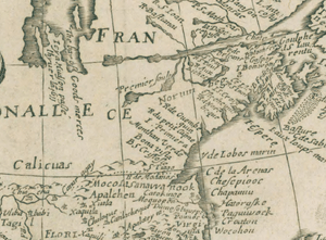
Calicua
The Calicua moved east to the upper Potomac River trade area. However, the tribe was later destroyed and joined with other tribes. The earliest location of the Calicuas is shown as a province north of the Chisca and Appalachians. This is according to a story from De Soto's expedition in 1540-1541. The Calicuas are on maps from 1570 and 1642. A map from 1650 showed more correct geography, placing the Calicuas generally in the West Virginia area. The Guyandottes appeared in southwestern West Virginia and southern Ohio around this time. They pushed out the Calicua and Mosopelea peoples from the Ohio Valley.
This time is sometimes called a "fire-side cabin culture." This is linked to hunters in the 1700s. A trading post from 1731, owned by Charles Poke, traded with these "Trade Indians," who were then called Cherokee. The Calicua were reported in the Tygart Valley River and Cheat River region in 1705 and 1707. Fort Lyttelton and Fort Shirley were built in 1755–56 by a fur trader named George Croghan. Colonel Andrew Lewis had about sixty Virginia Cherokee with him on an expedition to this area in 1756.
Tionontatacaga
The Tionontatacaga (Tobacco Indians, Iroquois) traded from areas east of Lake Erie. They were generally enemies of the traditional Iroquois League. The early historic Ohio Valley Siouans were neighbors with the Cat Nation to the northeast. Their trade neighbor to the east was the Neutral Nation. The prehistoric culture of the Cat Nation region was named for Charles Whittlesey. He was a geologist and archaeologist who started studying the Whittlesey Culture (1000 to 1600). Fort Ancient people grew beans at least from 1150–1200. West of Lake Erie's rivers were the villages of the Sandusky culture (1400–1500). Late Woodland people lived south of the Sandusky people and southwest of the Whittlesey people. The connection between these different prehistoric peoples and historic tribes is still unclear due to increasing migrations.
Chief Tsouharissen had a council that united about ten tribes within the Neutralia empire. A French friar reported three large deer pens near his village in 1626. They called themselves Chonnonton, or "people of the deer." Because these traders were at peace with the League and Huron, Champlain called them "la Nation neutre" in 1615. They traded deer hides and other products as far south as the Powhatan chiefdom. They traded for valuable marine shells. The Iroquois League destroyed this culture in 1651. Having been pushed south, these Wyandot mixed again. Some Tionontatacaga joined the Shawnee. Other Wyandot were known as Little Mingoe. The Guyandotte River was named in their memory.
Trade with Europeans
Spanish and French Trade
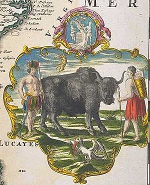
In the northern part of Chickasaw country, near where the Wabash and Ohio rivers meet, Jolliet and Marquette met an Iroquoian group in 1673. They thought this group was either Tuscarora or Cherokee. These groups were reported to be trading with the Spanish to the east and had firearms. The French explorers were in the northern Spanish trade country. John Peter Salley described the Ohio Falls area as a Spanish Manor in 1742. This began on the Kanawha River. The wild cattle mentioned are often thought to be a smaller type of the Eastern Forest Buffalo, which is now extinct. The last buffalo seen and killed in West Virginia was in Boone County in 1826.
Above the Potomac, Augustine Herman made a map from 1659 to 1670. It shows major rivers leading into the Allegheny Mountains. These rivers on the map lead into the eastern valleys of West Virginia. His explorers did not go through the gaps of the Monongahela National Forest.
Documenting early United States history became popular by 1876. Early settlers plowing fields near the Mouth of the Kanawha found more than eighty gun barrels. They also found an anvil, hammers, and other blacksmith tools. Locals also dug up tomahawks, pewter basins, and other items from ancient mounds.
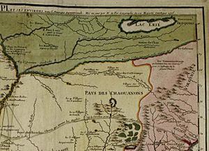
The Neutral Nation formed a league of eight hundred Upper Algonquians in 1653. This league was located southwest of Skenchioe, near a Fox village in Michigan. The Cat Nation neighbored the Upper Algonquians to the east. They were scattered around the southern shore of Lake Erie. From another direction, Iroquois destroyed kindred Kentaientonga villages. In 1669, at Montreal Island, La Salle was told to expect to find Chaouanon (Algonquian) and Honniasontkeronon (Iroquoian) villages on the Ohio River. Exploration information was rarely shared between different European nations. The Andasté (Chiroenhaka) were found on maps as Calicuas territory. They blocked New York and French Canadian trade in this region.
New York Trade
Trade between New York and the Ohio Valley region started around 1692-94. However, trade between the Ohio Valley area and Fort Henry (Virginia) began at least two decades earlier. Archaeological evidence also shows that trade between tribes and Europeans began long before this. Under the name Chaskepe in 1683, some Cisca seem to have joined the Shawnee. They moved to Fort St. Louis in Illinois and lived among the French traders.
Almost a century later, stories were still told about this time of war and trade. George Washington was about fifteen miles below Wheeling, Marshall County, in October 1770. An early Cut Creek Indian town was destroyed by the Six Nations (Haudenosaunee). This was told by the hired Crawford Indians and two Croghan Indians with Washington. These western Virginia Indians explained the geography of each stream they passed on the Ohio River. Washington spent a night at an old hunters' camp before returning to the main camp at the Mouth of the Kanawha. A few days before, he hunted through the Old Town Creek area near the Old Shawnatown.
Virginia Trade

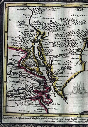
Trade from the Allegheny Mountains region began with Jamestown, Virginia. In a 1999 report, the Massawomeck offered gifts to John Smith during his Chesapeake Bay exploration in 1608. These gifts included bows and arrows, deer and bear meat, fish, clubs, and bear skins. Next, the Susquesahanock came and presented venison, tobacco pipes, baskets, and arrows. Many small, well-made arrow points have been found at the Jamestown archaeological site. These appear to be from these trades or gifts.
In the early 1600s, the Messawomeake from beyond the western slopes of the upper Allegheny Mountains moved to the upper Potomac area. They did this to be closer to English trade goods. This led to fighting with the Iroquois Trade middlemen, the Algonquian Nacotchtank, in 1632. Leaving French Canadian trade, they arrived and began trading with Captain Henry Fleet on the upper Chesapeake Bay. The Messawomeake settled in the northern rivers of the upper Potomac Valley. A period of general peace followed with the Algonquian groups down the Potomac.
In the 1640s, the Virginia Colony built Fort Henry. They traded with the eastern Siouan groups of early West Virginia. A fort of particular interest was the James River Fort built by William Byrd I in 1676. It was closer to Tutelo groups and nearby Monacan groups. The Monecaga were a western part of the Monacan Indian Nation. According to John Lederer, the Monacan had been driven by enemies from the northwest into the James River and Blue Ridge Mountains region of Virginia around 1250. There, they found hunter-gatherer people who did not grow corn. Along with Shattera, these were part of the Occane-Uchi Virginia trade through the south of the state.
|


