2025 Kamchatka Peninsula earthquake facts for kids

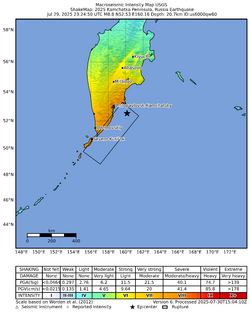
USGS ShakeMap
|
|
| UTC time | 2025-07-29 23:24:52 |
|---|---|
| ISC event | 643826916 |
| USGS-ANSS | ComCat |
| Local date | 30 July 2025 |
| Local time | 11:24:52 PETT (UTC+12) |
| Duration | 3–4 minutes |
| Magnitude | Mw 8.8 |
| Depth | 35 km (22 mi) |
| Epicenter | 52°28′23″N 160°23′46″E / 52.473°N 160.396°E |
| Fault | Kuril–Kamchatka Trench |
| Type | Megathrust |
| Areas affected | Kamchatka Peninsula, Kuril Islands |
| Max. intensity | VIII (Severe) |
| Tsunami | 5–6 m (16–20 ft) |
| Foreshocks | 192 >Mw 4.0 Mw 7.4 on 20 July 2025 (strongest) |
| Aftershocks | 373+ >Mw 4.0 Mw 6.9 on 30 July 2025 (strongest) |
| Casualties |
|
On July 30, 2025, a very powerful earthquake with a magnitude of 8.8 struck off the eastern coast of the Kamchatka Peninsula in the Russian Far East. It happened about 119 kilometers (74 miles) east-southeast of the city of Petropavlovsk-Kamchatsky. This earthquake was one of the strongest ever recorded by scientific instruments worldwide since the 2011 Tōhoku earthquake. It was also tied for the sixth-strongest earthquake ever measured.
Despite its immense power, the earthquake caused less damage than other earthquakes of similar strength. It led to moderate damage and several injuries in the Kamchatka and Sakhalin regions of Russia. The tsunami that followed spread across the Pacific Ocean, but its waves were generally smaller than expected, mostly 1 meter (3.3 feet) or less in height in most places. Sadly, one person died indirectly because of the tsunami evacuation efforts in Japan, and 21 people were injured during these evacuations.
Contents
Understanding Earthquakes: Tectonic Plates
Where the Earthquake Happened: The Kuril-Kamchatka Trench
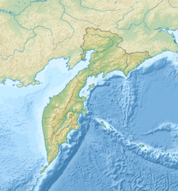
Earthquakes often happen where large pieces of Earth's crust, called tectonic plates, meet. The 2025 Kamchatka earthquake occurred in a special area known as the Kuril–Kamchatka Trench. This is a place where the Pacific plate is slowly sliding underneath the North American plate. This process is called subduction, and it's like one giant conveyor belt of rock moving under another. This constant movement builds up a lot of stress in the Earth's crust. When this stress becomes too much, it is suddenly released, causing an earthquake.
This region has experienced many powerful earthquakes in the past. For example, a very strong earthquake happened here in 1952. That event measured between magnitude 8.8 and 9.0 and caused a large and destructive tsunami along the Kamchatka coast. Another even larger earthquake occurred in 1737, with an estimated magnitude of 9.3. This earthquake generated a massive tsunami, with waves reported to be as high as 63 meters (207 feet). In 1841, another earthquake, estimated at magnitude 9.0, also produced a major tsunami that reached as far as Hawaii.
The Main Event: A Powerful Shake
How Strong Was It?
The main earthquake, which happened deep under the ocean, occurred on July 29, 2025, at 11:24 PM UTC. The United States Geological Survey (USGS) measured its strength as a magnitude 8.8. The earthquake's starting point, called its epicenter, was off the Pacific coast of the Kamchatka Peninsula. It was about 136 kilometers (85 miles) east-southeast of Petropavlovsk-Kamchatsky. The actual point where the earthquake began underground, known as the hypocenter, was at a shallow depth of 35 kilometers (22 miles). Other scientific groups measured the earthquake's magnitude slightly differently, around 8.6.
Foreshocks and Aftershocks
Before the main earthquake, a smaller earthquake, called a foreshock, struck on July 20. It measured magnitude 7.4 and was located about 60 kilometers (37 miles) southwest of where the main earthquake would hit. After the main earthquake, there were many more smaller quakes, known as aftershocks. At least 344 aftershocks were recorded, including a strong one of magnitude 6.9 that happened shortly after the main event on July 30.
Scientists from the USGS explained that the earthquake happened because of "shallow reverse faulting" on the subduction zone. This means that one part of the Earth's crust pushed up and over another. They estimated that the area where this movement occurred was about 390 kilometers (240 miles) long and 140 kilometers (87 miles) wide. The earthquake's rupture, or the area that broke, was believed to have happened in a "seismic gap." This is an area where scientists expected a big earthquake, but it hadn't happened in a while. The shaking from the earthquake lasted for about 3 to 4 minutes.
The Tsunami: Ocean Waves After the Quake
Tsunami Warnings Around the Pacific
Because the earthquake was so strong and happened under the ocean, it created a tsunami. A tsunami is a series of very long ocean waves caused by large-scale disturbances, like powerful underwater earthquakes. Warnings were quickly issued across the Pacific Ocean to alert coastal communities.
Russia and Japan
The Pacific Tsunami Warning Center (PTWC) warned of "hazardous tsunami waves" for the coasts of Russia and Japan. Russian authorities issued tsunami warnings for the Kamchatka Peninsula and the Kuril Islands. These warnings were later cancelled on the evening of July 30. In Japan, the Japan Meteorological Agency (JMA) issued a tsunami warning for many coastal areas, from Hokkaido down to Wakayama Prefecture. Tsunami advisories were also issued for other regions. About 900,000 people in 133 towns were advised to evacuate. The JMA expected waves up to 3 meters (10 feet) high and urged people to move to higher ground. Sendai Airport runways were closed, and several train services were temporarily stopped. Workers at the Fukushima Daiichi Nuclear Power Plant were ordered to evacuate, and a planned release of treated water was halted. The Japanese Defense Ministry sent aircraft to gather information. Around two million people across Japan were advised to evacuate. The JMA later lowered its warnings to advisories and then lifted them completely the next day.
Other Asian Countries
Indonesia's Meteorology, Climatology, and Geophysical Agency issued a warning for parts of Papua, North Maluku, North Sulawesi, and Gorontalo. They expected small tsunami waves, less than 50 centimeters (1.6 feet) high, and advised residents to move away from beaches. In China, the Ministry of Natural Resources issued a yellow alert, which is the second lowest level, for Taiwan, Zhejiang Province, and Shanghai. Taiwan's Central Weather Administration issued a "tsunami watch," expecting waves up to 1 meter (3.3 feet) on its southeastern and southwestern coasts. The Philippine Institute of Volcanology and Seismology issued a tsunami advisory for the Pacific coast of the Philippines, expecting waves up to 1 meter (3.3 feet). This advisory covered 22 provinces but was later cancelled as no significant waves were recorded. The PTWC also warned that waves less than 30 centimeters (1 foot) could hit South Korea.
The Americas

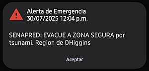
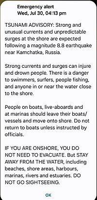
The PTWC and other agencies issued advisories for British Columbia in Canada and the Pacific coastline of the United States. They warned of potentially strong currents and surges, with waves generally under 30 centimeters (1 foot). Tsunami warnings were issued for parts of Alaska and Hawaii. The entire U.S. West Coast (California, Oregon, and Washington states) was placed under alert. Immediate evacuations were ordered for coastal areas across Hawaii. The U.S. Coast Guard ordered all vessels to leave ports throughout the Hawaiian islands. The first waves were expected to reach Hawaii around 7:00 PM Hawaii time. The National Oceanic and Atmospheric Administration placed the California Central Coast and San Francisco Bay area under advisory. A warning was also issued for a section of the California coast near the Oregon border. The Mexican Navy warned of strong currents at ports along Mexico's Pacific coast and urged residents to stay away from beaches. Alerts were also issued in Chile, Colombia, Costa Rica, Peru, and the Galápagos Islands in Ecuador.
Oceania and Pacific Islands
The PTWC warned that tsunami waves between 1 and 3 meters (3.3-10 feet) high were possible in Hawaii and the Solomon Islands. The Center also warned that waves up to 30 centimeters (1 foot) could reach many other Pacific islands, including American Samoa, Chuuk, Kiribati, Nauru, New Caledonia, Niue, Papua New Guinea, Pitcairn Islands, Tokelau, Tuvalu, Vanuatu, and Wallis and Futuna. The governor of Hawaii, Josh Green, noted that data from Midway Atoll measured waves of 6 feet (1.8 meters) from peak to trough. Hawaii later downgraded its warnings to an advisory. New Zealand's National Emergency Management Agency (NEMA) issued an advisory for "strong currents and unpredictable surges" around its entire coast. Tonga's Meteorological Services advised people in threat areas to evacuate. Fiji's Mineral Resources department issued a tsunami watch for low-lying coastal areas. The Cook Islands and Samoa also issued advisories. In the Marquesas Islands, French Polynesia, authorities warned that waves up to 1.1-2.2 meters (3.6-7.2 feet) could reach certain islands. Guam, Australia, Palau, and the Northern Mariana Islands were also put under an advisory.
How Big Were the Tsunami Waves?
The actual tsunami waves varied in height depending on the location.
Russia
In Russia, tsunami waves between 5 and 6 meters (16-20 feet) were observed in parts of Kamchatka and neighboring islands. Waves measuring 3-4 meters (10-13 feet) were seen in the Yelizovsky District of Kamchatka. A 5-meter (16-foot) wave struck Severo-Kurilsk in the nearby Kuril Islands. Some scientists estimated that waves of 10-15 meters (33-49 feet) may have hit parts of the peninsula's coast. An American tsunami scientist even estimated that waves up to 43 meters (141 feet) may have struck less populated areas of Kamchatka. In Nikolskoye, Kamchatka Krai, the waves were 0.2 feet (6 centimeters) high.
Japan
In Japan, tsunamis were observed in 22 of the country's 47 prefectures. A 1.3-meter (4.3-foot) wave hit Kuji, Iwate. Waves measuring 80 centimeters (2.6 feet) were reported in Hachijō-jima and Nemuro, Hokkaido. Waves of 50 centimeters (1.6 feet) were observed at Ishinomaki port in Miyagi Prefecture. Other areas reported waves between 20 and 40 centimeters (0.7-1.3 feet). On July 31, waves reaching up to 70 centimeters (2.3 feet) were recorded in Oarai and Tokachi Subprefecture, Hokkaidō.
Other Areas
In French Polynesia, the remote Marquesas Islands reported wave heights of 1.5 meters (5 feet). Waves of 30 centimeters (1 foot) were reported elsewhere in French Polynesia. A 1-meter (3.3-foot) tsunami was observed in the Galapagos Islands. In the Hawaiian Islands, a 1-meter (3.3-foot) tsunami struck Midway Atoll. Kahului, Hawaii, was hit by a 1.74-meter (5.7-foot) wave, while in Hilo, the tsunami was 1.49 meters (4.9 feet) high. In North America, water levels 1.4 feet (43 centimeters) above normal tide levels were observed in the Aleutian Islands. Waves over 60 centimeters (2 feet) were observed in various locations in California. The maximum confirmed heights were 3.6 feet (1.1 meters) in Crescent City and 2-5 feet (0.6-1.5 meters) in San Francisco. In Crescent City, the harbor suffered almost $1,000,000 in damage from the tsunami. Along the Chilean coast, waves over 1.5 meters (5 feet) were recorded, with some beaches seeing wave heights reach 2.5 meters (8.2 feet).
Impact and Recovery Efforts
Damage in Russia
In Kamchatka, at least four people were injured, but none of their injuries were serious. Some people were injured while quickly leaving buildings, including a hospital patient who jumped from a window. In Petropavlovsk-Kamchatsky, there was damage to buildings, power outages, and mobile phone service problems. Part of the facade of a kindergarten building collapsed, and cracks appeared in the walls of several medical and social service buildings. Rescuers checked about 900 homes, and 55 of them had some damage. At Elizovo Airport, the ceiling covering of a terminal collapsed, injuring a woman. In the Sakhalin region, some buildings had partially destroyed ventilators and stove pipes. A spokesperson for the Kremlin said that the strong building construction and local preparedness helped prevent more deaths and major damage. Emergency services noted an increase in calls from Petropavlovsk-Kamchatsky about high blood pressure and other health issues. Satellite images showed that Rybachy, a nuclear submarine base in Avacha Bay, was damaged by the earthquake and tsunami.
In the town of Severo-Kurilsk, located in the Kuril Islands, the earthquake caused more than 90 percent of chimneys to fall. The town's port was later flooded by the tsunami, and structures, including a fish processing plant, were swept away by waves that reached 200 meters (656 feet) inland. Russian authorities declared a state of emergency on the tsunami-hit islands. The town of Severo-Kurilsk was rebuilt on higher ground after a destructive tsunami in 1952, leaving only the port exposed to the waves. A state of emergency was also declared in the Severo-Kurilsky District and in Petropavlovsk-Kamchatsky. Around 2,700 people were evacuated from coastal areas. An electricity grid in Sakhalin was damaged, causing power outages.
Impact in Japan
In Japan, 21 people were injured or suffered from heat-related illnesses while evacuating in very hot temperatures, which reached 40 degrees Celsius (104 degrees Fahrenheit). Fourteen of these injuries were in Hokkaido, and one was in Miyazaki. Sadly, in Kumano, Mie, a 58-year-old woman died after she accidentally drove off a cliff while evacuating from the tsunami.
What Happened Next?
On July 30, shortly after the earthquake, an eruption occurred at Klyuchevskaya Sopka, a volcano on the Kamchatka Peninsula. While the eruption was not directly caused by the earthquake, volcanic activity had been observed there in the days before. On August 3, another volcano named Krasheninnikov also erupted, sending a plume of ash 6 kilometers (3.7 miles) into the sky. This was the first recorded eruption of the Krasheninnikov volcano since humans began observing it.
See also
 In Spanish: Terremoto y tsunami de Kamchatka de 2025 para niños
- List of earthquakes in 2025
- List of earthquakes in Russia
- Ring of Fire
- Kamchatka earthquakes


