Agoura Hills, California facts for kids
Quick facts for kids
Agoura Hills, California
|
||
|---|---|---|
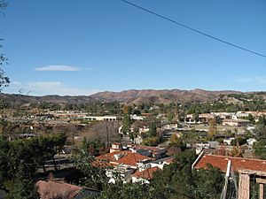
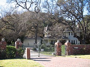
View of Agoura Hills looking from southern edge of the Historic Quarter in December 2006
|
||
|
||
| Motto(s):
"The Gateway to the Santa Monica Mountains"
|
||
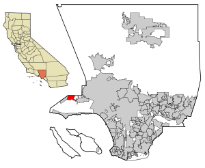
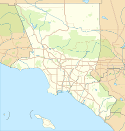
Location of Agoura Hills in Los Angeles County
|
||
| Country | United States | |
| State | California | |
| County | Los Angeles | |
| Region | Conejo Valley | |
| Settled (by the Spanish) | 1700s | |
| Incorporated | December 8, 1982 | |
| Named for | Don Pierre Agoure | |
| Government | ||
| • Type | City Council/City Manager | |
| Area | ||
| • Total | 7.82 sq mi (20.25 km2) | |
| • Land | 7.80 sq mi (20.19 km2) | |
| • Water | 0.02 sq mi (0.06 km2) 0.37% | |
| Elevation | 922 ft (281 m) | |
| Population
(2020)
|
||
| • Total | 20,299 | |
| • Density | 2,603.77/sq mi (1,005.37/km2) | |
| Time zone | UTC−8 (Pacific Time Zone) | |
| • Summer (DST) | UTC−7 (PDT) | |
| ZIP Codes |
91301, 91376–91377
|
|
| Area code | 747/818 | |
| FIPS code | 06-00394 | |
| GNIS feature IDs | 1733436, 2409666 | |
Agoura Hills is a city in Los Angeles County, California, United States. It's located in the Santa Monica Mountains area. In 2020, about 20,299 people lived there.
Agoura Hills is in the eastern Conejo Valley. It sits between the Simi Hills and the Santa Monica Mountains. The city is about 35 miles (56 km) northwest of Downtown Los Angeles. It's also less than 10 miles (16 km) west of Woodland Hills. Nearby communities include Calabasas, Oak Park, and Westlake Village.
Contents
History of Agoura Hills
Early Settlements and Spanish Influence
The Chumash people were the first to settle this area. They lived here about 10,000 years ago. In the late 1700s, Spanish missionaries came to the California coast. They created a road called El Camino Real. This "Royal Road" connected the Spanish missions in California. It passed right through what is now Agoura Hills.
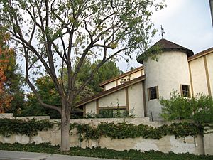
Around 1800, a Spanish grazing area was granted to Miguel Ortega. It was called Rancho Las Virgenes. After Ortega died in 1810, the land was given to José Maria Dominguez in 1834. Later, in 1845, Maria Antonia Machado de Reyes bought the rancho. Today, the "Reyes Adobe" ranch headquarters is part of the Reyes Adobe Museum. It was built around 2004 and is owned by Los Angeles County.
By 1900, Agoura Hills was a popular stop for travelers. It had a natural spring at the base of Ladyface Mountain. This mountain is a key landmark in the area.
Picture City and Naming Agoura
In the 1920s, the community was briefly known as Picture City. This was because Paramount Pictures owned a ranch there. The Paramount Ranch was used for filming Western movies.
To get their own post office, residents needed a one-word name. In 1927, they chose "Agoura." This name was a misspelled version of Pierre Agoure's last name. He was a local man from France who settled in the area in 1871. He was a successful sheep herder.
Growth and Cityhood
Agoura Hills started to grow a lot in the late 1960s. This happened after the Ventura Freeway (U.S. Route 101) was built. The freeway cut through the city, separating its northern and southern parts. The first housing areas built were Hillrise, Liberty Canyon, and Lake Lindero. Growth continued quickly in the 1970s. Many schools were built, and the downtown area grew.
In 1978, people in Agoura Hills worked together to get the Kanan Bridge widened. This bridge goes over the Ventura Freeway. Laws were passed to make the bridge bigger, from two lanes to four.
In 1982, the people of Agoura Hills voted to become a city. About 68% of voters said yes. Agoura Hills became the 83rd city in Los Angeles County. The first City Council included Mayor Fran Pavley. Becoming a city helped residents control new building projects. This also influenced nearby cities like Malibu and Calabasas to become cities later.
The 1980s saw huge growth. Many large areas were divided into housing tracts. Lots of people moved into the city. In the 1990s, many businesses opened. The downtown area filled with shops and restaurants.
Geography of Agoura Hills
Agoura Hills covers about 8.2 square miles (20.25 km2). Most of this area is land, with a small amount of water.
The city has a mountain called Ballard Mountain. It was named after John Ballard, an early settler. Ladyface Mountain is another important mountain. It is 2,031 feet high.
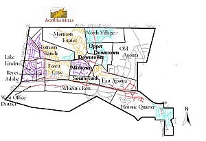
Agoura Hills is known as the "Gateway to the Santa Monica Mountains National Recreation Area". The city has several different areas or districts. These include Morrison Ranch, Downtown, Forest Cove, South End, Malibu Junction, East Agoura, and Old Agoura.
Population of Agoura Hills
| Historical population | |||
|---|---|---|---|
| Census | Pop. | %± | |
| 1990 | 20,390 | — | |
| 2000 | 20,537 | 0.7% | |
| 2010 | 20,330 | −1.0% | |
| 2020 | 20,299 | −0.2% | |
| U.S. Decennial Census | |||
Population in 2010
In 2010, Agoura Hills had a population of 20,330 people. Most residents (84.3%) were White. About 7.5% were Asian, and 2.9% were from other races. About 9.5% of the people were Hispanic or Latino.
There were 7,327 households. About 38.2% of these households had children under 18. The average household had 2.76 people. Most people (79.2%) lived in homes they owned. The median household income was $107,885.
Population in 2000
In 2000, there were 20,537 people living in Agoura Hills. The racial makeup was similar to 2010. About 86.96% were White, and 6.50% were Asian. About 6.85% of the population was Hispanic or Latino.
Economy
Top Employers
Here are some of the biggest employers in Agoura Hills as of 2020:
| # | Employer | # of Employees |
|---|---|---|
| 1 | Las Virgenes Unified School District | 468 |
| 2 | National Veterinary Associates, Inc. | 339 |
| 3 | Westlake Financial Services | 280 |
| 4 | PennyMac Financial Services | 264 |
| 5 | Teradyne | 205 |
| 6 | Nuance (Formerly Touch Commerce) | 143 |
| 7 | Motor Vehicle Software Corp/VITU | 132 |
| 8 | Wood Ranch | 115 |
| 9 | Cydcor LLC | 100 |
| 10 | Zebra Technologies | 96 |
City Services
The Las Virgenes Water District provides water to Agoura Hills. This water comes from the Metropolitan Water District of Southern California.
The Los Angeles County Sheriff's Department (LASD) has a station nearby. It serves Agoura Hills and other areas.
The United States Postal Service has an Agoura Hills Post Office on Clareton Drive.
Education
The Las Virgenes Unified School District serves schools in Agoura Hills.
- Sumac Elementary School
- Willow Elementary School
- Yerba Buena Elementary School
- Lindero Canyon Middle School
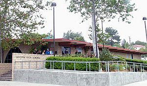
- Agoura High School
- Indian Hills High School
Sports and Events
Agoura Hills is the main office for the Los Angeles Rams football team since 2016.
Events
The Great Race of Agoura Hills is an annual running event. It happens every March at Chumash Park. The race started in 1986. It includes different races like a half-marathon, a 10K, a 5K, and a Kids 1 Mile run. In 2011, the Chesebro Half-Marathon was voted the best half-marathon in the U.S.
Notable People
- Doja Cat, rapper, singer, songwriter
- Tara Davis-Woodhall, Olympic Athlete
- Erin Brockovich, environmental activist
- Kirk Cameron, actor
- Brooke Candy, artist and musician
- Paul Carroll, volleyball player and coach
- Rob Chiarelli, multiple Grammy Award winner
- Guillermo del Toro, Mexican film director, lived in Agoura Hills for a few years.
- Jason Falkner, musician
- Foxygen, band
- Chelsey Goldberg (born 1993), ice hockey player
- Leo Gallagher, known as Gallagher, American comedian
- Ron Goldman, waiter and deceased friend of Nicole Brown Simpson
- Heather Graham, actress
- Skip Hicks, former UCLA running back and NFL and CFL football player
- Warren Hill, jazz musician
- Deena Kastor, Olympic medalist/American marathon record holder
- Grant Kirkhope, composer
- Hayley Kiyoko, singer, songwriter, actress, and dancer
- Taylor Lautner, actor
- Linkin Park, rock band
- Mike Shinoda, musician from the rock band Linkin Park
- Brad Delson, musician from rock band Linkin Park
- Casey Matthews, NFL linebacker for the Philadelphia Eagles
- Clay Matthews, NFL linebacker for the Green Bay Packers
- Tamera Mowry, actress
- Tia Mowry, model and actress
- Harry Nilsson, singer-songwriter
- Terri Nunn, musician from new wave group Berlin, actress, radio host
- Rob Paulsen, voice actor
- Russell Peters, comedian
- Alisan Porter, actress, & singer, winner of 10th season of The Voice
- Doug Robb, singer from post-grunge group Hoobastank
- Ray Romano, comedian
- David Shaughnessy, voice actor and TV director
- Todd Steussie, NFL offensive lineman
- Robert Stock (born 1989), Major League Baseball player
- Elias Toufexis, film, television and voice actor
- Jason Wade, singer and musician
- Rainn Wilson, film and television actor
- Matthew Wolff, professional golfer
- Mark L. Young, actor
- London Thor, Actress & Singer Songwriter
See also
 In Spanish: Agoura Hills para niños


