Bethlehem Pike facts for kids
Quick facts for kids Bethlehem Pike |
|
|---|---|
 |
|
| Route information | |
| Maintained by PennDOT | |
| Length | 42.21 mi (67.93 km)
Length source data gathered using historical 19th Century USGS maps.
|
| Existed | 1763–present |
| Component highways |
|
| Major junctions | |
| South end | Germantown Avenue in Philadelphia |
| North end | Main Street in Bethlehem |
| Location | |
| Counties: | Bucks, Lehigh, Montgomery, Philadelphia |
| Highway system | |
| Roads in Pennsylvania Interstate • US • State • Legislative |
|
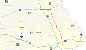
Bethlehem Pike is a historic road in Pennsylvania. It is about 42.21 mi (67.93 km) long. This road connects the cities of Philadelphia and Bethlehem, Pennsylvania. It started as an old Native American path. This path was later called the King's Road in the 1760s. Today, most of Bethlehem Pike is part of Pennsylvania Route 309.
Contents
History of Bethlehem Pike
The Road's Early Days
The Bethlehem Pike began as a Native American trail. It was known as the Minsi Trail. The Minsi Indians, a group of Lenape people, named it. This trail ran between the Blue Mountains and the lands to the south.
In 1740, a group led by David Nitschmann traveled this trail. They went to Bethlehem and Nazareth. A year later, more people joined them. Nicolaus Zinzendorf was one of these new travelers. He visited the first settlers near the Monocacy Creek. On Christmas Eve, Zinzendorf held a special service. During this service, the new settlement was named Bethlehem.
King's Road and Colonial Travel
After Bethlehem was founded, more towns grew along the trail. This made the road very busy. People started calling it the King's Road. The first regular trips between Philadelphia and Bethlehem began in 1763. George Klein used a stage wagon for these trips. He traveled weekly, starting from Bethlehem on Mondays. He returned from Philadelphia on Thursdays.
Bethlehem Pike and Germantown Avenue were key parts of the King's Highway. This was the main road for people and goods traveling north from Philadelphia. In northern Philadelphia, the pike crossed the Old York Road. There's a story that a great Indian chief named Tamanend gave land to early German settlers. They named the spot "Rising Sun" after a special ceremony.
Bethlehem Pike During the American Revolution
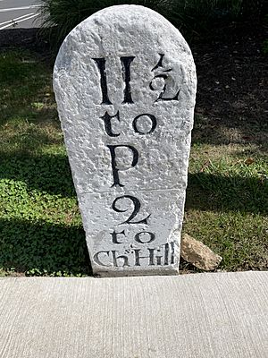
The Bethlehem Pike was very important during the American Revolutionary War. British officers gathered near the southern end of the pike. This was before their army faced the Continental Army at the Battle of Whitemarsh. Further north, in the Whitemarsh Valley, George Washington's army camped. This spot became known as Church Hill. Washington and his army stayed there on December 11, 1777. They then moved on to Valley Forge.
Bethlehem was crowded with officers, prisoners, and soldiers during the war. On September 13, 1777, there was great excitement. The Patriot Army retreated from Philadelphia. A letter arrived saying that military supplies were sent north on Bethlehem Pike. There were 700 wagons carrying these supplies. Even church and state bells were sent along the pike for safety.
The wagon carrying the Liberty Bell broke down in Quakertown. This happened on September 25, 1777. The bells had to be unloaded. After the wagon was fixed, the bells were sent to Allentown. They were hidden there on Hamilton Street to keep them safe.
The Bethlehem Turnpike Era
In 1804, the road became a toll road. This meant travelers had to pay a fee to use it. It was then called the Bethlehem Turnpike. In 1834, Pennsylvania's governor, George Wolf, allowed the company to set up toll gates. They could collect money from people on horses, with cattle, or in carriages.
After 100 years, in 1904, the Bethlehem Pike became a free road. The tolls were completely removed by 1910. In 1911, Pennsylvania started taking over many highways. The Bethlehem Pike became known by special legislative route numbers. It was LR 297 in Northampton County and LR 153 in Lehigh County. It was also LR 153 through Bucks and Montgomery counties.
Numbered Roads Today
In 1926, the U.S. Numbered Highway System was created. Roads across the country were given numbers. Most of Bethlehem Pike became U.S. Route 309 (US 309). For about 30 years, a part of the road from Bethlehem to Center Valley was Pennsylvania Route 12 (PA 12). South of Center Valley, it was US 309. By 1960, Pennsylvania Route 191 replaced PA 12.
Later, US 309 was moved to a new highway near Fort Washington. By 1970, US 309 was changed to Pennsylvania Route 309. PA 309 was then moved to a new freeway that bypassed Sellersville. Six years later, Interstate 378 was removed. Part of its route became Pennsylvania Route 378.
Bethlehem Pike Today
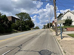
Today, much of Bethlehem Pike is part of Pennsylvania Route 309. This is true in the Lehigh and Delaware Valley areas. In Philadelphia, the road is called SR 4017. About 15,000 vehicles use it daily. In Montgomery County, it's SR 2018, running next to PA 309.
North of Fort Washington, the road is PA 309. About 17,000 to 21,000 vehicles use it each day. In Sellersville, it's SR 4013 and SR 4085. From Quakertown to Center Valley, there's an older part of the pike. This part is west of the current PA 309. In Quakertown, the PA 309 section of the pike sees about 18,000 vehicles daily.
North of Center Valley, the road is PA 378, Old Bethlehem Pike, and Old Philadelphia Pike. PA 378 has about 17,000 vehicles daily. The very northern end of the pike is called Main Street in Bethlehem.
A project was planned to improve Bethlehem Pike in Lower Gwynedd. This project was estimated to cost $500,000.
Major intersections
| County | Location | mi | km | Destinations | Notes |
|---|---|---|---|---|---|
| Philadelphia | Philadelphia | 0.00 | 0.00 | Germantown Avenue | Formerly part of US 422 |
| Montgomery | Whitemarsh Township | 3.07 | 4.94 | Southern terminus of overlap | |
| 3.27 | 5.26 | Northern terminus of overlap | |||
| Fort Washington | 4.85 | 7.81 | Formerly PA 731 | ||
| Lower Gwynedd Township | 8.98 | 14.45 | Interchange; Bethlehem Pike becomes PA 309 north of this junction | ||
| 9.38 | 15.10 | ||||
| Montgomeryville | Interchange | ||||
| 11.58 | 18.64 | Southern terminus of overlap; former segment of US 122 | |||
| 12.47 | 20.07 | Northern terminus of overlap; former segment of US 122 | |||
| Bucks | Hilltown Township | 18.60 | 29.93 | Interchange; Bethlehem Pike becomes SR 4013 north of this junction | |
| 18.89 | 30.40 | ||||
| Sellersville | 20.51 | 33.01 | Southern terminus of overlap | ||
| 21.36 | 34.38 | Northern terminus of overlap; former segment of PA 413 | |||
| 21.63 | 34.81 | East Walnut Street | Formerly PA 813 | ||
| West Rockhill Township | 22.71 | 36.55 | |||
| 25.08 | 40.36 | Interchange; Bethlehem Pike becomes PA 309 north of this junction | |||
| Quakertown | 28.07 | 45.17 | Western terminus of PA 313; northern terminus of PA 663 | ||
| Lehigh | Center Valley | 34.41 | 55.38 | Bethlehem Pike becomes PA 378 north of this junction; southern terminus of PA 378; former segment of PA 312 | |
| Northampton | Bethlehem | 40.07 | 64.49 | Northern terminus of PA 412; former segment of PA 43 | |
| 40.43 | 65.07 | Bethlehem Pike becomes Main Street north of this junction | |||
| 41.12 | 66.18 | Sun Inn Preservation on Main Street | |||
| 1.000 mi = 1.609 km; 1.000 km = 0.621 mi | |||||
 | Tommie Smith |
 | Simone Manuel |
 | Shani Davis |
 | Simone Biles |
 | Alice Coachman |


