Blue Earth County, Minnesota facts for kids
Quick facts for kids
Blue Earth County
|
|
|---|---|

|
|

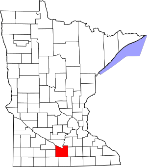
Location within the U.S. state of Minnesota
|
|
 Minnesota's location within the U.S. |
|
| Country | |
| State | |
| Founded | March 5, 1853 |
| Named for | Blue Earth River |
| Seat | Mankato |
| Largest city | Mankato |
| Area | |
| • Total | 766 sq mi (1,980 km2) |
| • Land | 748 sq mi (1,940 km2) |
| • Water | 18 sq mi (50 km2) 2.3%% |
| Population
(2020)
|
|
| • Total | 69,112 |
| • Estimate
(2023)
|
70,006 |
| • Density | 90.22/sq mi (34.836/km2) |
| Time zone | UTC−6 (Central) |
| • Summer (DST) | UTC−5 (CDT) |
| Congressional district | 1st |
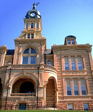
Blue Earth County is a place in Minnesota, a state in the United States. In 2020, about 69,112 people lived there. The main city, or county seat, is Mankato. It's named after the Blue Earth River. This river used to have blue-green clay along its banks. Blue Earth County is part of the larger Mankato-North Mankato metropolitan area.
Contents
History of Blue Earth County
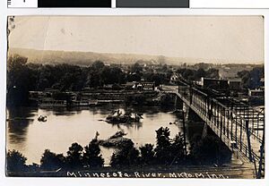
Long ago, Dakota people lived and hunted in the area that is now Blue Earth County. The Sisseton Dakota were one group. A French explorer named Pierre-Charles Le Sueur came here early on. He explored where the Minnesota and Blue Earth rivers meet. He tried to find copper in the blue-green clay that the Dakota people used for paint, but he didn't succeed. This area was controlled by France until 1803. Then, it became part of the United States through the Louisiana Purchase.
When Minnesota became a territory in 1849, the government wanted people to settle in the river valley. In 1850, the first steamboat trip on the Minnesota River reached the Blue Earth River. The first European-American settlers, P. K. Johnson and Henry Jackson, arrived and settled in what is now Mankato. In 1851, the Treaty of Mendota and Treaty of Traverse des Sioux were signed. These treaties made the eastern Dakota people move to nearby reservations.
Blue Earth County was officially created on March 5, 1853. It was formed from parts of Dakota County. It was named after the Blue Earth River. The first government leaders were chosen by Alexander Ramsey, who was the governor of the territory. In October of that year, the first election was held.
In 1855, the Winnebago (Ho-Chunk) people traded some of their land for new land on the Blue Earth River. They moved there and became very good at farming. However, other American settlers wanted their land.
Blue Earth County is close to the Lower Sioux reservation. This reservation was created in 1858. People on the reservation faced starvation. Government payments, called annuities, did not arrive on time. This led to the Dakota War of 1862. After this, all Native Americans were moved out of the county. In 1868, the railroad came to the county. This helped the area grow by bringing new people and goods.
Geography of Blue Earth County
The Minnesota River flows along the northern edge of the county. The Blue Earth River flows north through the middle of the county and joins the Minnesota River. Other rivers like the Watonwan River, Little Cobb River, Cobb River, and Le Sueur River also flow through the county.
The land in the county has low, rolling hills. Most of the area is used for farming. The land generally slopes towards the north. The highest point in the county is about 1,086 feet (331 meters) above sea level.
Blue Earth County covers about 766 square miles (1,984 square kilometers). About 748 square miles (1,937 square kilometers) is land, and 18 square miles (47 square kilometers) is water. There are over 30 lakes in the county. Some parts of the county in the northeast have "closed forest savannas," which are sometimes called big woods. Most of the county is open grassland, but some areas are wet prairies. Around the rivers, you can find oak trees and brushland.
Main Roads
Lakes in the County
- Crystal Lake
- Albert Lake
- Alice Lake
- Armstrong Lake
- Ballantyne Lake
- Born Lake
- Cottonwood Lake
- Duck Lake
- Eagle Lake
- George Lake
- Gilfillin Lake
- Ida Lake
- Indian Lake
- Knights Lake
- Lake Crystal
- Lieberg Lake
- Lily Lake
- Long Lake
- Loon Lake
- Lura Lake (part)
- Madison Lake
- Mennenga Lake
- Mills Lake
- Minnesota Lake (part)
- Mud Lake
- Perch Lake
- Porter Lake
- Rice Lake
- Severson Lake
- Strom Lake
- Wita Lake
Neighboring Counties
- Nicollet County - north
- Le Sueur County - northeast
- Waseca County - east
- Faribault County - south
- Martin County - southwest
- Watonwan County - west
- Brown County - northwest
Climate and Weather
| Weather chart for Mankato, Minnesota | |||||||||||||||||||||||||||||||||||||||||||||||
|---|---|---|---|---|---|---|---|---|---|---|---|---|---|---|---|---|---|---|---|---|---|---|---|---|---|---|---|---|---|---|---|---|---|---|---|---|---|---|---|---|---|---|---|---|---|---|---|
| J | F | M | A | M | J | J | A | S | O | N | D | ||||||||||||||||||||||||||||||||||||
|
0.9
24
5
|
0.8
30
10
|
2
42
22
|
3.1
58
35
|
3.5
70
47
|
5.1
79
57
|
4.3
83
62
|
4.2
81
59
|
3.2
73
49
|
2.3
60
37
|
1.9
43
24
|
1.1
28
11
|
||||||||||||||||||||||||||||||||||||
| temperatures in °F precipitation totals in inches source: The Weather Channel |
|||||||||||||||||||||||||||||||||||||||||||||||
|
Metric conversion
|
|||||||||||||||||||||||||||||||||||||||||||||||
In Mankato, the county seat, temperatures usually range from 5°F (about -15°C) in January to 83°F (about 28°C) in July. The coldest temperature ever recorded was -35°F (-37°C) in February 1996. The hottest was 107°F (42°C) in August 1988. The amount of rain and snow each month varies. February usually has the least, about 0.78 inches (2 cm), while June has the most, about 5.09 inches (13 cm).
People of Blue Earth County
| Historical population | |||
|---|---|---|---|
| Census | Pop. | %± | |
| 1860 | 4,803 | — | |
| 1870 | 17,302 | 260.2% | |
| 1880 | 22,889 | 32.3% | |
| 1890 | 29,210 | 27.6% | |
| 1900 | 32,263 | 10.5% | |
| 1910 | 29,337 | −9.1% | |
| 1920 | 31,477 | 7.3% | |
| 1930 | 33,847 | 7.5% | |
| 1940 | 36,203 | 7.0% | |
| 1950 | 38,327 | 5.9% | |
| 1960 | 44,385 | 15.8% | |
| 1970 | 52,322 | 17.9% | |
| 1980 | 52,314 | 0.0% | |
| 1990 | 54,044 | 3.3% | |
| 2000 | 55,941 | 3.5% | |
| 2010 | 64,013 | 14.4% | |
| 2020 | 69,112 | 8.0% | |
| 2023 (est.) | 70,006 | 9.4% | |
| U.S. Decennial Census 1790-1960 1900-1990 1990-2000 2010-2020 |
|||
2020 Census Information
In 2020, the total population of Blue Earth County was 69,112 people. Here's a look at the different groups of people living there:
| Race | Number | Percent |
|---|---|---|
| White | 57,222 | 82.8% |
| Black or African American | 3,873 | 5.6% |
| Native American | 208 | 0.3% |
| Asian | 1,834 | 2.7% |
| Pacific Islander | 24 | 0.03% |
| Other/Mixed | 2,730 | 4% |
| Hispanic or Latino | 3,221 | 4.7% |
Towns and Cities
Cities
- Amboy
- Eagle Lake
- Good Thunder
- Lake Crystal
- Madison Lake
- Mankato
- Mapleton
- Minnesota Lake (part)
- North Mankato (part)
- Pemberton
- Saint Clair
- Skyline
- Vernon Center
Special Places (Census-designated place)
Small Communities (Unincorporated communities)
Townships (Rural Areas)
- Beauford Township
- Butternut Valley Township
- Cambria Township
- Ceresco Township
- Danville Township
- Decoria Township
- Garden City Township
- Jamestown Township
- Judson Township
- Le Ray Township
- Lime Township
- Lincoln Township
- Lyra Township
- Mankato Township
- Mapleton Township
- McPherson Township
- Medo Township
- Pleasant Mound Township
- Rapidan Township
- Shelby Township
- South Bend Township
- Sterling Township
- Vernon Center Township
See also
 In Spanish: Condado de Blue Earth para niños
 | Kyle Baker |
 | Joseph Yoakum |
 | Laura Wheeler Waring |
 | Henry Ossawa Tanner |


