Harlesden facts for kids
Quick facts for kids Harlesden |
|
|---|---|
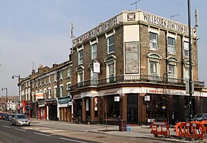
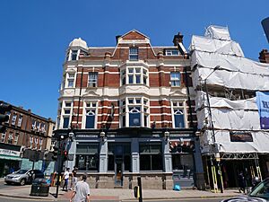 The Royal Oak, High Street/Park Parade |
|
| Population | 17,162 (Harlesden ward 2011) |
| OS grid reference | TQ215835 |
| Ceremonial county | Greater London |
| Region | |
| Country | England |
| Sovereign state | United Kingdom |
| Post town | LONDON |
| Postcode district | NW10 |
| Dialling code | 020 |
| Police | Metropolitan |
| Fire | London |
| Ambulance | London |
| EU Parliament | London |
| UK Parliament |
|
Harlesden is a lively area in north-west London, found within the London Borough of Brent. It's located north of the Grand Union Canal and Wormwood Scrubs. The main road, Harrow Road, runs right through the middle, connecting it to Central London and Wembley.
Harlesden is famous for its exciting Caribbean culture. Many people even call it London's "reggae capital" because of its important role in this music style. The town centre is full of different shops and businesses owned by people from all over the world. Near the canal, you'll find factories, including a McVitie's biscuit factory that has been making delicious biscuits since 1902! The community in Harlesden is very diverse, with people from Afro-Caribbean, Irish, Portuguese, Brazilian, Somali, and other Latin American and East African backgrounds.
Contents
Harlesden's Past: From Village to Town
Harlesden started as a small Saxon settlement. In the old Domesday Book, it was called "Hervlvestvne." For many centuries, it was just a quiet village with farms, orchards, and a few inns.
How Railways Changed Harlesden
In the 1800s, Harlesden began to grow and change. This happened when railways arrived in the area. Stations like Willesden Junction, Kensal Green, and Harlesden brought new life. Small homes were built for railway and factory workers. Larger houses were also built for middle-class families. By 1839, a coach to Harrow passed through the village every day. The village soon had a blacksmith, a grocer, and a shoemaker.
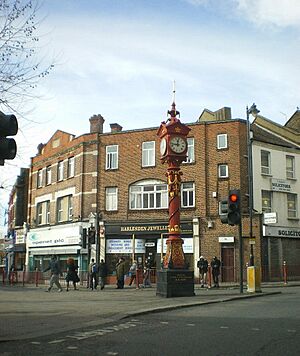
Harlesden slowly lost its rural feel as factories replaced farms. In 1871, a sewer system was built, leading to more houses. Many middle-class families lived here, enjoying the churches, cinemas, a court, a library, and Roundwood Park. By the 1930s, Harlesden had become a full part of London. A special jubilee clock tower was built in 1888. Harlesden also got great transport links with trains and horse buses to Paddington. Electric trams arrived in 1907. That same year, the Willesden Hippodrome Theatre opened, but it was sadly destroyed during a war in 1940.
Harlesden and the Olympics
In 1908, London hosted the Olympic Games. The marathon race actually went through Harlesden! Runners entered the area on Craven Park Road, turned onto Manor Park Road, then went down the High Street, passing the Jubilee Clock. After that, the race continued towards North Acton.

Growth of Industry
After World War I, one of Europe's biggest industrial areas was built nearby at Park Royal. Large factories, including McVitie & Price (which started in 1910) and Heinz (from 1919), opened in Harlesden. This industrial growth meant many middle-class families moved away. Harlesden became mostly a working-class area. The McVitie & Price factory grew to be the largest biscuit factory in the Western world, employing 2,600 people by 1978.
By 1939, some of the last large Victorian houses, like Roundwood House, were taken down. In 1939, a bridge carrying power lines over the Grand Junction Canal was damaged. Later, in 1941, a cargo ship named after Harlesden was sunk during a war, and some crew members lost their lives.
A Changing Community
In the 1950s, transporting coal from Durham and steel from Sheffield became important for the local economy. These jobs brought many new people to Harlesden, including immigrants from Ireland and Jamaica.
Harlesden as we know it today really began to take shape in the 1950s, 60s, and 70s. More people arrived from Ireland, the Caribbean, and the Indian sub-continent. This changed the mix of cultures and people in the area. Even with new arrivals, the population of Harlesden actually went down from 39,527 in 1951 to 26,970 in 1971. However, it remained a busy place.
In the 1960s, some parts of Harlesden, like the Curzon Crescent estate, faced challenges. To make things better, projects like the Harlesden City Challenge in the 1990s helped. They created public art and fixed up the jubilee clock in 1997. More recently, Harlesden has welcomed new communities from Brazil, Portugal, Somalia, Poland, Afghanistan, and Colombia.
Prince Charles visited Harlesden in March 2007. He said he really enjoyed walking down the high street and visiting some of the shops.
Harlesden has been improving lately. Crime rates have gone down, and house prices have gone up. But the area still feels real and welcoming. In 2015, a new "Town Garden" opened. It's a green space where locals can garden, meet friends, and exercise.
Places to See and Visit
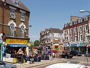
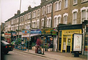
Harlesden's diverse community is clear when you walk down the high street. You'll find Afro-Caribbean hair and beauty shops, Somali restaurants, Portuguese bakeries, and Brazilian cafes.
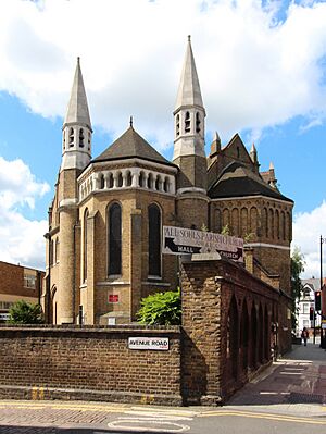
All Souls Church
The Church of All Souls is on Station Road. It was designed in 1879 by E.J. Tarver and is a very important historic building.
Jubilee Clock
Harlesden's famous jubilee clock was put up in 1888. It celebrates Queen Victoria's 50th year as queen.
Roundwood Park
Roundwood Park is the main public park in Harlesden. It's a great place for locals to relax and enjoy nature.
Willesden County Court
The Willesden County Court, located on Acton Lane, was built in 1970.
Our Lady of Willesden Church
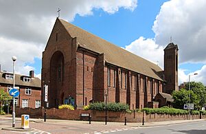
Our Lady of Willesden Church is a Roman Catholic church. It was important for the growing Irish population in the late 1800s. The current church building was built in 1931.
Harlesden House
This government building was built in 1960 and now holds a Jobcentre Plus office. Before this, the Willesden Hippodrome Theatre stood here. It was a large theatre that opened in 1907 and could seat 3,500 people. Sadly, it was destroyed during an air raid in 1940.
Who Lives in Harlesden?
In 2011, the Harlesden area had a population of 17,162 people. Most homes (71.4%) were apartments, while others were terraced, semi-detached, or detached houses. Many of the older apartments were once large houses.
Harlesden is known for its diverse population. In 2011, about 67% of the people identified as Black, Asian, or other minority ethnic groups. About 19% of the population was Black Caribbean, and another 19% was Black African. Other groups included White (not British) and White British. The main foreign languages spoken were Portuguese and Somali.
Harlesden's Culture and "Reggae Capital" Status
Harlesden and nearby areas in Brent played a big part in the growth of reggae music in the UK. In the 1960s, Planetone Studios and later Trojan Records were major reggae labels. They helped popular artists like Desmond Dekker and Toots and the Maytals become famous. Another important label for reggae and other black music was Jet Star, which was known as "the world's largest reggae distributors."
The Brent Black Music Cooperative Rehearsal Studios opened in Willesden in 1983. It offered a studio and training for many local and international music acts. In 1970, Sonny Roberts opened Orbitone Records, the first special record shop in the area. It became a hub for producing and selling soca music. In the 1970s and 1980s, dozens of record shops filled the streets of Harlesden. Today, two still remain on Craven Park Road: Hawkeye and Starlight Records. Many local pirate radio stations also played a big role in helping black artists.
The Cimarons, England's first home-grown reggae band, formed in Harlesden in 1969. Many reggae artists have lived in or near Harlesden, including Dennis Brown, Janet Kay, General Levy, Jimmy Cliff, Bob Marley, and Liz Mitchell from Boney M.
The 1998 film Babymother is set in Harlesden. It shows the black dancehall culture of the area. A book called A London Safari: Walking Adventures in NW10 (2014) was written by local author Rose Rouse about Harlesden.
More recently, Harlesden has also become known for hip hop and grime artists like K Koke, Nines, and George The Poet.
Media and Local News
The Beat London (also known as BANG Radio) is a radio station that broadcasts urban music and cultural shows from Harlesden High Street. You can listen to it on 103.6 FM across north-west London. Other local radio stations also broadcast reggae and other music genres.
Brent's biggest newspaper is the Brent & Kilburn Times.
The Queen Victoria Pub in the famous BBC show EastEnders was inspired by The College Park Hotel in Harlesden.
Harlesden's Location
 |
Stonebridge, St Raphael's Estate, Wembley | Church End/Willesden, Neasden | Willesden Green/Brondesbury Park, Cricklewood |  |
| Stonebridge/Park Royal, Alperton | Kensal Green/Kensal Rise, Queen's Park | |||
| Park Royal/North Acton, West Acton | Old Oak Common, East Acton | North Kensington, Shepherd's Bush |
Getting Around: Transport in Harlesden
Harlesden has good transport links with two train stations:
- Willesden Junction Station (on the Bakerloo line, Watford DC Line, North London Line, and West London Line)
- Harlesden Station (on the Bakerloo line and Watford DC Line)
Famous People from Harlesden
- O.G. Anunoby
- Ricardo P. Lloyd
- Steve McFadden
- Shane Richie
- Gappy Ranks
- Ronny Jordan
- Sabrina Washington
- James DeGale
- Audley Harrison
- K Koke
- Nines
- George the Poet
- Chizzy Akudolu
- Hastings Banda
- Dennis Brown
- Anthony C. George
- Ian Hancock
- Paul Merson
 | Jewel Prestage |
 | Ella Baker |
 | Fannie Lou Hamer |


