Hilo, Hawaii facts for kids
Quick facts for kids
Hilo, Hawaii
|
|
|---|---|
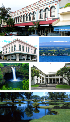
From top to bottom, left to right: S. Hata Building, Hilo Masonic Lodge Hall-Bishop Trust Building, Hilo Bay with Mauna Kea, Rainbow (Waiānuenue) Falls, Federal Building, Post Office and Courthouse and Liliuokalani Park and Gardens.
|
|
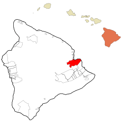
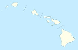
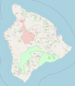
Location within Hawaii County and Hawaii
|
|
| Country | United States |
| State | Hawaii |
| County | Hawaii |
| Area | |
| • Total | 58.3 sq mi (151.0 km2) |
| • Land | 53.4 sq mi (138.3 km2) |
| • Water | 4.9 sq mi (12.7 km2) |
| Elevation | 20 ft (6 m) |
| Population
(2020)
|
|
| • Total | 44,186 |
| • Density | 757.89/sq mi (292.62/km2) |
| Time zone | UTC−10 (Hawaii-Aleutian) |
| ZIP Code |
96720-96721
|
| Area code | 808 |
| FIPS code | 15-14650 |
| GNIS ID | 359187 |
Hilo is the biggest town in Hawaii County, Hawaii. This county covers the entire Island of Hawaii. Hilo is also a special type of community called a census-designated place (CDP).
In 2020, about 44,186 people lived here. Hilo is the fourth-largest town in Hawaii. It is also the biggest town in the state outside of Oahu.
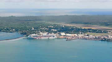
Hilo is the main city for the County of Hawaiʻi. It is located in the South Hilo District. The city sits by Hilo Bay. From Hilo, you can see two huge volcanoes. One is Mauna Loa, which is still active. The other is Mauna Kea, which is a dormant volcano.
Hilo Bay has been hit by giant waves called tsunamis two times. Most people in Hilo live from the bay up the sides of the volcanoes.
Hilo is home to the University of Hawaiʻi at Hilo. It also has the ʻImiloa Astronomy Center. Hilo hosts the Merrie Monarch Festival every year. This festival celebrates ancient and modern hula dancing. It happens after Easter.
You can also find the Mauna Loa Macadamia Nut Corporation here. They are one of the world's top producers of macadamia nuts. Hilo is served by Hilo International Airport.
Contents
- Hilo's Past: A Journey Through Time
- Hilo's Location and Weather
- People of Hilo: A Diverse Community
- Getting Around Hilo: Transport Options
- Learning in Hilo: Schools and Colleges
- Hilo's Economy: From Sugar to Stars
- Hilo's Culture and Attractions
- Famous People from Hilo
- Places to Visit in Hilo
- Media in Hilo
- Sister Cities
- Hilo's Legacy
- Hilo Districts
- Hilo in Books and Stories
- See also
Hilo's Past: A Journey Through Time
Around the year 1100 AD, the first people arrived in Hilo. They brought their Polynesian knowledge and traditions. We don't have much physical proof from that time. But old stories tell us about people living near the Wailuku and Wailoa rivers. This was during the time of ancient Hawaii. The name Hilo means "to twist" in these old stories.
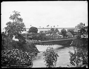
The name "Hilo" first covered a large area of the east coast of the island of Hawaiʻi. This area is now split into South Hilo and North Hilo. In 1823, a visitor named William Ellis came to Hilo. He noted that the main settlement was Waiākea, on the south side of Hilo Bay. Missionaries came to the area in the early to mid-1800s. They started the Haili Church.
Hilo grew a lot because of sugar plantations nearby. These plantations created many jobs. Workers from Asia came to Hilo to work. For example, by 1887, 26,000 Chinese workers were on Hawaii's sugar cane plantations. The Hilo Sugar Mill was one of them. It produced 3,500 tons of sugar each year back then.
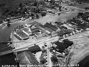
A large wall, called a breakwater, was built across Hilo Bay. It started in the early 1900s and finished in 1929. On April 1, 1946, a very strong earthquake happened near the Aleutian Islands. It caused a giant tsunami that was 14 meters (46 feet) high. This wave hit Hilo 4.9 hours later. It killed 159 people across the islands, with 96 deaths in Hilo alone.
Because of this, an early warning system was created in 1949. It is called the Pacific Tsunami Warning Center. Its job is to track these dangerous waves and give warnings. This tsunami also destroyed the Hawaii Consolidated Railway. Instead, the Hawaii Belt Road was built north of Hilo, using some of the old train tracks.
On May 22, 1960, another tsunami hit Hilo. It was caused by a huge earthquake off the coast of Chile. This wave killed 61 people. Many people did not listen to the warning sirens. Areas near the bay that were once full of homes were turned into parks and memorials.
Hilo started to grow further inland in the 1960s. In the 1980s, downtown Hilo became a cultural hub. Many art galleries and museums opened. The Palace Theater reopened in 1998 as a cinema showing special films.
In the 1990s, the sugar plantations closed down. This hurt the local economy. But in recent years, Hilo has seen new growth in businesses and population.
Hilo's Location and Weather
Hilo is on the eastern side of the island. This is the "windward" side, meaning it gets a lot of wind and rain. The U.S. Census Bureau calls Hilo a census-designated place (CDP). It covers a total area of 151.0 square kilometers (58.3 square miles). Most of this is land, with 12.7 square kilometers (4.9 square miles) being water.
Hilo's Climate: A Rainy Paradise
Hilo has a tropical rainforest climate. This means it gets a lot of rain all year long. Because it's on the windward coast, Hilo is one of the wettest cities in the United States. It gets about 120.39 inches (3058 mm) of rain each year. It rains on about 273 days of the year! The amount of rain changes with how high up you are. Higher parts of Hilo get over 200 inches (5080 mm) of rain annually.
Temperatures are warm all year. The average temperature is about 71.2°F (21.8°C) in February and 76.4°F (24.7°C) in August. The highest temperature ever recorded was 94°F (34°C) in May 1996. The lowest was 53°F (12°C) in February 1962.
Hilo's location on the funnel-shaped Hilo Bay makes it easy for tsunamis to hit.
| Climate data for Hilo International Airport, Hawaii (1991–2020 normals, extremes 1949–present) | |||||||||||||
|---|---|---|---|---|---|---|---|---|---|---|---|---|---|
| Month | Jan | Feb | Mar | Apr | May | Jun | Jul | Aug | Sep | Oct | Nov | Dec | Year |
| Record high °F (°C) | 92 (33) |
92 (33) |
93 (34) |
89 (32) |
94 (34) |
90 (32) |
93 (34) |
93 (34) |
93 (34) |
91 (33) |
94 (34) |
93 (34) |
94 (34) |
| Mean maximum °F (°C) | 85.2 (29.6) |
84.8 (29.3) |
85.0 (29.4) |
84.1 (28.9) |
85.4 (29.7) |
85.7 (29.8) |
87.1 (30.6) |
87.2 (30.7) |
87.7 (30.9) |
87.4 (30.8) |
— | — | 87.7 (30.9) |
| Mean daily maximum °F (°C) | 78.7 (25.9) |
78.4 (25.8) |
78.5 (25.8) |
79.0 (26.1) |
80.7 (27.1) |
81.8 (27.7) |
82.8 (28.2) |
82.9 (28.3) |
83.3 (28.5) |
82.4 (28.0) |
80.3 (26.8) |
78.8 (26.0) |
80.6 (27.0) |
| Daily mean °F (°C) | 71.4 (21.9) |
71.2 (21.8) |
71.9 (22.2) |
72.5 (22.5) |
74.0 (23.3) |
75.2 (24.0) |
76.3 (24.6) |
76.6 (24.8) |
76.5 (24.7) |
75.7 (24.3) |
74.0 (23.3) |
72.2 (22.3) |
74.0 (23.3) |
| Mean daily minimum °F (°C) | 64.1 (17.8) |
64.1 (17.8) |
65.2 (18.4) |
66.1 (18.9) |
67.3 (19.6) |
68.7 (20.4) |
69.9 (21.1) |
70.4 (21.3) |
69.8 (21.0) |
69.0 (20.6) |
67.6 (19.8) |
65.7 (18.7) |
67.3 (19.6) |
| Mean minimum °F (°C) | 59.3 (15.2) |
59.1 (15.1) |
61.1 (16.2) |
62.4 (16.9) |
63.6 (17.6) |
65.2 (18.4) |
66.1 (18.9) |
66.7 (19.3) |
66.1 (18.9) |
65.2 (18.4) |
63.4 (17.4) |
61.3 (16.3) |
58.2 (14.6) |
| Record low °F (°C) | 54 (12) |
53 (12) |
54 (12) |
58 (14) |
58 (14) |
61 (16) |
62 (17) |
63 (17) |
61 (16) |
62 (17) |
58 (14) |
55 (13) |
53 (12) |
| Average precipitation inches (mm) | 7.86 (200) |
10.22 (260) |
12.68 (322) |
9.40 (239) |
6.99 (178) |
7.30 (185) |
9.24 (235) |
11.30 (287) |
8.70 (221) |
10.24 (260) |
14.39 (366) |
12.07 (307) |
120.39 (3,058) |
| Average precipitation days (≥ 0.01 in) | 15.7 | 16.6 | 21.8 | 24.5 | 22.9 | 25.4 | 26.6 | 27.2 | 23.3 | 23.4 | 23.3 | 22.3 | 273.0 |
| Average relative humidity (%) | 76.6 | 76.0 | 78.1 | 80.2 | 78.9 | 77.4 | 79.5 | 79.5 | 79.2 | 80.0 | 80.3 | 78.7 | 78.7 |
| Average dew point °F (°C) | 62.8 (17.1) |
62.4 (16.9) |
63.7 (17.6) |
65.1 (18.4) |
66.0 (18.9) |
66.7 (19.3) |
68.2 (20.1) |
68.5 (20.3) |
68.4 (20.2) |
68.0 (20.0) |
66.6 (19.2) |
64.2 (17.9) |
65.9 (18.8) |
| Mean monthly sunshine hours | 161.0 | 152.0 | 152.7 | 135.9 | 155.0 | 176.9 | 167.2 | 174.9 | 161.5 | 136.3 | 115.0 | 129.0 | 1,817.4 |
| Percent possible sunshine | 47 | 47 | 41 | 36 | 38 | 44 | 41 | 44 | 44 | 38 | 34 | 38 | 41 |
| Source: NOAA (relative humidity, dew points and sun 1961−1990) | |||||||||||||
People of Hilo: A Diverse Community
| Historical population | |||
|---|---|---|---|
| Census | Pop. | %± | |
| 1910 | 6,745 | — | |
| 1920 | 10,431 | 54.6% | |
| 1930 | 19,468 | 86.6% | |
| 1940 | 23,353 | 20.0% | |
| 1950 | 27,198 | 16.5% | |
| 1960 | 25,966 | −4.5% | |
| 1970 | 26,353 | 1.5% | |
| 1980 | 35,269 | 33.8% | |
| 1990 | 37,808 | 7.2% | |
| 2000 | 40,759 | 7.8% | |
| 2010 | 43,263 | 6.1% | |
| 2020 | 44,186 | 2.1% | |
| source: | |||
In 2020, 44,186 people lived in Hilo. They lived in 16,225 homes. The population density was about 796.7 people per square mile.
Hilo has a very diverse population.
- 32% of the people were Asian.
- 18.4% were White.
- 10% were Native Hawaiian & Pacific Islander.
- 0.8% were African American.
- 0.1% were American Indian & Alaska Native.
- 0.6% were from other races.
- 38.1% were from two or more races.
- About 13% of the population was Hispanic or Latino.
About 21.1% of homes had children under 18. The average home had 2.71 people. About 21.1% of the people were under 18. About 21.1% were 65 or older. Females made up 51.1% of the population.
The average household income in 2020 was $70,356. The income per person was $34,678. About 16.1% of the people lived below the poverty line.
Getting Around Hilo: Transport Options
Air Travel
Hilo has its own airport, Hilo International Airport. Airlines like Hawaiian Airlines and Southwest Airlines fly here.
Bus Service
You can get around Hilo using the county's Hele-On Bus system.
Ocean Travel
Hilo is home to the Big Island's largest harbor, Hilo Harbor. It is located on Hilo Bay.
Learning in Hilo: Schools and Colleges
Hilo has many places to learn. There are two colleges: the University of Hawaiʻi at Hilo and Hawaiʻi Community College. Hilo also has primary and secondary schools in the Hilo and Waiakea districts. There are also charter schools for students of all ages.
Hilo's Economy: From Sugar to Stars
Hilo is the oldest city in the Hawaiian islands. In the past, its economy relied on nearby sugar plantations. These closed in the 1990s.
Tourism and Fun Events
Hilo does have tourists, but not as many as the sunny west coast of the Big Island. The west coast has more beaches and big resorts.
A major event for tourism in Hilo is the annual Merrie Monarch Festival. This week-long festival is the world's top hula competition. It brings visitors and dancers from all over the world. It starts on Easter Sunday each spring.
The local orchid society hosts a big orchid show every year. It's called the Hilo Orchid Show. It has been happening since 1951. People from all over come to see the beautiful orchids.
Hilo has Hawaii's only tsunami museum. It mostly teaches about the 1946 Pacific tsunami. You can also see banyan trees planted by famous people like Babe Ruth and Amelia Earhart. Hilo also has the Pana'ewa Rainforest Zoo, shopping centers, cafes, movie theaters, and restaurants. The downtown area has a lively Farmers Market.
Businesses and Science
The Mauna Loa Macadamia Nut Corporation is located in Hilo. It's south of the main town, off Hawaii Route 11.
Hilo is home to most of the astronomical observatories on Mauna Kea. It also has the ʻImiloa Planetarium and Museum. Astronomy brings about $100 million to the island's economy each year. Astronomy on Mauna Kea started after the sugar cane industry declined. The Hawaii Chamber of Commerce invited astronomers to set up here.
Hilo's Culture and Attractions
- East Hawaiʻi Cultural Center
- Lyman House Memorial Museum
- Merrie Monarch Festival
- Pacific Tsunami Museum
Famous People from Hilo
- Rodney Anoaʻi
- Matt Blair
- Keiko Bonk
- Ed Case
- Titus Coan
- Keenan Cornelius
- Glenn Cornick
- Kai Correa
- Wesley Correira
- Jennifer Doudna
- David McHattie Forbes
- Ryan Higa
- Michael Rikio Ming Hee Ho
- High Chiefess Kapiʻolani
- Keōua Kūʻahuʻula
- Harry Kim
- Kimberly Kim
- Darren Kimura
- Kinoʻoleoliliha
- Robert Kiyosaki
- George Lycurgus
- Troy Mandaloniz
- George Naʻope
- Gerald Okamura
- B.J. Penn
- Benjamin Pitman
- Bob Shane
- William Herbert Shipman
- Lani Stemmermann
- Kolten Wong
- Henry Bianchini
Places to Visit in Hilo
- Banyan Drive
- Coconut Island
- East Hawaii Cultural Center
- Haili Church
- Hawaii Tropical Botanical Garden
- Hilo Tropical Gardens
- Hoʻolulu Park
- ʻImiloa Astronomy Center
- James Kealoha Beach Park
- Kalakaua Park
- Liliʻuokalani Park and Gardens
- Lower Waiakea Mountain Bicycle Park
- Lyman Museum
- Mauna Loa Macadamia Nut Corporation
- Mokupāpapa Discovery Center for Northwestern Hawaii's remote coral reefs
- Nani Mau Gardens
- Naha Stone (a famous stone linked to Kamehameha I) in front of the Hilo Public Library
- Pacific Tsunami Museum
- Pana'ewa Rainforest Zoo
- Prince Kuhio Plaza
- Rainbow Falls (Waianuenue) & Boiling Pots on the Wailuku River
- University of Hawaiʻi at Hilo Botanical Gardens
- Wailoa River State Recreation Area with King Kamehameha Statue
Media in Hilo
Hilo has several radio stations: KWXX (94.7FM Hilo/101.5FM Kona), B93/B97 (93.1FM Kona/97.1FM Hilo), The Wave (KHBC 92.7FM Hilo), and KPUA (970AM Hilo).
You can watch local public access TV on Nā Leo TV.
The main newspaper in Hilo is the Hawaii Tribune-Herald. Other newspapers like the Honolulu Star-Advertiser are also available.
Sister Cities
Hilo has special connections with two other cities around the world:
Hilo's Legacy
An Asteroid (342431) is named Hilo, after the city.
Hilo Districts
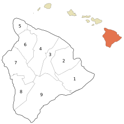
The Big Island was once divided into six main areas called moku. One of these was the District of Hilo. Now, Hilo is split into two parts: North Hilo and South Hilo Districts.
North Hilo District
The North Hilo District is along Hawaii State Highway 19. It includes small towns and places like:
- ʻŌʻōkala
- Laupāhoehoe and its Train Museum
- Ninole
There are also places inland along State Highway 200, such as the road to Mauna Kea mountain and Puu Huluhulu.
South Hilo District
The South Hilo District is along Hawaii State Highway 19 and Hawaii State Highway 11. It includes:
- Honalo and Akaka Falls
- Pepeekeo
- Wainaku
- Hilo Bay, the Wailuku River, and Rainbow Falls
- Downtown Hilo, where you can find the Pacific Tsunami Museum
Along State Highway 11, you'll find:
- Hilo International Airport
- Prince Kuhio Plaza Shopping Center
- Pana'ewa Rainforest Zoo
Along State Highway 200, there are places like:
- Kaumana
- University of Hawaii at Hilo
- Puainako Shopping Center
Hilo in Books and Stories
Jasmin Iolani Hakes' book Hula: A Novel (2023) is set in Hilo. This book won an award from Honolulu magazine for Book of the Year About Hawaii.
See also
 In Spanish: Hilo (Hawái) para niños
 | Bessie Coleman |
 | Spann Watson |
 | Jill E. Brown |
 | Sherman W. White |


