
Image: Oxfordshire UK location map

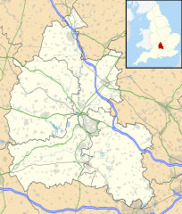
Description: Map of Oxfordshire, UK with the following information shown: Administrative borders Coastline, lakes and rivers Roads and railways Urban areas Equirectangular map projection on WGS 84 datum, with N/S stretched 160% Geographic limits: West: 1.74W East: 0.72W North: 52.19N South: 51.44N
Title: Oxfordshire UK location map
Credit: Ordnance Survey OpenData. Administrative borders and coastline data from Boundary-Line product. All other geographic data from Meridian 2 product. Inset derived from England location map.svg by Spischot.
Author: Nilfanion, created using Ordnance Survey data
Permission: This file is licensed under the Creative Commons Attribution-Share Alike 3.0 Unported license. Attribution: Contains Ordnance Survey data © Crown copyright and database right You are free: to share – to copy, distribute and transmit the work to remix – to adapt the work Under the following conditions: attribution – You must attribute the work in the manner specified by the author or licensor (but not in any way that suggests that they endorse you or your use of the work). share alike – If you alter, transform, or build upon this work, you may distribute the resulting work only under the same or similar license to this one. http://creativecommons.org/licenses/by-sa/3.0 CC BY-SA 3.0 Creative Commons Attribution-Share Alike 3.0 truetrue
Usage Terms: Creative Commons Attribution-Share Alike 3.0
License: CC BY-SA 3.0
License Link: http://creativecommons.org/licenses/by-sa/3.0
Attribution Required?: Yes
Image usage
The following 92 pages link to this image:
- Abingdon, Oxfordshire
- Abingdon-on-Thames
- Alchester (Roman town)
- Ardley Castle
- Ascot d'Oilly Castle
- Ascott Earl Castle
- Asterleigh
- Aves ditch
- Bagley Wood
- Bampton Castle, Oxfordshire
- Banbury
- Banbury Castle
- Barton, Oxfordshire
- Beaumont Castle
- Benson, Oxfordshire
- Bicester
- Bix, Oxfordshire
- Blackbird Leys
- Blewburton Hill
- Blewbury
- Boars Hill
- Bruern
- Burford
- Burgess Field Nature Park
- Carterton, Oxfordshire
- Charlbury
- Chimney, Oxfordshire
- Chipping Norton
- Cornmarket Street
- Cowleaze Wood
- Cowley, Oxfordshire
- Devil's Quoits
- Didcot
- Ducklington
- Eaton Hastings
- Enstone
- Faringdon
- FitzHarris Castle
- Frilford
- Godstow
- Grandpont
- Harcourt Hill
- Hawk Stone
- Headington
- Headington Hill
- Headington Quarry
- Henley-on-Thames
- Hinksey Hill
- Holywell, Oxford
- Jericho, Oxford
- Kelmscott
- Leafield Castle
- Little Wittenham
- Long Wittenham
- Lyneham Longbarrow
- Marston, Oxford
- North Oxford
- Northway, Oxford
- Osney
- Oxford Castle
- Park Town, Oxford
- Port Meadow, Oxford
- Rose Hill, Oxfordshire
- Rotherfield Greys Castle
- Science Area, Oxford
- Scutchamer Knob
- Seacourt
- Sonning Eye
- South Moreton Castle
- St Barnabas Church, Oxford
- St Clement's, Oxford
- St Mary's Church, Bampton
- St Mary's Church, Bloxham
- St Mary-le-More, Wallingford
- Summertown, Oxford
- Swerford Castle
- Thame
- Trap Grounds
- Tusmore, Oxfordshire
- University Church of St Mary the Virgin
- Wallingford, Oxfordshire
- Wallingford Castle
- Wantage
- Watchfield
- Waterways, Oxford
- Watlington, Oxfordshire
- Wheatfield, Oxfordshire
- Widford, Oxfordshire
- Witney
- Wolvercote Common
- Woodstock, Oxfordshire
- Template:Location map United Kingdom Oxfordshire
