Laconia, New Hampshire facts for kids
Quick facts for kids
Laconia, New Hampshire
|
||
|---|---|---|
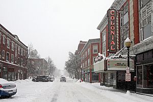
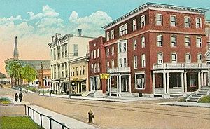
Main Street in Laconia
|
||
|
||
| Motto(s):
City on the Lakes
|
||
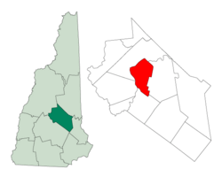
Location in Belknap County, New Hampshire
|
||
| Country | United States | |
| State | New Hampshire | |
| County | Belknap | |
| Incorporated | 1855 | |
| Named for | Laconia, Greece | |
| Villages | Downtown Lakeport Weirs Beach |
|
| Government | ||
| • Type | Council–manager government | |
| Area | ||
| • Total | 26.08 sq mi (67.55 km2) | |
| • Land | 19.84 sq mi (51.38 km2) | |
| • Water | 6.24 sq mi (16.17 km2) 23.93% | |
| Elevation | 502 ft (153 m) | |
| Population
(2020)
|
||
| • Total | 16,871 | |
| • Density | 850.44/sq mi (328.35/km2) | |
| Time zone | UTC−5 (Eastern) | |
| • Summer (DST) | UTC−4 (Eastern) | |
| ZIP Codes |
03246, 03247
|
|
| Area code(s) | 603 | |
| FIPS code | 33-40180 | |
| GNIS feature ID | 0867917 | |
Laconia is a city in Belknap County, New Hampshire, United States. It is the county seat of Belknap County. In 2020, about 16,871 people lived there. Laconia is located between Lake Winnipesaukee and Lake Winnisquam. It includes the villages of Lakeport and Weirs Beach. Every June, Laconia hosts Laconia Motorcycle Week, a very large motorcycle event.
Contents
What's in a Name?
Laconia gets its name from a region in Greece. This region is called Laconia (Λακωνία in Greek). It is located in the southeastern part of the Peloponnese peninsula in Greece.
Exploring Laconia's Past
Long ago, a large Abenaki Native American village called Aquadoctan was here. It was at a spot now known as The Weirs. Colonists named it this because they found fishing weirs there. These were traps used for fishing at the start of the Winnipesaukee River.
Early explorers hoped to find a way to the Great Lakes and St. Lawrence River. Around 1652, a group of surveyors visited the area. This event is remembered by Endicott Rock, a local landmark. A fort was built in Laconia in 1746. But fighting between the English, French, and their Native American allies stopped people from settling.
Settlement finally began in 1761. For many years, this area was part of Meredith and Gilford. It was known as Meredith Bridge.
How Laconia Grew
Starting in 1765, mills for cutting wood and grinding grain were built. Taverns, which were like inns, soon followed. Around 1822, a courthouse was built. This became the county seat when Belknap County was created in 1840.
In 1823, the Belknap Mill was built to make textiles (cloth). It started working by 1828. Today, this building is a museum. It is the oldest brick textile mill in the country that has not been changed.
Local factories made wood products, cloth, shoes, and knitting machines. The biggest employer was the Laconia Car Company. This company built train, trolley, and subway cars. It started in 1848 and closed in the 1930s. The railroad came to town in 1849. It brought goods and more summer tourists to popular Weirs Beach.
Becoming a City
In 1855, Laconia became an official town. It was formed from parts of Meredith Bridge, Lakeport, Weirs, and Gilmanton. The name likely came from the old Laconia Company. This company sold land during the colonial times.
A big fire in 1860 destroyed most of Main Street. Then, the Great Lakeport Fire in 1903 was so strong that fire companies came by train from far away. Laconia officially became a city in 1893.
Laconia's Location and Landscape
Laconia is in the middle of New Hampshire's beautiful Lakes Region. Four major bodies of water are partly or fully within its borders. These are Lake Winnipesaukee, Lake Winnisquam, Opechee Bay, and Paugus Bay. Paugus Bay is sometimes seen as part of Winnipesaukee.
Main Areas of Laconia
Laconia has three main villages:
- Downtown Laconia is in the southern part of the city. The Belknap County Courthouse is here. It is along the Winnipesaukee River.
- Lakeport is near the center of the city. It is located between Opeechee Bay and Paugus Bay.
- Weirs Beach is at the northern edge of the city. It is around the channel that connects Paugus Bay with Lake Winnipesaukee.
Getting Around Laconia
Several main roads pass through Laconia. U.S. Route 3 goes through parts of the city, including Weirs Beach. New Hampshire Route 11 also passes through. These roads lead to other towns like Tilton and Franklin.
The old Boston and Maine Railroad tracks run through Laconia. They are still used for freight trains. Tourist trains also use them between Meredith and Lakeport. The Laconia Municipal Airport is just east of the city in Gilford.
A fun walking and biking path is called the W.O.W. Trail. It connects parts of the city. It follows the railroad tracks from Lake Winnisquam to Lakeport.
Laconia covers about 26 square miles (67.6 square kilometers). About 23.93% of the city's area is water. The highest point in Laconia is a 960-foot hill in the northern part of the city.
Neighboring Towns
Laconia shares borders with these towns:
- Meredith (north)
- Gilford (east)
- Belmont (south)
- Sanbornton (west)
Laconia's Weather
| Climate data for Laconia, New Hampshire (Lakeport 2) (1991–2020 normals, extremes 1938–present) | |||||||||||||
|---|---|---|---|---|---|---|---|---|---|---|---|---|---|
| Month | Jan | Feb | Mar | Apr | May | Jun | Jul | Aug | Sep | Oct | Nov | Dec | Year |
| Record high °F (°C) | 64 (18) |
69 (21) |
82 (28) |
92 (33) |
95 (35) |
96 (36) |
98 (37) |
100 (38) |
95 (35) |
83 (28) |
75 (24) |
69 (21) |
100 (38) |
| Mean daily maximum °F (°C) | 30.3 (−0.9) |
33.7 (0.9) |
42.5 (5.8) |
55.6 (13.1) |
68.0 (20.0) |
76.6 (24.8) |
82.1 (27.8) |
80.8 (27.1) |
73.3 (22.9) |
60.1 (15.6) |
47.3 (8.5) |
36.2 (2.3) |
57.2 (14.0) |
| Daily mean °F (°C) | 21.0 (−6.1) |
23.1 (−4.9) |
31.8 (−0.1) |
44.1 (6.7) |
56.3 (13.5) |
65.7 (18.7) |
71.3 (21.8) |
69.8 (21.0) |
62.4 (16.9) |
50.0 (10.0) |
38.7 (3.7) |
28.2 (−2.1) |
46.9 (8.3) |
| Mean daily minimum °F (°C) | 11.7 (−11.3) |
12.5 (−10.8) |
21.2 (−6.0) |
32.7 (0.4) |
44.5 (6.9) |
54.8 (12.7) |
60.4 (15.8) |
58.7 (14.8) |
51.5 (10.8) |
39.9 (4.4) |
30.0 (−1.1) |
20.2 (−6.6) |
36.5 (2.5) |
| Record low °F (°C) | −24 (−31) |
−17 (−27) |
−11 (−24) |
12 (−11) |
24 (−4) |
38 (3) |
45 (7) |
40 (4) |
30 (−1) |
23 (−5) |
4 (−16) |
−13 (−25) |
−24 (−31) |
| Average precipitation inches (mm) | 3.08 (78) |
2.88 (73) |
3.39 (86) |
3.65 (93) |
3.47 (88) |
4.44 (113) |
4.61 (117) |
3.89 (99) |
3.77 (96) |
4.83 (123) |
3.68 (93) |
3.92 (100) |
45.61 (1,158) |
| Average snowfall inches (cm) | 18.8 (48) |
16.9 (43) |
9.4 (24) |
1.6 (4.1) |
0.0 (0.0) |
0.0 (0.0) |
0.0 (0.0) |
0.0 (0.0) |
0.0 (0.0) |
0.3 (0.76) |
2.1 (5.3) |
12.8 (33) |
61.9 (157) |
| Average precipitation days (≥ 0.01 in) | 11.7 | 9.2 | 10.8 | 11.2 | 12.1 | 12.6 | 11.4 | 10.0 | 9.8 | 11.2 | 10.7 | 11.6 | 132.3 |
| Average snowy days (≥ 0.1 in) | 7.4 | 6.0 | 4.0 | 0.8 | 0.0 | 0.0 | 0.0 | 0.0 | 0.0 | 0.1 | 1.0 | 4.9 | 24.2 |
| Source: NOAA | |||||||||||||
People of Laconia
| Historical population | |||
|---|---|---|---|
| Census | Pop. | %± | |
| 1860 | 1,806 | — | |
| 1870 | 2,309 | 27.9% | |
| 1880 | 3,790 | 64.1% | |
| 1890 | 6,143 | 62.1% | |
| 1900 | 8,042 | 30.9% | |
| 1910 | 10,183 | 26.6% | |
| 1920 | 10,897 | 7.0% | |
| 1930 | 12,471 | 14.4% | |
| 1940 | 13,484 | 8.1% | |
| 1950 | 14,745 | 9.4% | |
| 1960 | 15,288 | 3.7% | |
| 1970 | 14,888 | −2.6% | |
| 1980 | 15,575 | 4.6% | |
| 1990 | 15,743 | 1.1% | |
| 2000 | 16,411 | 4.2% | |
| 2010 | 15,951 | −2.8% | |
| 2020 | 16,871 | 5.8% | |
| U.S. Decennial Census | |||
In 2000, there were 16,411 people living in Laconia. There were 6,724 households and 4,168 families. The city had about 809 people per square mile. Most people (96.79%) were White. Other groups included African American, Native American, and Asian people. About 1% of the population was Hispanic or Latino.
About 28% of households had children under 18. About 46% were married couples. The average household had 2.32 people. The average family had 2.87 people.
The median age in the city was 39 years old. About 22.3% of the people were under 18. About 17.2% were 65 or older.
The median income for a household was $37,796. For a family, it was $45,307. The average income per person was $19,540. About 8.9% of the population lived below the poverty line.
Learning in Laconia
Laconia's public schools are managed by the Laconia School District.
Public Schools
The Laconia School District has one high school, one middle school, and three elementary schools:
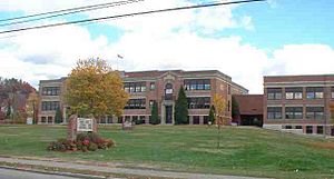
- Laconia High School
- Laconia Middle School
- Elm Street Elementary School
- Pleasant Street Elementary School
- Woodland Heights Elementary School
Private Schools
There are two private schools in Laconia:
- Laconia Christian Academy (for grades K–12)
- Holy Trinity Catholic School (for grades K–8)
Colleges and Higher Education
Laconia also has one college:
- Lakes Region Community College (with about 1,000 students)
Fun and Culture in Laconia
Sports and Events
Laconia is home to the Winnipesaukee Muskrats. This is a baseball team in the New England Collegiate Baseball League. They play at Robbie Mills Field.
Every winter, Laconia hosts the Laconia World Championship Sled Dog Derby. This is a big race for sled dogs.
Theater and Arts
Laconia has several places for shows and performances:
- The Colonial Theatre
- The CAKE Theatre
- The Opera House
Laconia Motorcycle Week
One of the biggest motorcycle events in the world happens in Laconia. It lasts for nine days in June, ending on Father's Day. It started in 1923. In 2004, 375,000 people attended. In 2010, there were 188,000 attendees. The event includes races, shows, and a motorcycle hill climb.
Laconia Multicultural Festival
This festival happens every year. It celebrates different cultures with music, arts, crafts, and food. Former Mayor Matthew Lahey and Police Chief Bill Baker started it in 2000.
New Hampshire Pumpkin Festival
In 2015, Laconia became the new home for the New Hampshire Pumpkin Festival. This happened after another city decided not to host it. The festival lights up thousands of jack-o'-lanterns. It has been held in Laconia every year since then.
Places to Visit in Laconia
- Funspot Family Fun Center: This is known as the "Largest Arcade in the World" by Guinness World Records. It also hosts a classic video and pinball tournament.
- Lake Winnipesaukee Historical Society Museum
- Robbie Mills Field: Home of the Winnipesaukee Muskrats baseball team.
- Weirs Beach
Many places in Laconia are listed on the National Register of Historic Places. This means they are important historical sites:
- Belknap-Sulloway Mill, now the Belknap Mill Museum
- John W. Busiel House
- Busiel-Seeburg Mill
- Colonial Theatre Complex
- Evangelical Baptist Church
- Federal Building
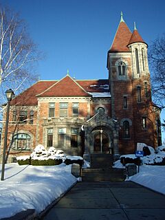
- Gale Memorial Library
- Laconia District Court
- Laconia Passenger Station
- U.S. Post Office-Laconia Main
- Ossian Wilbur Goss Reading Room
- United Baptist Church of Lakeport
- Endicott Rock
- New Hampshire Veterans' Association Historic District
- The Weirs
Famous People from Laconia
Many notable people have connections to Laconia:
- Donald C. Bolduc (born 1962), a U.S. Army general.
- Charles A. Busiel (1842–1901), a former Governor of New Hampshire and mayor of Laconia.
- Pearl Chertok (1918–1981), a professional harpist and composer.
- Connie Converse (born 1924), a singer-songwriter who disappeared.
- Werner Doehner (1929–2019), the last survivor of the 1937 Hindenburg disaster.
- Chas Guldemond (born 1987), a snowboarder and X Games medalist.
- Doris Haddock (1910–2010), an activist known as "Granny D" who walked across the U.S.
- Fletcher Hale (1883–1931), a U.S. congressman.
- John Adams Harper (1779–1816), a U.S. congressman.
- Martin Alonzo Haynes (1842–1919), a U.S. congressman.
- Ellery Albee Hibbard (1826–1903), a U.S. congressman.
- Joseph Oliva Huot (1917–1983), a U.S. congressman.
- Tony Lavelli (1926–1998), a basketball player for the Boston Celtics and New York Knicks.
- Thomas J. McIntyre (1915–1992), a U.S. senator.
- Penny Pitou (born 1938), the first U.S. Olympic skier to win a medal in a downhill event.
- Claude Rains (1889–1967), a famous actor who died in Laconia.
- Paul W. K. Rothemund (born around 1972), a scientist who received a MacArthur Fellowship.
- Daniel E. Somes (1815–1888), a U.S. congressman from Maine.
- Dawn Zimmer (born 1968), a former mayor of Hoboken, New Jersey.
Images for kids
See also
 In Spanish: Laconia (Nuevo Hampshire) para niños


