
National Register of Historic Places listings in Palm Beach County, Florida facts for kids

Palm Beach County, Florida, is home to many amazing places that are part of the National Register of Historic Places. This special list helps protect important buildings, sites, and areas across the United States. It's like a hall of fame for historic spots!
There are 73 places in Palm Beach County on this list, and two of them are even more special, called National Historic Landmarks. These landmarks are considered super important to the history of the entire country. A few other places were once on the list but have since been removed, usually because they were changed or no longer exist.
| Alachua - Baker - Bay - Bradford - Brevard - Broward - Calhoun - Charlotte - Citrus - Clay - Collier - Columbia - DeSoto - Dixie - Duval - Escambia - Flagler - Franklin - Gadsden - Gilchrist - Glades - Gulf - Hamilton - Hardee - Hendry - Hernando - Highlands - Hillsborough - Holmes - Indian River - Jackson - Jefferson - Lafayette - Lake - Lee - Leon - Levy - Liberty - Madison - Manatee - Marion - Martin - Miami-Dade (Miami) - Monroe - Nassau - Okaloosa - Okeechobee - Orange - Osceola - Palm Beach - Pasco - Pinellas - Polk - Putnam - St. Johns - St. Lucie - Santa Rosa - Sarasota - Seminole - Sumter - Suwannee - Taylor - Union - Volusia - Wakulla - Walton - Washington |
Contents
Exploring Palm Beach County's Historic Treasures
What is the National Register?
The National Register of Historic Places is the official list of the nation's historic places worth saving. When a place is added to this list, it means it's important because of its history, architecture, or what it represents. It helps people understand and appreciate the past. Being on the list can also help protect these places and sometimes even provide money for their care.
Amazing Historic Places to Discover
Palm Beach County has a rich history, and you can see it in the many buildings and areas on the National Register. Let's explore some of these cool spots!
The Breakers Hotel: A Grand Resort

The Breakers Hotel Complex in Palm Beach is a huge, fancy hotel that has been around for a long time. It was first built in 1896 by Henry Flagler, a very important person in Florida's history. The hotel has been rebuilt a few times after fires, but it always kept its grand style. It's a great example of the luxurious resorts that made Florida famous.
Flagler Museum: A Gilded Age Mansion
.jpg)
The Henry Morrison Flagler House, also known as Whitehall, is a National Historic Landmark in Palm Beach. Henry Flagler built this amazing mansion in 1902 as a winter home for his wife. It's a huge, beautiful house with 75 rooms! Today, it's a museum where you can see what life was like for the super-rich during the "Gilded Age" in America. It's like stepping back in time.
Mar-a-Lago: A Famous Estate

Mar-a-Lago is another National Historic Landmark in Palm Beach. It was built in the 1920s by Marjorie Merriweather Post, a wealthy businesswoman. This large estate is famous for its unique architecture and beautiful gardens. It has served as a private residence, a club, and even a presidential retreat.
Jupiter Inlet Lighthouse: A Guiding Light

The Jupiter Inlet Lighthouse is a tall, red lighthouse located where the Loxahatchee River meets Jupiter Sound. It was built in 1860 and has been helping ships navigate the coast ever since. Lighthouses are important symbols of safety and guidance for sailors, and this one has a long history of doing just that.
Old City Halls and Schools: Community Landmarks
Many old city halls and schools are on the National Register because they played a big part in their communities.
- The Boca Raton Old City Hall (built in 1927) is a beautiful building that once served as the town's main government center.
- The Boynton School (built in 1913) and Pahokee High School (built in 1928) are examples of historic schools that educated generations of students.
- The Old Belle Glade Town Hall also served as a fire station, showing how these buildings were central to town life.
Historic Districts: Whole Neighborhoods with Stories
Instead of just one building, some areas are listed as Historic Districts. This means a whole neighborhood or part of a town is important because of its history and the way its buildings look together.
- The Central Park Historic District and El Cid Historic District in West Palm Beach are great examples. Walking through these areas is like seeing a living museum of old homes and streets.
- The Clematis Street Historic Commercial District in West Palm Beach highlights a block of important old shops and businesses.
Shipwrecks and Ancient Sites: Clues from the Past
History isn't just on land! The Lofthus (shipwreck) is a ship that sank off the coast of Boynton Beach in 1894. It's now an underwater archaeological site, meaning it's a historic place found under the water. It tells us about old ships and sea travel.
The Big Mound City near Canal Point is an ancient archaeological site. These sites often contain clues about the lives of people who lived in Florida thousands of years ago, long before modern cities were built.
Places That Are No Longer Listed
Sometimes, a historic place is removed from the National Register. This usually happens if the building is torn down or changed so much that it loses its historic look and feel. For example, the Bingham-Blossom House and the Brelsford House in Palm Beach were once on the list but were later demolished. The Dixie Court Hotel and Hibiscus Apartments in West Palm Beach also met this fate. It's a reminder that we need to work hard to protect our historic places.
Images for kids
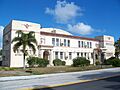
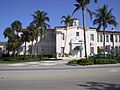
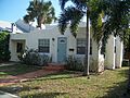
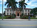
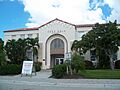
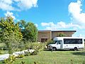
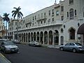
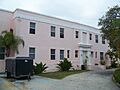
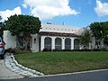
-
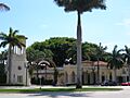
Administration Buildings in Boca Raton.
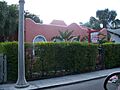
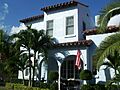
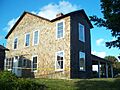
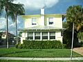
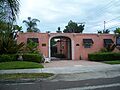
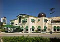
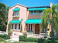
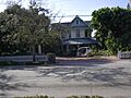
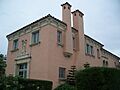
-
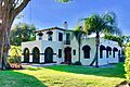
The Fred C. Aiken House.
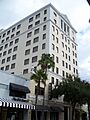
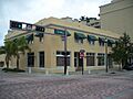
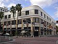
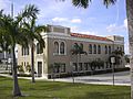
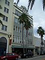
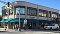
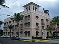
-
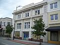
The American National Bank Building in West Palm Beach.
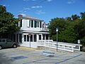
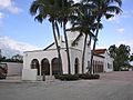
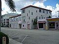
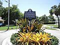
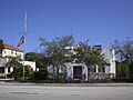
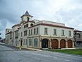
-
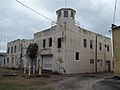
The Old Belle Glade Town Hall.
-
Boca Raton Old City Hall.
-
Boynton School.
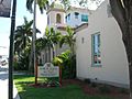
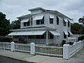
-
Boynton Woman's Club.
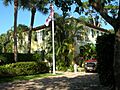
-
A house in the Central Park Historic District.
-
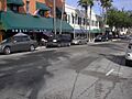
The 500 block of Clematis Street.
-
A home in the College Park Historic District.
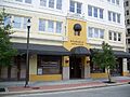
-
The Comeau Building.
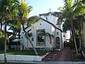
-
The Alfred J. Comeau House.
-
The Crest Theater, part of Old School Square in Delray Beach.
-
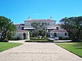
Eastover in Manalapan.
-
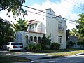
A house in the El Cid Historic District.
-
The J. B. Evans House.
-
The Ferndix Building.
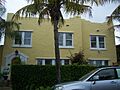
-
A house in the Flamingo Park Historic Residential District.
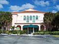
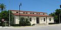
-
The Florida East Coast Railway Passenger Station in Boca Raton.
-
A house in the Grandview Heights Historic District.
-
The Guaranty Building in West Palm Beach.
-

The Gulf Stream Hotel.
-
Hatch's Department Store.
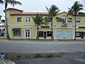
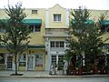
-
A building in the Historic Old Town Commercial District.
-
The House at 1240 Cocoanut Road.
-
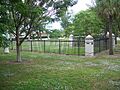
The Hurricane of 1928 African American Mass Burial Site.
-
A house at the Jupiter Inlet Historic and Archeological Site.
-
Kelsey City City Hall.
-
The Lavender House.
-
The Lofthus shipwreck site.
-
A house in the Mango Promenade Historic District.
-
A building in the Marina Historic District.
-
The Mickens House.
-
The Milton-Myers American Legion Post No. 65.
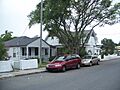
-
A house in the Northboro Park Historic District.
-
A building in the Northwest Historic District.
-
The Norton House.
-
Old Lake Worth City Hall.
-
A house in the Old Northwood Historic District.
-
A house in the Old Lucerne Historic Residential District.
-
The Old Palm Beach Junior College Building.
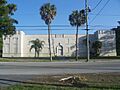
-
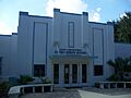
The Old West Palm Beach National Guard Armory.
-
Osborne School.
-
Pahokee High School.
-
The Palm Beach Daily News Building.
-
The Palm Beach Hotel.
-
The Palm Beach Mercantile Company.
-
Palm Beach Town Hall.
-
The Paramount Theatre Building.
-
Pine Ridge Hospital.
-
The Professional Building.
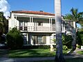
-
A house in the Prospect Park-Southland Park Historic District.
-
The Clifton Rice House.
-
A building in the Royal Poinciana Way Historic District.
-
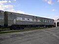
Seaboard Air Line Dining Car-6113.
-
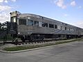
Seaboard Air Line Lounge Car-6603.
-
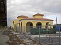
The Delray Beach Seaboard Air Line Railway Station.
-
The Seaboard Coastline Railroad Passenger Station in West Palm Beach.
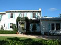
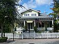
-
The John and Elizabeth Shaw Sundy House.
-
The U.S. Post Office in Palm Beach.
-
The Grant Van Valkenburg House.
-
A house in the Vedado Historic District.
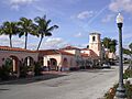
-
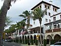
Via Mizner in Palm Beach.
-
The Vineta Hotel.
-
The William Gray Warden House.
-
The West Palm Beach Fishing Club.


