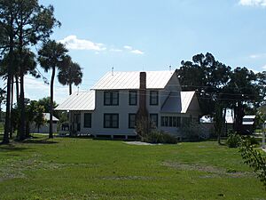
National Register of Historic Places listings in Collier County, Florida facts for kids
Have you ever wondered how we keep important old buildings and places safe for the future? In the United States, there's a special list called the National Register of Historic Places. It helps protect buildings, sites, and objects that are important to history. When something is on this list, it means it's recognized as a valuable part of our past.
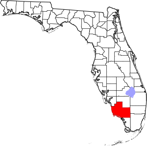
Collier County, Florida, has many interesting places on this list. These sites tell stories about the people who lived here long ago, how they worked, and what their lives were like. There are 19 places in Collier County that are recognized for their historical importance. Let's explore some of them!
Historic Buildings and Structures
Many buildings in Collier County have been saved because they are important parts of history. They show us how people lived and worked in the past.
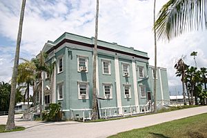
Bank of Everglades Building
The Bank of Everglades Building is a cool old building in Everglades City. It was built in 1926 and used to be a busy bank. Imagine people coming here to deposit their money or get loans almost 100 years ago! Today, it stands as a reminder of the town's early days.
Everglades Laundry
Also in Everglades City is the Everglades Laundry. This building, built in 1928, was where people would bring their clothes to be washed. Back then, not everyone had washing machines at home, so public laundries were very important. It shows us a bit about daily life in the past.
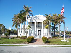
Old Collier County Courthouse
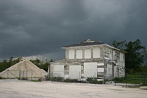
The Old Collier County Courthouse is another important building in Everglades City. It was built in 1928 and served as the main place for legal matters and government work in the county for many years. Courthouses are often central to a community's history, and this one tells a big part of Collier County's story.
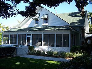
Palm Cottage
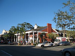
In Naples, you can find Palm Cottage. This beautiful house was built in 1895, making it one of the oldest homes in Naples. It shows what homes looked like when Naples was just starting to grow. It's a great example of early Florida architecture.
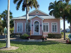
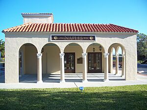
Seaboard Coast Line Railroad Depot
The Seaboard Coast Line Railroad Depot in Naples is an old train station. Built in 1927, it was a busy place where people arrived and departed by train. Trains were super important for travel and moving goods before cars became common. This depot reminds us of the days when train travel was king.
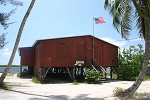
Ted Smallwood Store
The Ted Smallwood Store is a unique place located in Chokoloskee, near Everglades National Park. Built in 1906, it was a trading post where settlers and Native Americans exchanged goods. It's like stepping back in time to see how people traded and lived in the remote parts of Florida.
Historic Sites and Districts
Some places on the National Register are not just single buildings, but entire areas or special sites that hold historical meaning.
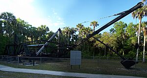
Bay City Walking Dredge
At Collier–Seminole State Park in Naples, you can see the Bay City Walking Dredge. This isn't a building, but a huge machine! It was used in the 1920s to dig canals and build roads, especially the famous Tamiami Trail across the Everglades. It's a giant piece of history that helped shape Florida.
Capt. John Foley Horr House
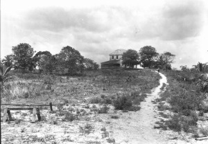
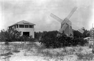
The Capt. John Foley Horr House is located on Key Marco. This house, built around 1877, belonged to Captain John Foley Horr, who was one of the first settlers in the area. It's a glimpse into the lives of the pioneers who first settled this part of Florida.
Keewaydin Club
The Keewaydin Club is on the northern end of Key Island, near Naples. This club, established in 1938, was a popular spot for people to relax and enjoy the beautiful Florida coast. It represents a part of Florida's history as a tourist destination.
Monroe Station
The Monroe Station in Ochopee was an old gas station and rest stop built in 1926 along the Tamiami Trail. Sadly, it was destroyed by fire, but it was once a very important stop for travelers driving through the Everglades. It shows how travel changed as roads were built.
Naples Historic District
The Naples Historic District is not just one building, but a whole area in Naples that is historically important. It includes many old homes and buildings that show how Naples grew from a small town into the city it is today. Walking through this district is like taking a trip back in time.
Roberts Ranch
The Roberts Ranch in Immokalee is a historic ranch that shows the history of cattle ranching in Florida. It was established in the early 1900s and gives us a look at the state's agricultural past. Ranches like this were very important for the economy of Florida.
Images for kids
-
Burns Lake Site.jpg
The Burns Lake Site is an archaeological site.
-
Halfway Creek Site.jpg
The Halfway Creek Site is an archaeological site.
-
Hinson Mounds.jpg
The Hinson Mounds are ancient Native American mounds.
-
C. J. Ostl Site.jpg
The C. J. Ostl Site is an archaeological site.
-
Platt Island.jpg
Platt Island is an important archaeological site.
-
Plaza Site.jpg
The Plaza Site is an archaeological site.
-
Sugar Pot Site.jpg
The Sugar Pot Site is an archaeological site.
-
Turner River Site.jpg
The Turner River Site is an archaeological site.
| Alachua - Baker - Bay - Bradford - Brevard - Broward - Calhoun - Charlotte - Citrus - Clay - Collier - Columbia - DeSoto - Dixie - Duval - Escambia - Flagler - Franklin - Gadsden - Gilchrist - Glades - Gulf - Hamilton - Hardee - Hendry - Hernando - Highlands - Hillsborough - Holmes - Indian River - Jackson - Jefferson - Lafayette - Lake - Lee - Leon - Levy - Liberty - Madison - Manatee - Marion - Martin - Miami-Dade (Miami) - Monroe - Nassau - Okaloosa - Okeechobee - Orange - Osceola - Palm Beach - Pasco - Pinellas - Polk - Putnam - St. Johns - St. Lucie - Santa Rosa - Sarasota - Seminole - Sumter - Suwannee - Taylor - Union - Volusia - Wakulla - Walton - Washington |


